
Jewell Hill
With reports of access restrictions fresh in our minds from recent northerly attempts, I was on the edge of the seat as Chris, my mountain running partner (better known as cgothberg on social media platforms), detailed how we might want to attempt summiting this lower peak of the New Hampshire 500-Highest - in actuality, our focus was placed on several ledgy outcroppings hiding in the woods to the south of the actual high point; our secondary objectives are also denoted as possible viewpoints on some topographic maps.

Headlamps illuminate a critter highway (Jewell Hill Lane)
At 1,990’, this low dome of a mountaintop hosts a plethora of hiking and snowshoeing trails, some even having been repurposed by the Hardy Country Snowmobile Club. Throughout our 7-mile ramble along the southern slopes of Jewell Hill, we never encountered any Posted or No Trespassing signage - just lots of fresh, muddy bear tracks atop the crusty snowpack.
Beginning from the spacious parking area for the Sculptured Rocks State Park, some care was required to watch out for the snowmobile club’s groomers, trailers and various other winter equipment stashed around the cleared area. Located just west of Hardy Country Road, on Sculptured Rocks Road, we walked back eastward along the main road to intercept snowmobile corridor 24, which would guide us across the deep chasm formed by the Cockermouth River - this stunning sight alone makes the visit worthwhile!

Strolling along the summit area of Jewell Hill
From our 5:01AM departure, the patchy snowmobile corridor was lit up by not only two headlamp beams, but also a brilliant near-full moon which illuminated the blanket of snowpack to such the degree travel without artificial light was entirely possible. Finding the sled trail a mere shadow of its typical snowy, wintery roadway, we often took to the open woods early on while following Corridor 24 upslope, finding a much deeper, solid snowpack trailside. At the first junction, we followed the well-signed trails as our route now climbed northwesterly rather steadily.
The groomed snowmobile corridors took snowshoe spikes and crampons well, only requiring us to meander around exposed earth or icy patches at several instances. Throughout the early ascent, we could spot loads of brushy, old woods or logging roads diverging in various directions, most had a narrow path of old wildlife tracks; on one brushy corridor I could discern old snowshoe tracks - content with our progress and course of direction, we followed Corridor 24 until reaching a point at 1,190’ where the snowmobile road would soon make a hard swing southward, away from our objective.
Summit of Jewell Hill
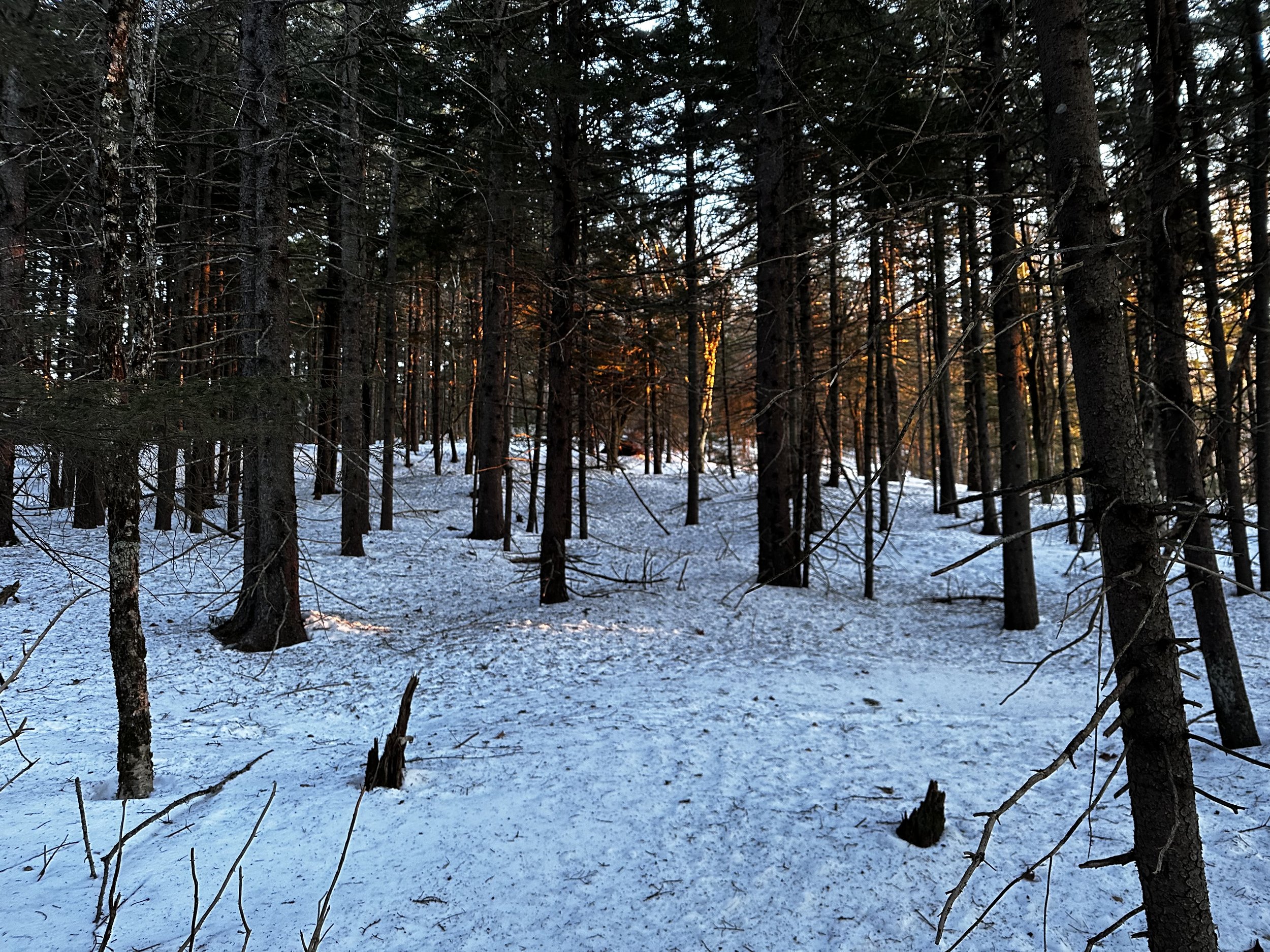
Pondering options momentarily, we concluded that the best choice was to simply enter the open mixed woods (mostly hardwood regrowth from logging) near to where we thence stood. As if following a narrow herd path, we found off trail travel extremely efficient and highly pleasurable as the morning sky began to illuminate in deep blues and purples. Only several times did we need to swing, dip, or meander around any brushy conifers, overall, the climbing was found to be highly satisfactory.
As we climbed beyond the 1,600’ contour line, we encountered yet another obvious old road corridor beelining upslope - this we knew to be Jewell Hill Lane; following a highway of wildlife tracks, we made terrific time ascending the old corridor. Remaining atop a rock-solid snowpack - our snowshoe crampons hardly left a dent in the fully supportive crust - this was winter snowshoe bushwhacking at its finest!

Sunrise over Newfound Lake
Following Jewell Hill Lane, we could occasionally, vaguely recognize a set of old snowshoe tracks which had evidently been through a ringer of freeze-thaw cycles. Reaching a point at about 1,790’, we opted to diverge from our relatively wide footpath to proceed steeply, once again, through beautifully open birch, spruce, and balsam - most of which was mature enough to require no avoidance of lower boughs, only a handful of instances found snowshoes plunging into softer snow surrounding young spruce or fir, effectively ensnaring snowshoes while traversing the broad mountaintop area.
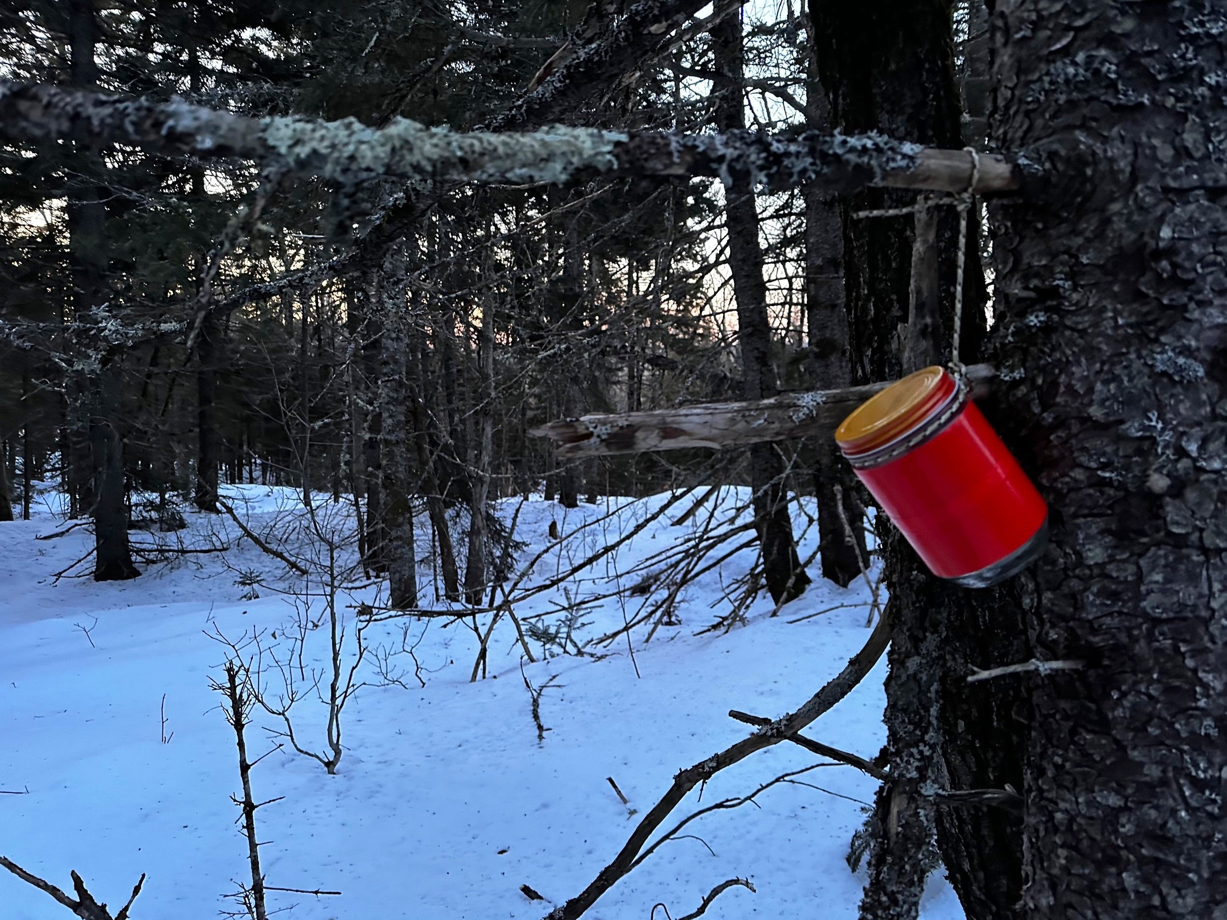
A very sprucy summit all aglow
Across the wide summit, we roamed like a couple of madmen looking for buried treasure - thankfully, this treasure was not actually buried; after several rambles to “could-be” high points, Chris located the brightly colored, glass summit jar - which would generally contain a small notebook for ascensionists to log their climbs into. This morning was frigid; thankfully we were mostly sheltered from any driving winds, but the ambient air temperature atop Jewell Hill at our 6:23AM summit kept bearded faces frosty, and fingers happily stuffed into insulated mittens.
Just as we proceeded east/southeastwardly from the recognized high point area, we could see the first glimpses of tangerine sunrise illuminating the skyline - the spruce grove atop Jewell Hill was alit with alpenglow, creating a scene of frigid wildfire, as the dark spruce bark radiated with glowing warmth from the low-angled, morning sun. Occasionally, we followed a poorly marked footpath (thanks to old snowshoe tracks) which encircles the mountaintop before leading to several ledgy outcroppings - while I gain great satisfaction from standing atop high places, the search for the perfect ledgy vista is what keeps Chris running and bushwhacking.

Southward views toward Mowglis Mtn/Firescrew of Mt Cardigan/Catalouchee’s
While continuing onto a small, 1,850’ sub-peak to the south of the main mountain mass, we began following relatively fresh bear tracks; as they soon diverged eastwardly into scrappy evergreen, we proceeded around stunted moose-grazed understory vegetation, to the final lookout of our morning jaunt. Along a cleared lane we tramped, still atop a rock-solid crust with perhaps 6-15” of snow beneath, depending on sun exposure and forest canopy coverage.

Early morning foragers out roaming Jewell Hill
From our ledgy lookout southward to Mount Cardigan, we followed the wide, old skidder road until meeting Jewell Hill Lane; following crusty, old snowshoe tracks, we bounded over drainage berms and other undulating, topographical features. Old logging roads were followed back to our ascending tracks along snowmobile Corridor 24; had we needed to enter the woods for any reason, we would have found a fine bushwhack through impressively open woods - as we had found earlier for our morning ascent.
Reaching terminal velocity while cruising downslope on the groomed snowmobile corridor, we entered a scene straight out of a movie as Chris and I ran down the wide logging road, directly into brilliantly blinding sunshine. Perhaps, for our next sunrise bushwhack run we will work on capturing a classic 1990’s film freeze-frame shot for our Warren Miller-style snowshoe bushwhack/trail running feature film.
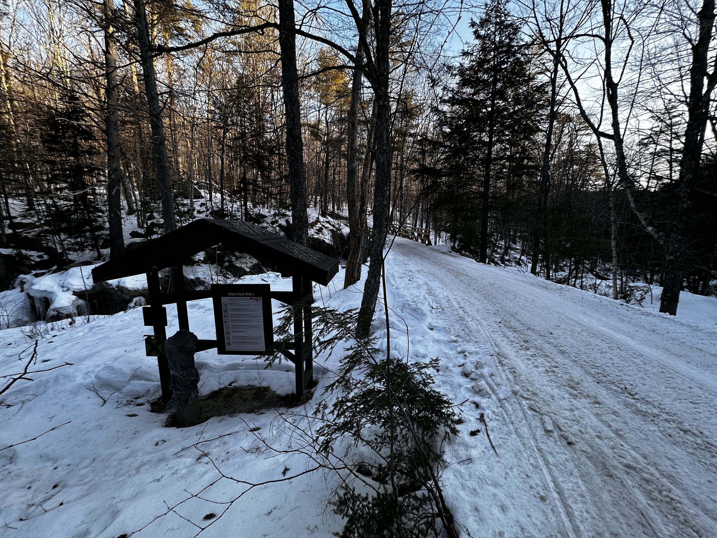
Back at the roadside kiosk for Sculptured Rocks
Returning back to the main snowmobile corridor, we briefly stopped to check out an old cellar hole just off trail; finding its foundational rocks having been cut and lain rather immaculately, I was impressed by the craftsmanship. The view from the bridged corridor into the icy chasm of Cockermouth River was also stunning, placing this natural, geologic area on a mental list of places to someday explore in warmer weather - Chris has already checked that box, and has reported back with rave reviews.
Overall stats for the day:
7.02-miles
2hr 26 minutes
1,762’ elevation gain
Jewell Hill - 1,990’