
Bear Mountain
My introduction to The Section Hiker website and blog began many years ago on a rare day not spent in the mountains: I was hooked. Regular trail reports of new destinations led me eventually to Phillip’s bushwhacking endeavors - a White Mountain pastime which was still fairly new to me as a hiker and trail runner. Having summited several trailless peaks in Vermont, and explored local, lesser known, lower peaks of the New Hampshire 500-Highest - any minor bump in the surrounding landscape became a morning destination before embarking on the remainder of my day. Before long, I found myself seeking out the northwest peak of Mt Hancock, or other obscure sub-peaks of the notorious 48 4000-Footers - bushwhacking had invariably hooked another hiker.

Nearing the gated snowmobile corridor of Bear Notch Road
Thanks to Mr. Werner and his excellent, fun-to-read blog write-ups, I had fully discovered the New Hampshire 3000-Footer list, many peaks on this list offering no marked or maintained trails to their summits; The Section Hiker had effectively shoved a bushwhack of Bear Mountain to the forefront of my narrow attention span - although, it would be several years before determining conditions and timing were impeccable - finally, an ascent of the 3,220’ trailless Bear Mountain was a go.
Located just north of the Kancamagus Highway in Albany Intervale, NH, Bear Mountain is sandwiched between the Sawyer Pond region to the west, and the mighty Moat Mountains to the east; the latter actually connecting to my objective by a high ridge dotted with the East Peak of Bear Mountain (2,336’), followed by Table Mountain (2,675’), before spilling over sub-peaks of Big Attitash Mountain, thus finally connecting to North Moat Mountain (3,196’).

Began on this spur trail, quickly took to trailless woods
Bear Mountain is currently considered a trailless peak, although the large mountain mass was once home to the Bear Mountain Trail; maintenance along the corridor ceased in the early 1960’s with the opening of the WMNF Attitash Trail to the east, which is still in use today. The current Attitash Trail traverses the ridgecrest from Big Attitash to Table Mountains, leaving the wooded slopes of Bear Mountain for those seeking a deeper delve into the remote wilderness setting.
Beginning its life as a logging railroad bed, the highway was opened to vehicular traffic in 1930; soon after opening, the roadway received significant improvements to the route with the addition of cleared outlooks at several points along its course. According to old USGS maps of the region, the old Bear Mountain Trail would have departed the roadway at a point within Bear Notch (Bartlett-Haystack Mtn-Bear Mtn col). From the notch, the old trail appears to have followed closely the course of the northwestern ridge before topping out on Bear Mountain itself, and soon heading due east, toward its eastern peak, and henceforth Table Mountain and subsequent points east.

Climbed out of the drainage to follow this ridgelet
Knowing that Bear Notch Road (old Bartlett-Passaconaway Road) was repurposed as a snowmobile corridor in winter months, parking was up in the air until arriving on-site, where I located a small hiker parking for the Rob Brook Trail, and various other cross-country ski routes. Arriving at Bear Notch Road at 7:06AM, I had my choice of parking as I had beat any other hikers or sledders to the trailhead area.
Throughout the commute from the western White Mountains, I watched the outside temperature fluctuate from 38° to 19°, depending on altitude. I welcomed the 24° start with great delight and was thrilled to find a similar rock-solid snowpack to what I had found closer to home several days prior - at a similar elevation. Much time was spent consulting old, historic maps (which showcased the old route of Bear Mountain Trail), newer maps for up-to-date forest roads and access points, as well as every aerial image I could get my mitts on - each year showing varying stages of selective “clear-cut” timber harvesting along the base of the mountain, as well as along a western ridge, which I scrutinized over - even locating ATV or an old skidder lane veering up the massive clear cut - I was heading directly for this location with the prospect of lofty views in mind.
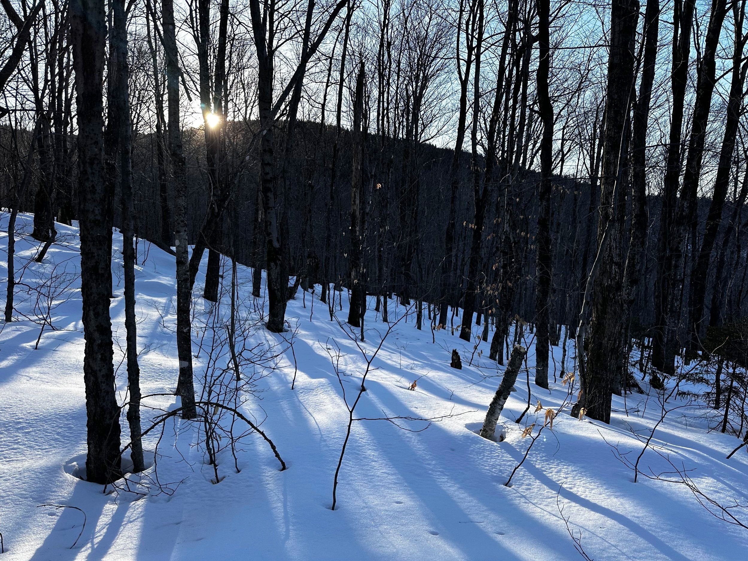
Southern bumps of the Bear Mountain ridge
After 0.7-miles of cruising atop groomed (frozen) snowmobile trails, I located the first minor drainage - which was essentially nothing more than a dip in the hillside, due to the waterway being mostly bridged by ice and snow. Into open woods I trekked with snowshoes now on boots - floatation was spectacular around 1,450’, where I began my bushwhack - this solid, highly efficient, crusty snowpack persisted up to about 2,800’, which, at that point alternated from somewhat supportive, to completely unsupportive, sinking into 8-15” of unconsolidated, large-grain powder, which was sheltered and shaded from daytime sun, and the freeze-thaw cycles it created elsewhere in the White Mountains.

Mt Passaconaway from a logged clear cut
Early into my ascent, I managed to climb steeply, and completely unnecessarily up a dramatic rise in the mountainside - once crested atop the abrupt rise, I could appreciate a sea of well-spaced hardwood; fully supportive, crusty snow blanketed the forest floor as far upslope as I could discern - my kind of bushwhacking! After soaking in a shaded patch of hemlock, I entered hardwoods once again and found the morning sun shining bright - directly through the baren canopy. Navigation was relatively easy while traversing the lower terrain, I had purposefully placed myself between two drainages (“guides”, to ensure I followed my proposed route upslope; this concept can be used anytime while bushwhacking, by following obvious/known land features, as long as it is known where these features lead) which would guide me directly into the old, cleared logging patch.
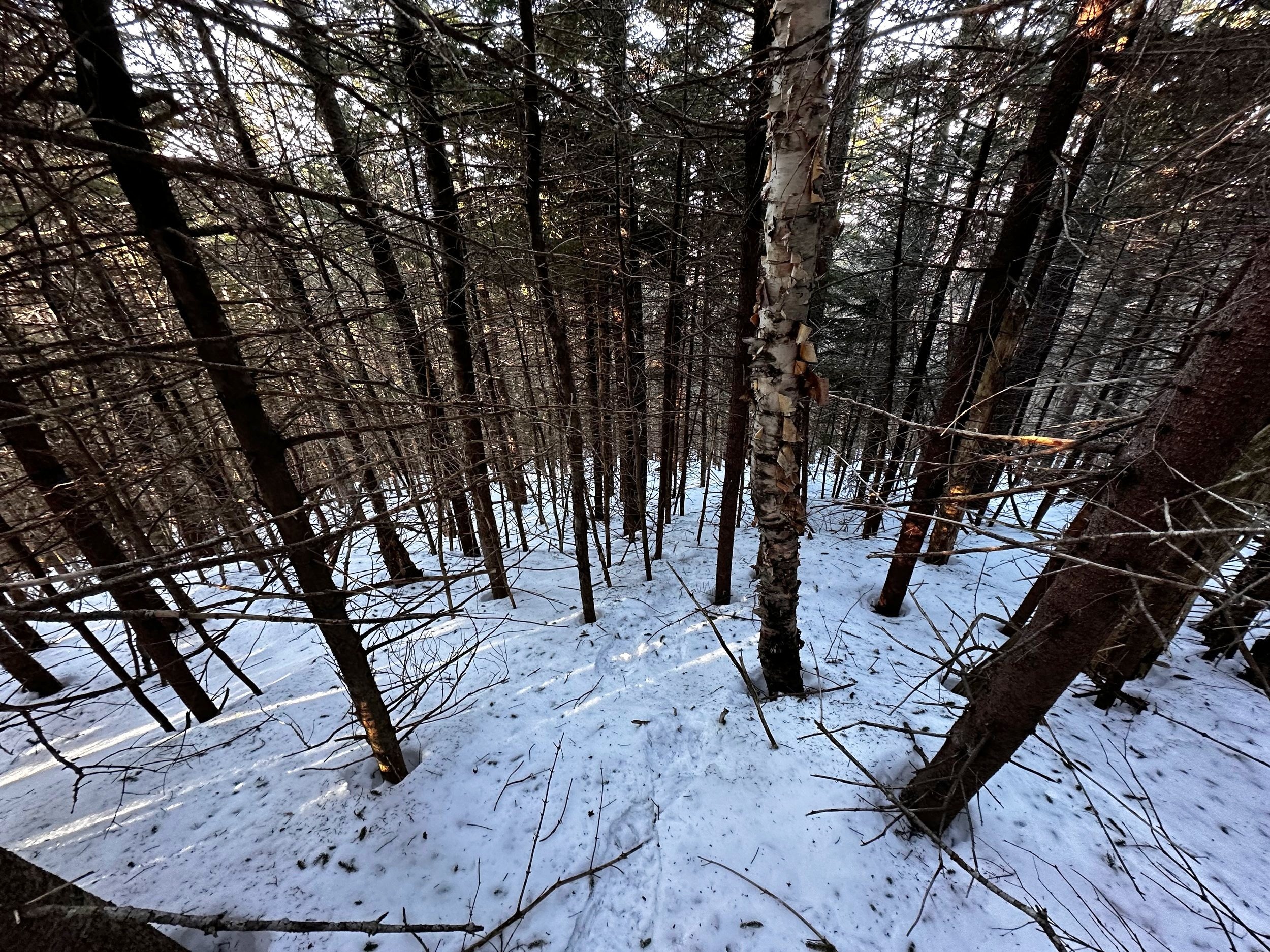
Getting thick, higher along the ridge
As I continued to ascend this particular western ridge, I worked to avoid dense softwood growth directly on the ridge proper by staying just slightly south of the true crest - this, however, necessitated some treacherous side-hilling while climbing steeply and steadily upslope. At about 1.5-miles, I could see the brightly lit clearing in full-sun. This butterfly-shaped clear cut which I viewed on aerial images had grown-in considerably since the most recent photograph I found; a single sled track veered steeply upslope, along the old skidder road - absolutely shredding and tearing up any rogue hobblebush, or beech sapling which dared to grow in its path.
Glancing back south along the ridgecrest
Opting to not focus on the vegetative destruction caused by the sled, I cast my gaze southwesterly, to the mighty mass of Mount Passaconaway - which dominated the mountainous horizon line. Around a band of exposed rock (or old foundation - hard to discern due to residual snow), I swung through a brief patch of brushy evergreen. Spotting more open hardwood to the right (south) of the ridgecrest proper, I reluctantly side-hilled some more, trying to cut straight along an elevation contour, then climbing directly up the steep slope - this method worked best for my gear selection of stiff-soled mountaineering boots matched with mountaineering snowshoes, I simply walked on toe points directly up the western aspect of Bear Mountain, until the snow grew too soft for this method.

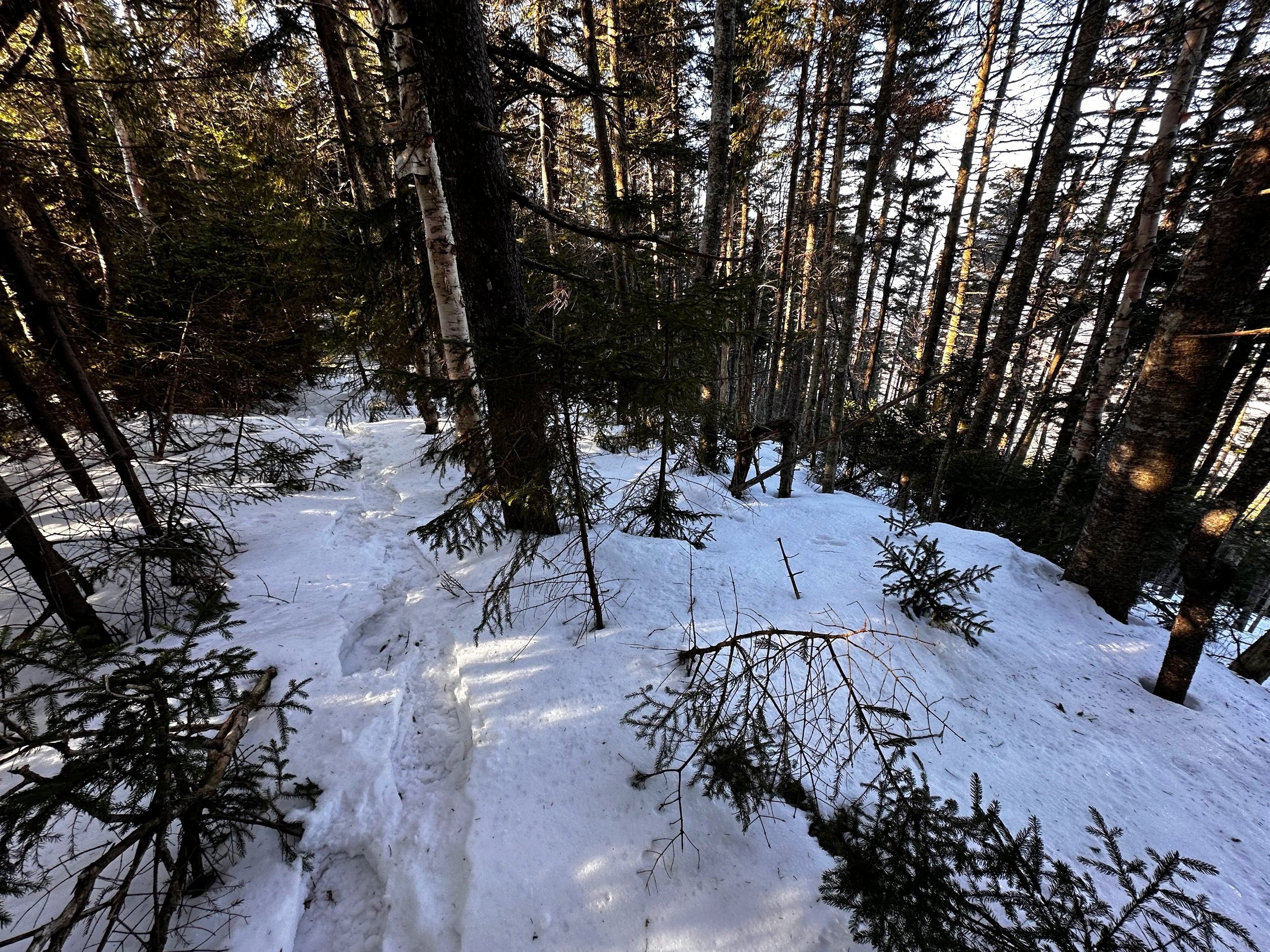
Summit area of Bear Mountain
As I had intentionally picked my route very diligently, and following much deliberation over topographic maps and aerial images - it was not hard for the trained eye to pick a route of obvious hardwood from the overhead images - I had spotted a patch of lighter green which continued much further up this western ridge than in other locations. This approach worked very well, I certainly encountered treacherously dense spruce at one time, but thankfully any thick patches did not last terribly long. Naturally, despite the well thought out approach, I zig-zagged constantly to locate myself in a “path of least resistance” - or just the least bad forest which I could find at any given time.
Overall, the woods were very nice along this route; beyond any thick patches the woods were decent, and the grade remained steep. I could tell from the surrounding terrain that I was quickly reaching the ridgecrest of Bear Mountain; low angle, morning sun began to spill in slivers between pencil-straight spruce trunks. Locomotion was slow and cautious trekking through dense spruce, but with a little care to watch for sharp, pokey spruce twigs, the climbing was really overall rather pleasurable.

A happy hiker atop Bear Mountain
Reaching the true ridgecrest, I looked south: no obvious trail corridor. Glancing north, it was possible to discern a slight corridor; but I do not trust that I completely picked out the old corridor - I found a similarly obvious “path” while climbing Mount Dartmouth, just to return to maps and determine I was nowhere near the old, abandoned corridor. While there were certainly parts of the ridge traverse which could pass as “trail”, I cannot say it was more than a brushy herd path at this point, with lots of evergreen to dip around or dodge altogether.
Surprised to find minimal in the way of larger wildlife along Bear Mountain, perhaps they were enjoying the Sawyer Pond area instead; while following along the obvious ridgecrest, I swung around a massive balsam to locate the recognized high point in the form of weathered PVC canister. The summit area was also marked by orange duct tape strung around trees which I promptly removed and carried out as that was completely unnecessary, and inappropriate to leave at a mountaintop - as the “flagging” was obviously not helping any parties find their way home.
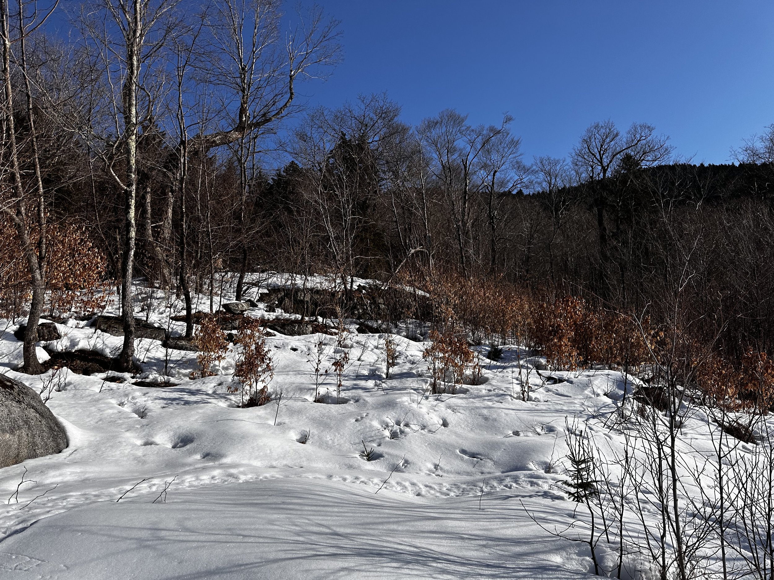
Exposed rock band along the old clear cut
After signing into the summit register notebook and sealing all contents back up into the PVC tube, I noted how tidy the contents of the canister were - one Ziplock bag, one functioning pencil, one notebook placed 2011 which was still completely dry, only half filled - and its entries legible; the contents of the canister contained nothing extra, no wasted space, no wet contents - this made me incredibly happy to find, and log my ascent into what I would claim to be the most tidy summit canister I have hitherto signed in - it’s all about the small joys in life, I suppose.
Following my ascending tracks southward along the ridgecrest, most snowshoe prints had sunk 6-12”, with no sign of supportive crust whatsoever at this elevation - several well intended steps even found their way into deep spruce traps (more like balsam fir traps), which I worked to avoid on my return. Once back along the shaded, western aspect of Bear Mountain, holding speed back became rather tiresome as my mind wanted to carry the downward momentum into forward progress; however, the grove of dense spruce before me ensured a ponderous pace at best.

Open hardwoods stretching far into the distance
Speed picked up once I had left the brushy evergreen in my wake; taking several moments to bask in the panorama caused by the logged clear cut, before reentering the wide-open hardwood stand for a hasty snowshoe run downslope, atop the residual crust layer - which was evidently growing soft underfoot; even nearly entering a slushy state by the time I landed atop the groomed snowmobile corridor at 8:57AM.
On the final trek out, several snowmobilers were preparing their sleds and gear for a lovely, blue-sky morning of riding through the notch. We exchanged greetings and good tidings, but my mind was already back on other outings of The Section Hiker - always a great read - even for those not terribly interested in bushwhacking, as I have become.
Happy Climbing!
Overall stats for the day:
4.35-miles
2hr 1 minute
1,995’ elevation gain
Bear Mountain - 3,200’ (3,221’ by recent measurements)