
Mt Washington via Huntington Ravine
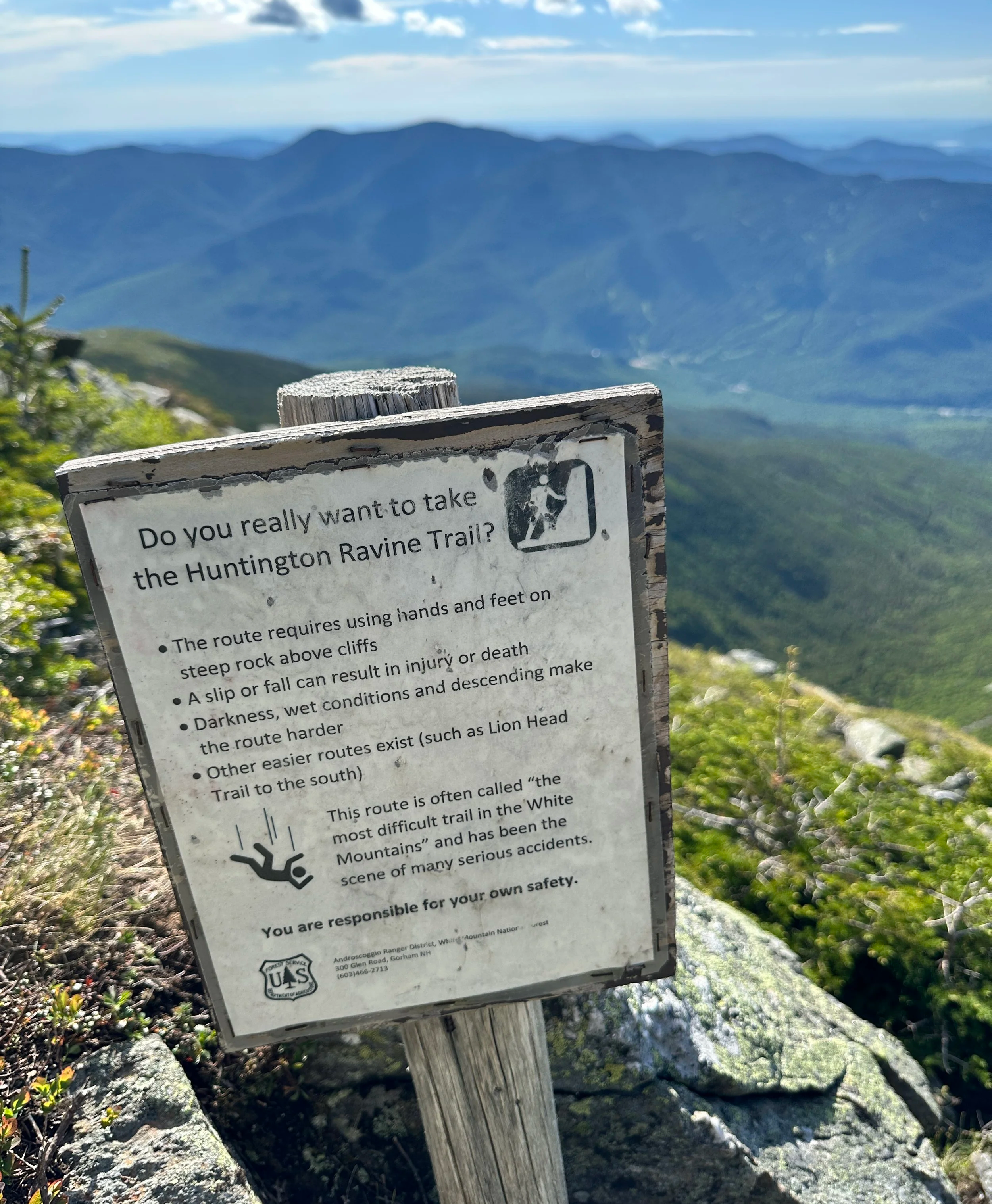
Named by the 2022 White Mountain Guide as “the most difficult regular hiking path in the White Mountains”, I had long anticipated paying a visit to this glacial cirque of a gully for many years. Having had climbed and scrambled a myriad of sheer rock faces from coast to coast, I had hitherto watched countless YouTube documentaries and read innumerable write-ups describing this route, but appropriate weather and timing for such an excursion had simply never lined up, until now.
Along Tuckerman Ravine Trail
With several days of dry, sunny weather followed by incoming rain, I knew my opportunity for a late-spring ascent was presenting itself - plus, I had read a recent report of conditions in the ravine by climbers several days prior on newenglandtrailconditions.com; the cards appeared to be stacking in my favor. With a 28-liter running pack, 2.5-liters of fluids and plenty of snacks, my bag also hosted a stash of warm layers, a set of gloves and a beanie for this mid-June ascent, seeing as the trailhead was listed to be 45-degrees and expected to be only chillier and windier with exposure and elevation gained.
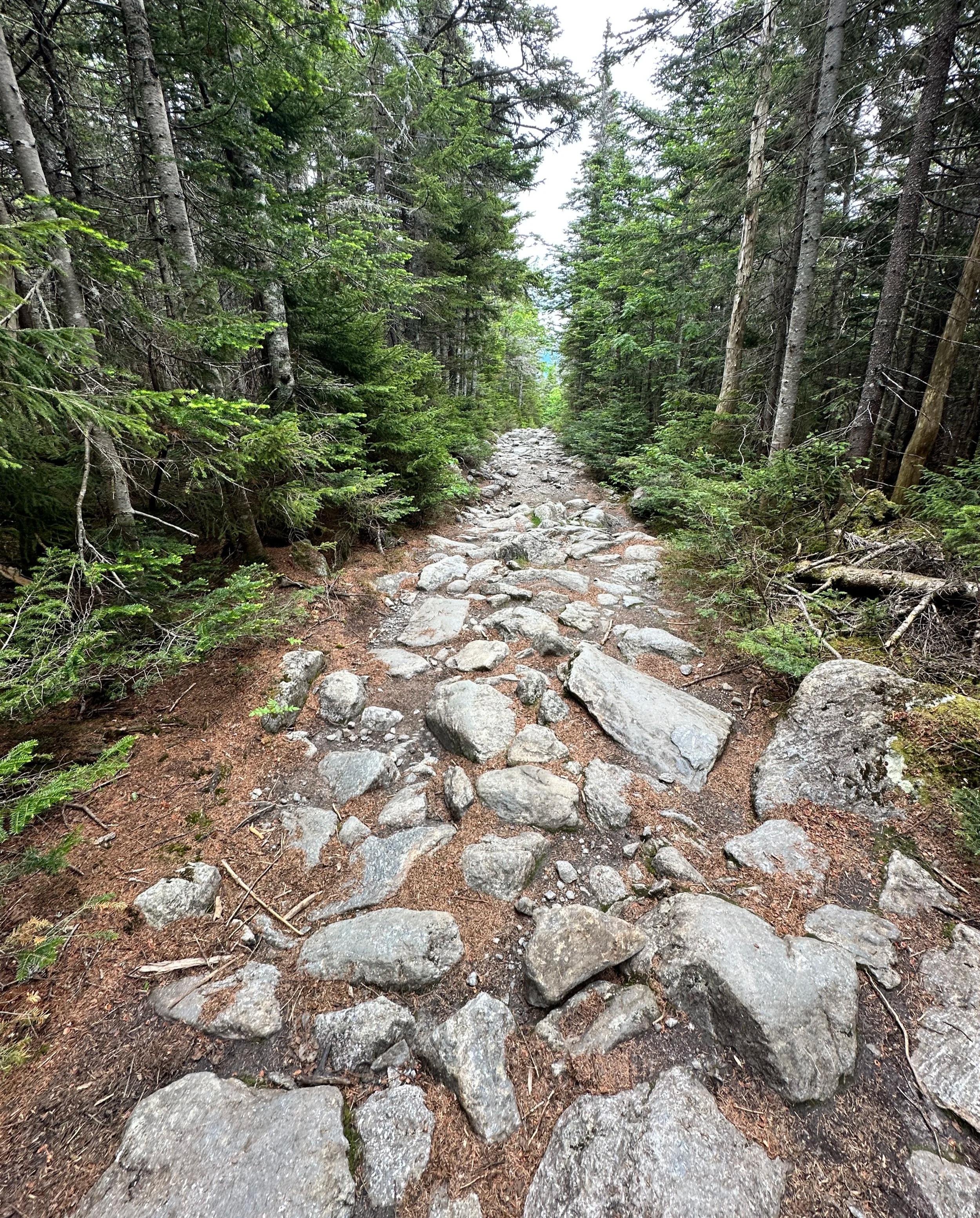
Along with several other hikers, trail runners and climbers, I departed the Pinkham Notch AMC Visitor Center parking lot at 5:45am, as morning light began cresting through the overhead foliage. While enroute to the Huntington Ravine Trail, Crystal Cascades are encountered around 0.4-miles out of Pinkham Notch, along the harrowingly rocky Tuckerman Ravine Trail, a marvelous resting place and unique offering of early stone masonry craftsmanship.
Start of the Huntington Ravine Trail (from Auto Road)
Continuing to follow the Tuckerman Ravine Trail as it switchbacks and gradually climbs about 1,000ft in the initial 1.3-miles, the Huntington Ravine Trail, which was denoted by a small, white, plastic disc which plainly stated, “Tucks ←” and “Hunts →” , I proceeded on the narrow cut in the wall of forestscape which otherwise engulfed the Tuckerman Ravine Trail. With fairly good footing, the Huntington Ravine Trail soon crosses the Cutler River on a line of steppingstone-like boulders; water levels remained slightly elevated from rainstorms earlier in the week, but crossing was completely manageable with some care. Springtime melt and runoff may improve the difficulty of this crossing.
Across the Cutler River, the narrow path meanders around boulders and old conifers, despite the daytime weather having been dry recently, the fallen conifer needles and dense canopy instilled a recognizable dampness in the low, mountain air; the scent of cotton candy often associated with balsam fir was strong on this morning. While ascending steeply at times, the lower Huntington Ravine Trail traces just north of the drainage, occasionally only a mere feet above; massive boulders and fallen trees began to showcase the often violent nature of weather and seasonality to be found along the foot of this east-facing ravine.
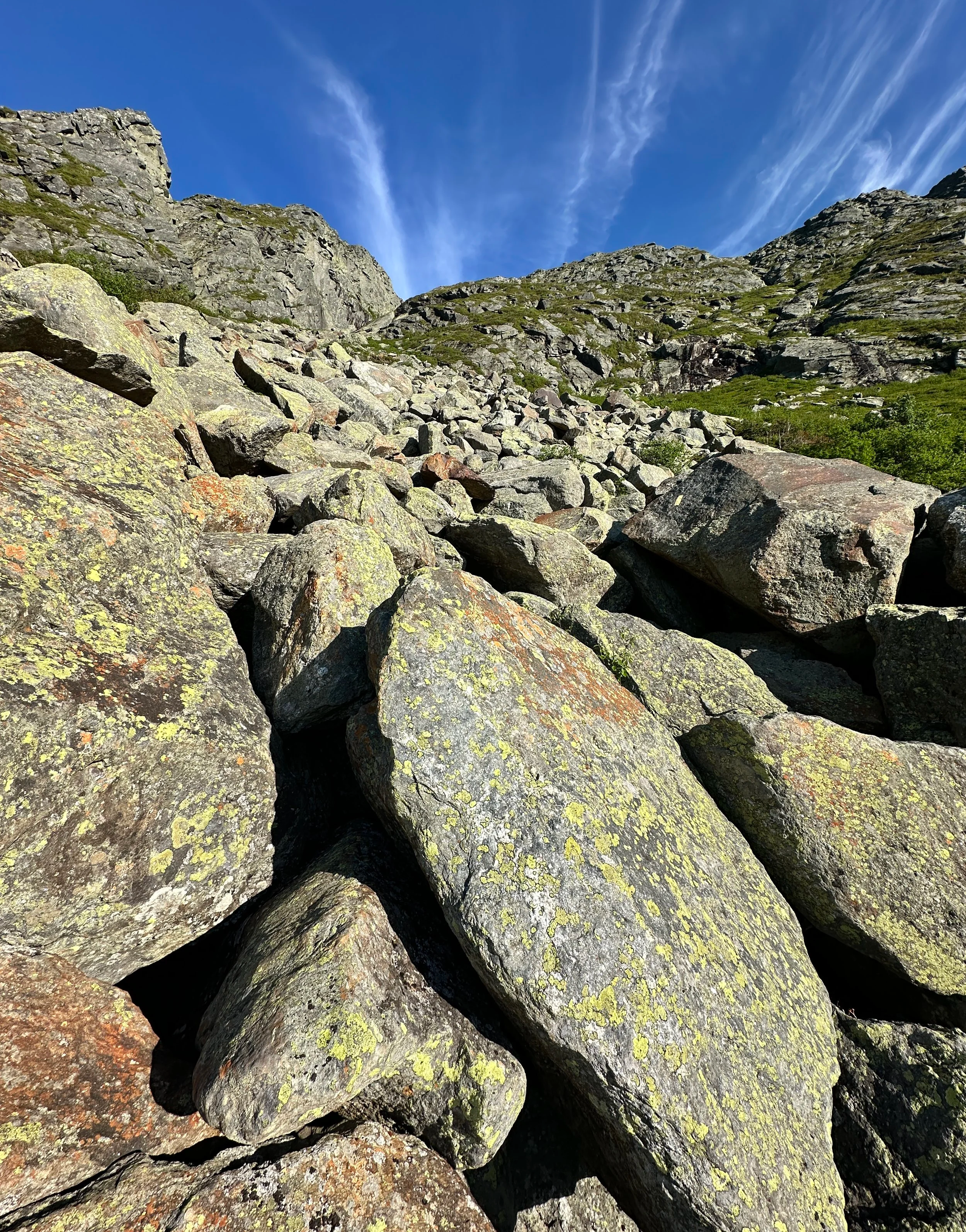
Crossing a boulderfield in Huntington Ravine
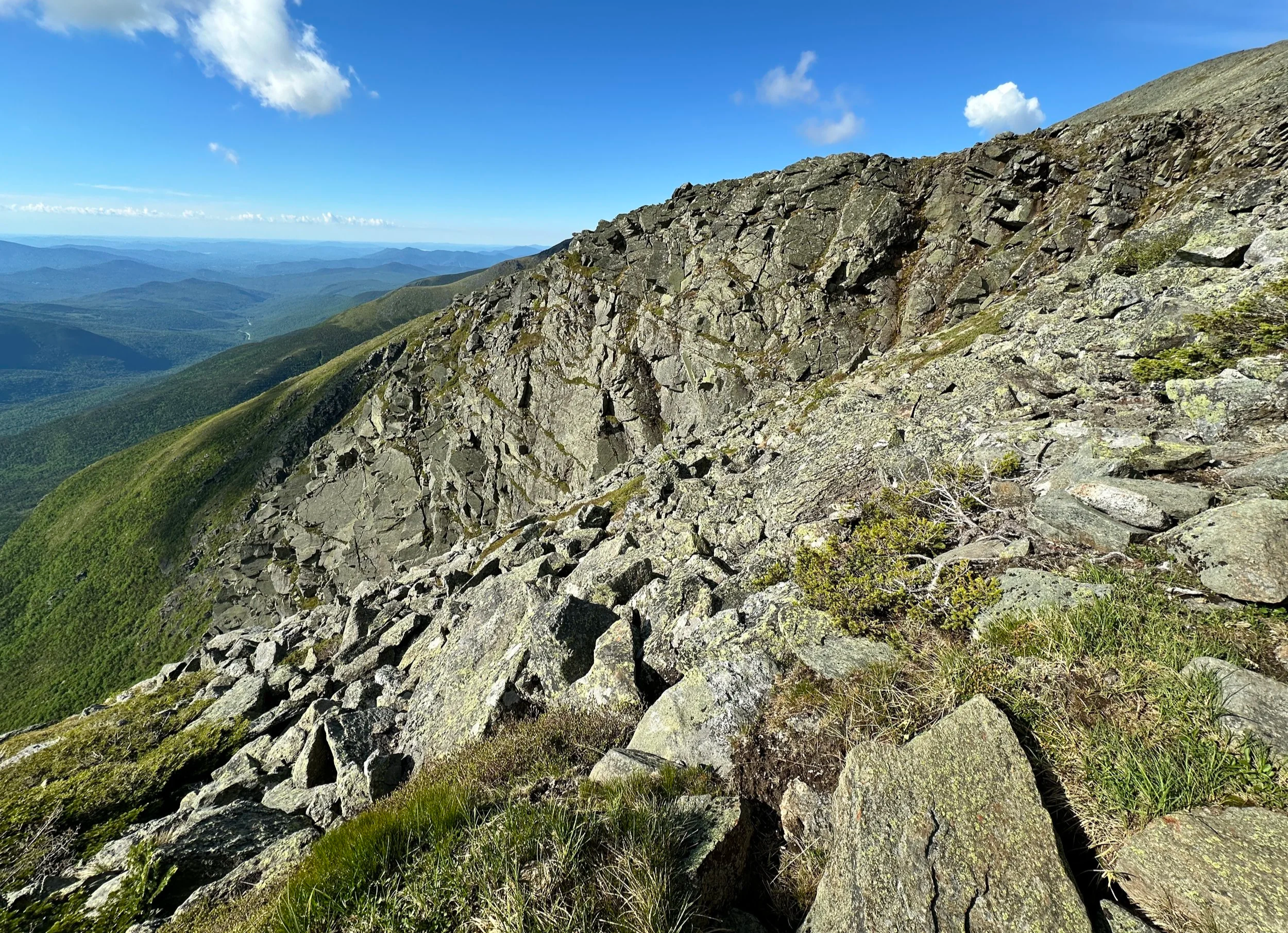
As the trail levels somewhat, larger boulders appear mid-trail, several stacked tightly create passageways and brief tunnels which must be navigated through - here, I was thankful for having a somewhat smaller pack as to not remove it half a dozen times to fit through the narrow spaces! The rock on many of these boulders is of a good enough quality for a climber to scramble to slightly higher ground, several of which offer a glimpse of the ravine headwall and surrounding precipices - certainly an absolute awe-inspiring sight to behold!
As the Huntington Ravine Trail climbs through a section of smaller, scrubby trees, a band of talus and shattered rock can be seen just to the right, this has been dubbed “the fan”; after a short bit of wooded climbing and crossing of a large talus rock field, climbers emerge at the base of a steep, ledgy scramble. Although small cracks and minute imperfections in the rock face can be used to aid in ascending, good, grippy shoes come in very handy along this initial ledge section. Today, some residual water drained down parts of the ledge necessitating climbers find drier rock to place footsteps, for, wet sand and slime do not provide the best traction at such a pitch!
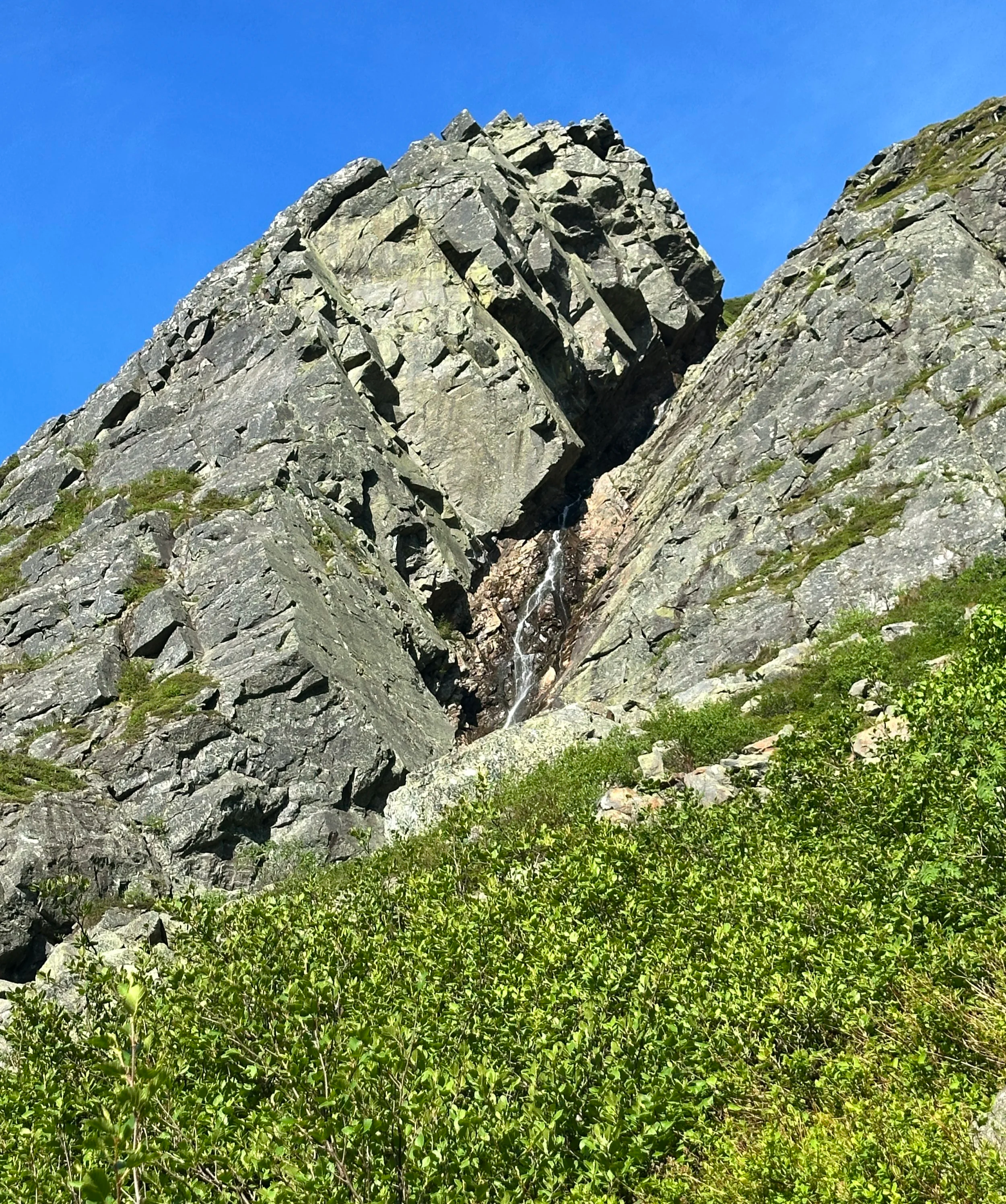
A waterfall flows south of the main headwall
As the guidebooks explain, the yellow-blazed route does appear to guide the climber along a path of least resistance, albeit with several of the maneuvers taking place in “no fall zones”; hands (for three points of contact) must be used in junction with solid footwork to ensure a slip and slide of any length does not take place in such a remote backcountry setting as this.
While ascending, the marked pathway coincides briefly with a small brook; stepping on small rocks can help keep feet dry, but it is good to note, during all but the driest of seasons, some trickle of water can be found along the Huntington Ravine Trail, if need be. Through a narrow chimney, the trail climbs steeply to skirt around a bulge of rock, to a resting place of sorts - a flat rock from which a glorious scene of rolling hills can be found; the mountain ridges of the Wildcats and Carters fill the immediate vista from side to side, while peaks of Maine rise in staggered layers, on a good weather day.

Wildcats and Carters beyond the ravine floor
Beyond this place of rest and reprieve, the steepest of slopes and scrambles have been scaled, a light grade of classically Presidential, frost-shattered rock forms the hillside landscape and the obvious path upward is often scree-lined. Before long, the alpine garden comes into view; sedges dance in the slightest breeze and the lawn bursts to life with tiny pink, yellow and white alpine flowers; life grows much slower and oftentimes smaller at such high elevation - so, please do be sure to watch your step when taking in the magnificent panoramas and remain on durable surfaces - “do the rock walk” as is often exclaimed in this delicate environment!
Ascending up and out of the ravine
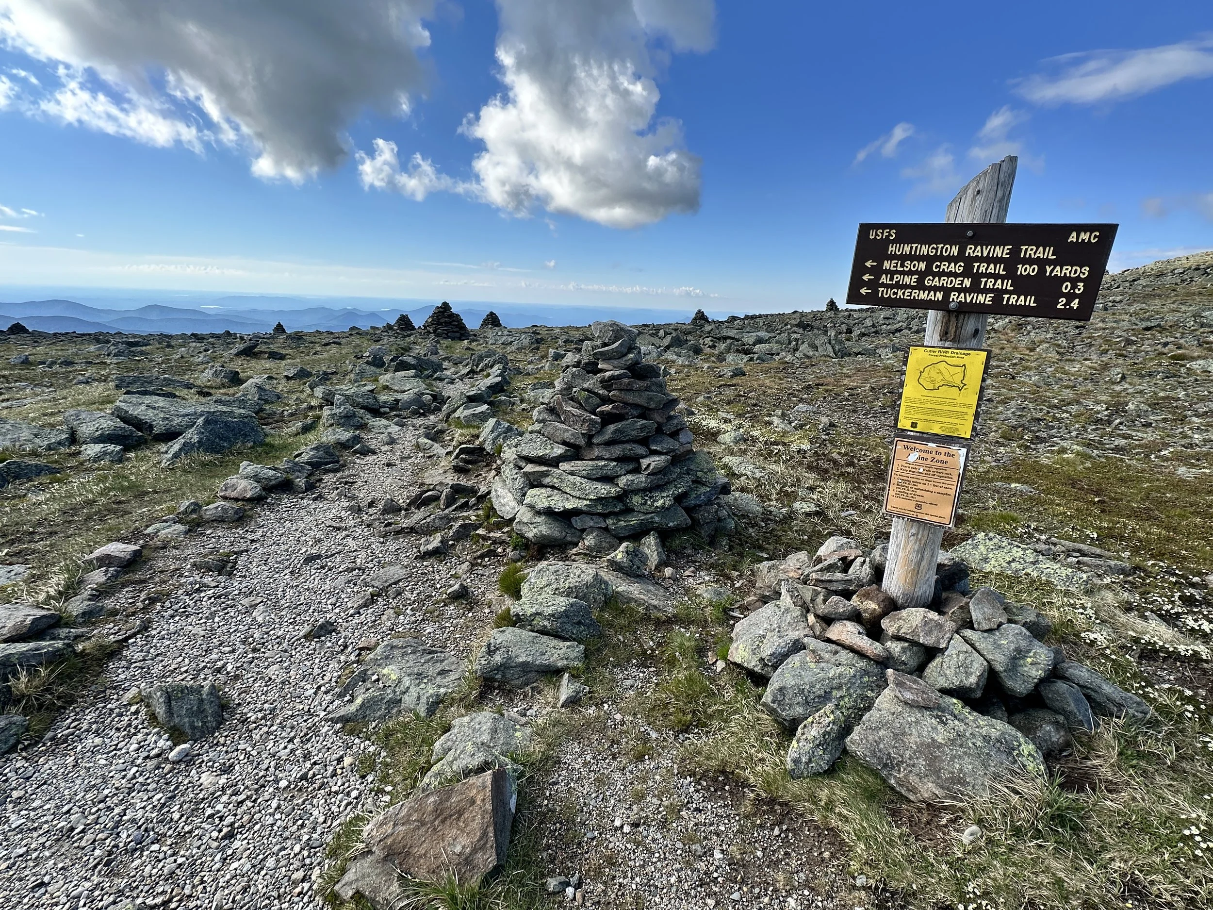
Approaching a small parking area along the Mount Washington Auto Road, the terminus of the Huntington Ravine Trail crosses the Nelson Crag Trail which can thenceforth be followed as it swings and climbs in a southwestwardly direction, to the 6,288ft summit of Mount Washington. This section of pathway offers climbers rock cairns to aid in navigation, some have been topped with white quartzite-like rock (or painted?). Admittedly, parts of this trail occasionally seem to blend in with the sounding sea of fractured rock, so care should be taken to glance up from the careful footing, look ahead and spot the direction of intended travel to be sure you stay found.
While enroute to the main summit, the Nelson Crag Trail tops a lesser summit known as Ball Crag (6,109ft); while not a full 360-degree view, the scene is no less outstanding to what may be found from the true high point, however, this spot can oftentimes be enjoyed with far less tourist traffic.
A note to potential climbers
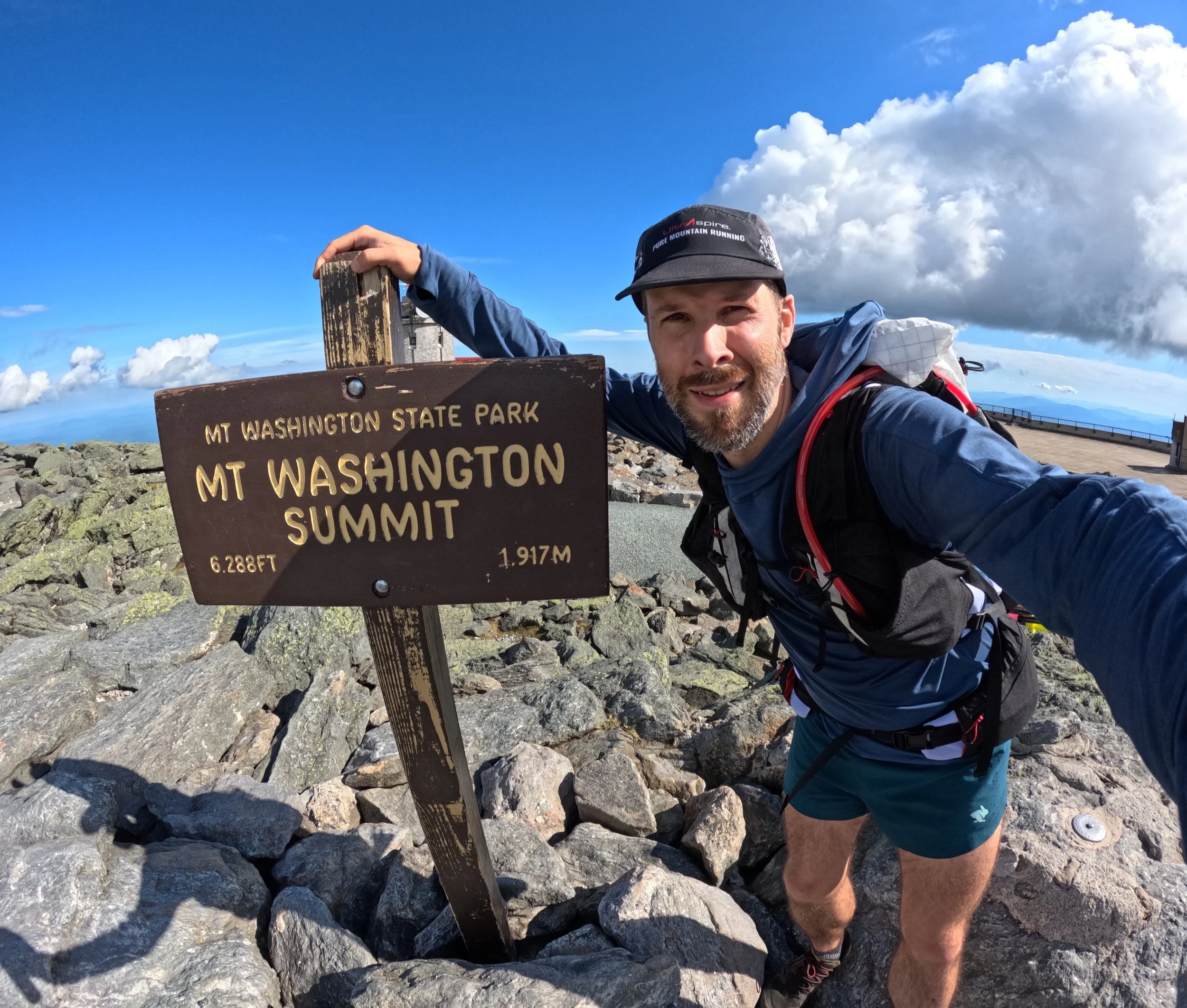
Unless climbing during the foggiest of days, the high point and summit of Mount Washington is absolutely obvious: towers and buildings scream into the skyline, the Cog railroad tracks wind and paved auto road all guide the eye upslope. Luckily, the Cog was not running during this mornings 8:00AM ascent, but oftentimes the plume of black diesel smoke can be seen for miles while its’ booming air horn can be heard rebounding off quieter, neighboring peaks.
After reaching the small mound of rock and summit sign denoting the highest point in the northeast, a multitude of routes in which to descend are offerings to the climber, all depending on how much time and energy one has remaining in their day. Tuckerman Ravine, Lions Head and Boott Spur, to name a few, all make for exciting and scenic descent routes, however, descending by Huntington Ravine Trail is never recommended, especially in wet or foul weather conditions - anyone who used this route to ascend should need no further explanation!
Overall stats for the day:
8.7-miles with 4,500ft elevation gain
Mt Washington - 6,288ft
A great way to spend the morning