
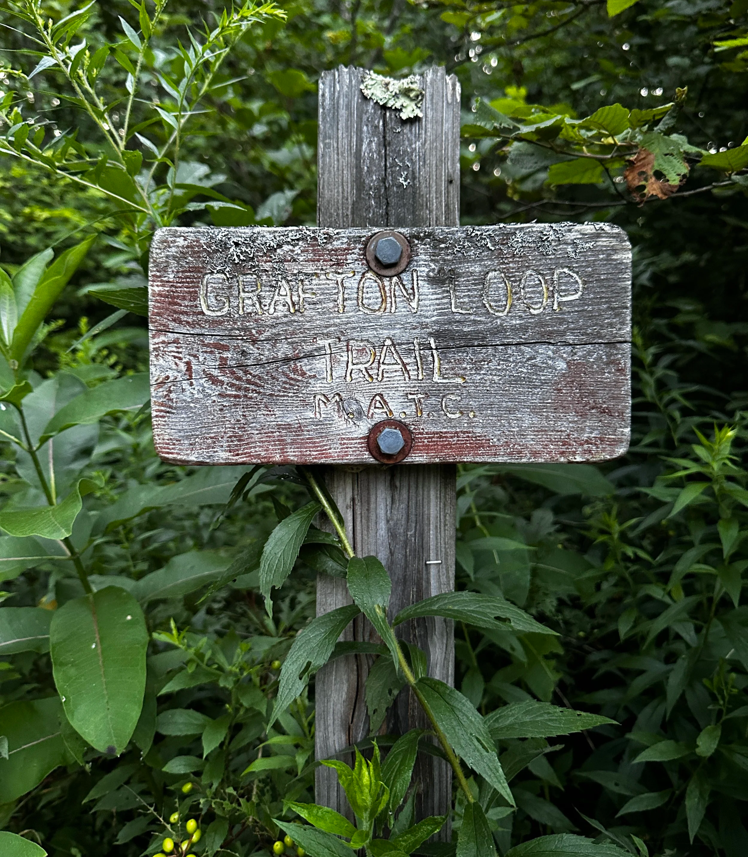
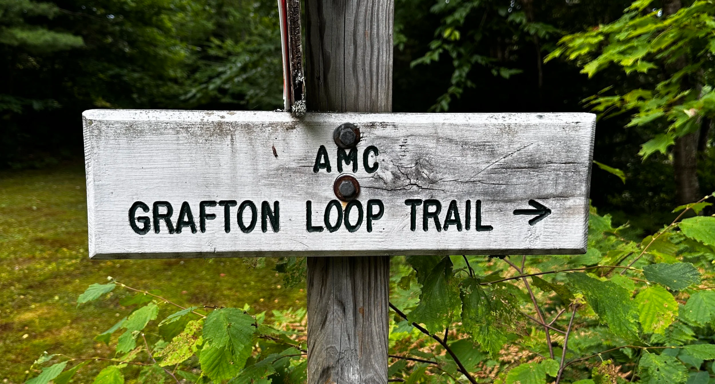
Grafton Notch Loop
The Northeast 115 (formerly Northeast 111) 4000-footers were fresh on my mind and top on my to-do list when I had first heard of the Grafton Notch Loop; the newest sections from the notorious Old Speck (4,188ft) to Sunday River Whitecap (3,368ft) and onward back to ME Route 26 were of questionable build status at that point. Designed with backpackers in mind, this trail on both east and west of the scenic byway offers recreationists earthen tent pads near generally reliable water sources - places to call home for the evening. However, I caught the notion of trail runners completing this 35+ mile rugged route in one long day and I badly wanted to experience this trek in the bouldery Maine woods, with it ledgy summit scrambles, bands of coniferous forests and cool, mountain streams.
The Grafton Loop Trail was an idea brought to light by members of the MATC (Maine Appalachian Trail Club), AMC (Appalachian Mountain Club), state and Federal agencies, non-profit organizations, and generous landowners; with the heavily trafficked Appalachian Trail nearby, its’ goal was to provide an alternative hiking experience, allowing options for multi-day outings for hikers who desired a more remote, natural setting.
Back in 2018, while working on ascending all four-thousand-footers of the northeast, I noticed the pathway continue eastbound off the summit of Old Speck, into the scrub. Aside from local news online announcing the opening of the trail, not much was to be found on the new trail back then - some reports I found described pleasant footing and easy going while others recounted horrific tales of entangling blowdown and entrapments which would surely impede foot travel.
Ascending Puzzle Mtn
Fast-forward to summer 2025 and I was fresh off finishing my first 100-mile ultra run and deeply craving a long day in the mountains, but no standard Pemi Loop would satiate that desire for mountain adventure, I needed something new, route I had dreamt of and spent many hours plotting out. For several years I traced that route as it clambered over mountaintops and dipped into river valley lowlands; I felt as if I knew each rise and fall, each bend in the meandering red line, I just had to go link up the peaks and run the trail myself. With a weekday off from work during a perfect weather window in July, the time had finally come for such an adventure in the Maine woods.
The primary parking options for the Grafton Loop Trail are found at either the large AT parking area located along ME Route 26 in Grafton Notch, or ten-miles southeast, also along Maine Route 26, located just across from Eddy Road, near North Newry. After considerations for either terminus, I opted to begin from the eastern trailhead, using Puzzle, Long and the Baldpate Mountains as a sort of “warm up” before climbing steeply to Old Speck, the high point of the route and finally strolling the newest section of trail back to my starting point, some thirteen-miles away.
Old Speck through a break in the trees
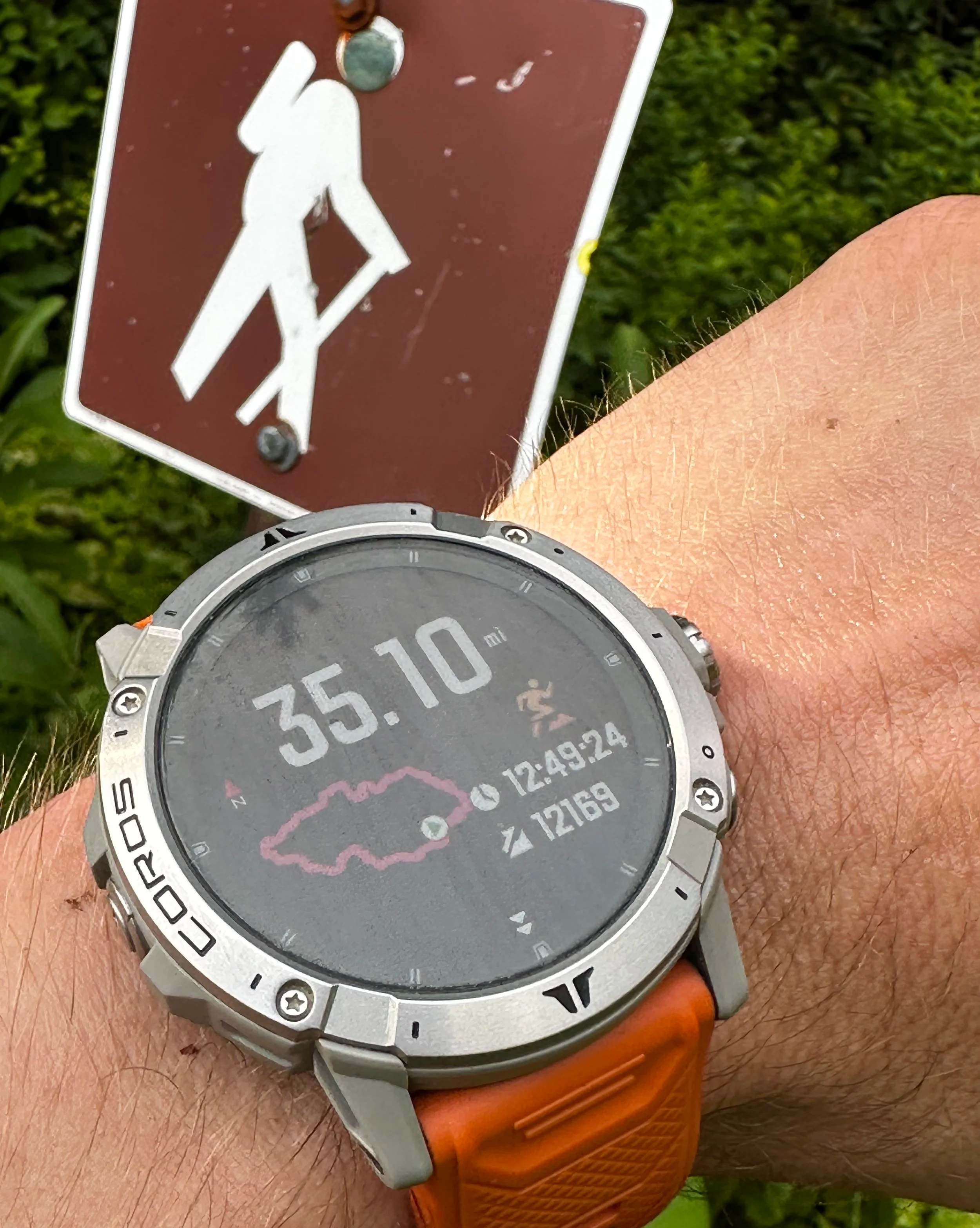
After a gorgeous sunrise during the long commute from western New Hampshire, I arrived to a quiet, sandy parking area shared with several other cars. Most of the gear for the day was packed and ready to go; with laces snugged on the Altra King MT 2’s, I queued up the Coros Vertix 2 watch and prepared my mind for several hours of what I hoped to be a beautifully scenic, explorative and meditative trail run. At 5:29AM, just beyond a brief wall of overgrowth I began down the soft trail I had been waiting years to pay a visit to: the Grafton Loop Trail.
For this long day of running mountains, I would be testing out a running pack from UltrAspire, a 22-liter roll-top called The Purist, which would carry extra clothing, a small first aid kit, Sawyer water filter, lots of food and snacks, with a 2-liter hydration bladder internally, and 3x 500ml soft flasks externally - all of which were carried remarkably comfortably and snug in this new pack-meets-vest, with mindfully designed pocket placement keeping its users from being contortionists and allowing for access to important gear while on the go (this pack was also used exclusively on my Infinitus 100-mile ultra run due to its comfort and ability to carry loads and not bounce obnoxiously).
Boulders nearing Puzzle Mtn summit
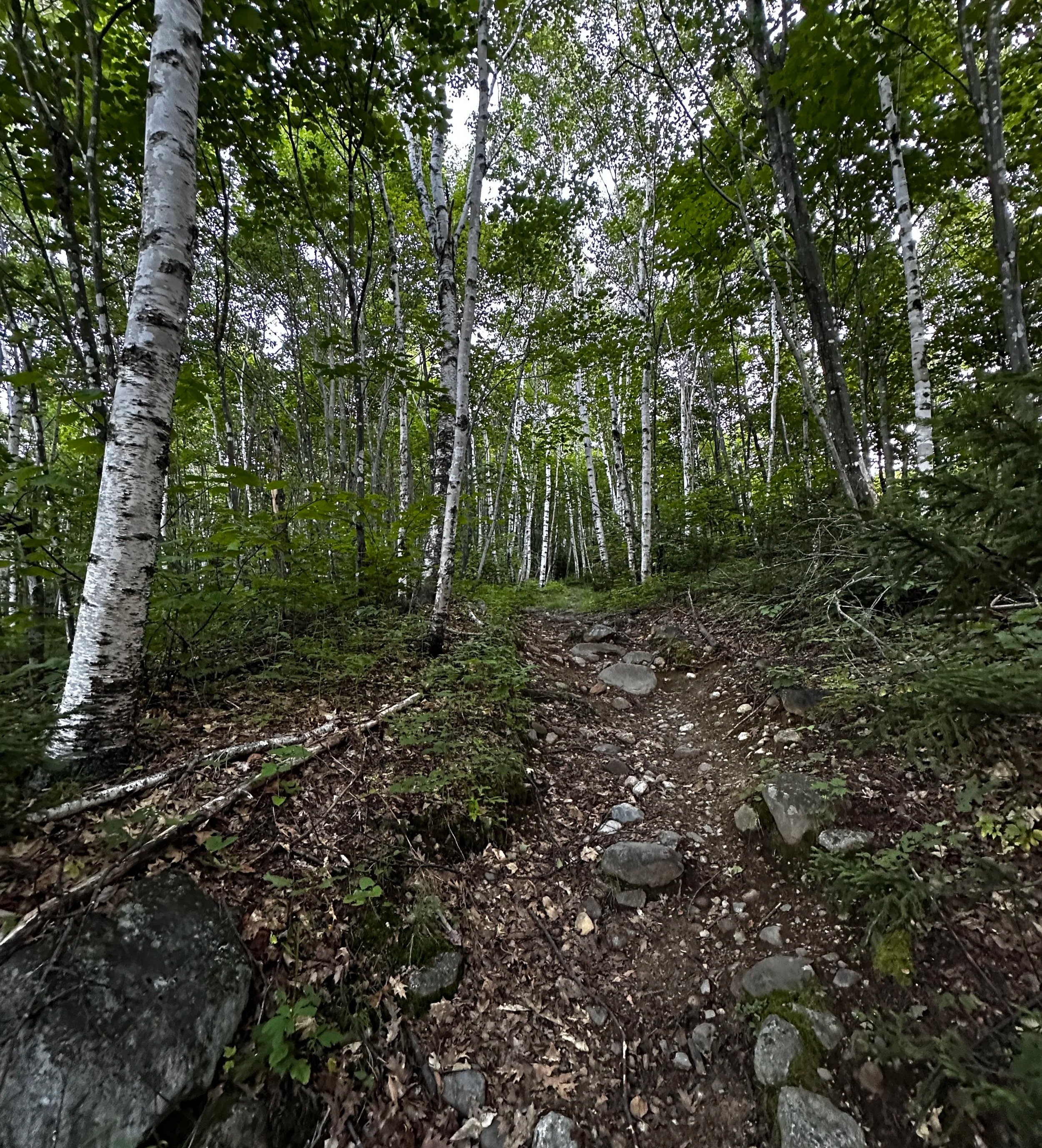
From footpath to old logging road, the path soon entered a gorgeous stand of birch, which reflected the morning glow of deep orange sunlight remarkably; footing was rocky and while it had become somewhat eroded over the years, it was not terribly loose underfoot. Before long, the trail crested over several ledges, offering distant views to the peaks I would later visit in afternoon, in Grafton Notch. Back into the forest, the trail rolled over the topography, meandering toward the summit of Puzzle Mountain; spruce and fir entered the forestscape while a jumble of massive boulders lined trailside. Much of the ascent was either navigating around, or up and over these gigantic stones and baren ledges.
Following a path of bedrock and rock steps, I stood briefly atop the southwestern peak of Puzzle Mountain (3,077ft), long enough to bask in the westerly views; noting to myself, Old Speck was one of the only higher summits in sight with a cloud capping its high point, with any luck the haze would burn off before my arrival. Weighing the option of diverging from my anticipated route, to the higher, main summit of Puzzle Mountain itself, I considered the great distance and unknown terrain before me, with this in mind, I continued onward, descending along rock slabs with scree walls, switch-backing down the western slope of Puzzle Mountain before re-entering the thick forest canopy.
Along an old woods road
As the undergrowth grew tight from ferns and hobblebush, my thoughts went to the local moose, surely moose roamed these slopes - the evidence was all around; this kept me alert to not just the required quick foot placement but also of any sticks cracking or suspicious leaves rustling trailside. I found temporary relief from the sensation of complete desolation upon passing the Stewart Campsite; a lone backpacker was prepping gear alongside a pot of coffee outside of their tent - the scent of breakfast was otherworldly amidst the rich, damp soil, the forest was alive with waves of sweet cotton candy from the fir trees.
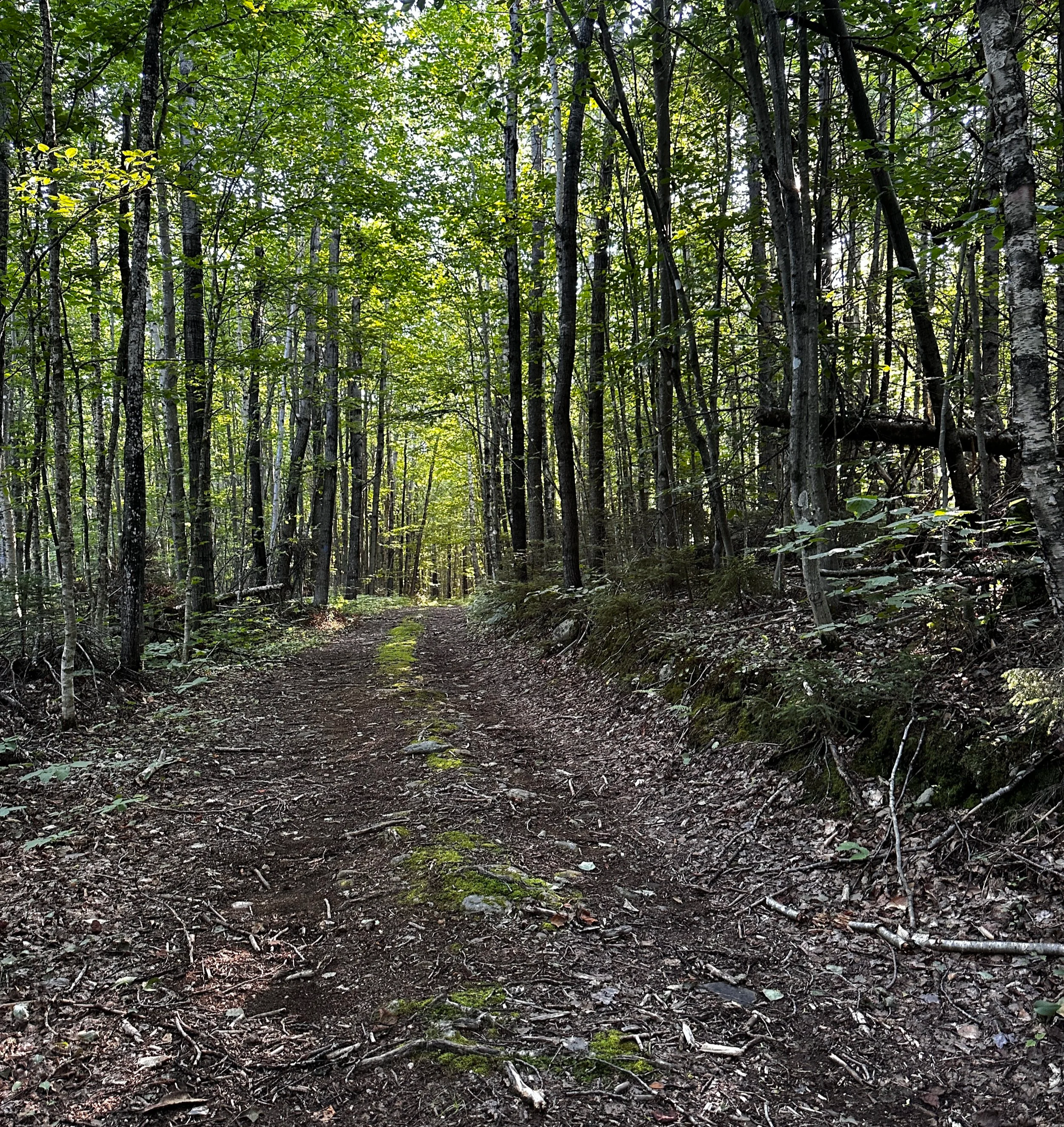
Any minor waterways were easily hopped over on a long, gradual descent to the Chase Hill Brook water crossing, it was obvious this lowland would no doubt become soft or muddy in times of high water or soaking rain, but during my July visit, I found nothing but quick travel and lovely trail underfoot. Across the brook and up a shallow embankment, my route for the Grafton Loop Trail swung briefly northeast, onto an old woods road for roughly 0.2-miles before diverging deeper into the forest, proceeding northwestwardly. Marked with a rock cairn at the junction, I entered a swath of densely verdant, northern hardwoods, over the undergrowth I could see much further than previously allowed by the tight conifers of Puzzle Mountain.
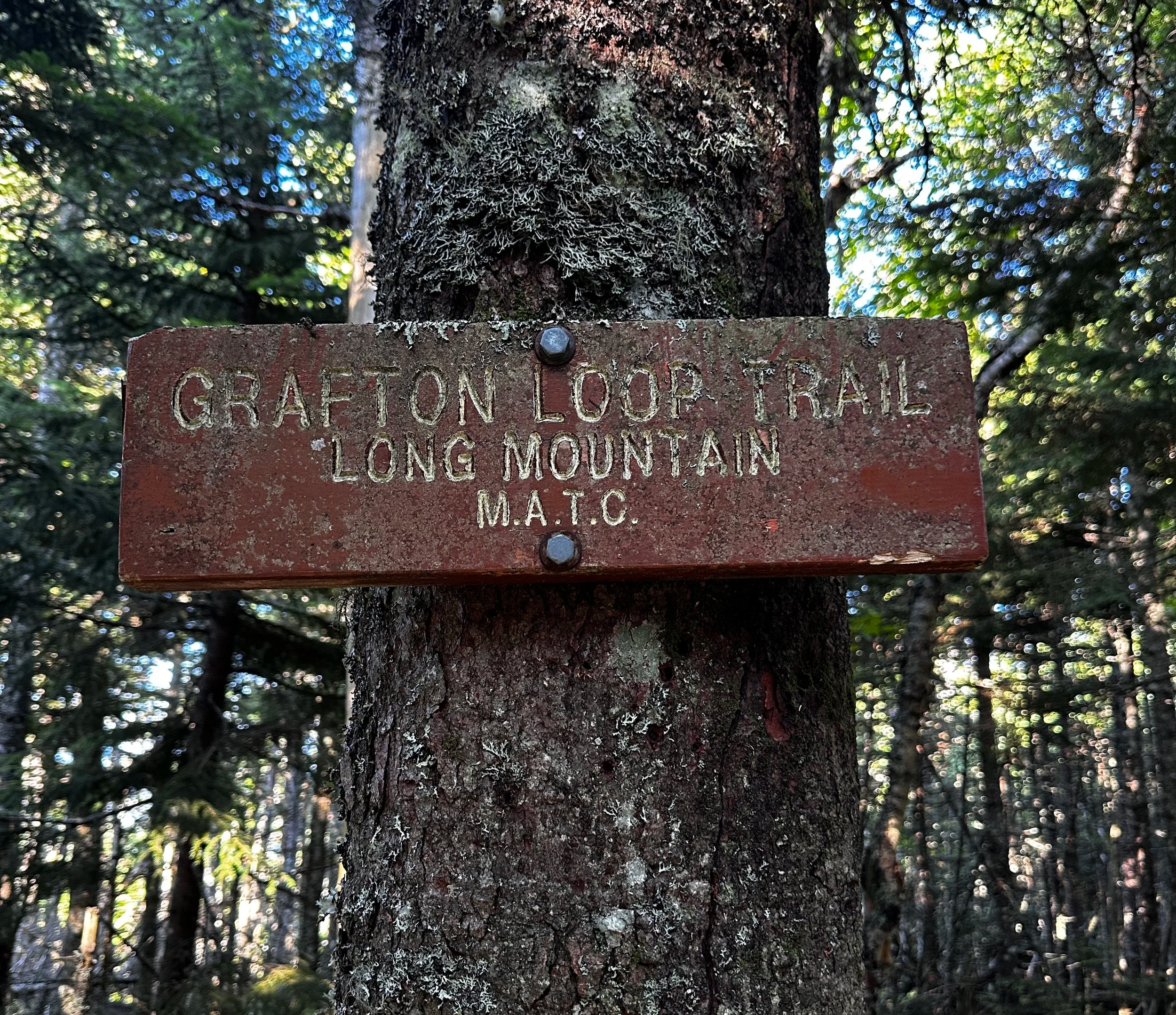
High point along Long Mountain
Finding out first hand why this mountain mass is named “Long Mountain”, the pathway zigged and zagged, occasionally offering restricted views to other nearby forest-capped hills. In sections, the pathway tightened and sharply switched direction, again, my mind played out encounters with moose and how the stiff spruce branches would allow no escape should we meet head-on along this stretch.
After nearly two miles of gradual ascent, my footpath leveled off and became a gorgeous moss-lined single track, one of my all-time favorites to encounter in the high hills! On the high point of this crest was an old, rust-colored MATC sign: “Grafton Loop Trail, Long Mountain”. I knew I was near to the summit of Long Mountain, but with the same regard as Puzzle Mountain, I was not here to tack on extra distance - especially not avoidable bushwhacks in the early miles of my 35-mile day.
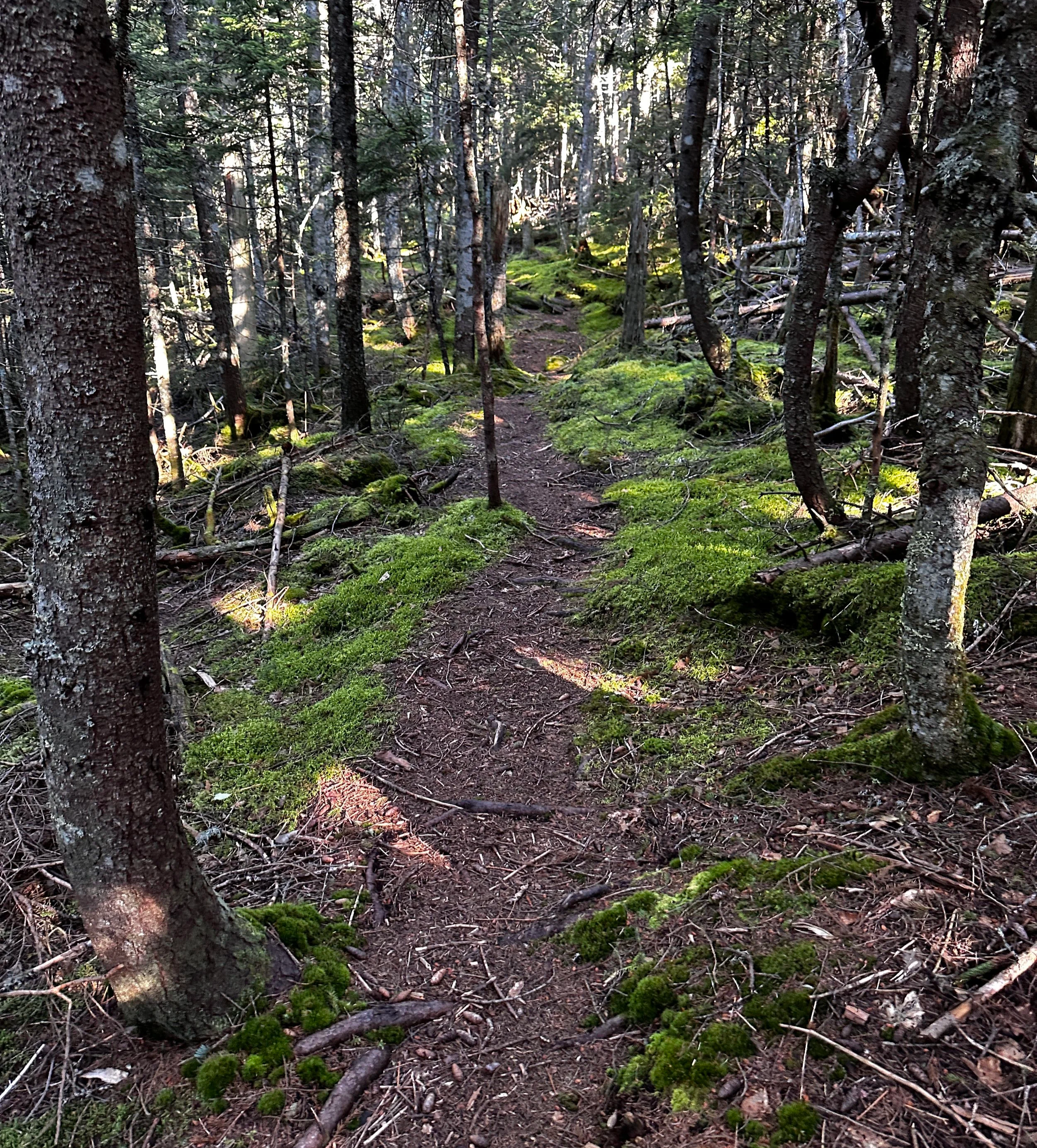
A lovely stretch of trail
The descent off Long Mountain was tight and brushy, it seemed obvious to me that this stretch receives perhaps the least amount of traffic of all sections I traversed this day; the trail felt distant and desolate, forgotten about and far removed from humanity - while still easily navigable, I found it beautiful. Several more backcountry campsites lined the trail while enroute to my next destination; crossing Wight Brook several times, hikers have the option to refill their supply or simply enjoy the beauty of several small flumes.
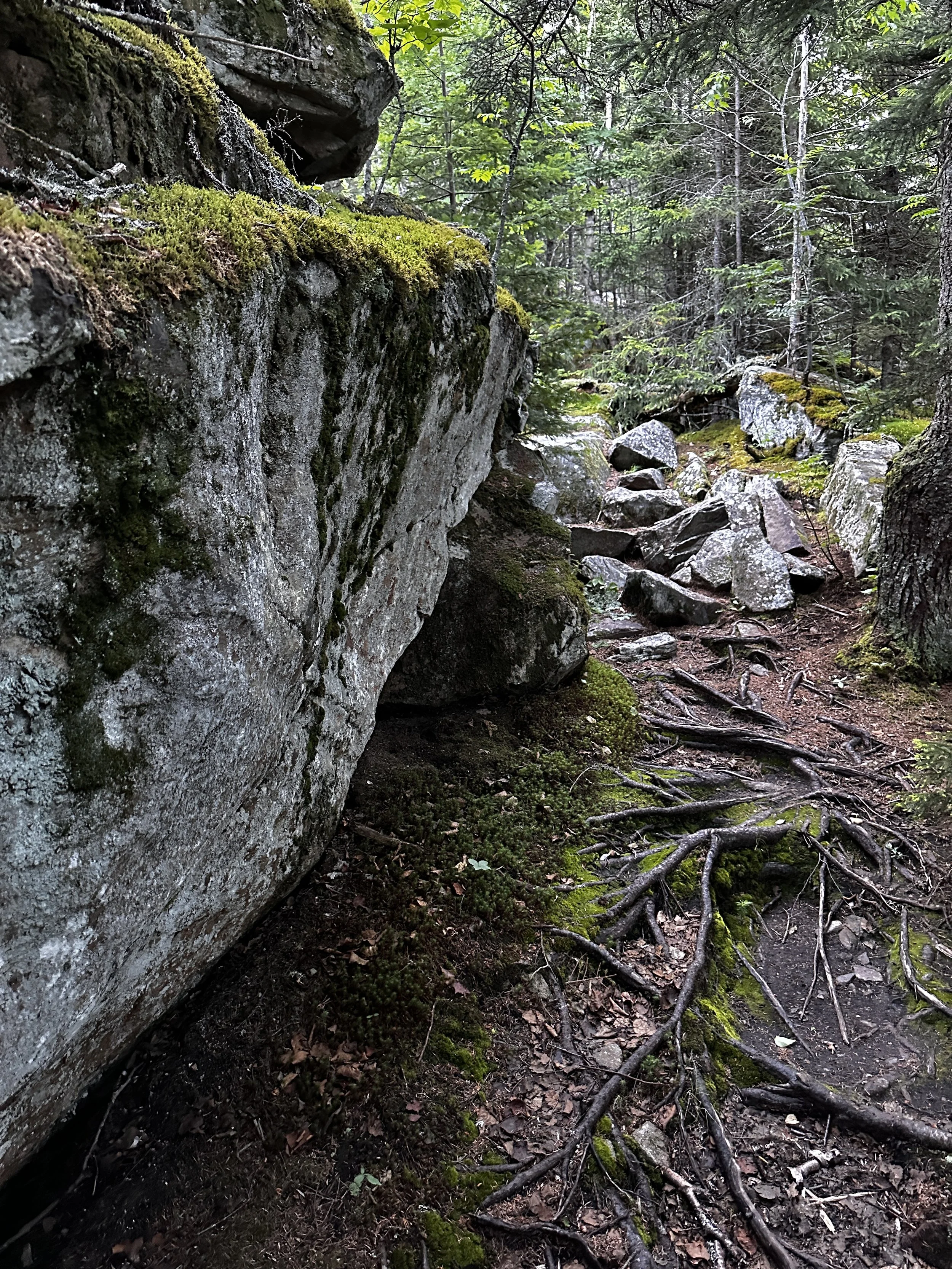
Climbing out of the ravine the trail becomes steep as it climbs to Lightning Ledge - it was around here I had my first unintentional bushwhack of the endeavor. I failed to spot a small stack of sticks laid across the trail, it was at this point I should have swung sharply right and climbed an eroded rock scramble - with blazes not obvious, I had continued following what was likely years of prior navigational mishaps, continuing straight, until the evidence of foot travel diminished to untouched forest floor. After consulting the map, I was glad to have chosen to retrace my steps instead of bushwhack to get back on track, a massive bulge of glacial erratic stood between my location and trail.
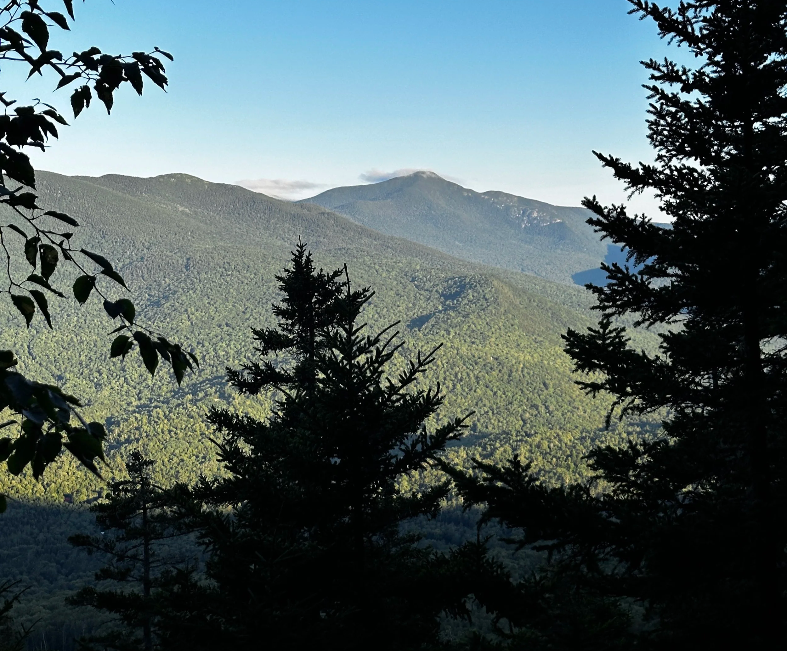
Old Speck behind (right) the West Peak of Baldpate Mtn
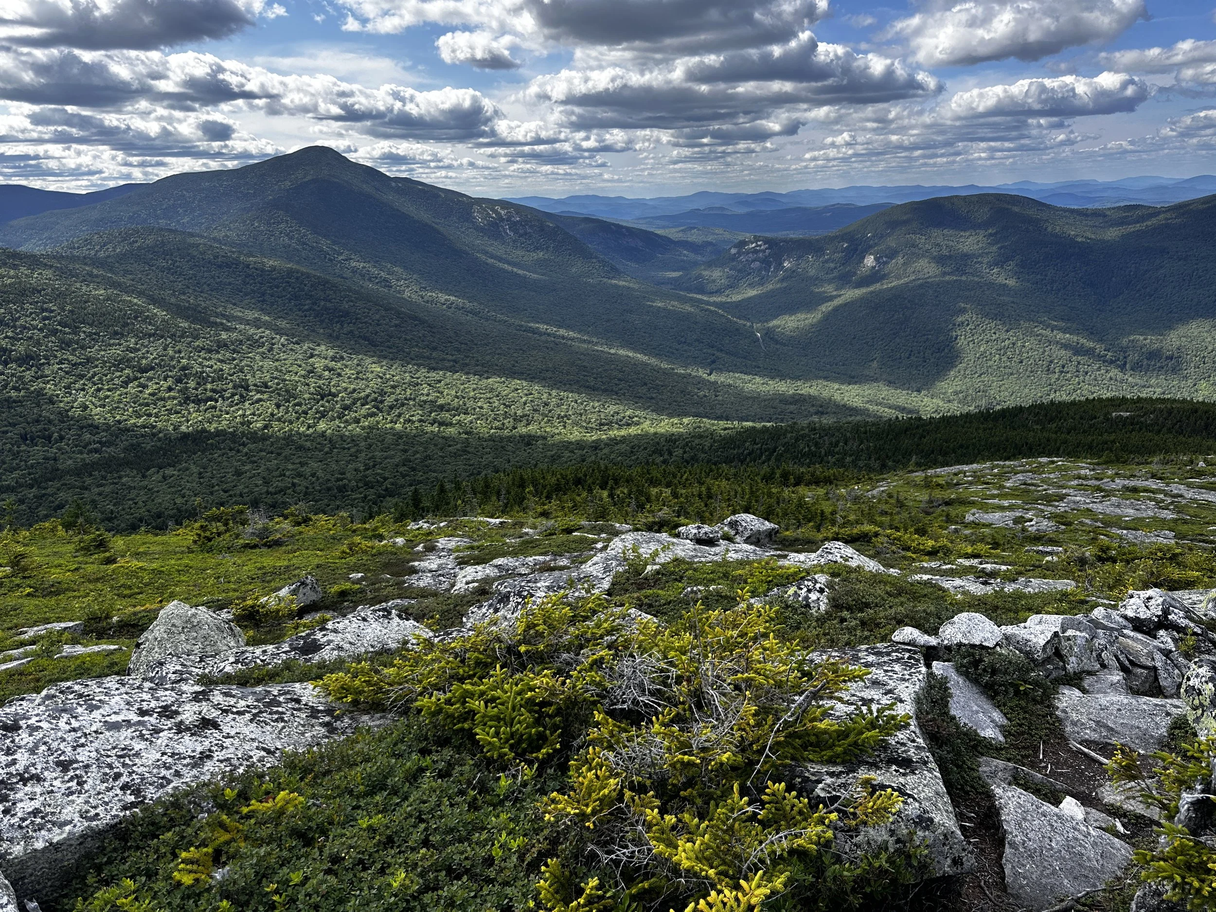
Back on my intended path, the lookout of Lightning Ledge was breathtaking - a glimpse back to the forested ridge of Long Mountain. Knowing the ledgy mountain crest of well-travelled Appalachian Trail was not far ahead, I pushed, climbing steeply up the rugged footbed along the eastern ridge of Baldpate Mountain’s East Peak. Not a single hiker was in sight as I crested onto the scrubby vegetation-lined rock ledge and stood before the summit sign.
For a short stroll, I found myself in the alpine, trail running on bare rock and following the scree-edged Appalachian Trail. I remembered the descent off Baldpate Mountain well; from here, one can see miles along the rolling terrain, the line of pathway visible through the forest as it rises from the col to the West Peak of Baldpate Mountain, thenceforth rising out of Grafton Notch, a streak cutting along the wooded shoulder of Old Speck.
Descent off Baldpate Mtn from West Peak
From the short yet steep ascent of West Peak, the glimpse back to where I had just descended always intrigues me - impressively steep, just a dome of rock appearing too steep to scale, but footing is surprisingly easy and the rockface deceptively tacky. I recalled each step of the descent off West Peak; one long staircase of placed rocks before the footpath tapers off somewhat, transitioning back to soil - soft and runnable earth.
Reaching the Grafton Notch parking area, there must have been some trail magic barbeque going on for thru hikers, however, my concern was swapping soft flasks, to rehydrate during the long, steady climb ahead. Old Speck is a great climb, steep and rugged in sections - it was here I really began to encounter other hikers for the first time of my long day out; it was nearing 1:30PM, after all.
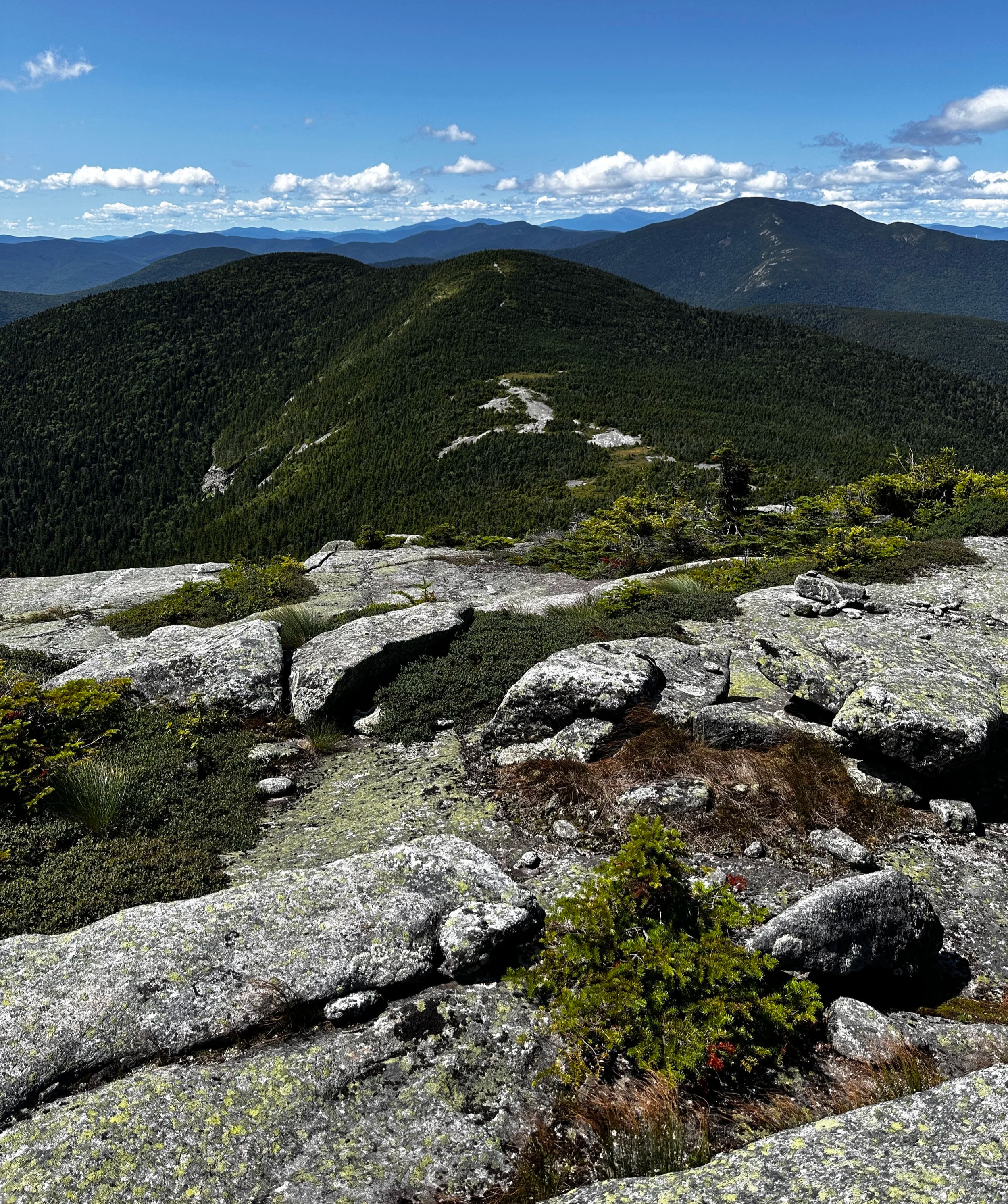
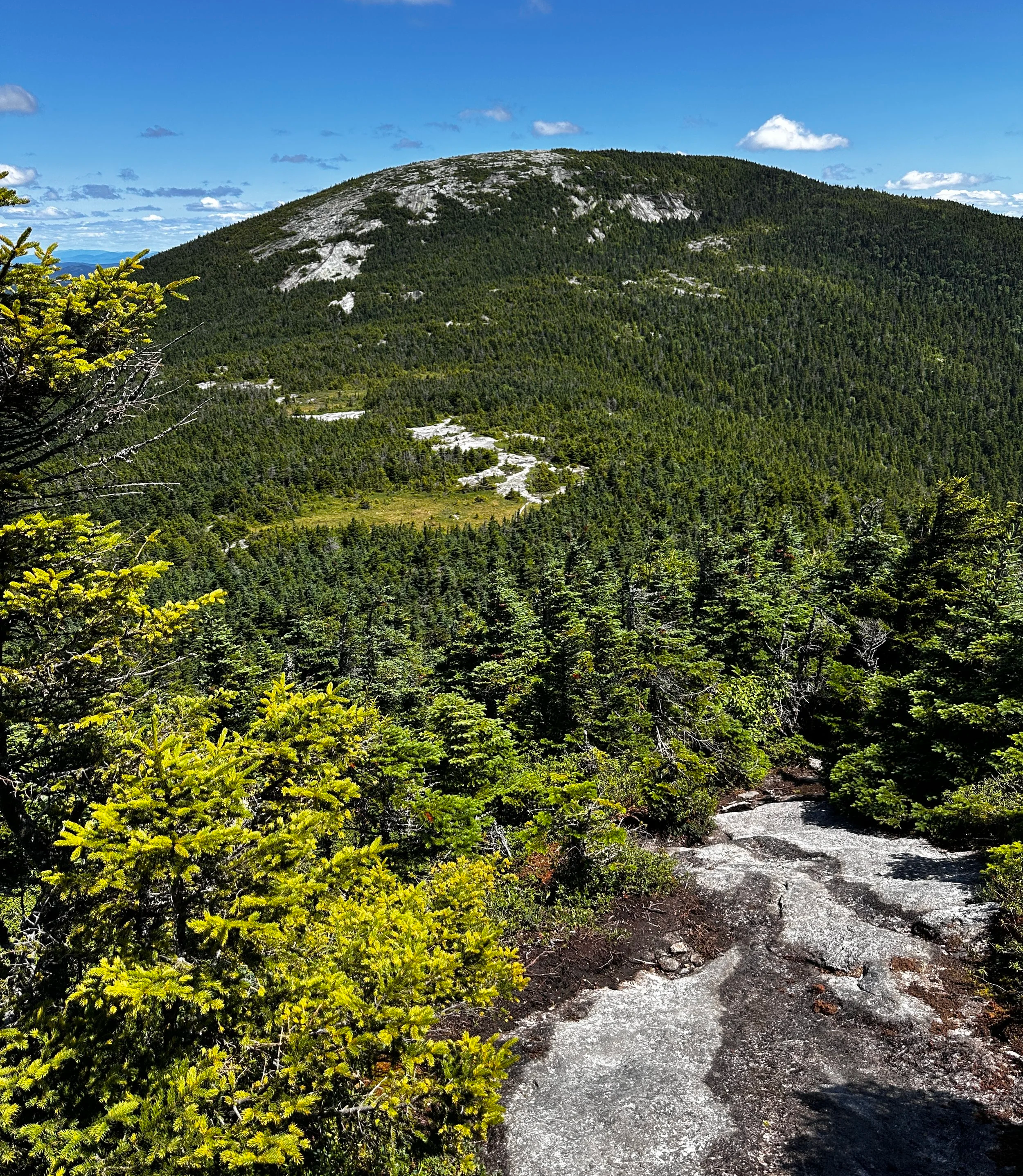
Approaching Sunday River Whitecap
During the ascent, I watched the accompanying waterfall just off trail to the north; seeing this as perhaps the last known water before I topped Old Speck and entered completely new terrain, I reached a good water crossing to filter ice-cold mountain water, to refill all flasks and top off the 2-liter, I also took this reprieve to have some snacks which were buried in my pack. Feeling like I just had a good “reset”, I continued climbing, fully loaded for the second half of my trek.
With the summit of Old Speck all to myself, I took the short ladder climb to the peak of the lookout tower, to gain some elevation above the wooded summit; the views from this perch are some of the finest along this loop. Excitement filled once again as I departed the summit area of Old Speck, onto a section of trail I had wondered about for so long - a stunning, soft, conifer needle footbed is what initially welcomed me. Before long the trail began a series of switchbacks, some of which were clogged with blowdown - a brief jog was slowed by a duck-under or step-over every several yards. But, upon reaching the base of the descent, the trot was back on for more lovely trail sections.
Back to Grafton Notch from the Whitecap
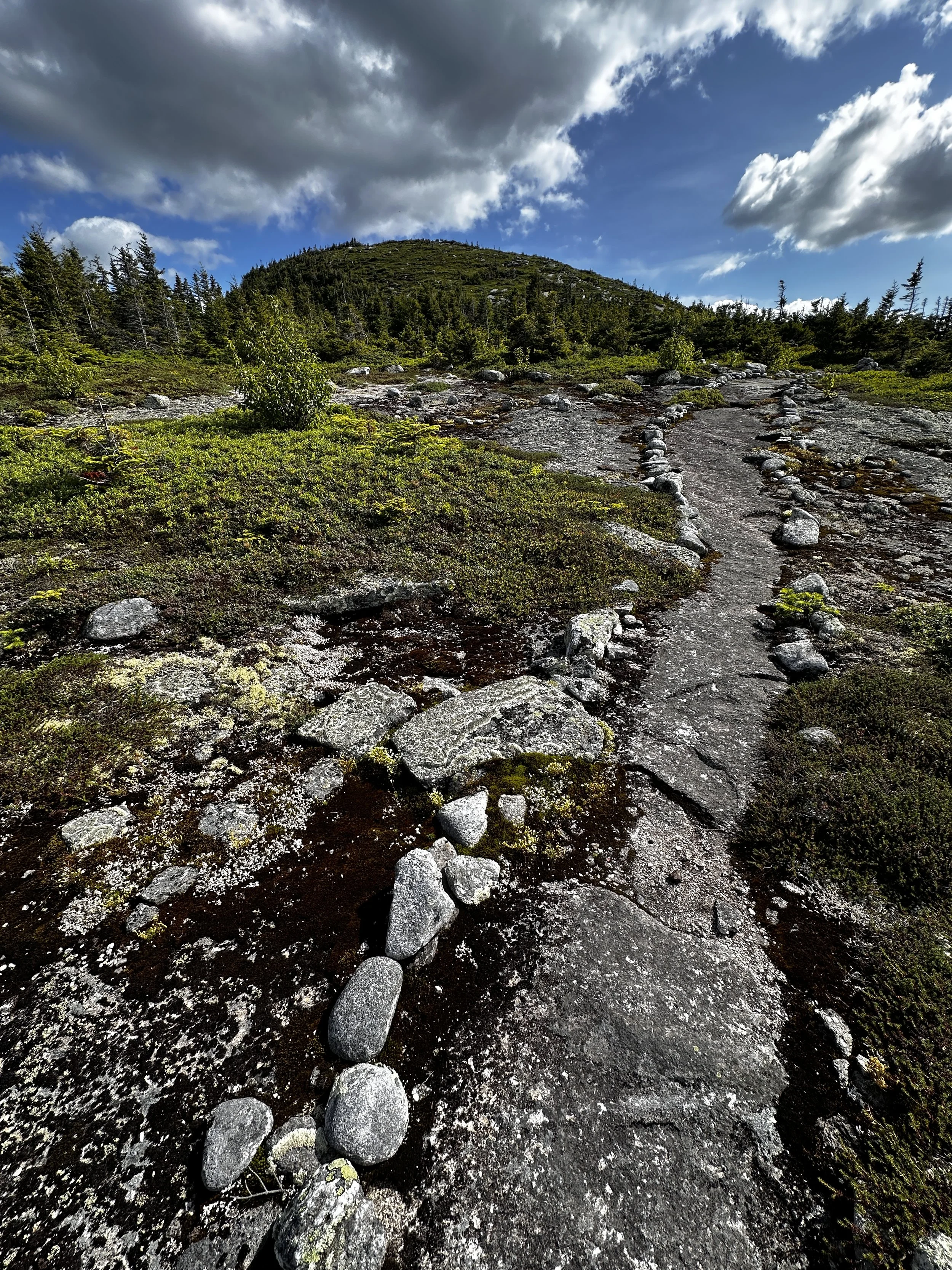
From Miles Notch, the gradual ascent was a stark reminder that the day was far from over, before long the path swung directly south and onto the bulk of Sunday River Whitecap. Legs burned for the first time of my day, but were deeply rewarded upon popping out of treeline. Traipsing a short distance along an elevated boardwalk section, the trail then meanders over more open ledge, similar to the crest of Baldpate Mountain - ahead, the baren dome of Whitecap comes into view and the scree-walled walkway leading to its crest. Views from this peak are truly unlike any afforded during this trek - the look back into the notch formed between Old Speck and Baldpate is unforgettable, as is the glimpse of streaked slopes of the Sunday River ski resort to the west.
While nowhere near as significant as the Whitecap itself, the remaining pathway descends gradually to another somewhat open ledge-topped mountain known as Stowe Mountain. A final, steep descent off the eastern slope of Stowe Mountain with several newer wooden ladder sections and switchbacks, hikers reach the low col leading to an even less significant, Bald Mountain. Glancing back, it becomes almost difficult to imagine descending the steep face of Stowe, through the forest one can see just a bulging mass of mountain.
Only a few remaining miles to go!
From the Bald Mountain campsite, the final stretch of trail traces a small brook, crossing it several times; the forest appeared nearing nightfall beneath such a canopy of lush conifers. Alongside the ravine, the footpath joins an old woods road, upon which it follows back toward civilization, but not before crossing the mighty Bear River on a wide bridge. Be sure to follow signs for the Grafton Loop Trail as it follows and crosses several snowmobile paths and old farm roads. With just under a mile of asphalt travel, I could see my car and starting point nearing; one good day in the mountains of Maine!
Start of the western section
Overall stats for the day:
35.1-miles with 12,169ft elevation gain
12hr 50min elapsed time -> 21’55” average pace
Summits of the day:
Puzzle Mountain-SW Peak (3,077ft)
Long Mountain (3,060ft)
Baldpate Mountain (3,815ft)
Baldpate Mtn-West Peak (3,694ft)
Old Speck (4,188ft)
Sunday River Whitecap (3,368ft)
Stowe Mountain (2,720ft)
Bald Mountain (2,097ft)
Grafton Notch Loop - Done