
Bigelow Ridge: FWT + LPT (2019)
Thirteen miles in the Bigelow Forest Preserve.
6:10AM
Morning found me tucked with cramped legs in the backseat of my Subaru, eager to stretch out after the prior days long miles and steep climbing. With one deep breath to fully awaken from the frosty night I shook loose a cluster of frozen breath from my side window – a reminder that cold trails awaited my arrival outside my down cocoon.
I had decided to call the Chapel parking lot at Sugarloaf ski resort my home away from home for the evening as I lay in my sleeping bag typing away until all the casual bar goers stumbled to their cars and made their way to their own homes.
Aside from chilly air the morning was absolutely stunning, I had a feeling that I was in for an even better day than yesterday (across the street for a long day in the Crockers), the brilliant tangerines with raspberry sherbet hues began trickling into the quickly fading deep blues of an overnight clear sky.

Morning rises over Stratton Brook Pond
I had to trigger the ‘autopilot’ switch on my morning routine just to get moving and out of my warm cocoon; crawl to my front drivers seat, foot on the clutch, super cold keys in the ignition and the boxer motor sprang to life. Before long my seat heat was radiating warmth and life into my bum while I finished getting gear prepped.
My new friends from the prior evening told me all about where to park and which unmarked road to be on the look out for as we descended Redington, which was now plugged into google maps on my phone, ready to guide me to my next big adventure of my long weekend in the wilderness of Maine.
At the parking lot, the echo of two campers in their frost-covered tent filled the air with deep bellowing laughter as I topped off two water soft flasks, consulted my waterproof paper map one last time before being tucked in the smaller of my packs – the Black Diamond Distance 8L was perfect for treks like this.
A dry pair of Darn Tough wool socks helped me ignore the fact that my Lone Peaks were still dampened with crusty mud. Once laced up again we were all ready to beat the crowds and hit the trails.
7:14AM
With trekking poles in hand I began a slow shuffle to get the cold blood flowing once again. Hiking past many SUVs that had been deposited sporadically along the dirt road I laughed to myself, assuming the wide, opaque mud bogs must have intimidated the drivers of these luxury “off-road” vehicles.
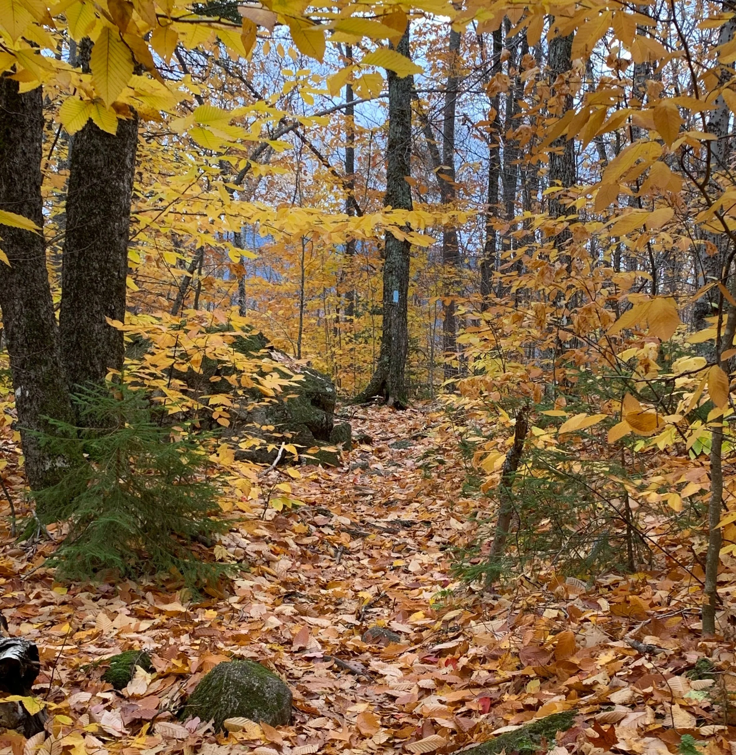
In minutes I reached the first bridge brook crossing for the outlet of Stratton Brook Pond where I met a young man appearing to be dressed in more goose down than an arctic expedition, he was fishing for a fresh morning breakfast. We exchanged waves and greetings as I picked up my pace down the most elegantly glowing trail - the morning rays reflecting off the pond and softly illuminating the yellows and oranges of the remaining autumnal forest canopy around me.
I tip toed across frosty wooden planks, gripped hand and foot holds to ascend the initial open rock slabs. Two quick miles later I found the intersection where I hoped to return later this fine day, completing a lollipop-shaped loop; The Fire Wardens Intersection has a registration box where it is recommended all hikers fill out a small tag with identifiers, helping to show how much traffic this area receives.

Boardwalk along the Esker Trail
I decided to hike ascending the steep Fire Wardens Trail, revisiting the Appalachian Trail again as I would be traversing South along the ridge then descend the Horns Pond Trail back to this very intersection. Originally planning to follow the AT down off the ridge, it was recommended by locals to descend the Horns Pond Trail as it was a gentle and picturesque path.
The views arrived through the trees behind me once on the Fire Wardens Trail and grew greater with every step up the stone staircase - vistas straight out to the ski slopes adorning Sugarloaf; the alpine zone high atop Abraham even further beyond was clearly visible, the glorious Crockers wrapped in a blanket of fall foliage colors as well.
Several switchbacks later I ran into a peculiar hiker standing atop one of the tent pads off a side trail. He stood beside a hefty pack with an unlit cigarette in his hand asking me of my backpacking plans, thinking of the tiny pack on my back I admitted that I was only up here for the day.
My nicotine fueled friend advised that crews were out cleaning up large scenes of blowdown from the windstorms that rolled through in recent days. From the distance of where he stood all I could make out was: “thirty blowdown sections”, followed by: “Horns Pond Trail – impassable“.
I thanked him for the trail report as he recommended I give the crew space and plan to descend this same trail I was currently on. While not a fan of sudden itinerary changes, I had initially planned to descend the AT anyhow.
Four miles into the morning and I was now taking the southern facing flank of the Bigelow ridge step by step, exchanging more morning greetings with other backpackers just off-trail as they packed up their tents and wiped the sleep from their eyes.
I could see the horizon above through the trees and within minutes found myself fully immersed in a bath of morning sunlight as more ice and snow toppled from frozen tree branches – I was now on the Appalachian Trail and in the col between the two ridgeline high points.

Avery Peak; 4088’
BIGELOW MTN. – AVERY PEAK ELEV. 4088FT.
8:52AM
Zipping past the quaint caretakers cabin and with no evidence of any inhabitants this morning I began my final jaunt over to the open summit of Avery along some of the most jagged east coast granite I had ever experienced. Along the upper reaches of 4000-feet, the boulders were encased in a fine hoarfrost so fine that shattered underfoot, turning quickly to a slanted ice-skating rink that tossed footsteps in every direction.
The summit views were breathtaking - worth the risky, methodical climb/crawl over these Appalachian Trail boulders! High up the morning sun shined brilliantly, negating the stinging wind on my exposed cheeks - I was in such a state of bliss as cotton candy clouds formed an undercast in the nearby valleys. Atop the high point of Avery peak, standing with the rime encrusted orange summit sign my gaze jumped slowly from peak to peak just taking in the views.
There are remains of an old stone fire tower near the summit, reachable by a well traveled herd path. Figuring survey markers would be dedicated for the higher peak of the ridge, I was surprised to find several USGS discs at the 4,088’ Avery Peak; often times three discs can be found (if they still remain) from the triangulation performed by the original crews. Take a look closely next time you find multiple USGS discs, generally they all display various tid-bits of information such as peak name, direction of north, etc.

Appalachian Trail, looking toward The Horns; 3750’
With eyes shut I took in a deep breath, simply standing with no distractions. Opening eyes to scan the nearby alpine grasses and stubby trees glazed with a fine frost; a cloud inversion melting through the valleys; stringy linear clouds that streaked an otherwise blue sky; birds hopping from ground to branch, bringing home seeds for breakfast and twigs for a nest renovation. Such lucky creatures to call this home.
These were the moments that I will never forget.
Turning to leave two backpackers made their way up the path, we exclaimed how lucky we were to have such a day in the mountains. Turns out they had been up here just several hours earlier as well to watch the sunsetting over the landscape.
They mentioned that Avery Peak was their very first 4000-foot peak. I congratulated them and mentioned that West Bigelow, in my near future that morning, would mark my 114th peak in the northeast. Their excitement was tangible as they reached out to enthusiastically shake my hand upon learning this.
Wishing each other well, I made my return trek down to the col over frost covered boulders, hand over hand, bracing myself over the slick granite.
With adequate photographs already taken I blew through the intersection and ran nose to nose with a barking pup, “don’t worry, she’s fine.. just going to bark at you!” said its young owner, Captain Obvious, as I greeted and passed by.
Back above the trees it was hard to believe that I was just minutes ago running across that green and gray mound. I could still see the cross-shaped summit sign atop Avery Peak, but evidently my friends had moved on as the summit was also alone.

Bigelow Mt - West Peak; 4150’
BIGELOW MTN. – WEST PEAK ELEV. 4150FT.
As I reached the final major summit of my day, I took a breath and in an instant of exaltation recounted all of the one hundred and thirteen summits prior that led me destined for this fine moment. Two fellow hikers glanced over but did not muster up a single word as they passed, I simply wished them well. I had the summit of West Bigelow and the surrounding summit rocks all to myself.
Again here, the views did not disappoint – if asked to choose a favorite it would unanimously be back on Avery - but this westerly peak had different vistas still, spanning even further down the west ridge, my next destination.
Down the ridge I was reminded of time spent on the Presidential Range of the White Mountains: sloping drop-offs on either side with a fine single track with a neat rock wall on either side of the path, my idea of heaven on earth!
Once the steep descent was over and I found myself back under the forest canopy where ice and slushy clumps of snow continued to rain down. The path was slick but felt so smooth underfoot. From rock to log and from log to rock my Lone Peaks bounced, quick and light steps to keep from plunging into the frigid puddles which lined the trail.
I caught myself numerous times debating in my mind that this may have been the truly the finest, most desolate and unencumbered wooded ridges that I had ever trekked.
Two miles of watching the sun glisten through the southern facing trees, traversing through snow and mud and over sections of bare rock, I felt like this was where I really needed to be in this moment.
As elevation increased once again I could glance over my shoulder at summit number 114, the West Peak smiling back at me, tipping its hat as if in approval of my epic fun run.

Looking into heavy blowdown; Horns Pond Trail
BIGELOW MTN. – SOUTH HORN ELEV. 3831FT.
With the orange summit sign strewn across the trail, I glanced around and ahead down the trail, “looks like a sort of summit to me!”. A few brief moments to soak in these views now at an even lower angle and it was time to continue on. Recurring thoughts of the four hour drive home and food in my near future.
Making quick work, I bounced effortlessly down the carefully laid rocks that resembled yet another staircase, descending the South Horn over what seemed much further than the half mile as estimated by the old signage to Horns Pond.
What a dreamy area tucked away in the woods; each of the entrances to the camping area had posted a laminated map instructing which paths led to the pond, the group shelter area, various other camping areas - a very complete, colored map containing hand drawn images of the area. I chose to continue along the white emblazoned trail, south along the AT.
Upon checking my AllTrails app maps that conveniently work even while in airplane mode – discovered that I had yet to pass the 0.2 mile cut off onto the Horns Pond Trail.
Just as I questioned my options: keep going extra miles to the AT to descend off the ridge vs attempt the Horns Pond Trail not knowing the current state of blowdown hindrances, I heard voices coming my way: three young men sporting remarkable French accents - reminiscent of early explorers.
I inquired about their tortuous ascent. They gave many descriptive attributes regarding the trail being sure to include the detail of their friend almost dying in the blowdown. My mind focused on one word: “do-able“.
Not wanting to add six extra miles onto my already long day, I became committed to attempting the fresh blowdown/bushwhack which was today’s Horns Pond Trail.
What started out as a “not so bad, where is the blowdown” kind of trail quickly turned into, “whoa.. uhmm.. there is NO trail here…” and absolutely no indication of which direction it went under easily 8-10 feet of deforested matchsticks laying in utter chaos.
Stabbing pine boughs sticking in every direction, trees entangled and facing every which way, when I finally stood 10-feet above chaos, what was there to see? Not a one tree in this catastrophe remained standing for quite a surrounding distance, atrocious destruction.
I recalled the one section of blowdown we encountered as a child where my mother and father handed my sister and I up and over, weaving down and under trees that very much resembled a similar circumstance.
I was able to spot several pieces of orange surveyor tape tied around distant branches, but completely uncertain of what they pertained to or how old they were, perhaps older than this debris pile and marking something else entirely?
Several times I had to guide myself off tree trunks into the abyss below, an entanglement of spruce boughs and all things cushy, yet still pointy and broken branches stuck in every direction imaginable. Felt like I was in a portal straight to hell.
Eventually, while proceeding in a generally southerly direction, I was completely unaware of where the trail emerged from this thick mess and knowing that if I went in the wrong direction, even 2 degrees off course for long enough, I’d never find my way back to the blue blazed trail. I reluctantly consulted my AllTrails app once again. To my absolute surprise I was spot on the trail. I could not believe it for a second, not a single notion of a used trail remained for as far as my eyes could see!
With no option but to push through safely and steadily, I was relieved to glance down at a blue 2” by 6” swatch of paint streaking along one of the downed trees, this was my path after all!
Out of the blowdown and back on track
Another twenty feet or so saw me back on a beaten path, the original Horns Pond Trail. I had time I wanted to make up now that I was beyond the mess - it was soft, lush moss lined trail as far as I could see, clear sailing!
As I exited the thick evergreen slopes of the Bigelow preserve and entered the colorful hardwood canopy of a lower altitude, the progress was tangible and soon enough I’d be at my final intersection.
Passing the registration box once again, my path swung to the right and back onto the Fire Wardens Trail, soon to be at the stash of fresh-picked apples awaiting at my Subaru.
Zooming past the bridge where Mr Goose Down was fishing earlier in the morning, I passed a tight community of North Face tents that had popped up along the road walk in and finally around the muddy bogs that enveloped the road remnants.
Once again: foot on the clutch, boxer motor hummed back to life, google maps was set to mindlessly follow as I ate everything in sight.
Back on the road with the Bigelows now in my rear view I could not help but whisper, “Damn.. I was really just up there.”
My long weekend in Maine was indeed an epic weekend of pushing myself beyond what I thought easily capable of: 42 miles with 15,000’ of elevation gain with the opportunity to visit 8 incredible four-thousand foot peaks of the Maine wilderness.
I have wanted to do this for a long while - and now find myself left with one final thought: I have one four-thousand foot peak in the northeast remaining until I can count myself as one of the NE115’ers – I recall being a 6-year old aspiring climber imagining this daunting feat, feeling inadequate and counting the endless excuses and reasons why I was not cut out to hike to all of these beautiful summits.
What an incredible journey it has been, and will always continue to be.
Happy climbing!
Overall stats for the day:
13.01 miles
4,281′ elevation gain
5hr 8minutes
Bigelow – Avery Peak – 4,088′
Bigelow – West Peak – 4,150′
Bigelow – South Horn – 3,831′

USGS marker atop Bigelow Mt; 4150’