
A Great Range Traverse
What had blossomed from a simple craving for a day well-spent encircling several mountains for the standard HaBaSa (Haystack-Basin-Saddleback) loop had quickly spiraled into a test to see how I could fair against a sole-crushing journey, mountain-running on some Adirondack granite - over some of the most picturesque, rugged and remote backcountry the upstate mountain range had to offer.
Whilest on a quest to summit all 46 High Peaks of the Adirondack State Park, the shorter loop would have still been a huge undertaking - having yet run anything that could be considered “distance”; back then a revered Pemi-Loop or Presidential Traverse of the White Mountains or an out-and-back to Basin or Allen Mountains would have me sidelined for days to follow.
Fast forward a few years; I had completed hiking the 115 4000-footers of the Northeast, had grown accustomed to long days in the mountains, and now several 50K (31.06-mile) foot races under my belt - both sanctioned races and self-created long treks in the woods, there was even a silly 12-hour endurance race in which I had cranked out 54.1-miles on foot in the timed event; I figured I was ready as ever for a day running and fast-hiking some of my favorite Adirondack peaks of The Great Range.

Morning along the Phelps Trail
Leaving little room for error, I weighed options of a starting point but later decided upon parking at the Rooster Comb trailhead parking lot on State Highway 73 in beautiful Keene Valley. Several other cars were in the lot, perhaps they had begun hiking that morning but it would not be unlikely that they were somewhere camping in the backcountry, still slumbering soundly in their sleeping bags.
The sun was just beginning to illuminate the sky as I made final adjustments to my gear and running pack. The initial 2.0-mile stretch of road mileage would serve as a slower-paced warm up to casually get the blood flowing. Running past shops which had yet to open for the day, I had never experienced such a quiet version of the bustling hiking town.
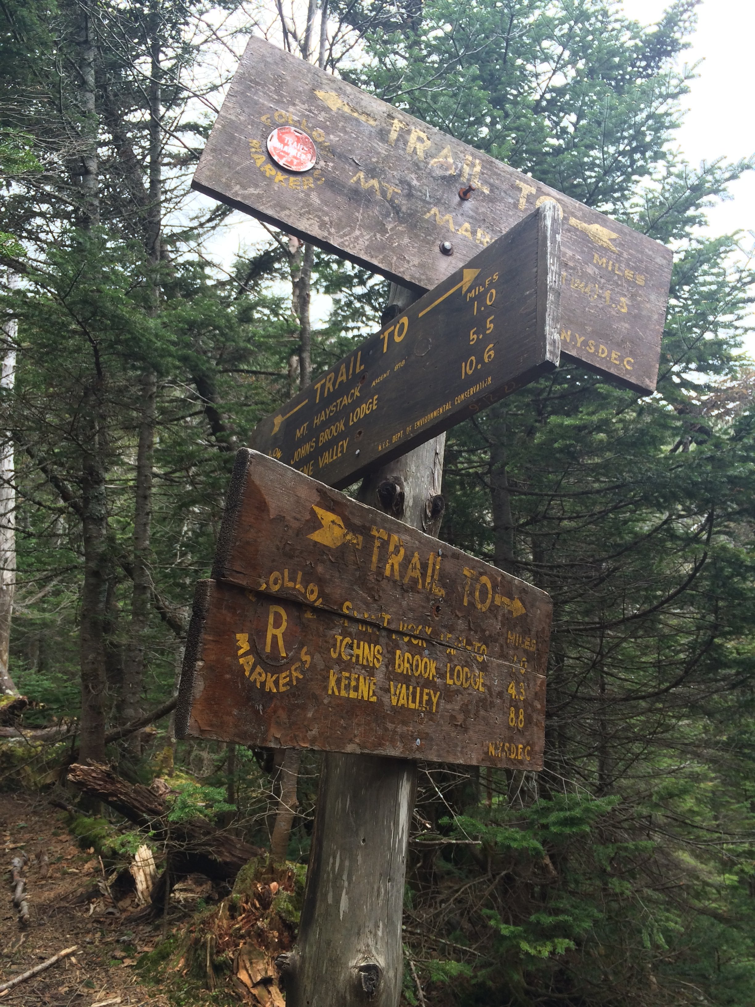
A busy intersection at John’s Brook Lodge
Turning left at the Ausable Inn I shuffled past massive boulders which sat alongside Interbrook Road - from the comfort of temperature controlled vehicle, for years I had spied these gigantic glacial erratics while trekking these high hills with family. Mentally, I took stock of John’s Brook - certain I’d be traipsing near or in the waterway later into my morning.
As the grade increased nearing the Garden Trailhead parking lot, what had been a leisurely jog inevitably slowed to a fast-hiking pace. Even this typically packed parking lot only had a handful of cars and trucks today, one couple readied large packs on their tailgate for a day of exploring the wilderness. Giving them a wave and “good morning!” greetings as I strolled by, we met back up and discussed our respective plans for the day; I thumbed through the trailhead register, eventually locating the next open spot to log my intended hike with contact information, should something go awry.
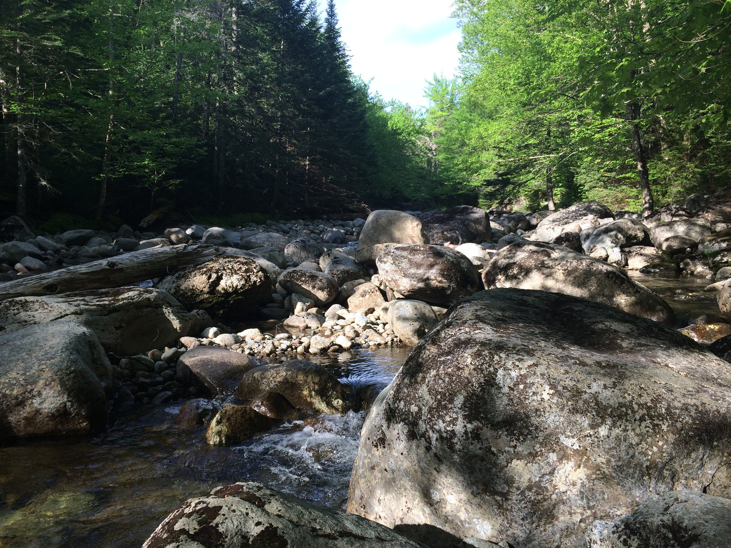
Trekking alongside John’s Brook
Utilizing a vast network of old forest and tote roads, this initial stretch is sometimes referred to the John’s Brook Trail or The Northside Trail; I know it as the Phelps Trail, cut by the son of the famous Adirondack guide, Old Mountain Phelps; this path will guide nearly to the summit of Mount Marcy. The beautifully wide footbed crosses over a small stream, a tributary to John’s Brook and begins gradually ascending over boardwalk planks and a well-crafted wooden staircase before giving way to earth.
The soft path gently dips and rises over the mountainside while making its 720’ ascent toward the next major intersection, several small brooks and waterways are crossed along the journey; water trickles downstream toward the south as woodland critters scurry around to stockpile food, overheard birds begin to awaken and sing as the clear sky above floods with soft sunrise hues.
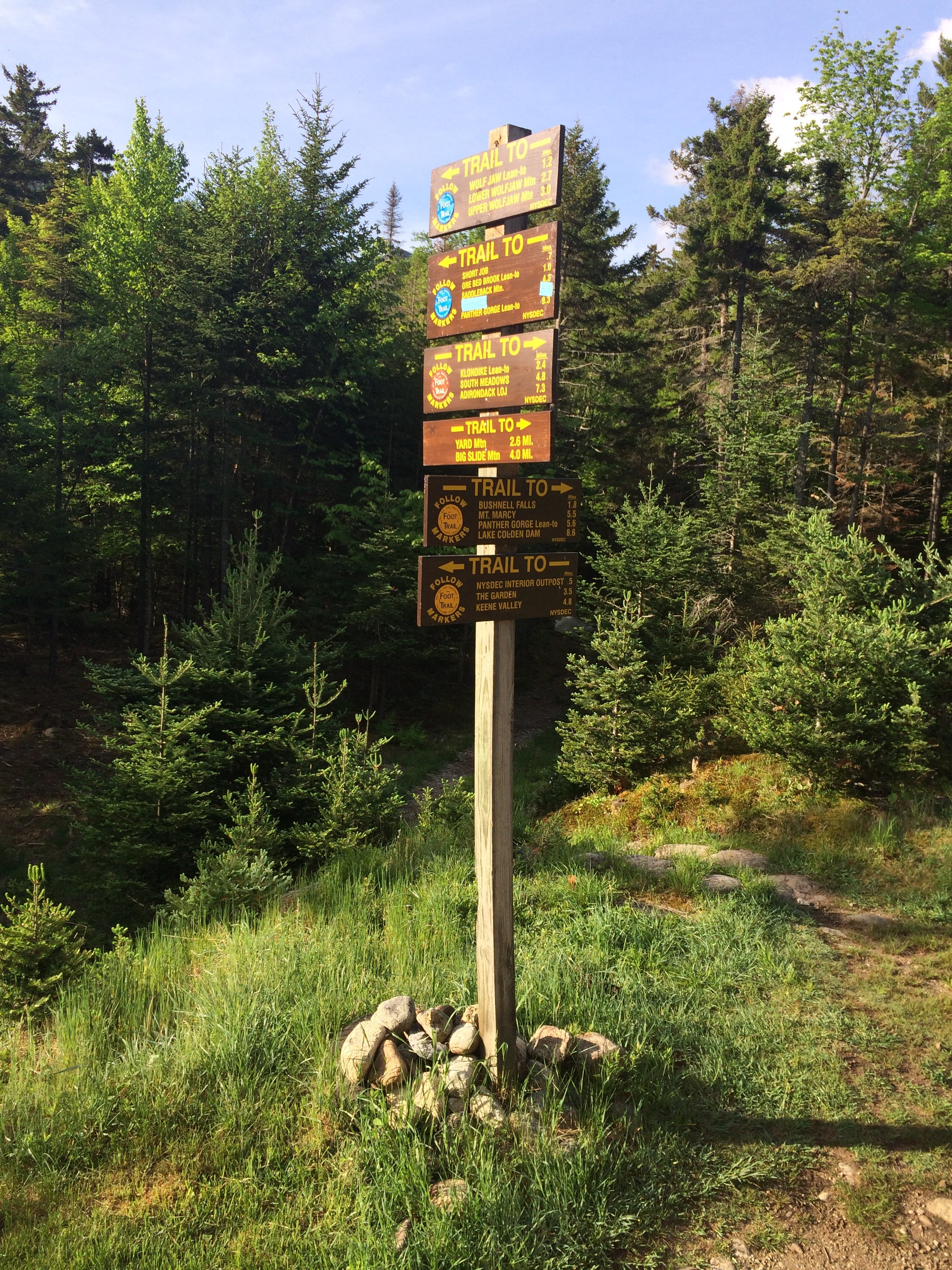
Start of the (Great) Range Trail
At 4.9-miles and following a brief descent toward the NYSDEC John’s Brook Interior Outpost intersection - all of which can be found shortly down the left-most branch of trails - I continued to the right, in a westerly direction toward John’s Brook Lodge. Almost immediately Slide Mountain Brook is reached which I could recall a rather precarious crossing of several years ago - prior to the replacement of the high water bridge and during a time of elevated water levels, I found I could leap further than previously presumed. Today, with a light and nimble pack, the crossing was made much simpler atop angled rocks which poked through the surface of the babbling brook.
Entering a more sheltered evergreen canopy, the pathway surrounding John’s Brook Lodge has always had a calming, soothing quality for me; dense conifers envelop the pathway as water flows all around, John’s Brook to the south/southeast while smaller tributaries and their wetlands are crossed atop logs and planks; Black Brook features a beautiful wooden bridge. Nowadays, while passing here I instantly recall being a child and hiking past while backpackers dangled their achy feet from this bridge - to me, they were the true explorers (of my generation) of the Adirondacks; they filled this youngster with admiration for their gigantic packs and display of comradery as they laughed jovially about the steep and rugged paths just hiked and what lay in store for them tomorrow.
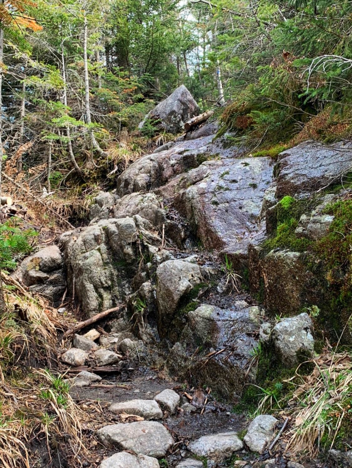
The steep-end of Phelps Trail, nearing Mt Marcy
Just prior to entering the JBL compound, a kiosk sign with map and various informative tid-bits is passed: knowledge on Leave-No-Trace principals, local bear activity, what to expect and how to prepare for the nearby High Peak mountains. There was also a large poster encouraging hikers to “do the rock walk”, to traipse atop boulders and rocks which have been intentionally placed to help trampers avoid mud and boggy sections, thus also avoiding widening the pathway by walking around the mud.
Several early risers sat on the porch area of the Lodge with coffee in hand as I passed by at 6:30am, the morning sun began illuminating and highlighting the upper crags of the Wolf Jaws; I was filled with great anticipation knowing I’d soon be up there, more than 2,000’ above my current location. As the sky turned from white to blue all around I could not wait to trek along the highest reaches of these surrounding peaks.
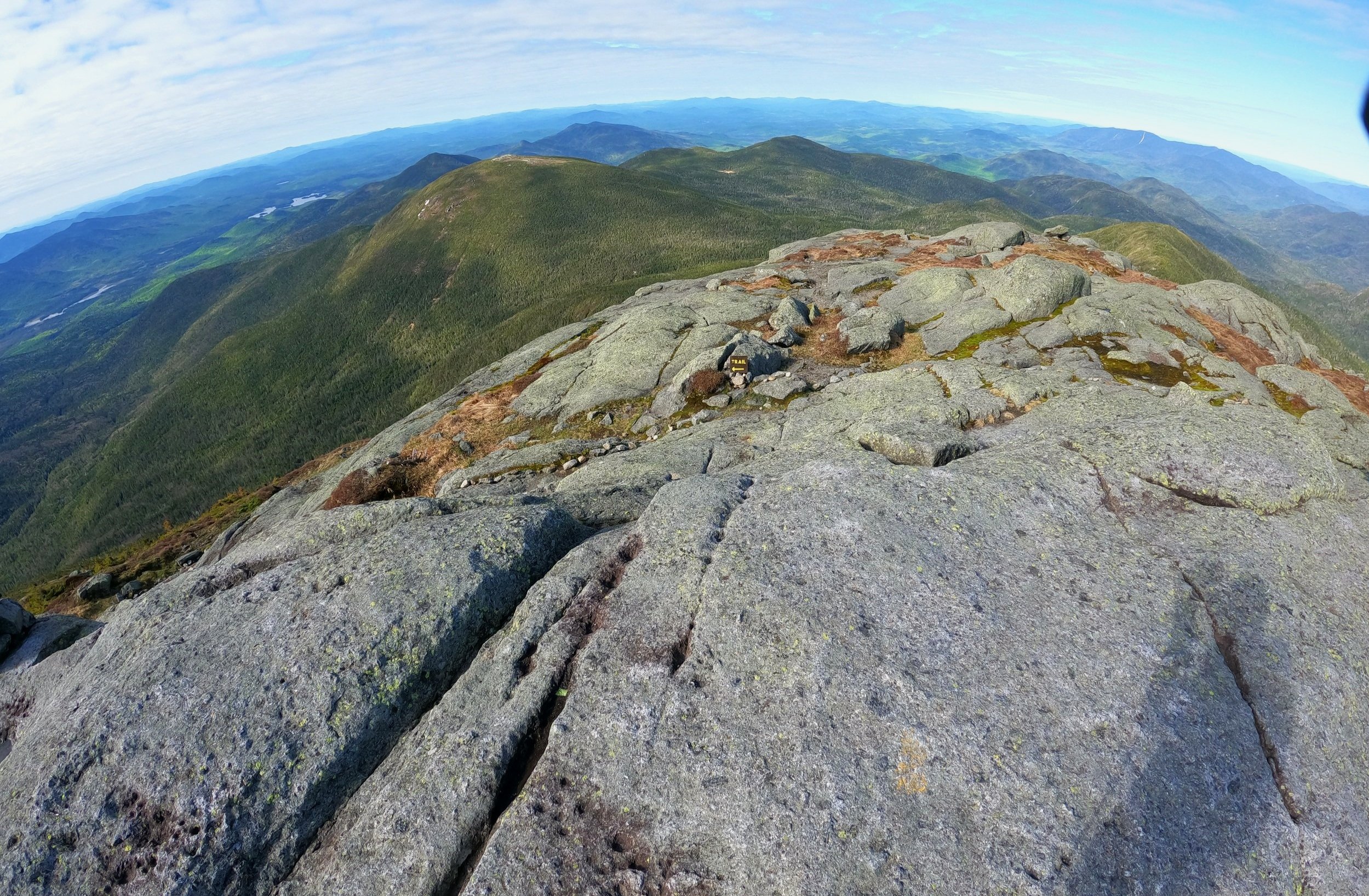
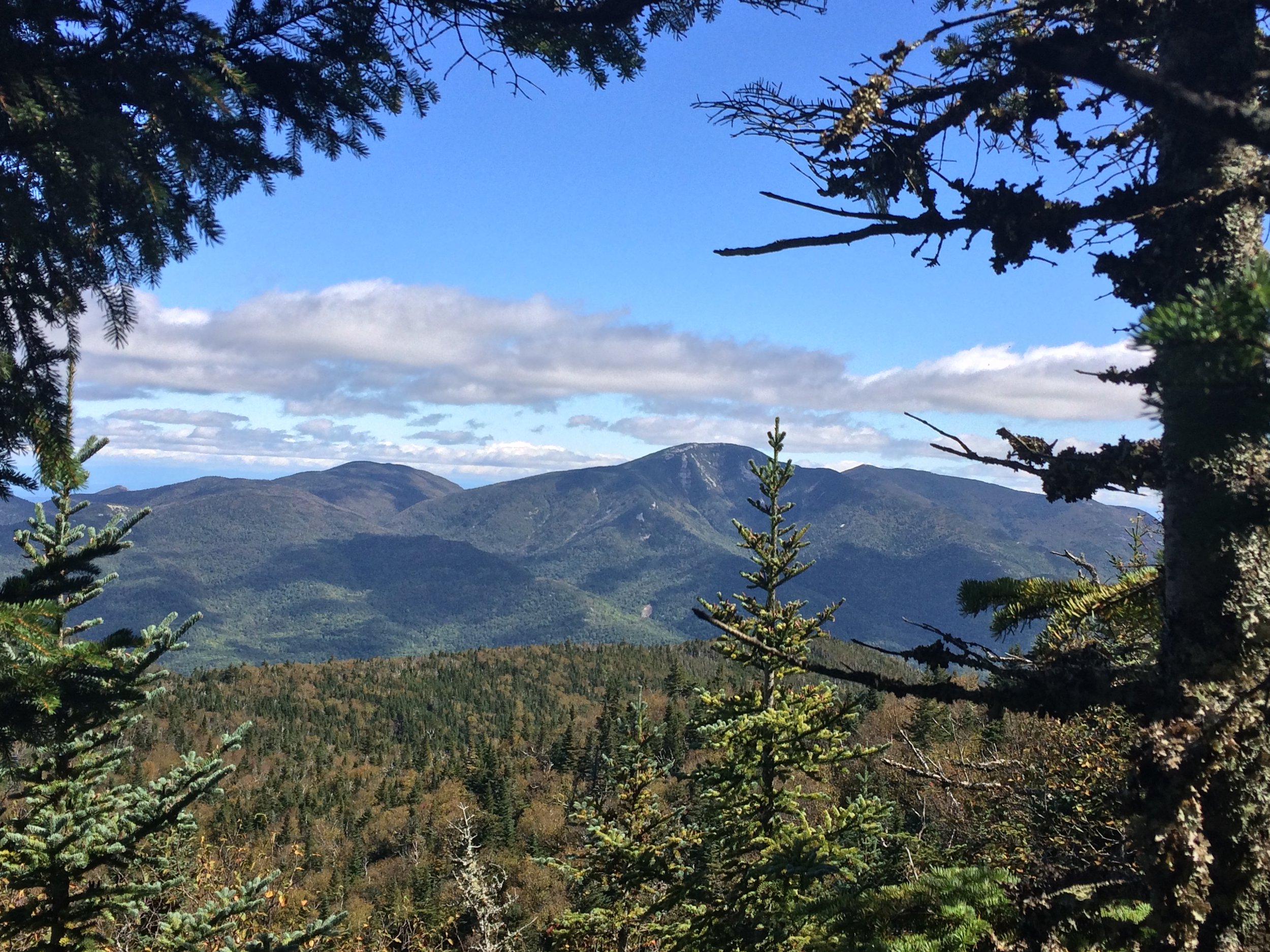
Haystack Mtn + Dix Range beyond, from Mt Marcy
Continuing down the Phelps Trail, the site of several former lean-tos are passed before the path dips down to nearly coincide with the shoreline-edge of John’s Brook; trekking atop rounded river rocks, the path weaves from woodland back to shoreline before finally crossing Hogback Brook and making the steady climb along a deposit of gravely lateral moraine - resembling a hogback ridge, this was a stark reminder of ancient glacial activity in the valley.
A short but steep 250’ ascent leads to the Bushnell Falls spur trail, beyond which the iconic Slant Rock (natural shelter) boulder and camping area is passed; now ascending over a relatively wet path, the trail winds along the far northern shoulder of Basin Mountain. The sweet scent of evergreen boughs filled the surrounding mountainscape, casting a deep green hue as far as I could see, several toppled spruce forced a quick hop-over or duck-under.
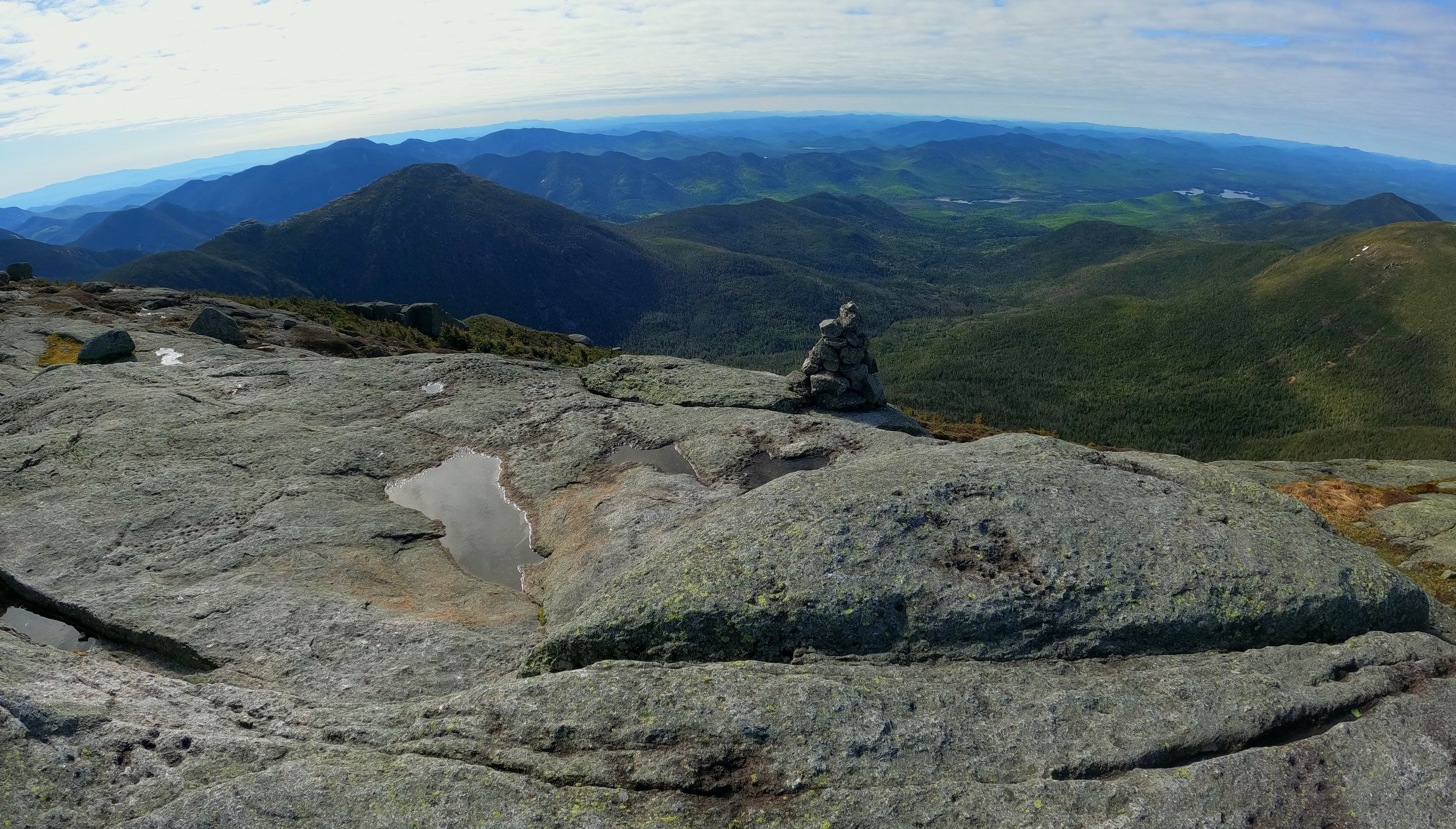
Skylight, Redfield and Allen from Mt Marcy
The trail soon became even more wet underfoot, while trying to utilize jumbled boulders and rocks as a make-shift staircase to remain above the downslope-flowing water, the view over my shoulder began opening up - sharp, saw-toothed Adirondack peaks framed by conifer branches, what a perfect place to find oneself.
Passing the diverging Shorey Short Cut Trail, which would guide hikers over a very rugged trail toward Basin Mountain, I continued over the moderate grade of the now, very rocky Phelps Trail until coming to a brief halt at 9.2-miles; I had reached the head of Panther Gorge; the start of the Range Trail broke off to the left while the Phelps Trail temporarily continued straight.

The Haystack mounds rise up
Before beginning the much anticipated Range Trail, I had a quick meet-up with Marcy; ascending over 700’ in the 0.6-mile climb over a very rugged and rocky trail, here I began hiking (scrambling is a better term for it) atop rotten yet rock-hard snow, which still stacked up to a depth of 3’ in places. Thankfully, the springtime, granular snow provided adequate grip; trailside conifers became shorter and stunted, nearing the sub-alpine region of 4,800’.
Back on more familiar terrain for the final 0.5-mile stretch to the 5,344’ summit of Mount Marcy, the trail merges with the VanHoevenberg Trail which was one of the original 1880-cut routes up the mountain. While initially soggy at its onset, the pathway meanders atop planks of boardwalk, some of which have begun to sag, creating an upward burst of bog water as the hiker passes overtop.

Mount Haystack from Little Haystack
For the final 0.4-mile above tree line, huge rock cairns line the bare rock treadway in times when the painted yellow blazes are not visible. Today, the wind was low and sun was shining bright - a rarity atop New York State’s high point. A father and son hiking duet descended as I climbed, the summit was all mine to stand atop momentarily, in silence I picked out familiar peaks from the jaw-dropping 360° panorama; years of memories instantly flooded back to my mind, recalling each and every trek to the surrounding peaks and rocky pinnacles.
Once I had my fill of high mountain vistas and checked out the plaque commemorating the mountain’s first ascent, I retraced my steps back into the tree line - all the while smirking blithely at the Haystack mountains; without the open views of the bald summits to monitor forward progress, I would be at those bare knobs in a blink of an eye, following a quick ramble back through the dense coniferous canopy.

Mt Marcy dropping down into Panther Gorge, from Mt Haystack
After a careful descent over the late-season snowpack I met the Range Trail junction which guides hikers over a very steep, rocky ascent up to a northern sub-peak bump of Little Haystack; the trail had a small, nearly avoidable amount of water running down the slabby path; as the soil had appearingly been washed clean off the bedrock, the ascending path resembled a small, narrow chute from which a small landslide had once slipped.
As one crests the 4,606’ precipitous knob, a gorgeous view of the coming climb shows itself - a trek atop two bulging mounds of exposed granite - the Haystacks lay just ahead. A quick 90’ descent brings hikers to a three-way intersection: the Range Trail continues northeasterly (left), while diverging southerly is the Haystack Trail (right); over a series of zig-zags one scales the rocky mountain-face, the trail climbs steeply 160’ to reach the summit of Little Haystack at 4,692’.

Haystack + Marcy from Basin
Looming in the near distance is the main Haystack, towering 270’ taller and appearing much more distant than the suggested 0.4-miles. The descent off Little Haystack is quick and abruptly steep, the worn rocks display several routes previous hikers have utilized over the years. The path makes a southwesterly swing before dipping back into a thick conifer forest momentarily; beyond the col lays a similarly exposed, bare rock approach to the states third highest point.
Several instances along the climb level-off just enough to have gathered rainwater and become boggy, but as with any alpine area, it is strongly recommended to traipse either atop bare rock or through the mud if necessary - it is never appropriate to step on any plant-life found in the high mountaintop regions - for even a minute patch of alpine grasses can take a century to grow.

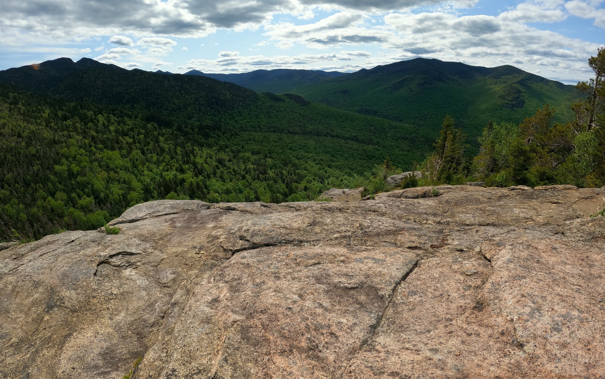
Basin’s East Face Cliffs from Saddleback
The summit of Mount Haystack is a precipitous one, coming to a very fine point which can host only a small party of hikers atop its true summit. However, in every direction, other ledgy areas can be found which provide just as good panoramas and make for a splendid lunch or rest spot. After taking a moment to recall the time spent atop this summit when I officially became an Adirondack 46er, back in 2016, with my father and our adopted hiking mother, Wendy, I retraced my steps back over the alpine granite; again, summiting Little Haystack just to glance back to where I stood mere moments ago.
Back at the Range Trail, I recalled just how rugged this stretch of trail was in summertime - a footpath consisting of jagged boulders with a brook running beneath. While only a short 0.3-mile section lay between junctions, the trail looses just over 500’ of elevation; today, the highly eroded trail was buffered with a residual layer of old snow - some supportive, some not.
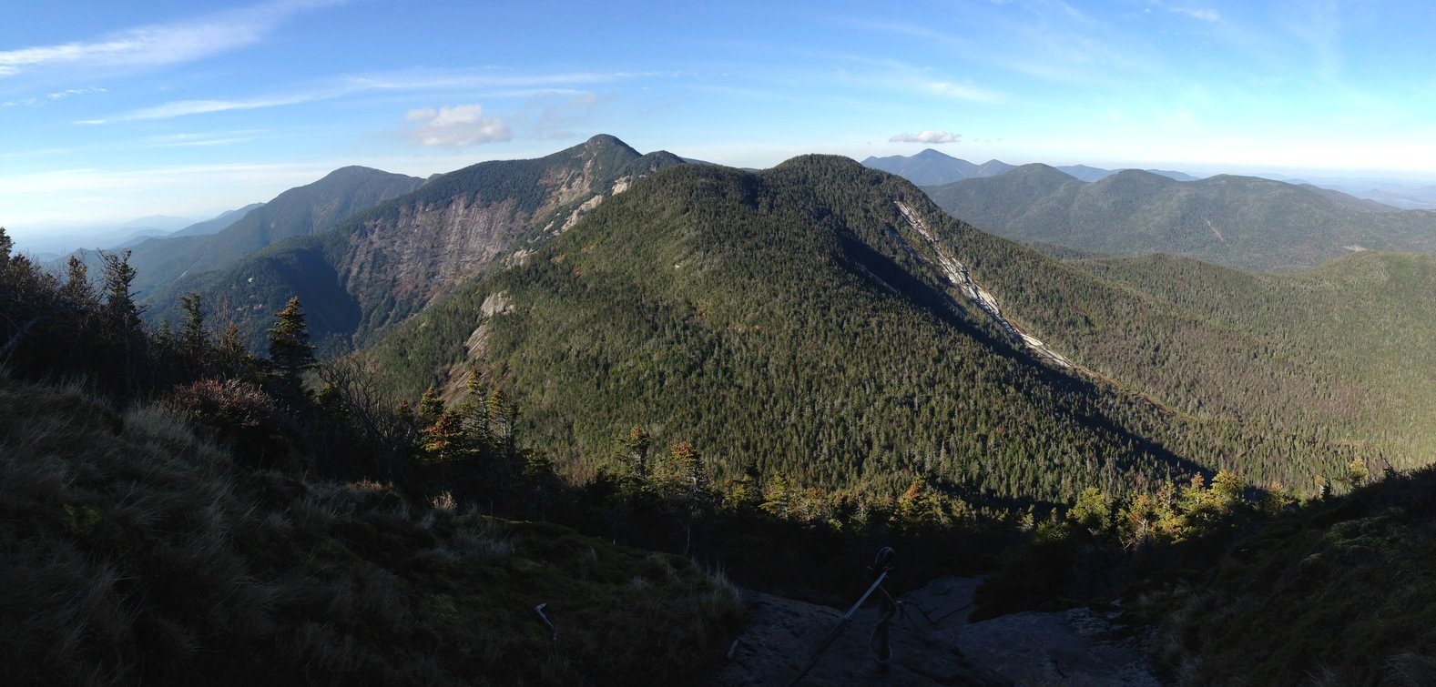
Saddleback + Basin from Gothics
Luckily, that was the last of the snow I’d encounter for the day, hitting the loose, wet rock amidst the 3,850’ low point from which Haystack Brook initiates, I began the arduous slog up over loose footing, up the southwestern face of Basin Mountain. Several locations along the ascent once featured ladder sections, evidently these have deteriorated beyond functionality as now, the climb is made by scrambling up sheer rock faces; keeping the edge of trail running shoes angled into cracks in search of the most secure traction, trailside tree roots have been made loose by hikers doubling them as handholds over the years.
From atop 4,826’ Basin Mountain one can view both where they have come and far into the direction they are heading; views from the open summit are some of the best in the Adirondacks. From atop Basin’s northeastern sub-peak, the Saddleback Cliffs soon come fully into view - streaked with greens, yellows, purples atop the monochromatic-bare granite, the intimidating precipitous cliffs encompass a majority of the climb in which to gain the summit ridge of Saddleback Mountain.

Looking down the cable-route on Gothics
While there is a plethora of circumstances (weather) in which I would not want to scale these bare ledges, ascending with a small, light pack in warm, dry weather was nothing short of an extremely enjoyable ramble; hand-over-hand with one step at a time, always searching for secure footing, I was soon standing atop the Cliffs at 4,510’ and wanting more bare rock to scramble upon. Here, words fail to describe the immense scale of the views - to glance back at the bare, slide-ridden shoulders of Basin Mountain, its southeastern face almost completely devoid of any forestscape is a truly humbling experience.
Descending Saddleback Mountain is one trek that keeps on giving; over its numerous bumps and down rocky, bouldery clefts, the shaded, mossy rock was often as slick as ice, I skated as if to glissade lightly on-foot down the slabby footway enroute to my next intersection. After a 500’ descent I arrived at the Orebed Trail junction, while one of my favorite paths in the Adirondacks with its extensive staircase atop rock slide; today, however, I would be breaking my steady decline up with another steep, craggy climb.

1876 Adirondack survey bolt
The Range Trail ascends nearly 600’ over bare rock while enroute to the 4,734’ Gothics summit; here, the trail features the iconic “cables” to ascend the steep grade. What was once perhaps a secure aid in travelling up or down the sheer granite is now questionable, I have never placed my faith into these garden hose-wrapped cables, as I have found upper segments simply dangling from their hangers - unattached to anything at all. While the cables could use some refurbishing, they do remain an interesting sight and are synonymous with hiking up the western ridge of Gothics.
At the top of the climb one can look ahead to the true summit of the high peak, while a 0.3-mile trek still remains, the short hike contains a dive back into scrappy spruce and fir which temporarily removes the vast Adirondack mountainscape from sight, that glorious panorama will return briefly once one reaches the high point of the mountain. Atop some of the summits of the Great Range Traverse, original 1876 bronze-color bolts can be found, embedded in bedrock by Verplanck Colvin and his team during the massive Adirondack Mountain survey.

More recent US Geological Survey Bench Mark disc
A descent of Gothics over its northern ridge affords even more unique views of terrain yet to be traipsed. Through a dense coniferous forest, the path now meanders to a low, boggy col before making a northerly swing toward the summit of Armstrong Mountain.
Named for the lumberman who once owned the title to the property in which the Great Range and Mount Marcy is located, sold the forested land to the Adirondack Mountain Reserve in 1887; this summit has always been a joy for me as it is not the highest around, not the flashiest - yet the forest is pristine and it gifts the hiker with a small ledge in which to gather a small glimpse down the line of massive, slide-streaked peaks.

The upper-Great Range from Armstrong
Armstrong Mountain is often of a high peak which is simply “passed-over” while enroute to the higher, more open summits - particularly Gothics as its immediate neighbor. I found time to grab a snack and rehydrate atop the panoramic downlook into John’s Brook Valley and the upper Great Range - until the blackflies began to sense my diminished pace, at which point I packed up and hustled on down the muddy trail.
The descent off the 4,429’ mountain is a rugged one; erosion on the steep, muddy rock slabs makes for a slow trek; a large ladder aids in a cliff descent while several switchbacks lessen an otherwise steep mountainside grade. Just off-trail, near the summit of Upper Wolf Jaw, an open rock affords a good resting or snack area and from there stunning northeasterly views toward the Giant Mountain Wilderness can be gained. Today, this ledgy area was occupied by day-hikers so I pressed on toward my next objective down the ridgeway.
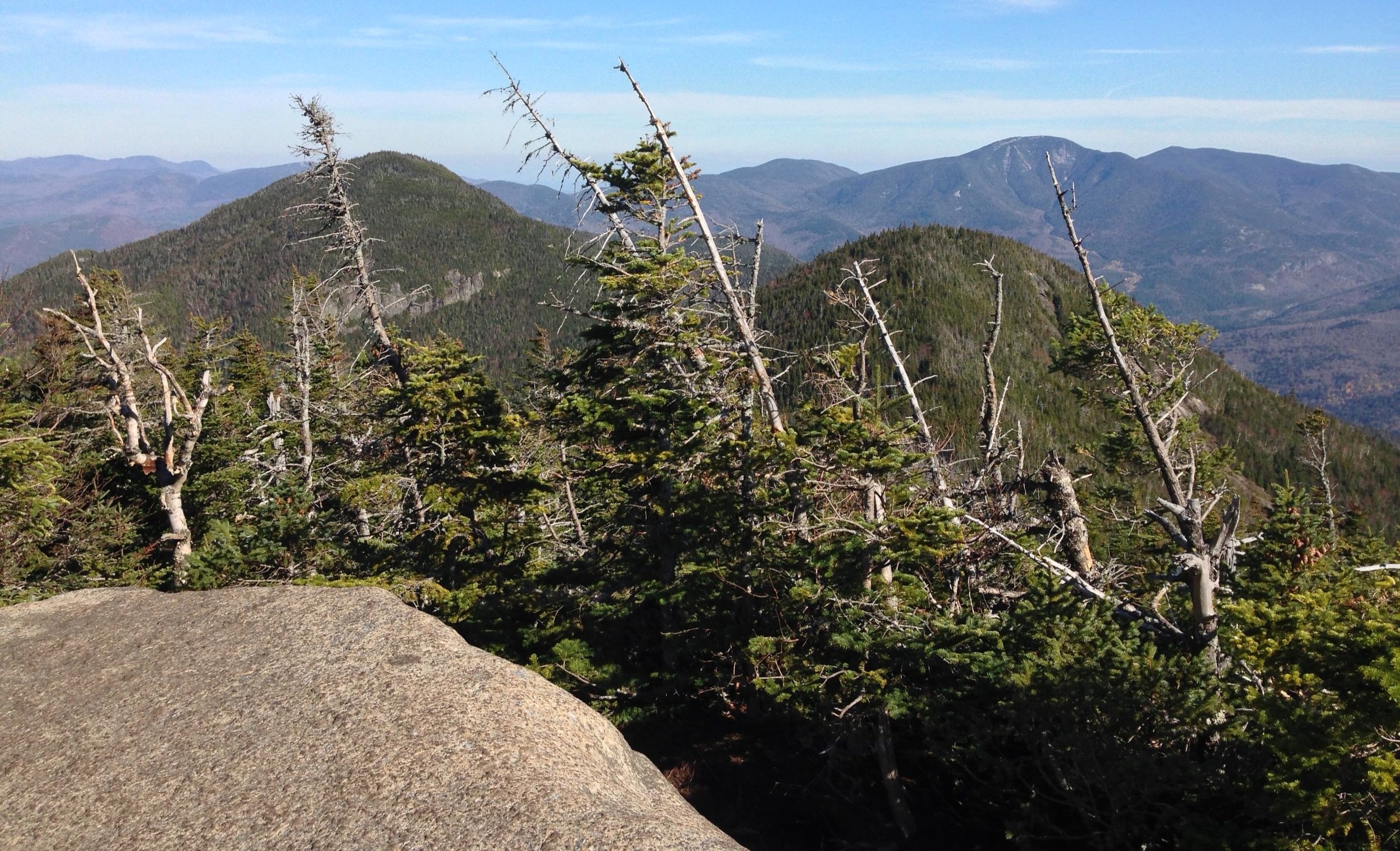
LWJ (left) from UWJ (false peak on right), Giant Mtn far distant
A 770’ descent over a moderately eroded and rocky footway brings hikers over a false summit and down to Wolf Jaw Notch, via several switchbacks; during the lower part of the ascent, the sharp profile of Lower Wolf Jaw protrudes from the surrounding hillside; appearing much steeper from a distance, dread began to fill my mind knowing I now had to regain all of the elevation I had just lost - such is the game of mountain climbing, I suppose.
As I made my way further from the high-traffic and easily looped summits of the upper Great Range, the pathway grew exponentially softer underfoot; for stretches, fallen conifer needles hid the dark, rich, Adirondack soil. On the northern slope of Lower Wolf Jaw, the forest became much cooler; sheltered rocks and boulders shroud in dark green moss, little rivulets trickled underfoot as they flowed downslope. Instantly I was plucked from the rugged Great Range I had been navigating and immersed in a lush, lichen-laden moose territory.
Giant Mtn from Lower Wolf Jaw outlook
From Wolf Jaw Notch I had been trekking the W.A. White Trail; named for one of the founding members of the Adirondack Trail Improvement Society (ATIS) and designer of the Great Range Trail spanning Haystack to Gothics. From the 3,140’ col of Deer Brook I joined the Hedgehog Trail for a gradual ascent to its namesake mountain, which was just a beautiful trail run through evergreen forest, a welcome reprieve from the past hours of scurrying atop bare rock and descending over slick, wet, muddy trail.
Briefly, I went back and forth atop Hedgehog Mountain searching for its true high point at 3,389’; all the while I had been climbing I heard chainsaws, upon hitting the forested summit and making the northerly swing in the trail I encountered the source of the raucous - a young woman with her saw worked to clear fallen debris from along the 1953-cut pathway. Once she acknowledged my presence I slipped by, thanking her for improving an already charming stretch of trail.

Summit ledges of Rooster Comb
Ahead, the forest began transitioning from evergreen to hardwood, which had yet to fully leaf-out, providing a somewhat unobstructed view through the forest canopy - not far beyond I could see my next and final destination, the rocky precipice and southern ledges atop Rooster Comb mountain.
At the final intersection I swung onto the Rooster Comb Trail for a 320’ climb over 0.4-miles; by now, in the lower elevation, the path had transitioned to large-grit sand with jagged bedrock poking through, more so as one neared the 2,789’ summit. Encountering no one atop this lesser peak, I took one last meditative moment and a strong gander at the surrounding Adirondack peaks from this lower-angle mountaintop; while the bulk of Hedgehog Mountain blocked out any of my summits from earlier in the day, Giant Mountain always seems to make itself visible in these high hills.
John’s Brook Wilderness from Rooster Comb ledges
Returning to trace my steps back downslope, I descended for the final stretch along the Flume Brook Trail; hemlock lined the otherwise hardwood forest as tributary to Flume Brook meandered underfoot several times along the route. The scent of rich Adirondack soil once again filled the air as my finish grew tangible. What an appropriate cool-down as the trail lastly passes by a reservoir pond, a series of wooden boardwalk span the surrounding wetland.
Greeting several dog-walkers along the final forest road stretch of trail, I recounted my journey through the high hills; miles and miles through stunning alpine environment; employing hands to scale up and over tremendously rugged terrain, just to finish up with such soft paths through a beautiful Adirondack forest. So much beauty to behold and experience along this 25-mile trek; while it is a joyride to complete in short-time, I think a second visit must be instore - to roam at a slower pace, encompassing perhaps several days to camp and really become immersed in the remote forest setting; the Adirondacks will always be a place which tugs my heart to return.
Overall stats for the day:
25.09-miles
11hr 13 minutes
10,305’ elevation gain
Mount Marcy - 5,344’
Little Haystack - 4,692’
Mount Haystack - 4,961’
Basin Mountain - 4,826’
Saddleback Mountain - 4,528’
Gothics Mountain - 4,734’
Armstrong Mountain - 4,429’
Upper Wolf Jaw - 4,203’
Lower Wolf Jaw - 4,173’
Hedgehog Mountain - 3,389’
Rooster Comb - 2,789’