
Flat Mountain
Hoping to enjoy one more off trail, snowshoe ramble atop what crusty, supportive snowpack might be lingering in the hills, my attention was placed on the 3,331’, Flat Mountain. All previous research on this trailless peak had culminated in the notion that this wedge-shaped mountain contained a mess of forest so dense that I could not determine which direction I would have preferred, had I wanted to attempt a summit of Flat Mountain.
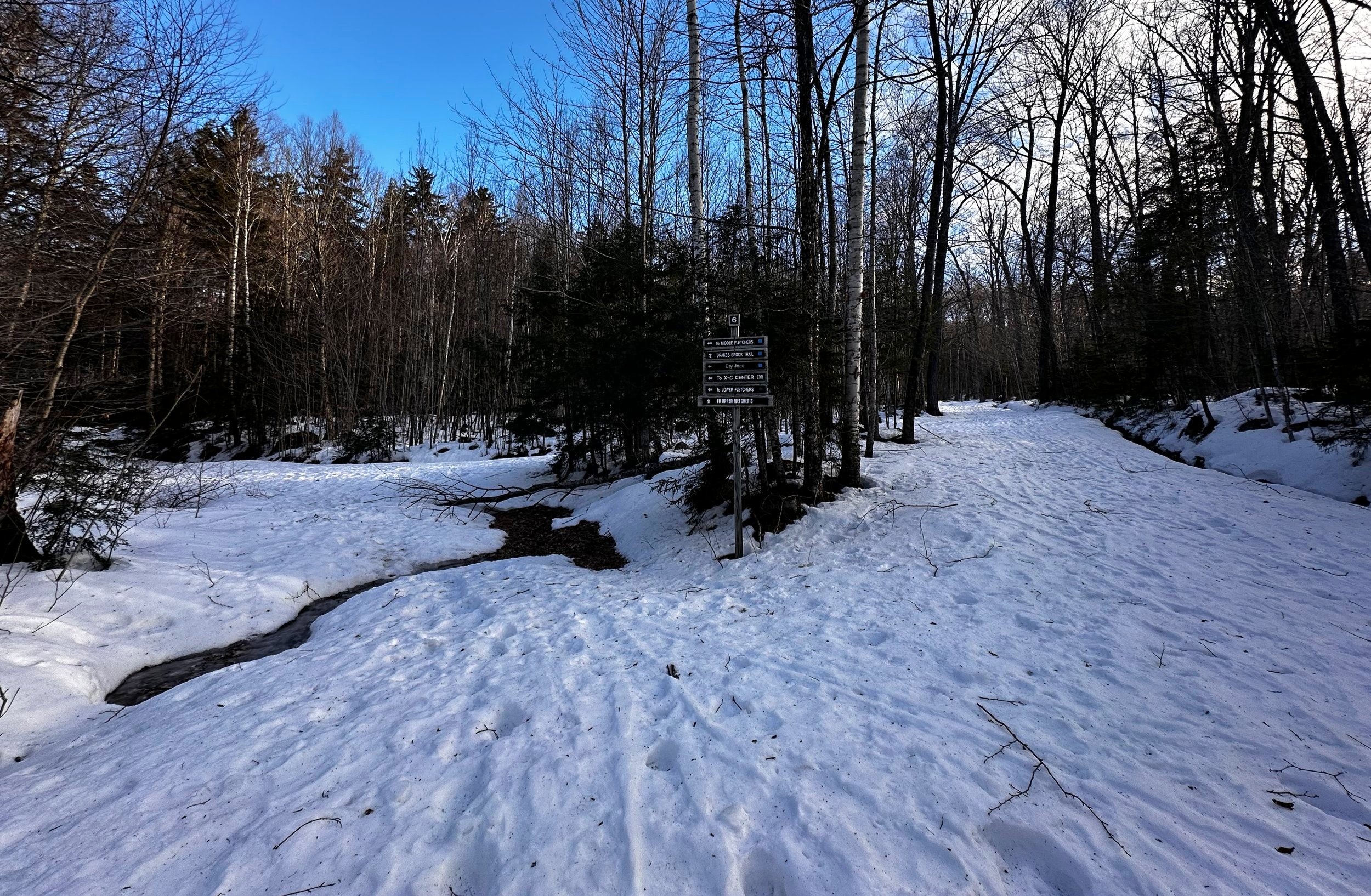
Drakes Brook Trail and ski trails diverge
While there are two Flat Mountain’s located within close proximity to one another - this ascent will be focusing on the higher summit located further north of the two; these two Flat Mountains are separated by a deep depression in the topography, which contains the Flat Mountain Ponds and several trail segments which utilize the old Beebe River Railroad bed. My objective can be found on White Mountain National Forest maps, slightly southeast of the Waterville Valley Welcome and Information Center; Drakes Pass separates Flat Mountain from the bulk of Sandwich Mountain (3,980’), to the southwest.
After consulting vintage topographic maps for any older logging roads or abandoned trail networks which may make this climb a bit more streamlined, I was able to spot Forest Road 452 which has essentially been repurposed by now into a vast network of cross-country ski trails. With snowshoes on boots, I hoped to use any of these wide paths to cover ground easily. A slight nervousness overtook while consulting maps and aerial images as my attention connected literal dots which streaked the upper mountain slope - it was not hard to discern timber stacked like matchsticks from the photos: old blowdown patches, AKA: “obstacles”.
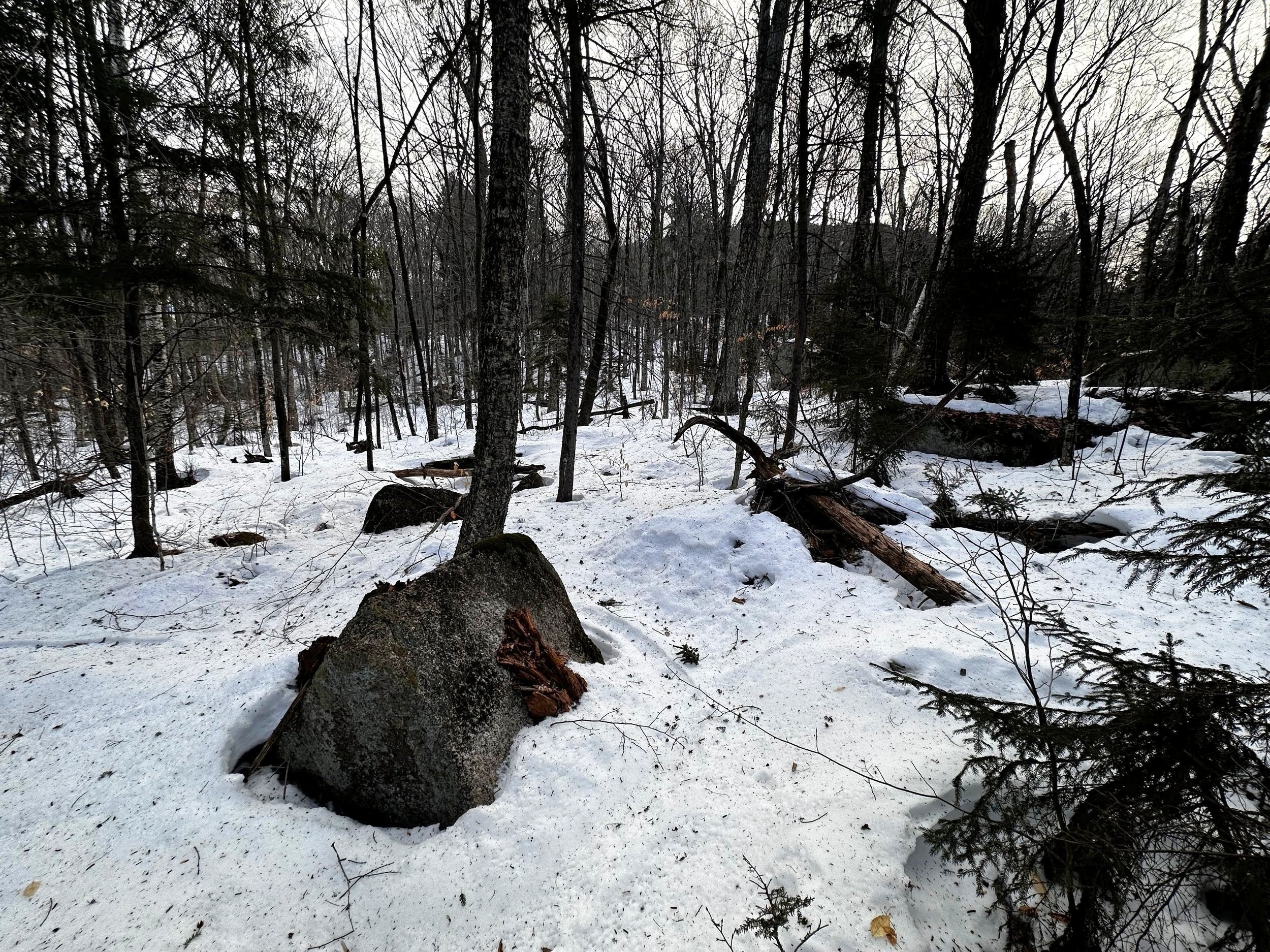
Twiggy hardwoods of lower Flat Mountain
Knowing (and seeing the evidence visually) this mountain contained patches of dense blowdown, I knew the uphill ascent would be a game of navigating around localized patches of dense, younger evergreen growth, which would have sprouted up in the jumble of toppled trees, thus filling the void in the forest canopy and thriving in the newly available sunshine.
The best bet for a smooth and efficient approach of Flat Mountain, in my mind, would be found if I could remain directly atop a NW-facing ridge (on maps, it parallels Snows Mountain to the south); it was along this ridgecrest where I was able to spot lots of colorful hardwood foliage, thanks to an autumnal aerial footage I tracked down; this hardwood swath was where I would be aiming my intention, hoping for pleasant, open-woods strolling - but prepared to do battle with any treacherously toppled timber patches.

Spotty forest along the NW ridge
Arriving at the Drakes Brook/Sandwich Mountain Trailhead at 7:41AM, my Subaru bounced and jostled over a parking lot of frozen tire tracks and potholes, as the lot appeared to have been neglected from any winter maintenance whatsoever. Once satisfied that my car was not going to receive a flat tire from driving over the undulating rock-solid, icy surface, gear was readied as I listened to the wind howl high overhead. At the 1,410’ trailhead, the ambient temperate was hovering around 16°; knowing I should remain sheltered by the forest canopy throughout the relatively short bushwhack ramble, I came prepared with a whole slew of winter hiking and backpacking gear - even an alpine bivy, should the need, or want to spend a night in the backcountry arise.
Still relatively open woods, heading toward that bump in the distance
The Drakes Brook Trail was smooth and streamlined, a regular boot pack led into the wilderness along the old logging road corridor, plenty of frozen postholes could be seen just off the narrow, packed track. I began in snowshoes simply to avoid needing to stop early into the trek and switch into snowshoes, once off trail. Only once had I spotted trailhead signage requesting hikers do not enter the Jennings Peak corridor, which returns northbound, to the WVV Welcome Center - perhaps to keep foot traffic off designated ski trails, it appeared this trail welcomed traffic of any kind - with skis or snowshoes, or not.
Passing the diversion for the Drakes Brook Trail, I watched the icy water cascade over patches of frozen ice while my route trekked alongside the brook - I had yet to attempt a crossing from this side of the mountain but had crossed Drakes Brook in other winters and was thankful for my simplistic route which did not feature any haphazard water crossings. From the Drakes Brook Trail junction, it was not hard to spot the sign indicating the turn off for Fletcher Cascades ~200’ beyond. There was a time I had considered using the Fletcher Cascades Trail to gain deeper access to the wilderness, but the harrowing climb up and out of the drainage gully was less than appealing to me this morning.

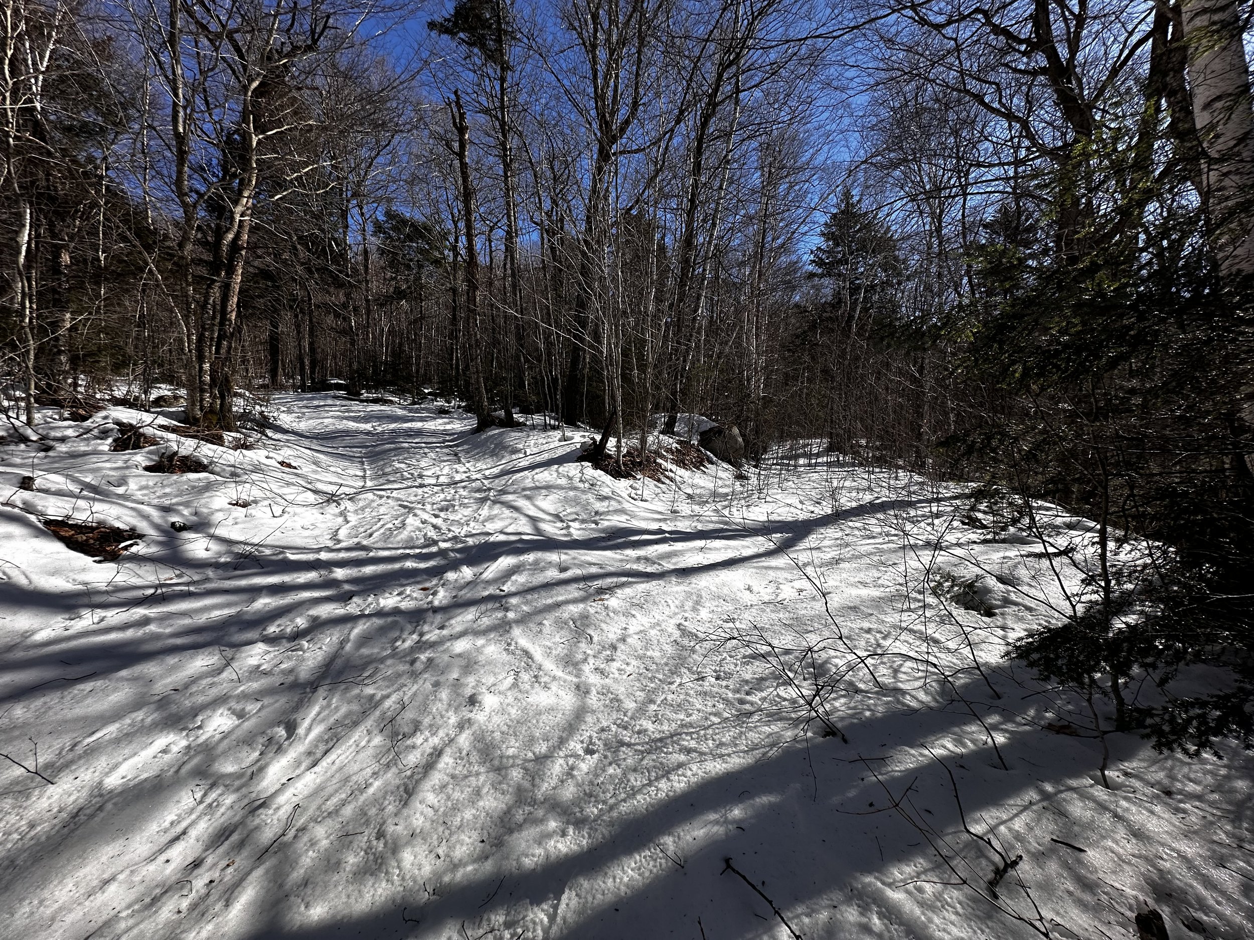
Thin, hardpacked snow covered the steep pitches
Each junction for the ski trail network is very well signed; arrows indicating where certain service shops can be found. Very similar to how regular snowmobile corridors and networks are laid out - this all made for easy, efficient travel toward my objective. Spotting one, brushy, old logging road - its wide surface brimming with twiggy beech saplings from side to side. Thankful that none of the branches were snow-loaded, I could swing and wind a course through the young growth rather efficiently, without plowing through directly, thus leaving an ugly sea of snapped branches in my wake.
Departing any semblance of logging roadbed, I gazed around at my surroundings, and at the elevation I had gained thus far: to my right the sharply pointed Noon Peak (2,976’) rose tall - a beacon of known object from which I could roughly locate my upslope direction of travel. Once I had trekked to a point I visually assumed to be directly atop the ridgecrest, this was the landform I had intended to follow toward the recognized high point.

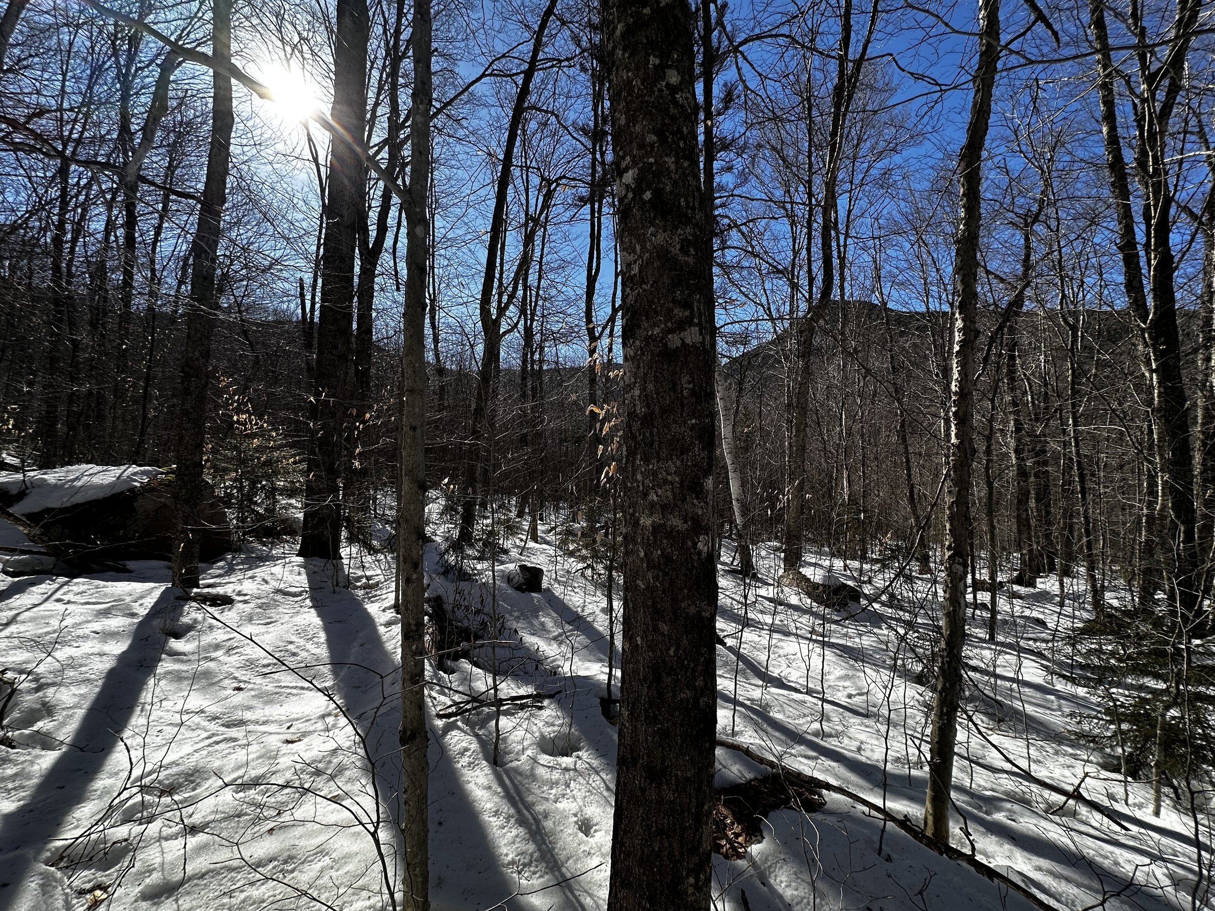
Looking back down a gentler grade of the NW ridge
Early into the bushwhack, the lower pitched mountainside was a blanket of snowy, pillow-topped boulders; although, it was not hard to pick a route around the jumble of exposed boulder by snaking around (or climbing directly up and over) while remaining on the rock-solid snowpack. Overall, well over a foot of snow remained beneath the hard, supportive crust - I hoped for this to persist through the coming warm, rainy days - but I do entertain some doubt.
Reaching a point at about 2,400’, the ridgecrest before me rose rather steeply; sheltered by massive, spruce trunks, the hillside rose like a mighty ship’s prow. Knowing that the grade tapered once atop this abrupt rise, I thanked the rock-hard snowpack as front crampon points of the Tubbs Flex Alp snowshoes bit into the frozen surface beautifully. With solid, upslope traction, progression was reduced to an exhaustive game of steep stair-stepping, while bracing with trekking poles as to avoid the occasional backward slide.
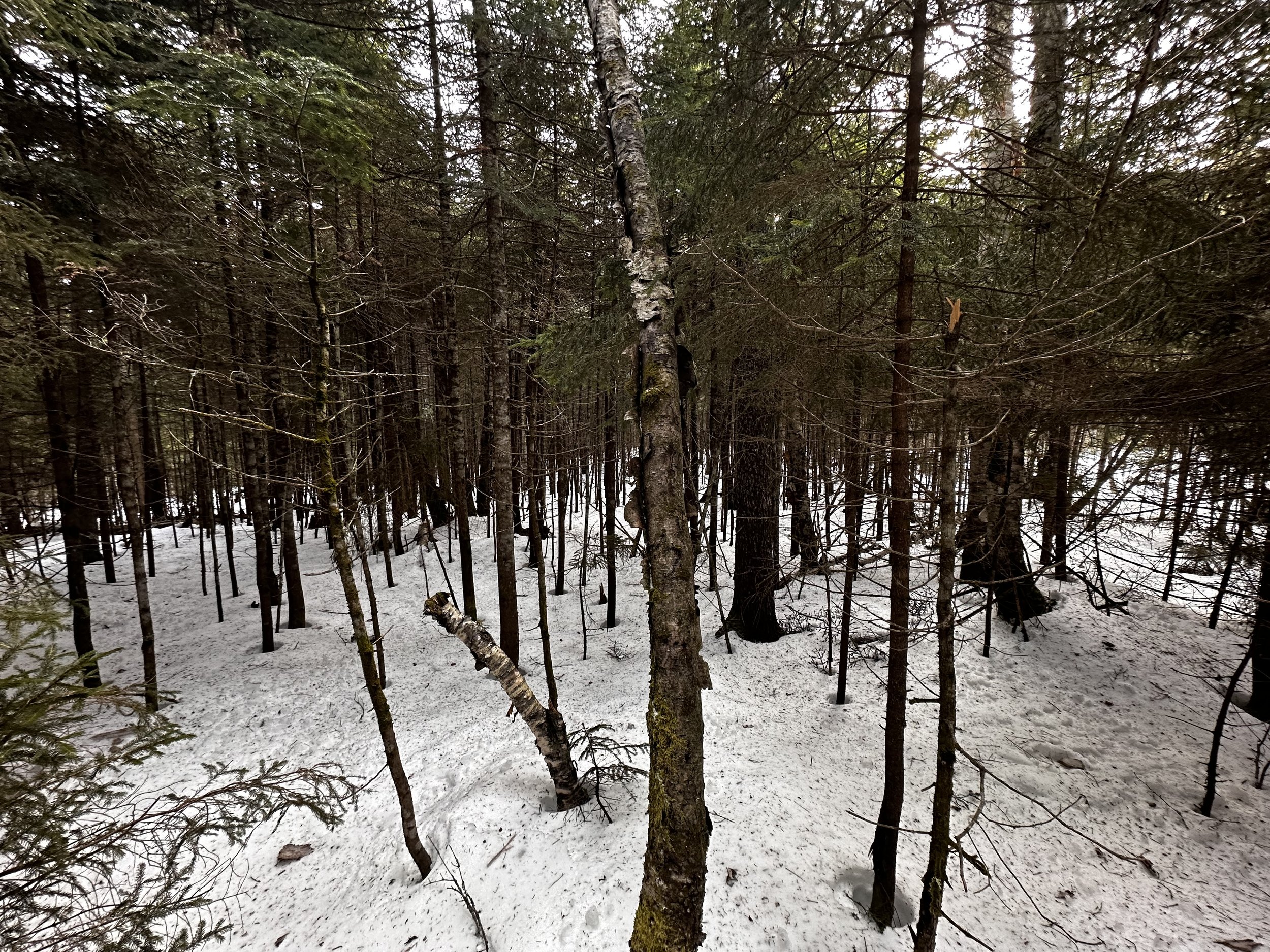
Becoming thicker, but never too bad
While the approach was direct, and the terrain steep, I was thrilled to be trekking through open woods; however, that is not to say I did not hit narrow bands clogged with younger softwood growth. Those appeared every so often, akin to a fir-wave along a higher, exposed slope. At least along this aspect, the conifers were spaced apart enough as to allow for easy passage; slipping between bushy evergreen boughs, beyond each of these thick bands I would emerge to find a glorious sight of wide-open spruce and fir.
While any topographic map will have the observer believing that the hillside might be a slow, steady rise from base to summit, once crested over the initial steep pitch, it was not hard to figure out how Flat Mountain came to obtain its name: countless gentle rises would result in either a flat stretch through the wilderness, or a soft decline; the terrain and forest provided fantastic, and highly enjoyable snowshoeing, but the 2.9-mile journey to stand atop the high point felt double that distance.

Nearing the final approach through open woods
At several instances along the climb, I found myself meandering through patches of hobblebush which emerged from the remaining snowpack. Certainly, this mountainside would be littered with ferns, mosses and other dense understory vegetation - I was once again relieved to be strolling through in winter, while most of this plant-matter remained hidden beneath the crusty snow.
Throughout the remaining climb, it was basically a game of following a gentle rise in the mountainscape, generally southeastwardly; although care should be taken as to not accidentally begin heading toward, and subsequently ascending any sub-peaks of Flat Mountain. Around a brief patch of what appeared to be moose-gnawed, stunted balsam growth, I swung, trying to avoid their 2-3’ twiggy stems as they were extremely stiff and scrappy, making it hard to pass by without snagging clothing or gear.
This wooded summit even offered a small standing area
Once beyond the remaining low growth, I found myself strolling through an expansive, rolling hillside blanketed with mature spruce-fir. During the final several rods to the recognized high point, I remained atop the rock-hard snowpack; occasional branches poked up from the otherwise smoothed over forest floor. Small pieces of balsam and spruce littered the top of the snowy crust - evidence of recent high winds. Even this morning, being completely sheltered from the driving winds, they still found a way to sneak into the mountainous canopy and suck the warmth from my own layers.
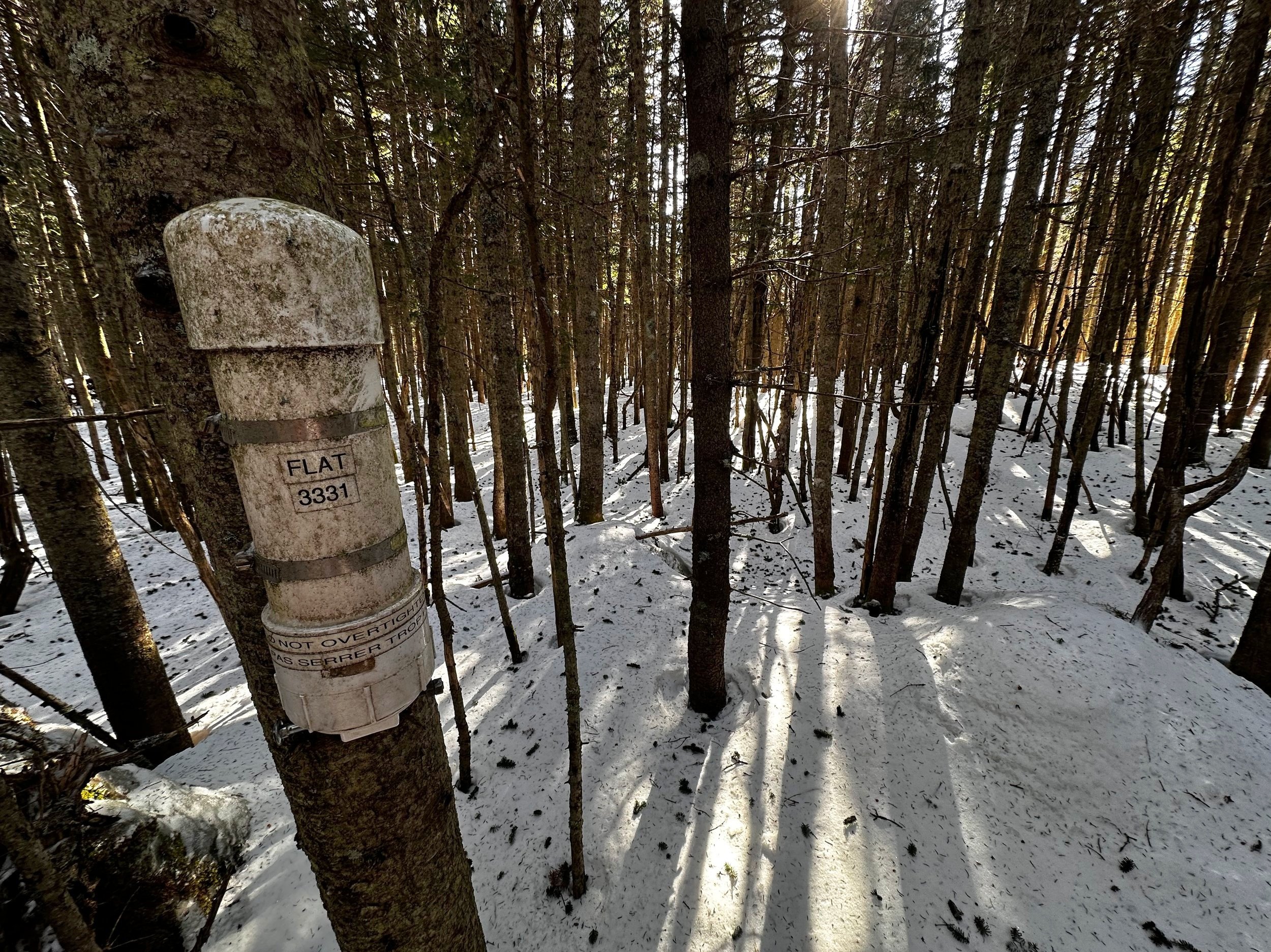
From afar, I could spot the PVC canister mounted to a narrow, fir trunk; strolling right over to it was no problem, thanks to stellar floatation. Picking the first of three notebooks to register my ascent, I noticed the previous entry into this book was placed by a climbing party December 23rd, 2023 - what a nice Christmas gift to oneself, a trailless 3000-Footer!

Edge of a wooded cliff band along the NW ridge
With the contents wrapped back up in multi-layered Ziplock bags, I took a moment to watch the morning sunrays flicker through the evergreen canopy. As the wind continued to shred through the wooded summit, I turned to follow my snowshoe track back downslope, albeit relatively flat for a healthy distance. Following my own ascending tracks soon proved time consuming - if possible, at all. In many instances, my snowshoe crampons hardly punctured the surface, leaving essentially no track to follow back out.
Departing the summit area, little did I know that I would not encounter any of my ascending snowshoe tracks until returning back to the old logging roads/ski trails surrounding the Drakes Brook area. Dropping off the highest peak of Flat Mountain soon had me working diligently to constantly correct my descending route - I was too far west along the ridgecrest and was getting sucked into the Fletcher Cascades gully. Knowing this was not how I wanted my day to go - I could essentially spot the brighter canopy of open woods to my right; occasionally, I tried to side-hill over to my ascending tracks (not knowing I was that far off my uphill track until reviewing my route later at home), but all the while, descended in a mind game of brushier evergreen than I could recall on the ascent.
Logging road split: the right branch was used in both directions
The descent off the steepest pitch of the northwest ridge could have been made a bit more protected and safer had I thought to bring an ice axe instead of simple trekking poles. But, slowly and methodically, I picked a route down the steep, icy face. Once back in the second growth hardwood stand, I still did not recognize anything as I was finding much more snowy, pillow-topped boulders and rocky terrain. Shooting straight downslope, using the edge of the Fletcher Cascades terrain feature now as a guide, I popped right onto the wide, beech sapling-filled logging corridor which I followed back to the main trunk branch, and henceforth the trailhead.
Overall stats for the day:
5.8-miles
2hr 43 minutes
2,320’ elevation gain
Flat Mountain - 3,331’