
Russell Mtn: East, West + Pond Peaks
With a multi-peak climb topping out at 2,460’, I was on a quest to see how lower elevation snowpacks had fared from overall unseasonably warm temperatures with overnight rain. As a higher summit would have offered too much variability while trekking from lower to higher elevations, I chose carefully, a route which would certainly still have some snow; with snowshoes strapped to a 28L pack and ready for deployment at the sight of deep snow, would I find winter or spring conditions hiding in the undulating hills of Russell Mountain?

The gated end of Tripoli Road
The mass of Russell Mountain consists of several gentle rises which encircle Russell Pond - a White Mountain destination better known for its serene campground and waterside recreation setting. The southern-most peak of Russell Mountain is known as Russell Pond Peak; the lowest of today’s trio, at 2,071’, this topographic mound is connected to Russell Crag by a narrow band of south-facing ridge - this peak would be the first objective for my day out.
To the north of Russell Pond, the East and West Peaks of Russell Mountain can be found; at 2,460’, and 2,424’ respectively, these lower peaks are wedge-shaped, glacially sculpted, and absolutely stunning - from a geological standpoint. While preparing for this ascent, I searched for not only older topographic maps (knowing a bit about the Russell Pond Trail, which had been abandoned by the mid-1940’s), but also aerial footage, to check for any residual traces of logging corridors in the area, as well as for faint suggestions of foot traffic, or herd paths along any of the proposed route.

Old logging road (right), drainage gully (left)
While most who climb these lower peaks begin their treks from roadside, or within the Russell Pond Campground complex, this was not an option this morning as Tripoli Road is still gated for the winter season. Assuming I could make quick work of the lower altitude northern hardwoods, I was content beginning an approach from the gated, western end of Tripoli Road, a mere stones throw away (east) from Interstate 93.
At 6:46AM, I arrived on the scene and parked well off Tripoli Road on its northern side, as signs warned motorists of frequent logging truck traffic in the area. Upon stepping out of my car, right away I could hear the flowing cascades of a low tributary to the Pemigewasset River; this would need to be crossed as soon as I embarked into the woods. Finding no signs of snow at the 870’ trailhead parking spot, snowshoes were strapped to my pack, assuming conditions along the northern aspects would still warrant snowshoe use.

Through decent woods, climbing to the ridgecrest
Observing a roadside of beer cans and various processed food packaging, I trekked toward the waterway just to find it certainly flowing heavily, but was easily stepped over with the aid of a mid-stream boulder. Continuing along a low rise in the terrain, which would bring me eastwardly toward the southern ridge of Russell Pond Peak, I had hardly roamed 0.15-miles from my Subaru when I popped out of the woods and directly onto an old, brushy logging road. Glancing both up and downslope, I could see Tripoli Road, but more importantly - I could view the mountainside well into the distance - not a flake of snow to be found at my present location.
Atop the ridgecrest - above the undercast over Tripoli Road
Locating this old woods corridor was very lucky, despite rather rocky and mossy footing, the logging/skidder road offered a reprieve from the trailside bushy evergreen - all of which was clinging tightly onto the previous evening rain droplets, as if waiting for my passing to release all droplets while brushing past.
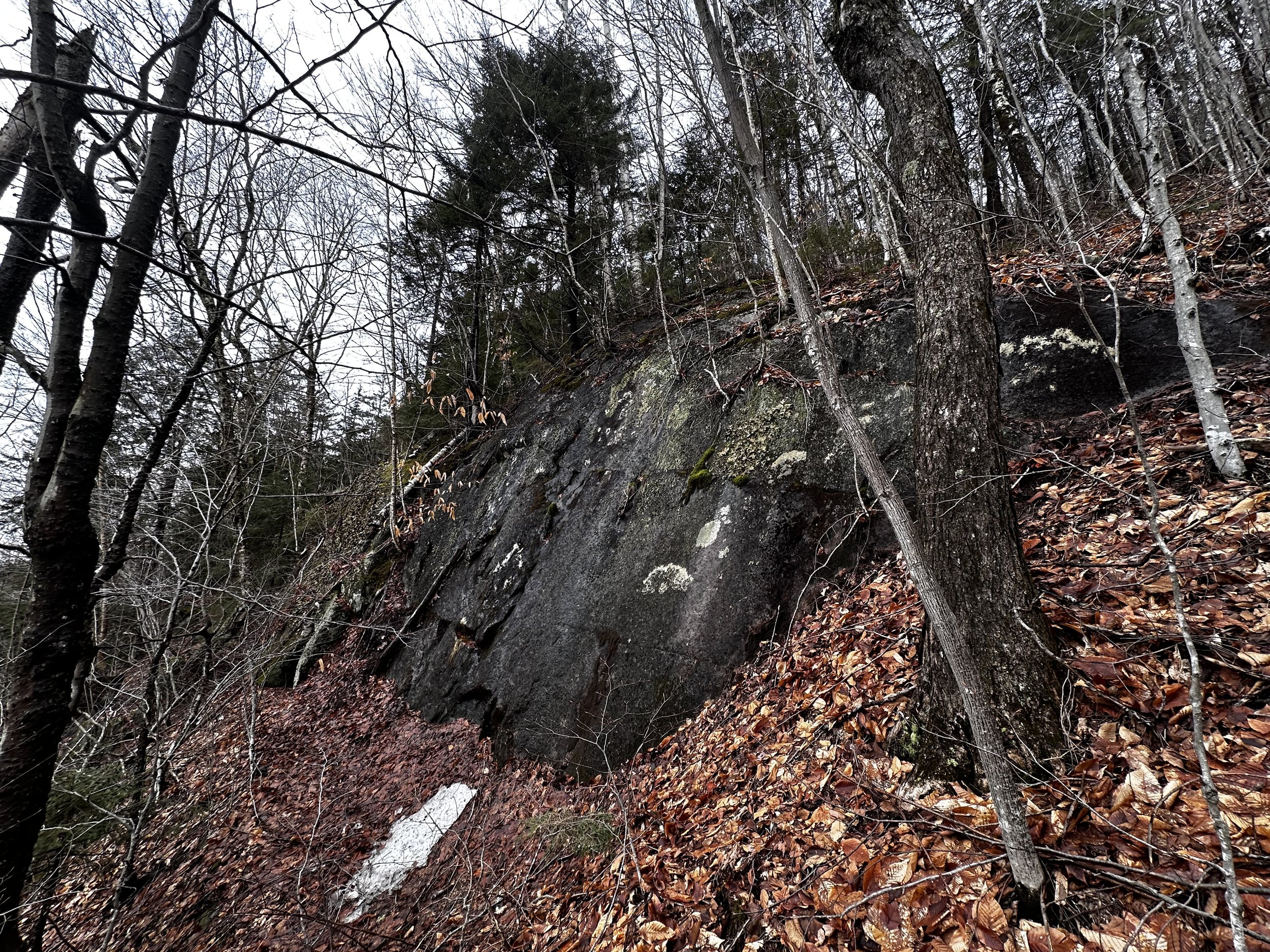
The climbing grew steep as I left the hardwood canopy behind and trekked into a dark, dank forest of overhead evergreen boughs; footing was overall solid despite the steep grade, a deep blanket of forest duff worked to fill in any voids between jumbled boulders. Glacial erratics and boulders which had succumb to frost action weathering began appearing as I climbed closer to the 1,810’ ridgecrest, I side-hilled around several large rocky outcroppings before standing on somewhat level terrain.

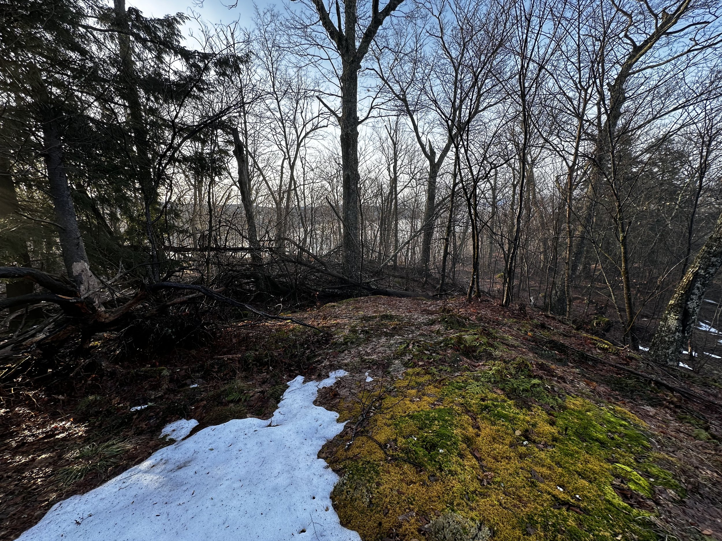
Sun-drenched open woods of Russell Pond Peak
From atop the ridgecrest (some maps denote this southern bump as the Russell Crag, while other maps list a western sub-peak as Russell Crag as well), I could see an opaque blanket of low-hanging cloud inversion covering the course of Tripoli Road as it meanders toward Mount Tecumseh and the Breadtray Ridge. To the north I had a surprisingly open forest with moss covered rock slabs underfoot. Travel was soggy atop the dense blanket of leaf debris which held any runoff; I was thankful for waterproof mountaineering boots and for having not worn simple trail runners this morning.
Beginning to pick a route toward my first objective, I found it easier to climb up and over the craggy knob which lay before me - it turns out summiting this “high point” is neat, but completely unnecessary as it is wooded and a bit messy with treacherous footing (IE: frost-shattered, moss-covered boulders) and junky, mixed forest cap. Beyond the low knob, the open hardwood forest persisted with localized patches of evergreen which began to appear sporadically along the ridge.

Summit of Russell Pond Peak
Quickly, it was learned that upon reaching any flatter section of ridge I would have to search for either a dry footing route, or simply trudge through up to 6” of standing water - which is generally what was done when steppingstones or other such aids were not available. At several points along the final ascent, I stopped to listen to, and watch drainage water cascade down narrow gullies in the landscape - between snowmelt and the previous day of rain, even these lower peaks were shedding some serious runoff.

Crossing Russell Pond Road in the col
The summit area of Russell Pond Peak was very broad and rocky; smoothed over, mossy bedrock which was highly reminiscent of standing atop Mount Cilley (2,227’) or either of the Grandview Mountains (2,012’) - which was interesting because I could look due west and spot the lower domes of Hubbard Brook Experimental Forest from whence I stood. Spotting the hazard orange summit canister, I took the lid off just to realize how wet my hands had become from every tree I passed raining down - closing the lid back up, I had serious considerations of calling the day done and returning back to my Subaru - the forest was very soggy and drippy, at least the snow had yet to become problematic!

Leaving the Campground compound on an old road
Continuing to weigh the options of proceeding toward the East and West Peaks of Russell Mountain; I was nearly off my first mountain before I had fully committed to at least seeing how the coming terrain would treat a climber in early shoulder season. As with nearly any glacially sculpted mountain in the northern hemisphere, this peak too is tapered northwardly, a much more gradual grade in which to trek along a northern ridge - which on map, essentially connects to the East Peak of Russell Mountain - which was my intended path this morning.
Completely open hardwoods made the navigation elementary, as I could view the glistening white, frozen surface of Russell Pond through the trees and knew to remain not only along my current ridge, but to the east of the pond as well. The footing along these mountains contain much more shattered rock and boulder than I could have ever imagined, with a dense layer of moss or leaf litter, or with the occasional patch of completely unsupportive snow, slipping a foot between boulders was a frequent occurrence which facilitated great care in foot placement - and trust in a footstep!

Massive blowdown patch nearing the summit of East Russell Mtn
From afar, I could spot the iced-over road surface of Russell Pond Road at the extreme low-point of the col. Remembering the slew of maps which I had viewed prior to undertaking these climbs, I recalled spotting a peculiar herd path of sorts beginning from an obvious pull-off along the southern side of the paved road. During the hiking, I was unaware that the location in question was only 0.15-miles east, but given the glorious sight of open woods across the road, I was eager to begin picking a route toward my next destination of the morning: the East Peak of Russell Mountain.

In the patch of blowdown, the recognized high point tree stands!
Only several rods into my current bushwhack and I found myself passing several maintenance buildings for the campground, before locating an old woods or logging road which appeared on none of my maps; this road was incredibly soggy, with about 3-inches of water coursing under a blanket of fallen leaves - noting this, I opted to trek on higher ground, just off the road, in the open hardwoods. Before long I began to favor the low grade of the mountainside as the old roadbed directed a bit more west than I would have preferred. Now, officially committed to locating the ridgecrest which would lead to the recognized high point of the mountain, I climbed steeply, directly at the south ridge until I could look over the far side, toward Scar Ridge.

Russell Mountain beyond the col from the East Peak
Navigation was obvious, as both sides of the ridge fell abruptly; I climbed northbound, sometimes scrambling up wet, mossy boulders, other times swinging around, under, or over toppled trees. When I reached a point roughly 30’ beneath the summit of the East Peak, I looked up the precipitous mountainside to a scene of utter devastation - and this appeared rather new, the way the lush moss had been peeled from shattered bedrock. The canopy of balsam and spruce appeared as if a mischievous child had haphazardly tossed a hundred matchsticks - each piled and stacked as if the slightest breeze could send them careening down the steep slope.
Initially, I looked into the mountaintop blowdown and was unsure how to navigate through the entanglement; with one intentional step at a time, I carefully fed my body and gear through, around, over, or under leaning tree trunks. Knowing I was nearing the ultimate high point of the mountain, I cast my gaze deep into any mess of toppled conifer, searching for a flicker of hazard orange duct tape - of a canister trapped within the tangles. Hardly surprised to not locate the canister, I traipsed carefully off what I assumed to be the highest point remaining on this peak. Glancing back, as if to give one final nod as to say “thank you for letting me pass”, to the strewn timber - just then it appeared right next to my head - I had not passed it after all, but now found myself somehow standing next to the one tree which remained standing (or perhaps the jar had been placed since the micro-burst had destroyed the summit vegetation).

Old stone foundation nearing Russell Mountain
As my hands had somehow become even more waterlogged from the forest precipitation raining down (thankfully not cold due to temps nearing 50s - I also had 3 pairs of gloves in my bag, none of which were currently being used), I opted to forego signing into the summit register notebook as I preferred to keep its paper contents dry for the next climber.
With a quick bearing to solidify my escape route off the East Peak, I was shocked at how quickly I departed the coniferous cap of the mountain and found myself back in the open-air hardwood stand. Across the col, the main peak (albeit not the highest) of Russell Mountain rose up as a wooded dome; trekking toward it, I entered a shaded area with much residual snow, what snow I did find was akin to a wet slushie: large grain snow pellets which did nothing to support any footsteps; if anything, the slush collapsed around each footprint, just adding weight to each cumbersome step.

Recent moose activity atop Russell Mountain
Trekking through the col, naturally, I spied around the forest for any semblance of Russell Pond Trail, but as that corridor had fallen out of use over 80-years prior, I did not locate its course, but could imagine it whisking adventurers from Russell Pond, to the old 18’ wooden lookout tower which once stood atop Russell Mountain, and henceforth to Horner Brook, Loon Pond, and other northerly destinations.
Reaching the base of Russell Mountain, it was obvious to see exposed cliff bands adorning the southeastern aspect of Russell Mountain - all of this came at no surprise as the exposed ledges and rock bands are clearly visible on aerial photography. While a clamber directly up the exposed face seemed like it could be a quick thrill - the sight of moss and leaf duff filling-in around the wet rock looked completely unforgiving and a downright terrible idea to pursue.

Looking back along the summit ridge of Russell Mountain
Opting for a more gradual approach, I swung northerly around the exposed bedrock, to ascend more in a trough of sorts, between aspects and features of the mountain than straight on. From the northeast, I climbed well away from the cliffy feature, which had a cluster of evergreen at its precipice that I wanted to avoid anyhow. Following relatively newer moose tracks (we had the same idea for traversing this mountain), I swung around any low, tree branches, but overall had found a fairly open patch of woods to gain elevation.
Within several minutes, I followed the moose tracks as it took a brief bath in an open mud puddle, then climbed a gentle pitch onto a rocky landing where I found the round stone structure previous reports had mentioned - is this the foundation to the old 18’ wooden lookout tower which had been built alongside an open-front shelter roughly 200’ from the summit of the mountain? Or was this circular rock structure the base to an outhouse toilet? Either way, it sure is an interesting find out in the trailless mountains.

Restricted, westerly views while descending Russell Mtn
By the 1930’s, several ski trails had been cut along the northern and western slopes of Russell Mountain, for intermediate skiers; even Russell Pond had been home to several shelters and shacks in the early 1900’s; but, as reported in the 1946 edition of the AMC Mountain Guide, trails which formerly departed the Russell Pond area had been abandoned by that time. Then, reported in the 1963 edition, the Russell Pond Campground had been tentatively planned for opening July 1st, 1963, forever altering the glacially-sculpted landscape.
From the area containing the old, stone foundation, more blowdown was encountered while navigating to the true summit. Upon reaching each minor rise, it was always determined that higher ground could be observed just ahead, each instance I searched for higher ground, until traipsing as far southwest as one could venture without dropping steeply off the rocky rise - directly into a sea of young spruce and lichen. Glancing back along the wooded ridge toward my ascending footsteps, I saw no brilliantly glowing orange salsa jars this time, no flicker of color amidst this dark, wet conifer bark.

East Peak shoulder (left), Hix Mtn (Middle), Russell Pond (right)
Convinced that I had either trekked directly past the high point canister, had it succumb to bears as other summit jars had recently, I would never find the miniscule object out in this vast wilderness - plus, this would have been yet another jar I had intentionally planned to not sign into - due to moist hands. Satisfied that I had stood or trekked directly atop the main peak of Russell Mountain as well, I took one look into the surrounding summit canopy and scrapped all prior plans of my descent route.
Being able to spot a flicker of white nearly 800’ below, the frozen surface of Russell Pond appeared not too far away. Being my next destination, I scrapped any notion of trekking westward first, away from the steep, southern face of Russell Mountain before cutting southbound, toward the pond. The woods invited a direct approach, and I took it. At any point in the steep descent, I could peer ahead through relatively open woods, to the mountainside below - which was a steep, rocky descent, but not the sheer cliff face I had expected to find.
One of several brief ledges on south face of Russell Mtn
The mountainside was an easy descent to start, followed quickly by a sea of glacially plucked boulders - more of which were covered in moss or leaves. Thankful to have packed my ice axe for today’s outing, this is always a welcome addition to late-season winter bushwhacking or climbing; where it is possible to stabilize, or gently hook a sturdy tree in the event I need to rappel down, or scramble up brief stretches - I always carry lengths of cordage, strapping and rope, should the terrain warrant more equipment as well.
Atop rather tricky footing, I eventually picked a route to the edge of Russell Pond, but with one waft of chlorine or bleach (public beach treatment??) up the nostrils, I felt sorry for any wildlife which once called this beautiful waterbody “home”. Along the western shore of Russell Pond, I trekked a rather rough footpath which circumnavigates the pond - trail crews have much work cut out for them with blowdown and obstacles if they are to make this loop enjoyable for beach-goers who may not be accustomed to sub-par hiking trails.

Southward views from Russell Pond
Stopping at various lookouts to get a better glimpse of the mountains where I had roamed this morning, it is interesting to look at the Russell Mountains and simply see forested mounds - finding each mountain’s nuances or quirks of pesky blowdown patches, or exposed rock bands are what makes exploring lesser known mountains so enjoyable. Swinging southeastwardly around the pond, I was thankful for a bridged crossing of Russell Pond Brook, as the drainage was high, and flowing hard this morning from both rain and snowmelt.
Proceeding onto either a ski trail or snowmobile corridor - the wide path was signed as a snomo road would be - I followed this for several rods upslope until its course no longer served me. Aiming in my mind for the long arm of ridgelet which connects my first objective for the day, Russell Pond Peak with Russell Crag (more aptly known as a craggy peak with some views which hosts a Verizon cell tower), I followed alongside a cascading drainage, even stopping to sip from its flow when I got higher along the ridge.

Side-hilling the ridge with a steep drop off beyond
Once up and over that long ridge, I knew dropping off too early would cause a treacherously long walk back to awaiting car; to avoid this slog, I began side-hilling along the steep ridge. Initially, travel just off the crest of the ridge was easy going, but as I began to drop elevation while navigating sharply southwest, I encountered several 15-25’ cliff bands, and harrowingly steep sections - this required great care and careful foot placement as to not dislodge the entire mountainside - the blanket of moss and leaves was the first to go - to get run over by another boulder was not the way I wanted today to end.
Hiking and roaming the wilderness cannot get a person closer to living directly in the moment until finding oneself in such a precarious position where all skill and practice must come into play. The sound of water cascading beneath the bouldery hillside did nothing to set my mind at ease while descending this steep aspect. At several instances, make-shift rappels were set up as to not slide downslope uncontrollably - even the southern face of Russell Mountain was not as exposed as this rocky terrain.

Many exposed ledges descending Russell Pond Peak
Once off that brief, impressively steep face, I had reentered the open hardwoods for a leisurely stroll back to the logging road, upon which I had ascended the early bushwhack. I do not think I will ever grow accustomed to hearing water trickling beneath the surface of the hillside, at several instances the cascade breached the surface, but soon dipped beneath the next downslope boulder.
Opting to follow the found logging road corridor, it was laughable to me how close to my parked car the road came before terminating at Tripoli Road. Had I have been venturing to other destinations along the roadway, I would have never discovered it and had the opportunity to hike up and see where the old corridor meandered to. Now I know: it whisks visitors away to shaded, secluded hemlock groves, rocky mountainsides, and lofty ridge crests - from which only the craggiest of peaks of the White Mountain National Forest can be glimpsed and relished.
Overall stats for the day:
5.79 miles
3hr 39 minutes
2,861’ elevation gain
Russell Pond Peak - 2,071’
Russell Mountain - 2,424’
Russell Mountain, East Peak - 2,460’