
Ebright Azimuth (Delaware HP)
While driving to visit family in New Jersey, Alanna and I found ourselves steering toward the high point of Delaware - this mediocre high point, having been on our to-visit lists for quite some time, we were excited to finally be paying the sidewalk a visit. Ebright Azimuth is often trekked as merely a drive-up destination; sure, lengthier jaunts could be formed by linking adjacent neighborhoods, or sections of sidewalk. But, as the bell rang 9:00pm upon our arrival at Delaware’s highest, we decided to keep our visit concise.
Entering the area from the south, along Route 92 (Naaman’s Road), we entered the town of Brandywine before taking a left turn, to veer northbound on Ebright Road. The brightly lit Concord High School is passed as the street begins to climb steadily.

Survey benchmark atop Ebright Azimuth
Reaching the height-of-land, we could recognize familiar details, structures, and signs from viewing YouTube videos and reading reports of previous excursions to this state high point. First encountered is the 1947 erected, steel skeletal structure of an old fire tower. However, not for spotting forest fires, this tower was employed by Western Union to house microwave and relay equipment. The site was reportedly decommissioned upon the advent of fiber optics; more recently the structure has been repurposed to house mobile radio equipment.
Initially, we pulled onto Turf Road, where the old tower still stands, but were met with various No Trespassing placards. Knowing our stay atop Delaware’s high point would be kept to a brisk pace, we invariably pulled into a nearby housing development. To the far, right corner of Ramblewood Drive and Ebright Road, we parked long enough to pay a good, quality visit to the hill.
Directly across from Ramblewood Drive, a buffer of sidewalk shoulder has been added, affording a small standing space at Ebright Azimuth. Curious how this location was given its unique naming? Apparently, the land where this state high point is found, was at one time owned by a fellow named Ebright. The latter part of this high point’s name is representative of “the direction measured in degrees clockwise from north on an azimuth circle”; an azimuth circle consists of 360°.
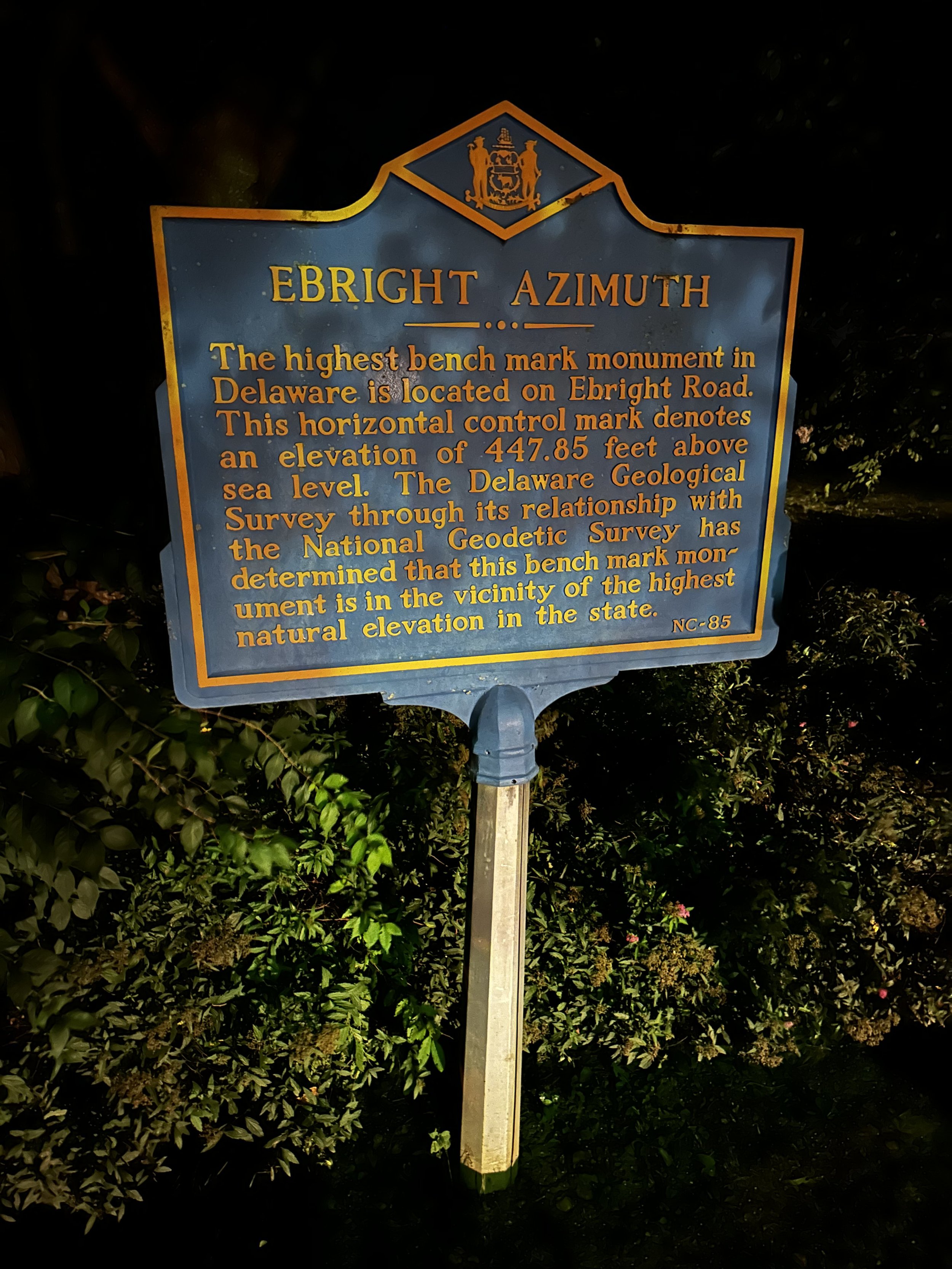
Historical plaque for Ebright Azimuth
Following the sidewalk southwesterly, a standard Geodetic Survey benchmark disc can be found just off the sidewalk, in a tuft of grass - evidently, the sidewalk must have been paved several times over as the monument disc now resides several inches beneath the surrounding turf.
After taking a moment to glance around (not much else to see at 9:00pm in a residential area), we returned to our car, and drove off into the night - pleased to have visited the second lowest state high point - only Florida resides at a lesser elevation above sea level.
Overall stats for the day:
0.2-miles
5 minutes
0’ elevation gain
Ebright Azimuth - 447.85’