
Bald Mountain
What do I do when I need to shop for groceries? Find a nearby New Hampshire 500-Highest peak to snowshoe bushwhack while out running errands, naturally. Several years ago, I could not have predicted the extent to which the Carr-Stinson-Kineo region of the White Mountains would satiate my desire for off-trail roaming and climbing; the forests are often less tangled with young evergreen growth than other regions of the New Hampshire mountains.

Beginning along FR 605
Bald Mountain; there is a good chance a visit to this 2,204’ wooded summit would not have happened, had it not been recognized as one of the 500-Highest summits in New Hampshire; after climbing steeply to reach its narrow lookout windows from the summit area, it is apparent, this lesser mountain was visited at just the right time.
A dirt (mud, when the morning sun warmed the road surface) road departs Rumney, NH. Heading northeasterly on East Rumney Road, the pothole-stricken roadbed seemed to improve somewhat as the miles passed. From a bare, dirt and mud surface - as residences were passed, the road transitioned to a dusting of snow. Here, the road remained frozen, and free of muddy ruts.

Passing the red blazed WMNF boundary
As a bend is encountered in East Rumney Road, switching to a eastward (southeast) direction, the old Forest Road 605 corridor proceeds straight ahead, however, it has been obliterated by a newer residential driveway. Following East Rumney Road around the sharp bend leads one to the gated terminus of Forest Road 605. Today, a small parking space on the roadside was plowed enough to fit just one vehicle.
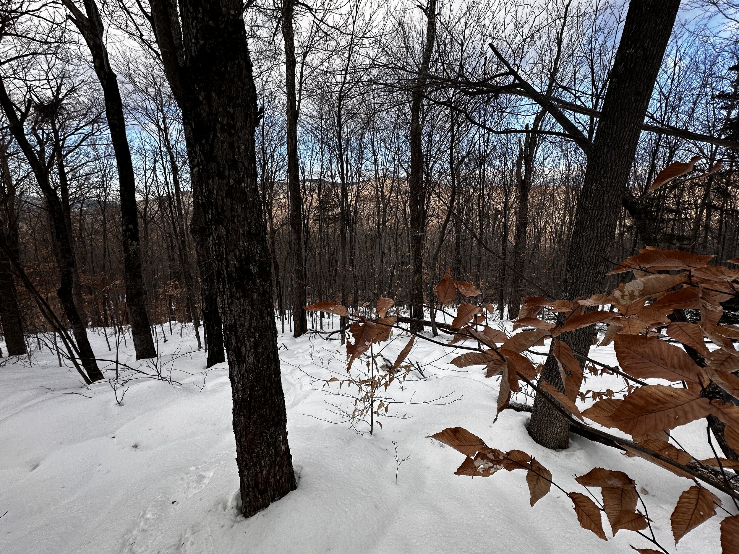
With snowshoes on mountaineering boots starting at the edge of the road, the old, overgrown forest road had a lumpy, 6-8” of snow remaining; today’s conditions were completely unsupportive snow with a 0.5” crust, from 1,050’-1,650’. This elevation was overall spent trekking through an stunningly open, hardwood gully between Stinson and Bald Mountains.

Back on wide FR 605
Young, white pines sprouted up directly on the old road corridor, while the surrounding forest appeared to be relatively young birch and beech, primarily. At 0.15-miles into the trek, the roadway being followed veers to the right suddenly, as it begins climbing. Labelled as FR 605A, this spur is visible on some topographic maps, not all maps depict all these old forest roads - many maps do not show FR 605 and 605A together. FR 605 continues straight, along a large, boulder wall. This old corridor evidently doubles as drainage for higher terrain, as water was visibly flowing atop a bed of fallen leaves, I stepped on snowy, pillow-topped rocks.

Off the forest road and into a hemlock grove
Merging with Forest Road 605A, it was not noticed while ascending, but on the return trek: it appears a rough, unmarked trail could be observed heading northeastward; however, it was not followed at all on this ramble. Continuing along FR 605, this corridor was much more defined than the straight path I had taken while trying to avoid unnecessary added milage of the curvy FR 605A.
Several downed trees exist along the near-straight trek of the old road, all of these could be ducked under, or stepped over. Following the road until about 1,425’, I could now spot my objective through the open canopy, and reckoned that I was just wasting time by following FR 605 any further northward, just to cut eastward anyhow. Initially, I assumed following the forest road until its end would get me around any wider sections of Avery Brook, and also avoid unnecessary elevation loss and gain.

Lots of young beech while beginning the climb
Through beautifully open hardwoods, I descended atop snowy pillow topped boulders to the brook, finding a safe place to cross was no issue: with the aid of one icy rock mid-stream, the crossing was reduced to a simple step-over. After the only water crossing of the excursion, I could still spot my destination through thin beech and birch - the morning sun shone through the airy canopy, warming this bushwhacker to the extent that only a simple base layer was needed, unless wind picked up nearing the summit.
Evidently, I had trekked right through the middle of Rumney Town Forest and never knew, without any signage that I could find. All I located was pink surveyor flagging - since this neon tape was not affixed to anything, just stuck in a tree, I packed it all out.
The thin forest allowing westerly views toward Stinson Mtn
The mountainside grew steep, but navigating around tree trunks only helped lessen the grade. Aiming directly for the west-facing ridge, I kicked steps into the snowy hillside, remembering that my right snowshoe was held together with landscaping wire. Today’s secondary mission was to see if the snowshoes would hold up for the remainder of the winter season, given the amount of snapped wire upon my return to the car, I think they will be reduced to wall art.
As elevation was gained, I could turn to glance over my shoulder and begin to see mounds of Stinson Mountain stacking up. At about 1,700’, I veered off my straight-up-the-ridge approach, to swing around a brief wall of dark green - young balsam fir, at least the conifer boughs were not snow loaded any longer. Around the fir, and back into open woods - at this elevation, it seemed I had met the conifer cap of Bald Mountain.

Even the conifer cap was airy, and easy to travel
I could not keep from laughing as I climbed, had I ever encountered a softwood mountainside as open, and bushwhackable - without the conifers whacking back? If so, I could not recall the time nor place. With my vision cast several rods through the forest, I spotted an area of bright white - the snowmobile corridor. I had thought of using this trail to descend from Bald Mountain, but knowing that route would necessitate a road walk, and given how open and enjoyable these woods had been, the obvious answer was to follow my ascending snowshoe tracks back through open woods.

Snowmobile corridor at ~1,900’
Crossing the snowmobile corridor, it appeared that the groomer had come through recently, but with minimal snow depths, did not seem to be grooming much of anything! Back into the open woods I trekked, assuming for sure there would be an obvious herd path from here to the summit, I actually found no evidence of any prior traffic on the route I chose. A short distance beyond the snowmobile corridor, I encountered a small band of ledges - not quite exposed enough to want to call them “cliffs”, the exposed band of rocks really only emerged from the hillside by about 2-4 vertical feet.

Nearing the summit of Bald Mountain
Locating an area of steep snow with no exposed rock, I climbed on front points of the snowshoe crampons; around here, the snow had transitioned to overall supportive with a crust - every couple of steps I would sink into the powder beneath - but, overall floatation was prime from 2,000’ to the 2,204’ mountaintop and back.
The bushwhack path I had picked brought me to the southern aspect of the summit. This was the only instance of the entire bushwhack where I had to push through any dense vegetation. Gently shoving spruce twigs aside, and stepping over one large toppled tree trunk, I finally landed on a slabby area covered with crusty snow. With ease, I let the dull, old crampon points do all the hard work as I picked my way to the high point of the mountain. But, not without turning for several moments to gawk at the southern Mount Kearsarge, with the white-streaked ski slopes of Ragged Mountain visible in the foreground. From another lookout, a frosty-sloped Mount Cardigan with its surrounding sub-peaks were visible in a low notch formed by Tenney and Fletcher Mountains.

Southward views from Bald Mountain
After standing on what I assumed to be the high point of Bald Mountain, I followed an obvious trail corridor eastward, hoping to find more views. After turning several corners, and descending further than I had wanted to, I backtracked to the summit area, and continued along the western edge of the mountaintop; following another brief corridor along this side - did they meet up? Maybe, but I was not here to find out. Into the woods I dove, to see if I could find another, higher location atop this mountain mass.
After a very beautiful stroll through the trailless summit area, I returned back to my starting place, convinced that this may have been the peak I had heard about with the summit canister on the ground - if that was the case, I would never find it until the spring thaw. Returning to the narrow, south-facing vista, I watched smoke roll into the atmosphere from far below.

Kearsarge + Ragged Mountains
Once satisfied with the amount of time taken atop Bald Mountain, I began following my snowshoe tracks back into the conifers. Any meandering, uphill tracks were smoothed right out. Taking the path of least resistance, I nearly had a full, trail running trot while descending Bald Mountain, in mountaineering boots, nonetheless.
While picking a westerly route off Bald Mountain, I ditched my ascending tracks to blaze new ones, and had a serious case of déjà vu along the way. Letting gravity whisk me back downslope, I began veering more southward than westward - a technique I was able to perform while descending the trailless North Hitchcock, and through nearly identical, fully open beech and birch woods.

Avery Brook
Once again, I passed directly through the Rumney Town Forest and never knew it existed. Re-crossing Avery Brook took several moments of pondering, and considering options - not entirely as straight forward as the initial crossing of this morning. The black waterway flowed a much wider course being 0.2-mile further south. Using mid-stream stones, the wider crossing soon became a simple step-over as well.
West of Avery Brook, old road corridors can be found heading in many directions, from the brook I followed one wide swath, which had begun to sprout new beech, and evergreen trees. Also, along the brook, hobblebush clogged the low, surrounding land; I cannot recall seeing any hobblebush stems poking through the snow higher up - just a fine regrowth of hardwoods.

Easier snowshoeing than most trails
The snow was becoming noticeably soft, almost sticky underfoot, in the 10:00am sunshine. Given the easy terrain remaining, I continued following my ascending tracks along the highly overgrown FR 605 corridor, leaving FR 605A - although I had considered taking the wide path, any woods travel was so efficient that it did not make sense to follow a smoother corridor over a longer distance.
Arriving back to my awaiting car, I could finally understand the peculiar feeling I had for most of the hike: I had been listening to chickadees, blue jays, and other birds sing their song of springtime; the mountain air was unseasonably warm amidst the blue sky and full sun; I could close my eyes at any point along the trek and find myself in late-March. Here we go into another shoulder season!
Overall stats for the day:
3.92-miles
2hr 5 minutes
1,434’ elevation gain
Bald Mountain - 2,204’