
Brasstown Bald (Georgia HP)
While making a long commute back eastward, Alanna and I paid a visit to a rather popular state high point: Brasstown Bald. With its lofty observation decking visible from lesser heights, this destination offers something for the whole family - or in our case, two average hikers with a insatiable desire for more mountain exploration. A museum is also contained within the mountaintop Brasstown Bald Visitors Center, providing reprieve from any passing rainstorms, or oppressive mid-day heat.
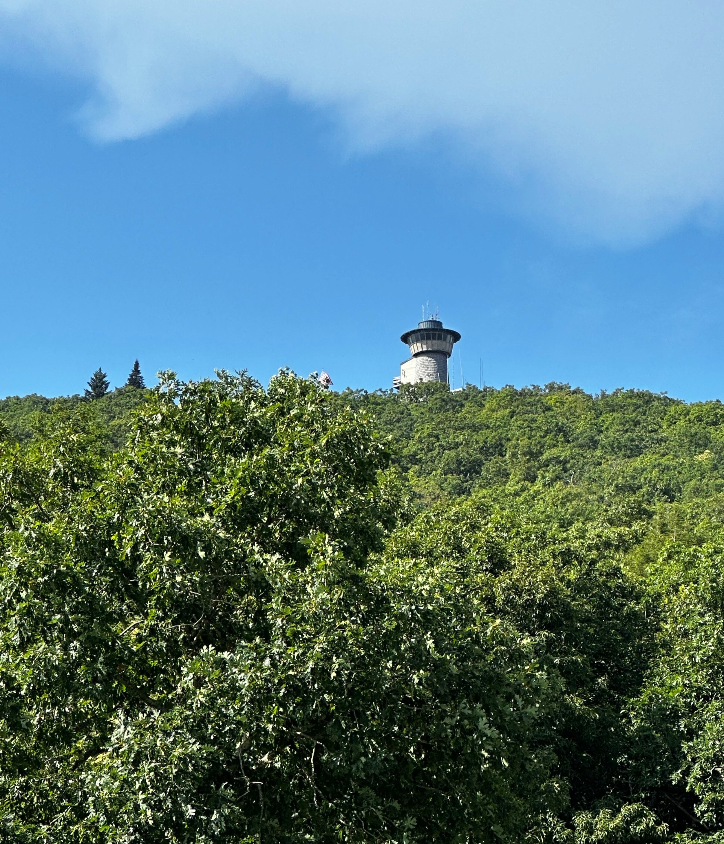
Observation Tower emerging from the wooded Brasstown Bald
The pinnacle of Brasstown Bald can be reached either by foot, or vehicular travel. The Jacks Knob Trail scales Wolfpen Ridge with an impressive number of switchbacks, following the ridgeline proper before cresting to convene with the southern corner of the vast, visitor parking area. Alternatively, the parking area can be reached by automobile, by following GA Route 180 north/northeasterly.
At a fork in the main road, the Jacks Knob path can be found crossing nearby (seasonal parking generally available here), following in the direction of our left turn, onto the GA 180 Spur we continued - this road is seasonal and may be gated depending on weather conditions. It would behoove a reader looking to visit Brasstown Bald, to consult the US Forest Service website for current status before arriving.
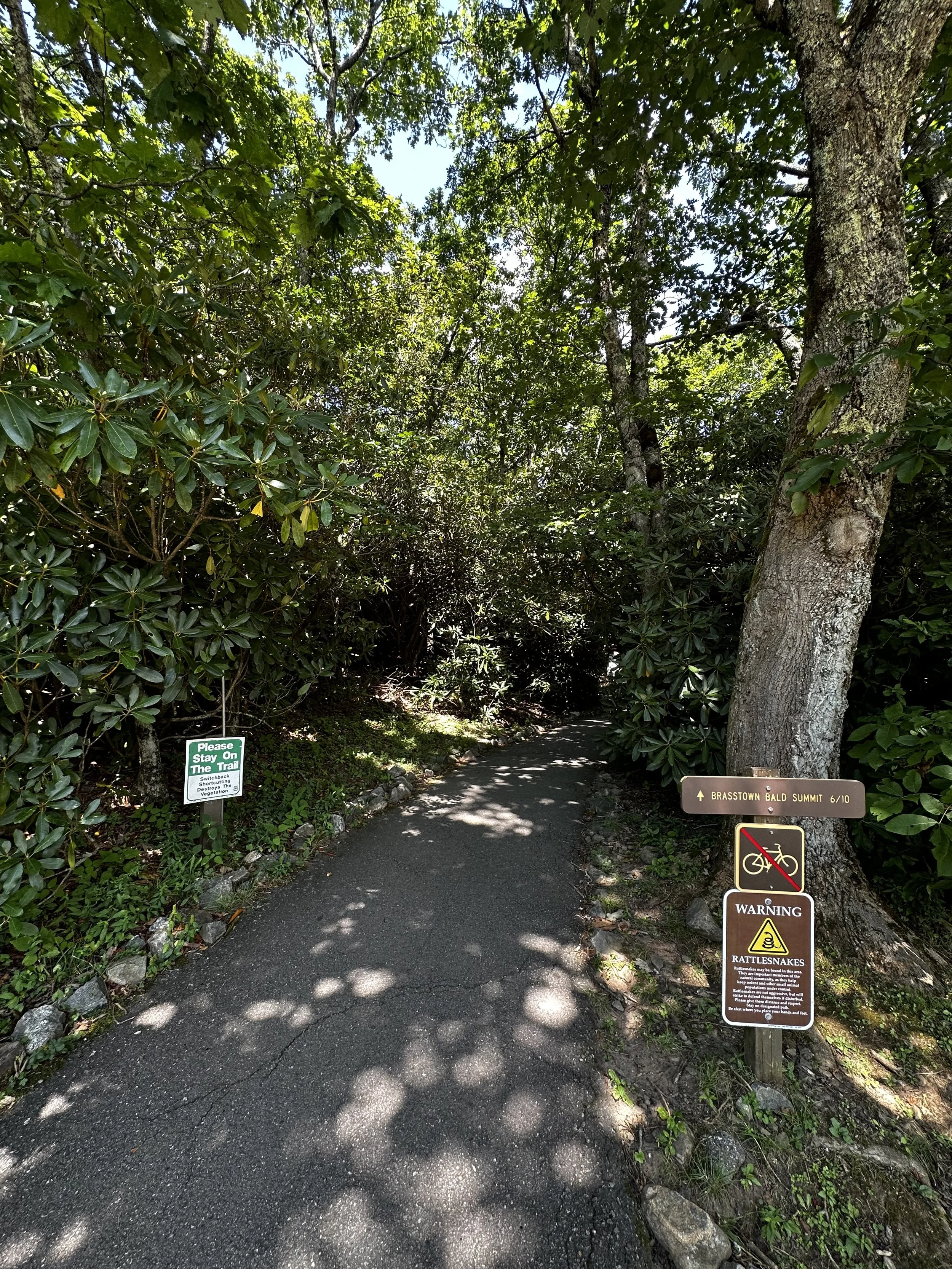
Beginning along the Brasstown Bald Summit Trail
The lush, dense canopy seemingly envelopes the winding forest road spur; trickling drainages can be heard plunging below the asphalt roadway; as the sound of water cascading over jagged pieces of dark bedrock resonates off ravine walls. Perhaps noted at the base of the spur road is the requirement to pay a day-use fee (parking and shuttle service), or come prepared with an American The Beautiful Interagency Pass, which can be purchased securely via the US Geological Survey website, here.
An extroverted gate attendant welcomed us, immediately requesting our payment before inquiring about the Interagency Pass which was hanging from our rear-view mirror. After parking, however, Alanna promptly saw the signs advertising our pass, at which point I was able to display my pass to the attendant and get my money back - be sure to let the attendant know if you have an Annual Interagency Pass, to receive a discounted rate!

Dense forest surrounds much of the Summit Trail
Once parked and ready to meander to the summit of this state high point, we followed the sidewalk toward a Visitor Center Gift Shop, which offered restrooms, drinking fountains, and vending machines - whether or not those worked is another story. When the park is open during warmer months, a shuttle bus service is provided, which runs from 10:00am - 4:30pm, providing an alternate route to the summit area and state high point.

Historical plaque just below the recognized high point
An asphalt path guides the way, albeit steeply in some brief sections, to the high point of Brasstown Bald. Rhododendrons line trailside, affording a sense of seclusion to the narrow swath of footpath. Footing remains very good despite small cracks in the paved walkway. At 0.1-miles into the hike, a narrow, brushy path (appearing as a faintly used herd path) can be found intersecting the Brasstown Bald Summit Trail - this is the old Wagon Train Trail, an original route scouted for Georgia’s Route 66.

Close up of the Lookout Tower (with Alanna catching all the sun)
Traffic along the summit road is limited to the shuttle bus, which can be occasionally heard while the path parallels the roadway, eventually crossing over the summit road at 0.4-miles. One final swing north/northeasterly, toward the summit, brings trampers to a small, shaded, resting area, where a historical plaque explains how the region acquired its unique naming.
Crossing the paved summit road for a final occurrence brings hikers to the base of the Visitors Center and old Lookout Tower; the tower was closed to the public at the time of our visit, but the wrap-around decking provided a stunning 360° panorama, including peaks from four surrounding states - each cardinal direction is indicated by appropriately placed wooden signs.

Eastwardly views from Brasstown Bald
Inside the Visitor’s Center, we took a moment to stroll through the museum, this was a pleasant surprise to find atop a state high point; the summit caretakers were extremely kind and accommodating as well - even offering to unlock a gated access door to allow us to visit, and photograph the geological survey marker, which apparently had been there since 1965.
The museum itself is a great way to spend several afternoon minutes, it is very informative, with many interactive activities for kids. Buttons can be pushed, allowing the wax Forest Ranger figures to use their voices to explain early forest maintenance practices, from some early, prominent names in the forest industry. As we were unaware that this moderate-sized museum existed atop Brasstown Bald, we had a great time with the surprise, even taking a moment to climb inside a replica steam locomotive - if only it had a functional whistle!

Northwardly views from Brasstown Bald
Short, historical films are also shown on a rotating basis throughout afternoons when the summit Visitor’s Center is open. While there is no additional fee to enter, and access the museum exhibits, there are stations where generous visitors can leave anonymous donations, which help to fund necessary park projects, and maintenance costs.
Souvenirs can be found at either Visitor Center, although I vaguely recall the lower shop containing many more options for books, maps, clothing, toys, refreshments - the lower Gift Shop was loaded with odds and ends - even a penny press, where a turn of several visible gears and wheels results in your copper penny being pressed and molded into a souvenir paper weight. The attendants at the lower Gift Shop were even proficient in the days’ weather forecast, as well as trail information, a very helpful bunch!

Ranger Marisue Hilliard describes forest life through audio recording
Having returned by the same paved (Brasstown Bald Summit Trail) path as we embarked on, the descent was hastened due to an egocentric hiker letting their dog defecate on the side of the hiking trail - not the scent we wanted to encounter in the 85° mid-day heat; it is very unfortunate to allow this kind of selfish behavior at our National Parks, Forests, and other natural scenic places.
But not to let a careless dog owner spoil our lovely ramble to the high point of Georgia; when we departed from this mountain, many of the towns folk were out barbequing in their yards - all seeming to be enjoying this blue-sky day just as much as the young climber who just tackled the steep grade of the Brasstown Bald Summit Trail on their first attempt.
Overall stats for the day:
1.23-miles
46 minutes
436’ elevation gain
Brasstown Bald - 4,784’