
East Huntington Mountain
Any trip into the wilderness can offer something new for us to learn, if we are willing to accept the gift; from learning to identify birds, bugs, or bigger woodland critters; an improved sense of navigation with the ability to recognize land features and relate them to a flat topographic map; other times stepping into a quiet, remote area of forest can help teach us the art of Zen - remaining calm in the midst of an ultra-dense spruce thicket with its spindly, twiggy branches that are seemingly more tight-knit woven than a barn spiders web.
At least that’s how it felt hiking out to East Huntington this morning, the last remaining of the four Huntington’s I had yet to visit. Recently I made a loop of West Huntington, Mount Huntington (Middle) with an out and back to South Huntington - check out that brief write-up here, if you’d like. I’ve heard reports of a rather steep descent off the South peak, and with limited available time during that day, I’d just as soon come back to visit the East peak on its own.

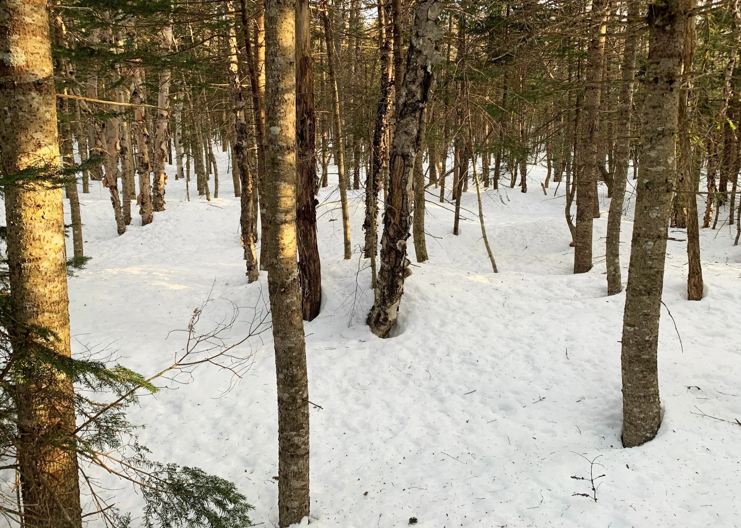
Out of the trailhead and into the bushwhack
Sawyer River Trail or Hancock Notch Trail would have been an option if I woke up to no snow on the ground, but with a hefty 4-5’ remaining in much of the White Mountains, that long trek sounded more enjoyable to plan as a backpack - tent camping along the way.
After reading that East Huntington is easily the most robust bushwhack of the bunch, I settled on taking the rough and tough bushwhack over a shorter distance - beginning at the CL Graham Wangan Overlook on the Kancamagus Highway (US Rt 112). For those keeping score: yes, mileage would have been slightly shorter had I began at the Pemigewasset Overlook, this was my original plan but the lot has not been plowed in quite a few snowstorms.
A better, more enjoyable stretch of woods
At 7:13am I pulled behind a snowbank in the Overlook lot and with snowshoes on I set off north/northeasterly out of the back of the parking lot. Trying to beat the sun as I knew the snow would be growing soft by 10am, I enjoyed the initial trek through the forest as the trees were narrow and branches had yet to become any annoyance.
The density of the spindly branches came and went, often a push through thick evergreen would give way to a corridor which appeared to be an old woods road or some roughly-constructed pathway, these never lasted more than 25-30’ before more scrappy woods took over.
Mt Kancamagus through the trees as elevation is gained
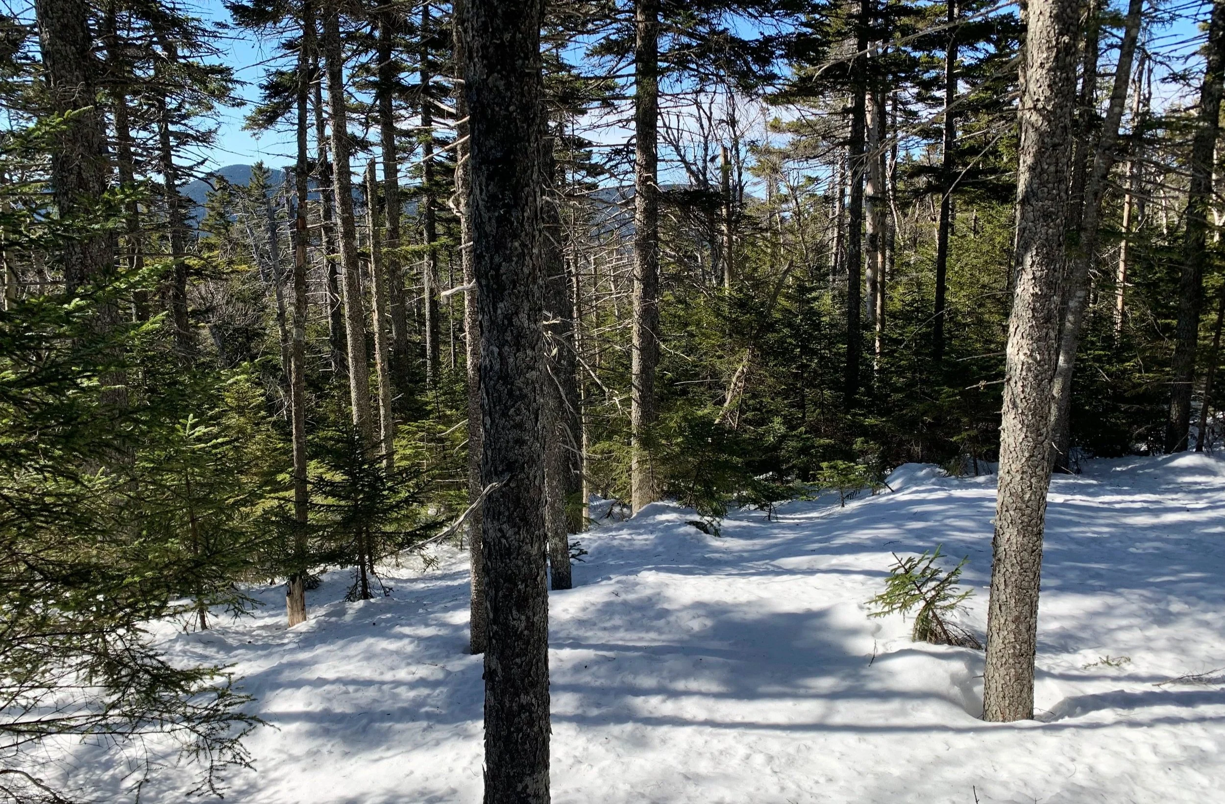
Sticking toward the eastern slope of the initial ~3,020’ hump, the woods were always open enough to let the morning sun shine through but never enough to let my arms down - it was a constant game of swimming, blocking and dodging thin branches.
Continuing along the col in a northeasterly direction, occasionally views beyond some of the shorter canopy would open up showcasing the southern slopes of South Huntington; I’d shoot more-or-less straight to that landmass and once reaching ~3,200’, begin veering due east, toward East Huntington.

Ascending East Huntington
I was really beginning to assume this semi-dense forest would take me all the way to the summit of East; often I’d find myself searching to either side - it must be more open and easier going just 30’ to either side, right? I could not see any nearby forest which appeared any more appealing.
After another quick push through 10-15’ of dense, young balsam the forest finally did open up; the snow had transitioned to a rock-solid crust from which I could see the upper branches of spruce and fir poking through - spruce traps! This along with my new-found forest helped me move just a bit faster - knowing I’d surely want to beat the warming morning air and sunshine before the spruce traps softened up at all.
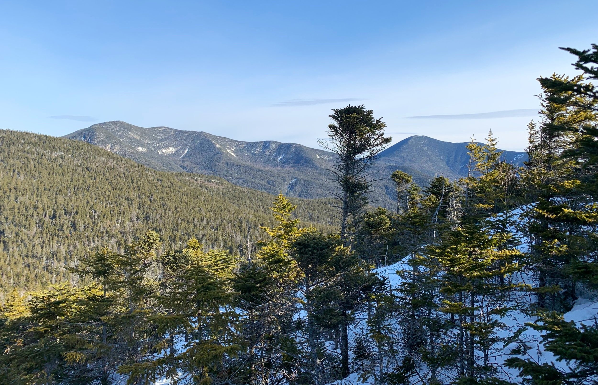
South Hancock + Carrigain rising up on the horizon
Just beyond ~3,000’ the forest made this beautiful switch, no more shoving branches out of my way I could just pick my route and meander along, atop the hard-packed snow crust. Quickly reaching ~3,200’ I began the easterly swing which had become quite a mind game, constantly assuming I was over or under-shooting my destination.
Luckily, the mixed-age forest remained relatively open, enough to cruise through the trees and see subtle hints of the landscape dropping away as I neared the col between South and East Huntington mountains. Once climbing, I left the agreeable forest behind and entered another dreaded patch of dense, spindly branches.
South Huntington + Scar Ridge behind
Nearing the summit, I continued to proceed due east, aiming directly at the high point - this was a mistake which I will surely avoid next time. While the views from above were quite lovely, the narrow band of krummholz was perhaps the toughest 15’ section of bushwhacking I had ever undertaken; the snow was completely unsupportive with the stunted conifer below the snowpack; the branches were completely entangled and unwilling to budge. I thought for sure I’d snag and break a snowshoe trying to gracefully slide up through that stuff!
Needless to say, I ascended through those wind-bent branches but I would never do it again; thankfully, I can report no broken branches while making my way up the steep slope. Once I had cleared the mess of trees I could stand upright to feast upon the heavenly, completely unobstructed views out to the Osceola Mountains and Scar Ridge with the nearby mound of South Huntington - simply breathtaking after just trudging through enclosed forest for 2.25-miles.

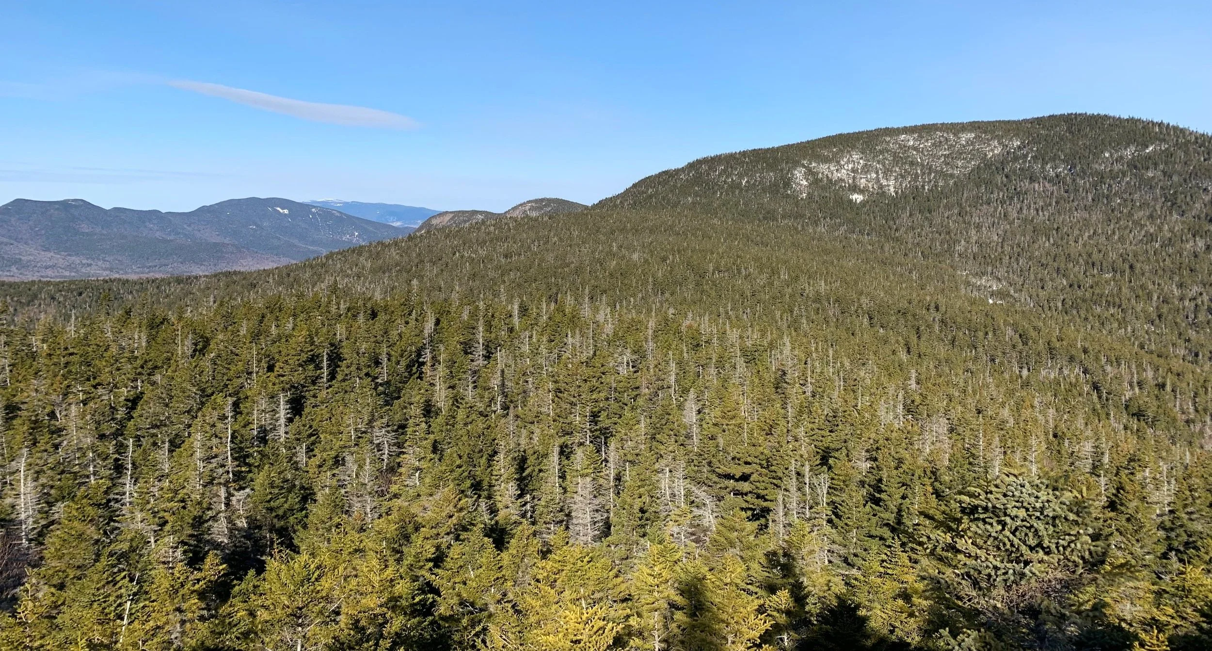
Ridgeline of Mt Kancamagus
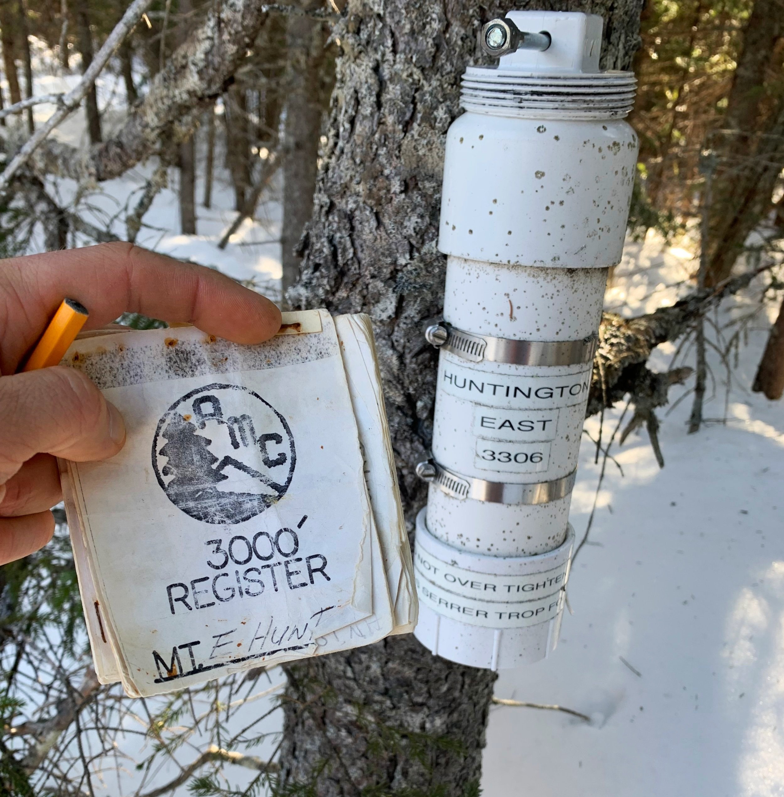
With still a short ascent remaining, now through an easier conifer stand to reach the recognized high point; just beyond the summit register I even found remnants of the old wooden elevation sign, perhaps where the high point of East Huntington used to be assumed.
With a few good sips of dandelion tea, I signed into the summit log book, recording my ascent into the history (note)books - while even taking a few moments to glance at entries in an older AMC 3000-footers register log placed in the early-’90s.
East Huntington summit
Continuing further east momentarily I was able to find a stunning lookout with a similar South Huntington view as earlier, but now with a wider panorama including the southern side of South Hancock (4,319’) and Mt Carrigain (4,680’) with Signal Ridge. A mountaintop I could have stayed for a good long while had it not been for threats of melting snow giving way to spruce traps on my trek out.
Knowing I stood no chance of descending back through the krummholz of the eastern ridgetop, I could see a nice welcoming forest to the south with a low, descending grade. This loop worked out well, descending clockwise off the summit to eventually meet back up with my ascending snowshoe tracks, of which I would follow back to my car.

Old elevation sign atop East Huntington
In such a lovely stretch of forest - when it is not inducing claustrophobia - I would have liked to pause, listening to the chickadee’s calling spring back home and to inhale the sweet, fresh scents of boreal air, all around the snow crackled and popped as its depths shrunk, one water droplet at a time.
With about 1-mile remaining, I began telling myself that there will be a time when I’d crave a forested landscape of any kind; to be stuck in a city and want to be surrounded by mighty trees, old or new - this was my chance. The thicket was reeking havoc on my patience; I knew forcing my way back to my car would only end with a stick in the eye, or poked somewhere else that I’d regret.
I could not fight the forest, I had to accept that was entirely where I found myself at that moment - I could resist it, or I could swim with it.

A some-what thick section
Seemed like a good time for a tea break and gather myself for the final trek back to the parking lot. Breaking the snowshoe bushwhack down into palatable bites - I recognized the open herd paths and what could have been old roadways; following my tracks I recalled each branch along with the swing and dance I had performed on the hike-in as to not impale myself - but more importantly - to not leave a trail of broken sticks in my off-trail meanderings.
Upon reaching the parking lot I was welcomed by an elderly man taking a break from his work; resting in his truck while facing into the sunshine. He asked about the snow, the forest and where I had been off to; I told him all about the deep snow of the Nancy Pond area several days prior and he grew somber as if regretting something; the man reminisced of wishing he got into snowshoeing 30-years prior, as he had strongly desired back then. Stating he was far too old now to do the things he wanted, that even getting into the forest with his chainsaw was becoming a taxing stroll.
These are the adventures and memories I’ll be wishing for when I inevitably turn his age. I’m glad to share my outings, bringing a glimpse of how I see the vast forests and mountainscapes to anyone who cares to listen.
Overall stats for the day:
4.81-miles
3hr 24 minutes
1,424’ elevation gain

An enjoyable register find