
Groton State Forest: Deer Mtns + Osmore Pond
Groton State Forest has long been a local go-to for a short or longer distance ramble in the wilderness; it’s close proximity to the Connecticut River Valley and well-maintained roads in which to access, the 25,000-acre Groton State Forest has trailhead parking areas, lakeside campgrounds, day use picnic areas as well as nature and interpretive centers to shed some light on the plethora of flora and fauna which can be found in the forest preserve.
With the original 1981 Groton Nature Center, on the northern shore of Lake Groton, still under construction at the time of my visit, I enthusiastically await the opening of the newly updated inside and out, fully accessible, energy-efficient Nature Center in the near future. However, with construction underway, trail access from the Nature Center parking lot is restricted and had to be rerouted elsewhere to start the trekking.

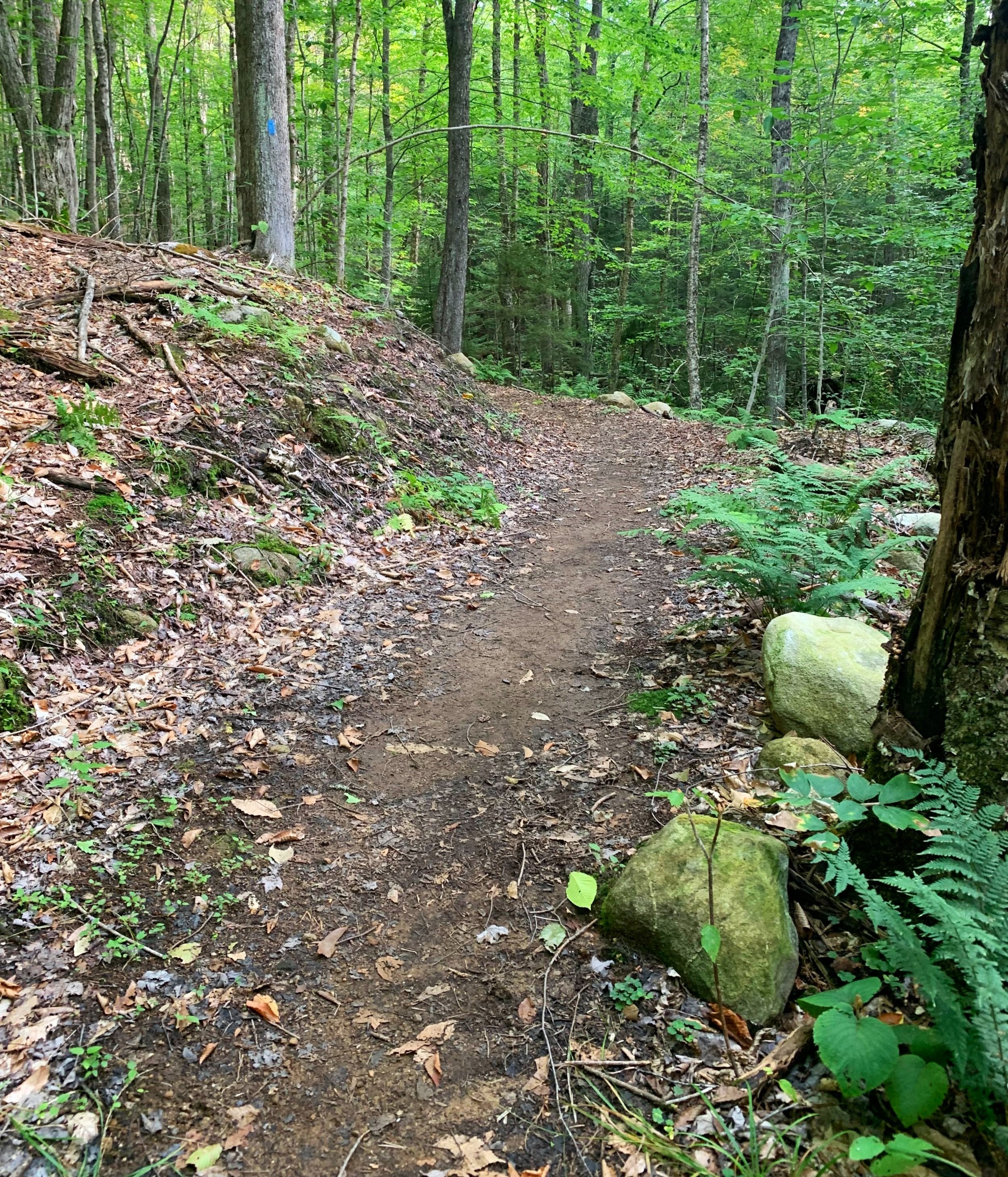
Soft paths of Groton State Forest
While most adventurers would likely choose to begin an alternate journey from the New Discovery State Park along Route 232 to the north, I chose to leave my car along a small trailhead pull-off found on Gravel Pit Road, just beyond the Nature Center construction zone on Boulder Beach Road.
Over a rather rugged, sandy and rocky forest access road I parked at the southern terminus of the Peacham Bog Loop Trail and began north, hiking the remainder of the forest road and past the old logging mill gravel pit. While I had been unsure about driving any further down this section of road, once on-foot the road became much smoother, with less rocks sticking out of the roadway; vehicles likely can be driven and parked further north along the road or in the gravel pit itself, however, evidently the hillside appears to be a popular target practice and shooting area.
For 0.2-miles I followed the access road which soon transitioned to the densely forested Coldwater Brook Road. Reaching the first junction with the northern section of the Peacham Bog Trail I diverged left to begin hiking west, toward the network of trails radiating from the closed Nature Center. Through a very peaceful forest, the trail meanders over somewhat rocky footing until reaching a bridged crossing of Coldwater Brook, at which point the pathway makes an abrupt southerly swing to intersect the north-running Coldwater Brook Trail; a left at this point would guide hikers over the Little Loop Trail and eventually back to the Nature Center which was not on my itinerary today.
More soft paths of Groton State Forest
The Coldwater Brook Trail was a delightful taste of just what I had come to Groton State Forest for - soft, rich soil devoid of most larger rocks, roots and mid-trail obstacles. The same enjoyable trail conditions followed as the path merged with the wide-track of the Telephone Line multi-use trail. At 0.6-miles from departing the Peacham Bog Loop and beginning northbound, the overgrown Coldwater Brook Road merges from the east (on the right).
Continuing along the Coldwater Brook Trail, I began noticing overgrown ski trails and as the path begins ascending and turning toward the west, away from Coldwater Brook I actually got mixed up and began inadvertently following one of those ski trails. Knowing eventually I’d meet back up with the appropriate trail, I proceeded to follow the wide ski path until it became increasingly boggy and even more grown-in. For a short stretch I actually chose to bushwhack through the somewhat open understory to locate my lost trail.

Atop Big Deer Mountain
Once I had tracked to the correct trail it was no issue to follow as it began ascending; gaining ~300’ since the departure from Coldwater Brook, the path meets up with the Big Deer Mountain Trail. Ascending gradually along the western slope of Big Deer Mountain, in a short 0.2-miles the spur trail in which to reach the mountain top is met.
From the junction the path begins gradually ascending but quickly becomes rugged, climbing up bare rock slabs with oftentimes loose footing. After the short, steep ascent the trail reaches the summit crest and levels out, heading just beyond the high point toward open ledges while passing several massive trailside boulders, several of which have been fractured by years of frost-wedging.

East ledges of Big Deer Mountain
Following the conifer-lined pathway straight ahead will reward handsomely with a stunning south-facing view toward Lake Groton; here, there are several rocky outcroppings in which to rest, botanize the beautiful summit area or gaze at the prehistoric-appearing vultures soaring overhead as they gracefully ride the rising thermals of warm air off the forest canopy.
Just prior to reaching the main lookout area, there is a softly trafficked herd path which leads several rods to a beautifully open east-facing ledge, atop which a wide panoramic view can be found of more softly rolling hills of eastern Groton State Forest. Backtracking to the main trail and descending toward the north, I began once again along the Big Deer Mountain Trail toward Little Deer Mountain toward the southwest.
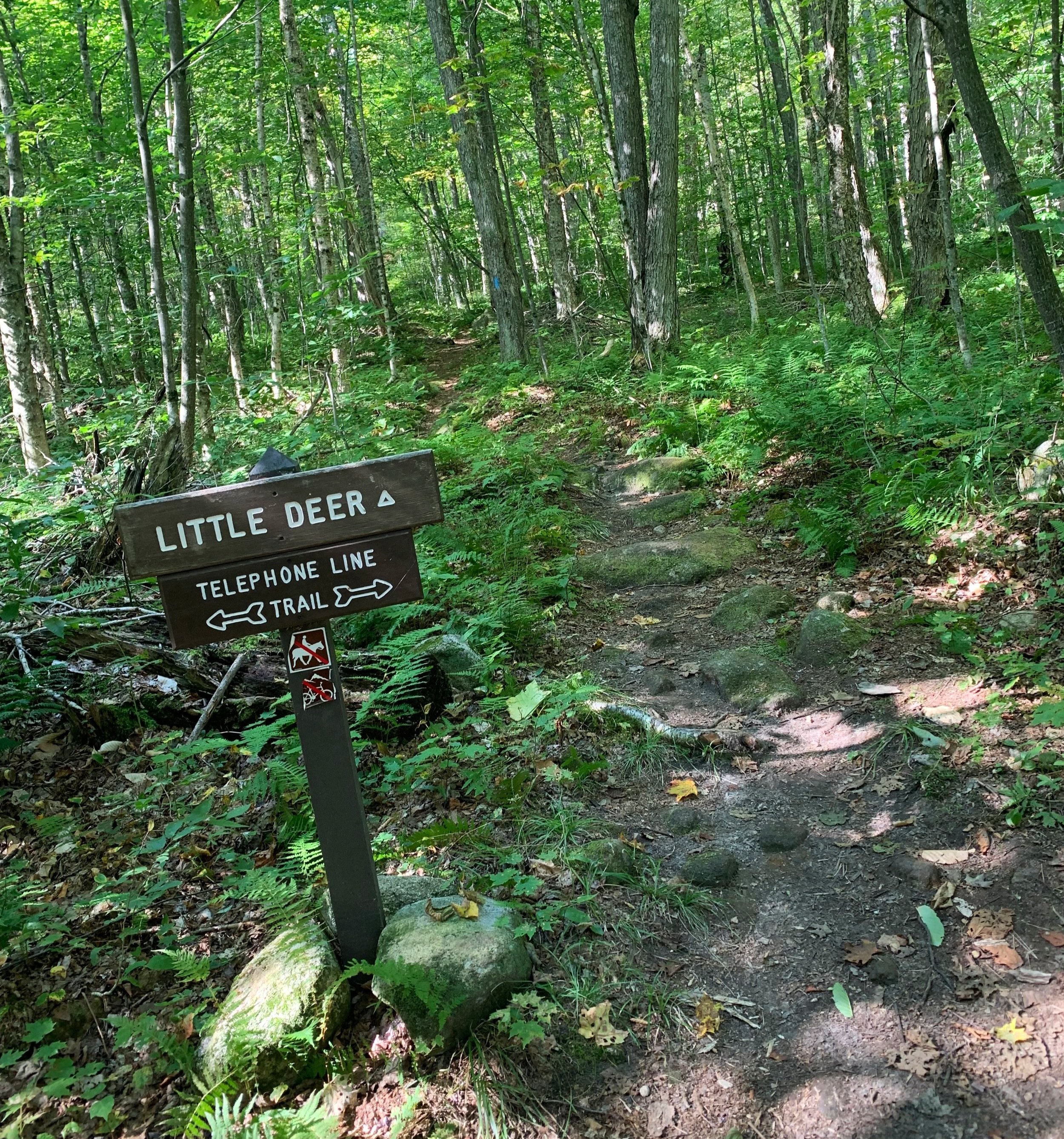
Little Deer Mountain spur trail
The pathway becomes increasingly rocky and features several stretches of boardwalk which keeps hikers dry and elevated off the soggy trail nearing the outlet of Osmore Pond. Osmore Brook gently babbles underfoot as it flows south, before long the pathway dries out and intersects the wide Telephone Line Trail.
For 0.4-miles the Little Deer Mountain path now gently ascends the low grade of the mountains northern ridge before making a slight southbound swing and following atop the ridge. During the climb, the leaf littered forest floor is brightened up with lively ferns and club mosses, whose spores were once utilized for flashes in early photography.

Atop Little Deer Mountain
Just beyond the 1,759’ summit of Little Deer Mountain, another south-facing lookout toward Lake Groton can be found which is similar to, but perhaps slightly more open than the bigger rock pile to the east.
Once the sunshine and views had been taken in, I backtracked once again and enjoyed the gradual descent toward Osmore Pond. While this loop is perfect all on its own, it made for a great way to break up the continuous elevation gain and loss of Big and Little Deer mountains. Just prior to reaching the outlet of the pond, a left turn onto the Osmore Pond Loop trail brings hikers north for a clockwise loop around the 48-acre pond.

Osmore Pond tent site views
Along the western shore of the Osmore Pond circumnavigation, hikers can expect several stretches of boardwalk bridging wet spots with a soft footway - hobblebush, young conifers and various ferns create a dense understory as the mixed canopy shades high above. Several short spur paths along the way break up the hike and afford stunning views across the pond. Osmore Pond features four remote leantos and several tent camping sites alongside the loop trail, one of which is accessed by boat, which the State Park also rents.
Nearing the New Discovery State Park picnic pavilion and facilities, at 0.5-miles along the Osgood Pond Loop, a pondside tent site with a picnic table and fireplace offers possibly the best lookout across Osgood Pond, from here Big Deer Mountain can be viewed to the southeast.

Northern Osmore Pond
The pathway beyond the picnic area and boat launch becomes increasingly narrow from reaching evergreen branches and soggy underfoot as the path nears the boggy northern terminus of the pond. Massive boulders poke up from the water surface as mixed conifers surround. Just beyond the outlet and wetland area the trail returns to become a pleasant stroll atop rich soil made softer still by fallen leaf duff.
A mossy blanket cloaks both fallen trees and boulders while the pond glistens in the sunlight just beyond the tight-knit canopy. The boat-accessed leanto is passed as well as a short spur path (just prior to the south swing of the trail) which leads to a rocky area with more good views; from here Little Deer Mountain can now be seen just beyond the southern tip of the pond.

Lush corridor of northern Osmore Pond Loop
Following along the narrow trail corridor, the forest transitions from evergreen rich to increasingly hardwood near the south as the path swings away from the shore to intersect the Big Deer Mountain Trail; straight across is the Hosmer Brook Trail which I would have followed had the Nature Center trailhead been open.
From here I simply followed my descending tracks back along a familiar Coldwater Brook Trail to reach my parked car. With so many intertwined trails along the Groton State Forest, loops of nearly any size can be created in which to view a multitude of plant species - from conifers, hardwoods, ferns, to flowering and carnivorous plants along the Peacham Bog area.
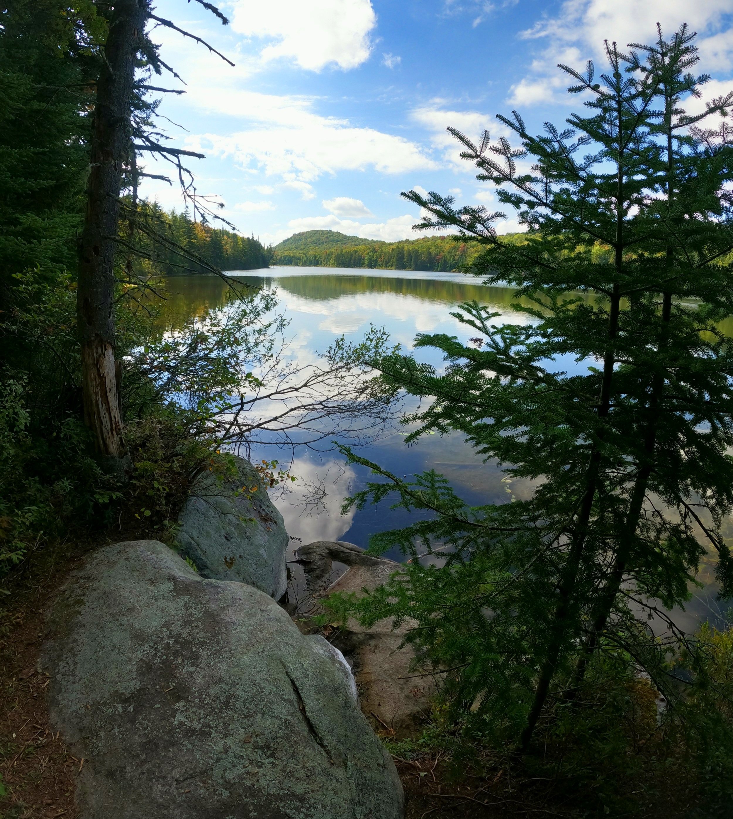
Little Deer Mountain across Osmore Pond
Everywhere the hiker turns along these trails or mountaintops evidence of glaciation and mountain formation can be witnessed, from scratches in the bedrock to glacially deposited boulders to even the shape and orientation of its lakes and waterways, natural history can be found anywhere one looks.
More recent history also abounds in Groton State Forest; 9.2-miles of the old Montpelier and Wells River Railroad line, which once provided transportation for Groton’s flourishing logging industry, has now been repurposed as a well-graded hiking and biking path, also coinciding with the 90+ mile Cross Vermont Trail.
Overall stats for the day:
11.11-miles
4hr 45 minutes
2,539’ elevation gain
Big Deer Mountain - 1,988’
Little Deer Mountain - 1,759’