
Wolf Cub
The Wolf Cub might be dwarfed by its bigger brother, Mount Wolf, which can be found just to the west, at 3,480’ - but this little cub packs a mean bite - it will leave a hiker not only feeling, but also looking as if they just took part in a serious off-trail ramble; with arms which appear to have just gotten out of a brawl with a feral feline; even my hair stuck up in strange ways I had hitherto not yet witnessed when the trek was finished.
While I have wanted to visit this peak for quite some time - even in the midst of deep-winter snowshoe bushwhacking, I am glad to have saved it until today - as they say, after all - everything at the right time.

Beginning up the Kinsman Ridge Trail
Some folks prefer to begin their hike from the southern terminus of the Gordon Pond Trail, while others commence their hike from the Beaver Brook Trailhead, which is also a popular starting point for Mount Moosilauke; whichever approach a hiker takes, there is undeniably a robust traverse just to reach the point of diverging off-trail.
The trek to Mount Wolf last November, from the latter trailhead, introduced me to a part of the Kinsman Ridge Trail (also part of the Appalachian Trail) which I could not wait to return to. Here was my chance to roam and see the beautiful Blue Ridge Mountains once again, before any ferns or hobblebush choked the ground-level.

Along the ridgetop
To my delight I had driven out of the low-laying fog, which generally engulfs the Connecticut River Valley most spring mornings, and arrived to an empty parking lot along US Rt 112 under totally clear skies. At 7:11am I started along the Appalachian Trail north where the Kinsman Ridge Trail also coincides while it meanders over Mt Wolf and the Kinsman Mountains before splitting ways.
The trail, which immediately begins climbing atop a burly rock staircase, gains 825’ in the first 0.7-miles; also passed was the - now unsigned - Dilly Cliff Trail, which appears well-trodden, like an herd path on the hillside. It is rumored that good views can still be found despite recent forest fire damage along the trail and upper-cliffs; as this spur path was not included in my itinerary today, I cannot report on the condition of the old path nor its views.

Mt Wolf in the trees (left) with the Wolf Cub (center)
As the Kinsman Ridge Trail begins to level off at 2,700’, a boggy meadow is passed which has an old boardwalk to guide hikers through; these days most of the planks have begun to rot, exposing the massive nails. While most of the boards remained above the water level, several had succumb to the higher water levels of this springtime thaw - here was the first of many instances where I’d experience wet feet during my outing.
At the first main descent, down North Kinsman Notch Peak, the lush evergreen gave way to a brilliantly lit hardwood hillside which stretched in all directions before me. The pathway meanders downslope and through the rust-colored, fallen leaves before climbing once again into the evergreen canopy of the ridgetop.

Views toward the east, from Blue Ridge Mountain
For the remainder of the ridge, the trailside was carpeted with shiny, wet moss; conifer trees draped with lichen smelled of sweet cotton candy as their sap warmed in the morning sunshine, even occasional shelf mushrooms poked out from their wet tree bark; I found myself back in a favorite forest setting as the trail inevitably dipped just to rise yet again.
There are several lookout points along the trail, all featured on the right side of the path, giving incredible downlooks into Lincoln and the vast Pemigewasset wilderness - Loon Mountain was unmistakable, while the Scar Ridge and Osceola’s rose up just beyond. Swinging to look northerly, the wooded shoulder of Mt Wolf was visible as was today’s main destination - the Wolf Cub.

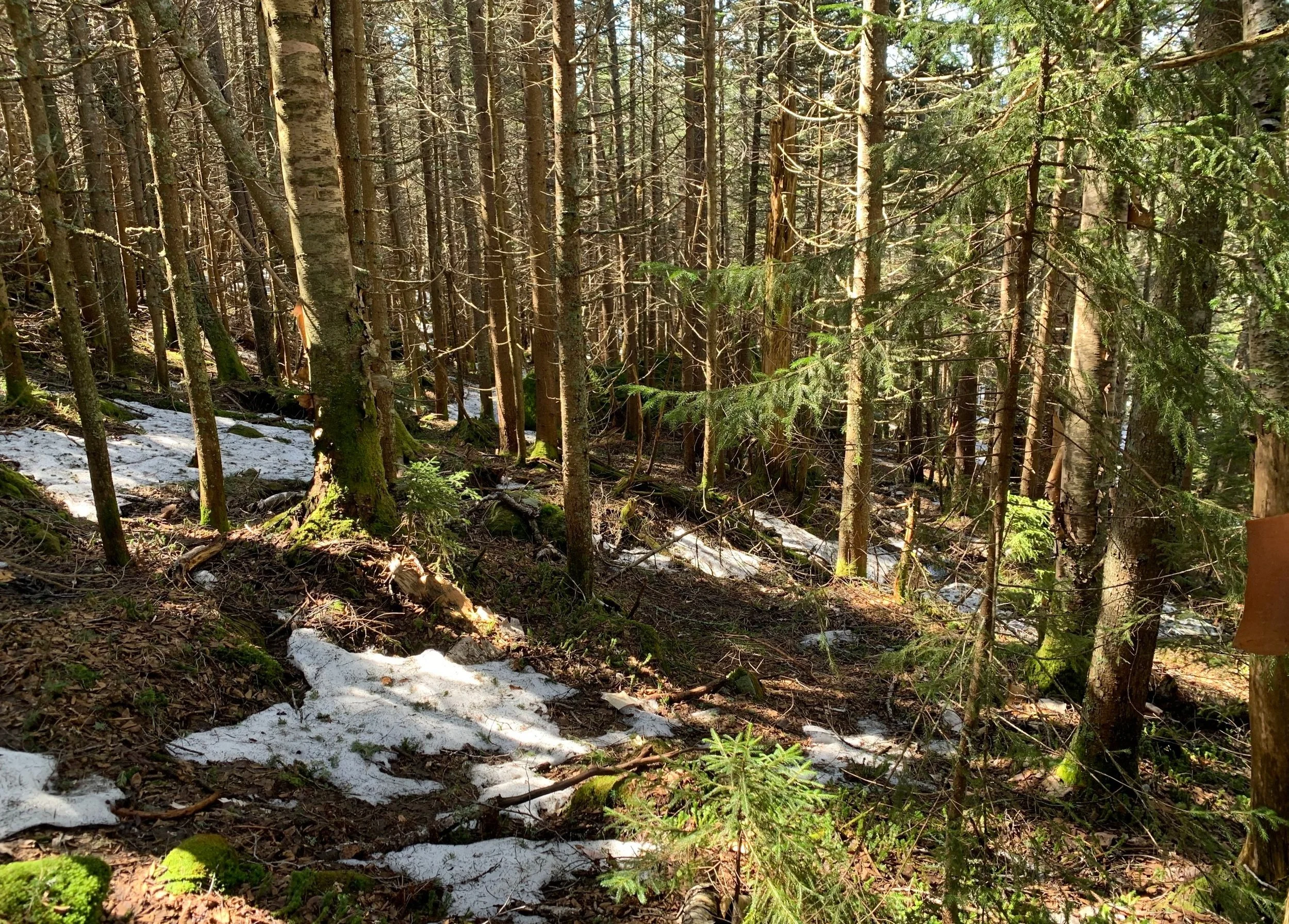
Lingering snow in an open forest
Beginning the long descent off the North Peak of Blue Ridge Mountain, the snow was clearly still deep yet remained mostly supportive. Soon I came to the intersection which I recalled well - I had veered left several months prior to follow the Kinsman Ridge Trail up to Mt Wolf, however, if I were to take a right I’d be guided to Gordon Pond via the Gordon Pond Trail; I went straight.
This was the location where I departed any marked trail and began the off-trail navigation. What I mean by navigation is that, I wanted to see if I could locate and simply follow the old, abandoned section of Kinsman Ridge Trail/Appalachian Trail which used to track southeast of Mount Wolf, avoiding the actual the summit.

Mount Wolf from the Wolf Cub summit
Initially I thought I had an old trail, perhaps just a simple herd path, but by my standards I thought for sure I was following something about trail-wide. If that was not the case then I may have lucked out and picked a favorable route. Bobbing and weaving my way from thicker forest and patches of light blowdown, I directed my attention toward brighter areas where the forest might remain open, affording easier travel. This method worked rather well as I traversed a 2,650’ contour, staying well above any soggy terrain around Gordon Pond.
At several locations along my route I passed 4 or 5 small brooks which flowed down toward the pond below; here, the snow grew soft and punchy, forcing me to temporarily wade through the springtime snow in search of more solid footing. Once I had successfully swung around the pond and basically maintained my elevation I began climbing through fairly decent and actually enjoyable forest along the low taper of the Wolf Cub’s southwestern ridge.

A forested glimpse of Mt Liberty
Several turns along the route I intuitively knew immediately were poor choices or that I could have streamlined the line of travel just a bit. While keeping all that beta in mind for my return trek, I followed the ridgeline -which was often easier said than done.
Perhaps it could be due to the massive boulders which lay along the ridge; I’d climb atop a mossy, blowdown stricken pile of rock and boulder just to arrive at the peak and realize I could have simply walked around - this happened several times along the ascent, more landscape information I’d retain for my descending route.

Wolf Cub summit
Excitement grew substantial when I could tell I was nearing the summit cone; the forest was now not as devilish as it had been - the once constrictingly tight spruce now grew spaced apart enough, making for quick and efficient travel up the mossy mountainside. I located one northern knob but quickly determined there were higher places to be found through the trees to the south.
Up a steep, slick scramble I made my way as the grandiose views toward Franconia Ridge finally opened up. Being so accustomed to seeing these summits topped in white during the winter hiking, it took a moment to orientate myself to the new look of the bare mountains - Mt Liberty and Flume rose up high, Mt Flume’s massive slide looking dingy today - the first glimpse I’ve had of it devoid of snow this year.

Growing thick on the descent
As I followed the contour of the rising mountaintop ever higher I had the southeastern flank of Mount Wolf very nearby. Just over my shoulder was the old PVC canister, I could still recognize where the words were once placed: Wolf Cub: 3,063’
The contents inside were old snack wrappers, but since I was standing atop the summit and the recycled register paper had an available spot and I had a pencil, I logged my ascent for future generations to see. With a couple of photographs of the surrounding mountainscape I retraced my steps back down from the summit of Wolf Cub.
Occasionally I followed my snowy footprints while other times I’d deviate from the ascending tracks to streamline my route back toward the pond. When the minor southwesterly bump at the tail of the ridge was reached I turned northwesterly to bisect an obvious trail that I had crossed on my bushwhack out to Wolf Cub.
Not all too thick and prickly
Locating the old trail, which I assumed to be the old Appalachian Trail, as it paralleled the route old maps indicate it would have taken, I began following it toward Gordon Pond, hoping for a much easier trek or even a break from plowing through evergreen boughs.
While the path was wide and unmistakably easy to follow, the snowpack was growing soft in the late morning sun, eventually forcing me to retreat into the upslope treeline to the east. When compared to the soul-crushing bushwhacking that I had done on my trek earlier, this was a piece of cake.
I could see the surface of the pond shining through the trees but with snow growing mushy I did not dare get too close to open water like that; I had a complete change of clothes and emergency gear on my back but getting close to a pond which had risen far beyond its usual height during spring thaw, not today.

Old trail corridor through the forest
As I grew close to the sound of the ponds outlet, Gordon Pond Brook, I knew my blazed trail would also be just up ahead. It was; however, I was uncertain if I was following a real trail or still on the abandoned section from moments prior. Atop boulders I crossed the brook and entered a corridor cut into the forest, assuming I was now on the trail. In its defense, I did spot two blue blazes during the 0.2-mile stretch, confirming that I temporarily been on the trail; much of it, I am certain, was more like a light bushwhack.
Very happy to arrive back at the three-way intersection, I was back on familiar turf now. The Kinsman Ridge Trail from earlier in the morning would guide me back to the trailhead - not without a final off-trail ramble to the high point of the North Peak of Blue Ridge Mountain, which tops out at 3,009’; I had roamed, searching for the high point months prior but since I was in the area and the day was young, why not another visit.

Back on the Kinsman Ridge Trail
I am fairly certain these days, when I trek into the forest and go for miles without seeing wildlife, despite evidence of their existence literally laying underfoot, perhaps they are just so stealth as to be watching me from a distance, from behind a boulder or through a conifer bough - a guy with a bright backpack bopping down their trails, usually talking to himself; it will certainly give them a story to tell their pals.
As I write this with hands still spotted with balsam sap and little spruce scratches all over I’m not sure if my mind has grasped the fact that I hiked this off-trail stretch of land today. While looking forward to adventuring and summiting this peak for so long, I had done the mapping and research but never committed my mind to the climb as I often do with others days in advance, this was one of the best last-minute decisions I had made in a while.
The Wolf Cub has perceptively now become the alpha.
Overall stats for the day:
9.49-miles
5hr 24 minutes
3,763’ elevation gain
Wolf Cub - 3,063’
Blue Ridge Mtn North Peak - 3,009’
North Kinsman Notch Peak - 2,740’