
A long day out in Maine
Sugarloaf via ski trails to Spaulding to Abraham, back to Spaulding via the AT North to South Crocker to North Crocker, back to South Crocker to Redington via a mean bushwhack.
Or at least that was the lofty plan running though my excited mind at 1000mph as I made the drive from western New Hampshire to Central Maine Saturday morning at a cool and calm 2:45am. The sun would not rise for many hours, which would allow my mind to race, jump, hop and skip all the way along the 186 mile commute – heck, I was even convinced for a brief moment that I had actually witnessed a goat walking down the side of Rt 16 in pitch darkness.. “what the heck even was that doing out here..?“.. I never will find out what creature of the darkness was I had just witnessed.
As I sit here in a post-weekend haze with bruised legs still dotted with dried blood, hearing fellow hikers reiterate all of the ‘do not even attempt to cross the Carrabassett River‘ warning signs, I am still not even sure that a trek like this was possible.

Ascending Sugarloaf Mt; 1900’
7:30AM
Relieved to pull into the Sugarloaf Ski Resort parking lot to find that the morning onslaught of frigid rain drops had tapered during the preceding 5-minutes, I grabbed for my larger of two running packs that this weekends trail-fest would see, laced up the almost-still-pristine Altra Lone Peaks, once the two watch beeps indicated both GPS signal and my heart rate were found, hit Start, and with trekking poles in hand – I began up that hill.
I stopped several times during this initial 2,553 foot climb; not far into my day and I could still look back. I could nearly reach out and touch the bottom of the cloud layer, like whisping cotton candy awaiting my entry. Once in, however, my beautiful post-fall-foliage mountain scape was replaced with gusting winds, the unbearded spots on my face bombarded with sideways travelling snow and ice chunks, I desperately wanted to reach for my sunglasses but hoped I could just crest over the summit rocks before removing my pack.
The 4,237ish (varying sources will give varying elevations) summit cone offered little to no escape from the torrent of weathering ice pellets, with squinted eyes I tried to discern some indication of where the path dove into the cover of the forest and henceforth to the Appalachian Trail.
Once on the Sugarloaf Side-Trail, time slowed down and the one-half-mile trek to the AT south seemed to last a lifetime, a sea of frosted boulders and trees shrouded in glistening hoarfrost. Just to add a little consequence to this mornings outing, the winterized trail would not be complete without some ice water trickling down the path. “Dunk a toe now and you will be wearing ice bricks for the remainder of the day, you won’t make it anywhere.”, I thought to myself.
Still I managed to enjoy my time in this Northeast Winter Wonderland, bear bells jiggling, all I needed now was to recall and belt out a few good carols to keep the wildlife at bay.
Admittedly, I was completely unsure if my day would be what I had hoped, I was busy readying my mind for the ‘abort mission‘ phase and retreat back to the warmth of heated Subaru seats.
Up ahead, the burnt orange hue rang through the blinding plainness of all-white-everything.

Spauling Mt spur trail junction; 3880’
SPAULDING MTN. 150 YDS. M.A.T.C.
Steep and bouldery. Then, more steep, super slick rock; becoming increasingly steep, and finally a hint of view out to the Crockers across the ravine.
That was precisely how the so called 150-yard jaunt up to Spaulding went; in fact the summit was so unremarkable that I continued on, completely unsure of when I had reached the summit until the trail topped out and began steeply once again, this time descending the other side.
I had found my second summit of the day, when I returned from the frost-covered boulder descent I was faced with the next question: push on down the white trackless trail into even deeper wilderness, far from the safety of any rescue mission or turn back now with the hopes that I could retrace my footsteps in the morning, perhaps with warmer temps and more sunshine.
While still brimming with early morning energy, my legs made the decision for me and with no time lost at the junction, I was heading deeper toward a peak containing the largest alpine zone in the state, second only to that found on the highest reaches of Katahdin.
I was now fully immersed in proper moose country.
With about a mile to go south on the Appalachian Trail, my gaze was struck from straight down to one far into the distance. Through the trees I now saw the massive ice-covered bare granite rock faces that adorned the northern slopes of Abraham. Just then it hit me, there was no option remaining – I was going over to that mound of glorious rock.
I met the junction with open arms and excitedly joined the Abraham Spur Trail, remnants of footprints in the overgrown grass that harkened back to the wildest herd paths of the Adirondack Mountains. I wanted to run these trails, but decided to save the effort for the return trek, agreeing to focus on my delicate footwork over the still frosty boulders.

Mt Abraham summit; 4043’
My frozen herd path soon opened up to a jagged boulder field, which I wasted no time autopiloting up. Only a handful of foot prints were laid down before I glanced to my left, the massive rock cairns continued left, not straight up this mound of shattered rock.
“Ohhhh… I see now”, I thought to myself and to my disbelief what I saw appeared to be dozens of miles in the far distance – Abraham was over there, not over here.
Over some rocks and through some woods found me now on the side slopes of Abraham where I found the hiding wind; I had not even experienced wind thus far into my day until I began up the final ascent of Abraham.
Putting my trekking poles to good use, I braced at every step ‘three points of contact at all times‘, I reminded myself before taking each tedious step onto frozen boulders. Not a single step on this peak was flat or easy going – and I adored this mountain for that!
I would admit in hindsight that I hung out on the summit cone for a few minutes too long, but the incoming wildly whipping cloud layers were absolutely mesmerizing. Initially, I had my first totally clear views of the day, all the way to Spaulding and beyond to the second highest in the state, whence my day had begun.

Looking back at Mt Abraham; ~3500’
More than once I had almost been blown away like a rag doll from the rocks high atop Mount Abraham and somehow deep inside, I remained calm to this fact, I was where I wanted to be - I felt in the right place at the right time.
The return trip was more of the same in reverse, employing my trekking poles every step along the way to keep what little balance that I still had, retracing my wind swept Lone Peak foot prints back down to tree line.
Now was the time to throw some coal to fuel the fire; coal that is, in the form of dates washed down the hatch with several gulps of coconut water.
At this point in the day the sun had rose to an angle warming the icy white caps atop each surrounding tree, every second that passed found plumes of ice and snow falling to the earth which, had my heightened senses believing moose and bear were trampling and snapping branches all around. The forest had never sounded so alive to my soul.
One would think living in rustic New Hampshire, where black bear and moose regularly use my driveway to reach the other side of the forest, that I would have experienced the sound of a moose call, I had not. Not until Saturday morning at 11:40am, that is.
I don’t think I have ever experienced something that has raised the hair on my neck so abruptly, what a true treat of nature – the way its call just reverberated through the valleys. I had just witnessed the magic of nature, 110%.
Then, to even further my surprise this morning, I heard yet another rarity this far into the depths of Maine wilderness – people. Thinking it was only a quick encounter, I simply told Ryan and Yvonne about the ice and wind with incredible views that awaited them, and just as soon as we ran up on each other, our paths diverged. Once again I was alone with the sound of creaking trees straining to remain upright from the weight of ice and wet snow in their boughs.

Views atop North Crocker Mt; ~4200’
1:13pm, mile 15
I was quickly approaching the most important decision of my day: continue following my beloved Appalachian Trail north, or call it a day; retrace my steps back up the steep slopes of where my morning had begun, up and over the mighty Sugarloaf.
Faster than the most efficient supercomputer, I debated my options and with a blink of an eye, I said, ‘see you in a couple of mountains!!‘, and sped past the intersection. My feet had subconsciously made the call: I was now headed AT North.
Not an inch shy of 1,000 feet is all I now had to descend to reach the river crossing, run across the old logging roads and quickly make the 1,800ft ascent up to South Crocker.
That’s all I had to do, recalling my morning thus far, those miles didn’t seem so bad.
This is where I really hit the line of traffic: kids, parents, friends, a thru-hiker, plus several pups slowly crawling up the flooded trail as I tip-toed cautiously from rock to rock, avoiding the chilly foot bath below my shoes at every well placed step.
The Carrabassett River thundered from down below in the ravine, all of the melted ice and snow finally making its way and adding their droplets to the white capped roar slamming down the river bed.
I had heard reports of a plank now spanning the river, creating a tight rope of sorts and an extreme sport on top of this pre-winter climbing! To my delight, the plank remained in place, held by a series of cables on one end.
One foot was placed onto the old weathered plank. As soon as I found myself mid-span along this old piece of drift wood, it was evidenced that neither end of this plank was fastened to anything!
Left foot led as the plank began to roll, completely off kilter, the rogue waves crashed underfoot as I tried to escape my mind from the sights and sounds below; I was off balance and there was nothing I could do about it.
Using a trekking pole, I jammed that sucker into a nearby rock as hard and fast as my reflexes could muster up, pushed off and began to run using pure, raw instinct. No way was I going into that churning ice bath below, fearing I’d be washed away by the high water.
Once on the distant side of the river, I stopped to thank whatever forces helped me traverse this mess. I did not even want to think about my return trip, all I knew was that I had to return while there was still daylight, that gave me about five hours to cover the next twelve miles over three summits.
I had my bail out options, but none of them were easy: ascend South Crocker to North Crocker and bail out by continuing north along the AT and add far too many miles to my day vs. return now back across the river and pick up my trekking in the morning vs. ascend these three linear peaks while following the logging roads back to civilization.
I continued weighing my options during the coming miles.
I was greeted by many hikers now descending the South Crocker trail past the cirque as I pressed my way from one boulder to another, through the frosted mud, clawing inch by inch to the next summit of my journey.
Every step higher brought this hiker closer to views where I could see the surrounding peaks, Sugarloaf now appearing to be miles away!
As the trail topped out and leveled off, I found myself very relieved to have reached the summit sign:

Summit, South Crocker Mt; 4010’
SOUTH CROCKER MTN. ELEV. 4010 FT.
As the ice continued to pelt down around me. I took a chunk of it to the top of my head, standing momentarily, I thought, “hmmph.. so this is how I get broken on this trek, I bleed to death from my scalp by falling ice.. oh the irony!“
To my delight, I did not bleed much and the wack did next to nothing to alter my determined pace. South Crocker had been checked once and what appeared too far away must have been North Crocker; “they call that a mile?!”
Turns out this mile absolutely flew by, concentrating on one step at a time, the trail was covered in fresh soil from the water bars that trail crews had recently dug out in anticipation of the ‘nor-easter’ only days prior.
Fresh blackened soil, decorated with a delicate white layer that resembled permafrost and strewn with softball sized rocks made up the trail, steep down for half a mile, steep up for half a mile – with some upper body use to crawl up and over some erratics blocking my path.

Summit, North Crocker Mt; 4168’
NORTH CROCKER MTN. ELEV. 4168 FT.
The summit of North Crocker was not quite the open view that I had read about, however, I really quite enjoyed the enclosed peak. Took a walk down a short spur path to get the Northwest vistas while I chewed up the remaining dates that became my afternoon snack. All trees that encircled the orange signage indicating I had indeed reached the highpoint of this loop spur were encrusted in ice and snow, which continued to crackle, pop and drop into the surrounding forest – it sounded truly alive and in that moment felt not so alone.
The run back to South Crocker was exactly that, I had fuel back in my belly and several gulps of water from what I had been conserving (of course I had my Sawyer water filter had I actually run out, and plenty of sources along the trail from which to filter), and I was jamming right along. Concentrating on not catching a toe on any rocks or roots, it was more like a fast cadenced dance than an actual run for the one mile back to the main junction.
My intuition told me to head out toward a herd path that was labelled as “view point”. Turns out I had actually gone past the cut off for the bushwhack over to Redington! Glancing back over my shoulder, I caught glimpses of orange surveyors tape strung up in one of the trees, this lone tie indicated the start of ‘into the deeper woods’.
Initially, the trail zig-zagged. Several branches reached out attempting to jab eyes and tear flesh. Becoming caught on a few, I could feel the sting of sweat mix with fresh red blood – simply battle scars.
To my utter surprise, I met another couple on their return bushwhack who boosted my confidence even further as they assured me the path ahead was certainly ‘followable‘, just what I needed to hear as the sun crept even lower still in the sky above.

Herd path to Mt Redington; ~3560’
The so-called bushwhack actually reminded me of some of the ‘unmarked’ herd path trails that I had hiked on my pursuit to becoming an Adirondack 46er. Certain seasons might require better route finding skills, but today, simply being aware and looking around provided all the evidence one needed of a trafficked pathway.
Reaching the col between South Crocker and Redington, the bushwhack spat me out to a bulldozer-wide old logging road; there was absolutely no question of which direction to trek now, with all of the arrows and cairns made from rocks and logs guiding my way.
Perhaps a quarter mile had passed and I began to wonder if I had missed the junction to where the bushwhack re-entered the mountainside and departed the old road, I had not. Spirits were super high as I shot a few more photos and picked up my pace into the woods once again, my day was going okay!
Weaving through standing trees, zigging and zagging, trying to keep flesh away from sharp pointy things, that sense of seeing the blue sky over the horizon crept in once again and I knew that the infamous summit canister should be hiding on a very near tree.
Of all places in these Maine backwoods, I heard voices yet again. Which really should not have been a surprise as it was Saturday in the 4000-footers, but what really perked me up was the sound of: “HELLOOO AGAIIIIN!!!!“.
Nobody but my old pals from the other side of the river, Ryan and Yvonne, making their way down from the summit. We talked for a bit and shared tales of our treks since we last saw each other, they had a terrible bushwhack down from the Spaulding lean-to and up to Redington, where we stood. Best part of all: Redington was officially the final, 67th summit for Yvonne!
Once at the summit, I found a wooden “Redington 4010” sign that had seen many snowstorms and could count more storms than I had years. Just off to the right, through yet another herd path was where I located the white summit canister strapped to an old tree.
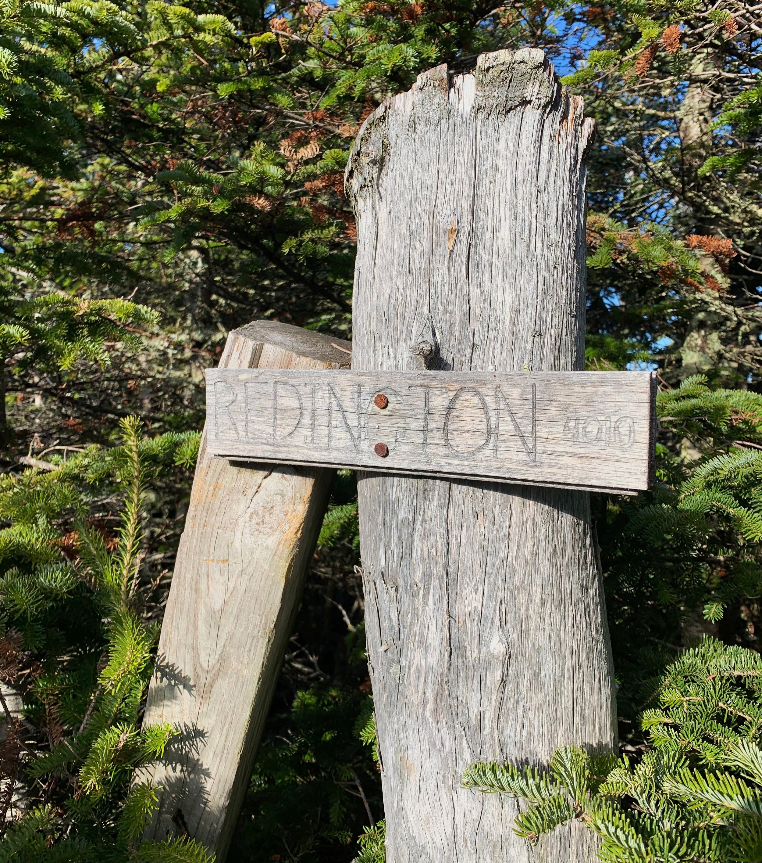
Summit, Mt Redington; 4010’
All the years that I’ve seen pictures of this hidden gem, wondering if I was capable of such a feat, I now stood at this coveted location. This was a huge moment for me, that canister, as simple as it is buried deep in the forests of Maine, on a summit with no official trail, represented so much for me. I did it. I did it for me. I took each step in that unmarked forest for each day that I struggled. These are the moments I live for, the mountains that take me home, the mountains that help me breathe life.
I stayed long enough for some photos, trying to forever burn this image of this summit into my memory bank – and then I turned to leave, so quickly and it was over.
Running back down the trail, I had a rad couple of trail runners to catch up to. My new friends informed me of yet another side trail that led more directly down to the logging roads. Before we went in opposite directions they had suggested that, “if you are not trying to reach a certain mileage today.. we are more than happy to show you to our car.. and give you a ride back to yours!”
Eventually, turn by turn through this thick canopy, I began to hear their voices. Once caught back up, we re-entered the openness of old logging terrain. Running occasionally, the two strangers of the woods told stories of hiking this area almost a decade prior, truly an entertaining bunch.
The low trickle of the river soon turned into a roaring river once again, indicating that we were nearing the gate of the old logging road, and thence their Subaru hatchback.
They stopped their watches: 13 miles for the day.
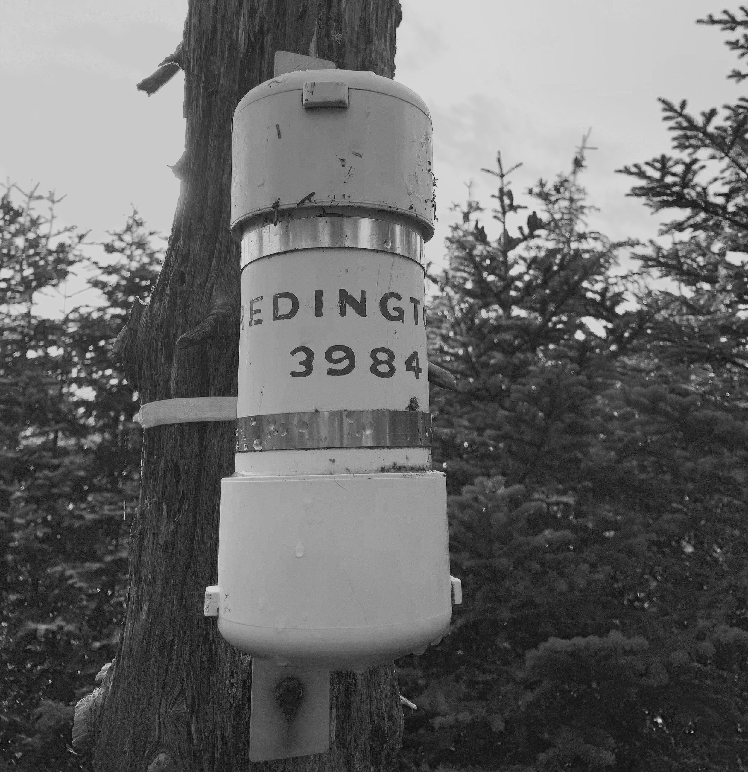
Mt Redington summit canister
I stopped my watch and exclaimed, “Nooooo!!! I have to jump around for TEN more feet!!”, was my response when I saw 9,990 feet of elevation gain for the day.
Joking of course, I humbly tucked my muddy Lone Peaks onto their sides as to not get the hearty black Maine mud all over Ryan’s Subaru interior.
Super thankful for helping me along with the final miles of my day, we all talked of seeing each other some day, somewhere out on the trails. They invited me to a celebratory BBQ, I politely declined, opting instead for the spinach salad with bread and garlic hummus that I had stashed in my trunk.
I had accomplished what I had set out to do and quickly settled into my home for the night with dinner and a change of clothes in my near future. Life in the backseat of my Subaru Impreza was not so bad as the sun quickly set and the frigid evening temps quickly set in.
Sugarloaf, Spaulding, Abraham, South Crocker, North Crocker, Redington.
This was my day, this is what I drove 186 miles for - this is the time with nature that I craved.
Now I settle into my sleeping bag, try to stretch out stiff limbs and get ready, for tomorrow I will do it all over again.
Tomorrow I will be in the Bigelow Forest Preserve for the first time, and certainly not the last time.
Overall stats for the day:
27.55 miles
9hr 54 minutes
9,990′ elevation gain
Sugarloaf Mtn – 4,250′
Spaulding Mtn – 4,010′
Mt Abraham – 4,050′
South Crocker Mtn – 4,050′
North Crocker Mtn – 4,228′
Mt Redington – 4,010′
*summit elevations provided by AMC