
Mount Rogers
It wouldn’t be long now before more weather would be moving in; the forecast now called for wind and snow in North Carolina. While I had anticipated taking several “zero” days along this 8,000-mile road trip, to rest amongst my pint-sized backseat apartment, to recover sore muscles and read whatever books and maps I had packed - up to this point I had no reason to sit idle, I moved with the weather and this method worked well.
Not wanting to begin any unstructured sitting now for fear of becoming stuck for unforeseeably too long, I once again moved with the incoming weather, into a pocket of the Appalachians which looked clear; a sunny day which would quench my thirst for more hiking, running and proper exploration.

Rhododendron-lined soft paths
With coffee in hand I plugged the next state high-point into my GPS and began my 2 hour 26 minute drive northeast into Virginia; Greyson Highlands, here I come!
Locking the Carolina Hemlock campground gate behind me I was on the road before the sun even began illuminating the horizon. I witnessed a simply stunning sunrise consisting of orange, pink, red, blue and purple pastels streaking the open sky. Kids boarded school buses while cars dragged folks to work on a beautiful Friday - and here I was just out here doing my job: exploring my beautiful world and living as enjoyably as I knew how.
From researching the Greyson Highlands State Park website I knew the gates opened at 8am. I pulled in at 7:57am to the best sight I could have wished for - a self-service kiosk. Knowing I did not have correct change I simply took an envelope with the mirror-hang pass, thinking I’d bring it to the office on my way out and get correct change.

Greyson Highlands panorama
Greyson Highland Lane rode the contours of Haws Orchard Mountain (5,080’) and climbed steadily as my heart began to sink - posted every 20’ were, “No Hiking” signs advertising that it was open hunting season in these hills. Determined, I drove until the main road was gated and reluctantly sunk into a nearby parking spot facing north.
Interestingly, I noticed that all of the signs were behind me - on the south side of the Park - I had not spotted a No Hiking sign in perhaps a quarter-mile along this north-facing side. There were trails, in fact, the trail that I had hoped to take up to Mount Rogers, the state high point, was directly in front of my car, not posted!

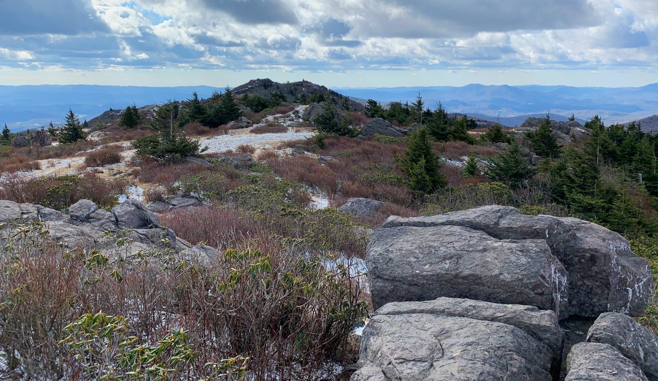
Highlands of Greyson
Now I was excited; no one was around to see me change clothes and get gear ready, I was the sole car at the Massie Gap Trailhead. To be safe I hung the State Park tag from my mirror hoping to not draw unneeded attention.
Eleven minutes after the park opened I stepped onto a spiderweb network of foot trails and horse paths; the Rhododendron Trail was like walking through a Better Homes & Gardens estate lawn showpiece, absolutely stunning bushes and trough-like soft paths. The surrounding grasses were frosty, frozen with dew but warming quickly in the early morning Spring sunshine.
Once again, I found myself on a series of trails unlike anything I had ever trekked before, Virginia was absolutely beautiful! Next up was Horse Trail N which would lead me over sand and soft gravel to the Appalachian Trail.
Along the AT
“Back on the AT?!”, I thought to myself as I began passing thru-hikers who appeared to be still in a sleepy daze from their alpine-start; at least I knew I’d have good company out on the trails and not be alone all day - as the State Park lot made it appear.
While trying to tramp softy I still cracked and shattered the thin sheet of ice which formed delicately atop muddy puddles. The trails were that typical AT trench, forest and countryside worn to dark soil with occasional well-placed rock steps. I couldn’t get enough of the seemingly thousand-mile vistas, it felt as if the trail was placed atop a plateau, all surrounding land just dropped away until reaching distant mountains and other high places.
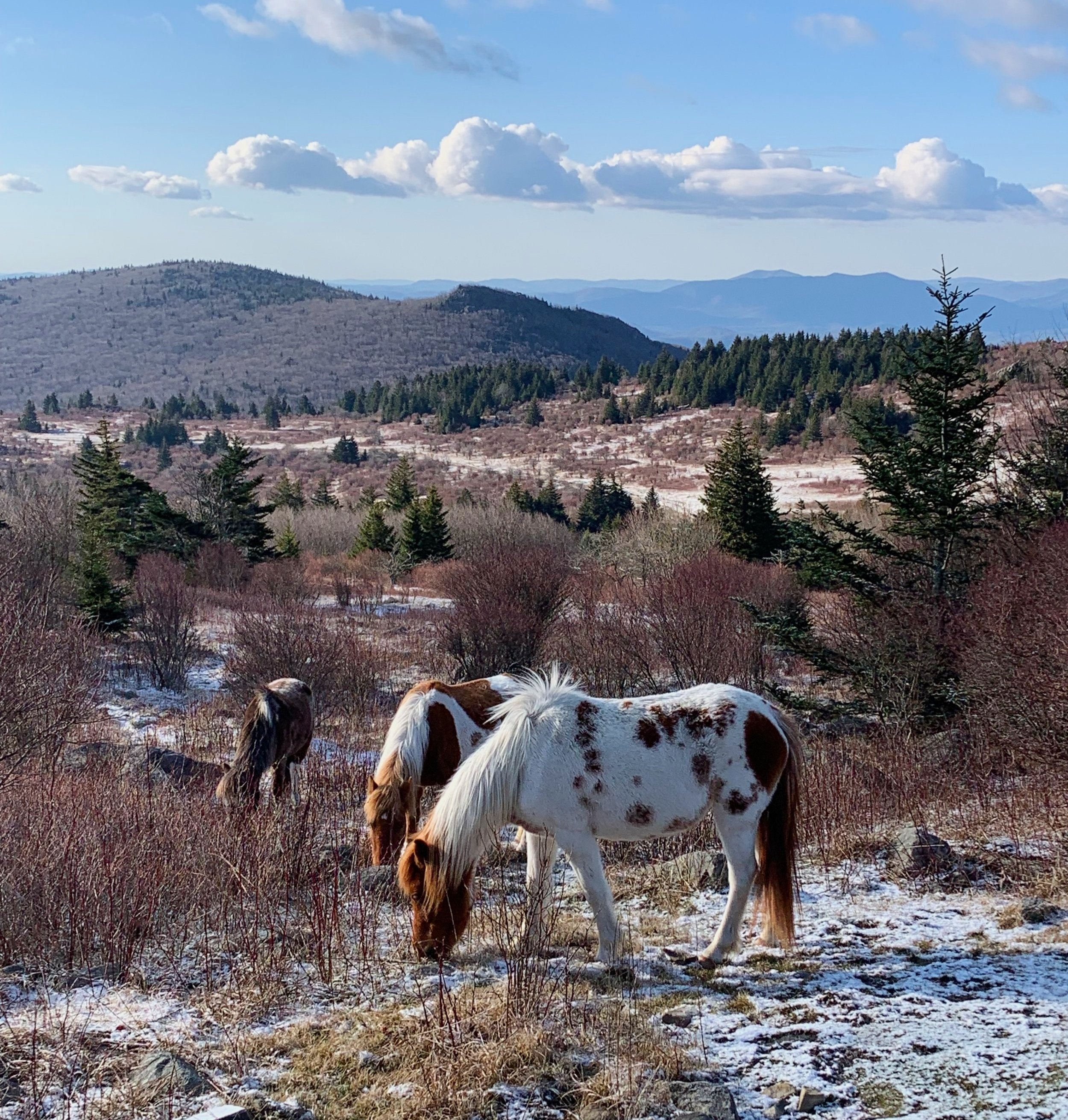
Free-roaming wild ponies of Greyson Highlands
As I recall, every person I’ve talked to who has ever been to Greyson Highlands remarks with two simple words: “THE PONIES!!!”. Ahh yes, the ponies. I knew nothing of the free range ponies prior to hiking this stretch of Appalachian Trail but now I just want to return for more.
Hikers enter the pasture through a wooden gate which we are entrusted (and instructed) to close and latch behind us, we walk amongst the beautifully soft brown and white creatures and then leave by way of a second wooden gate.
Upon passing the gated section the trail becomes rather rocky, skirting around the eastern side of Wilburn Ridge affording fine views all-around as the path crests open rock slabs and continues through a short rock tunnel.
Straddling the Lewis Fork Wilderness, the trail soon passes through a small thru-hiker village in the highlands and begins suggestions of the spruce forest to come. Here, the Thomas Knob Shelter site is passed which was unoccupied this morning. All throughout, hikers are treated to elagant rock staircases and well-graded paths.

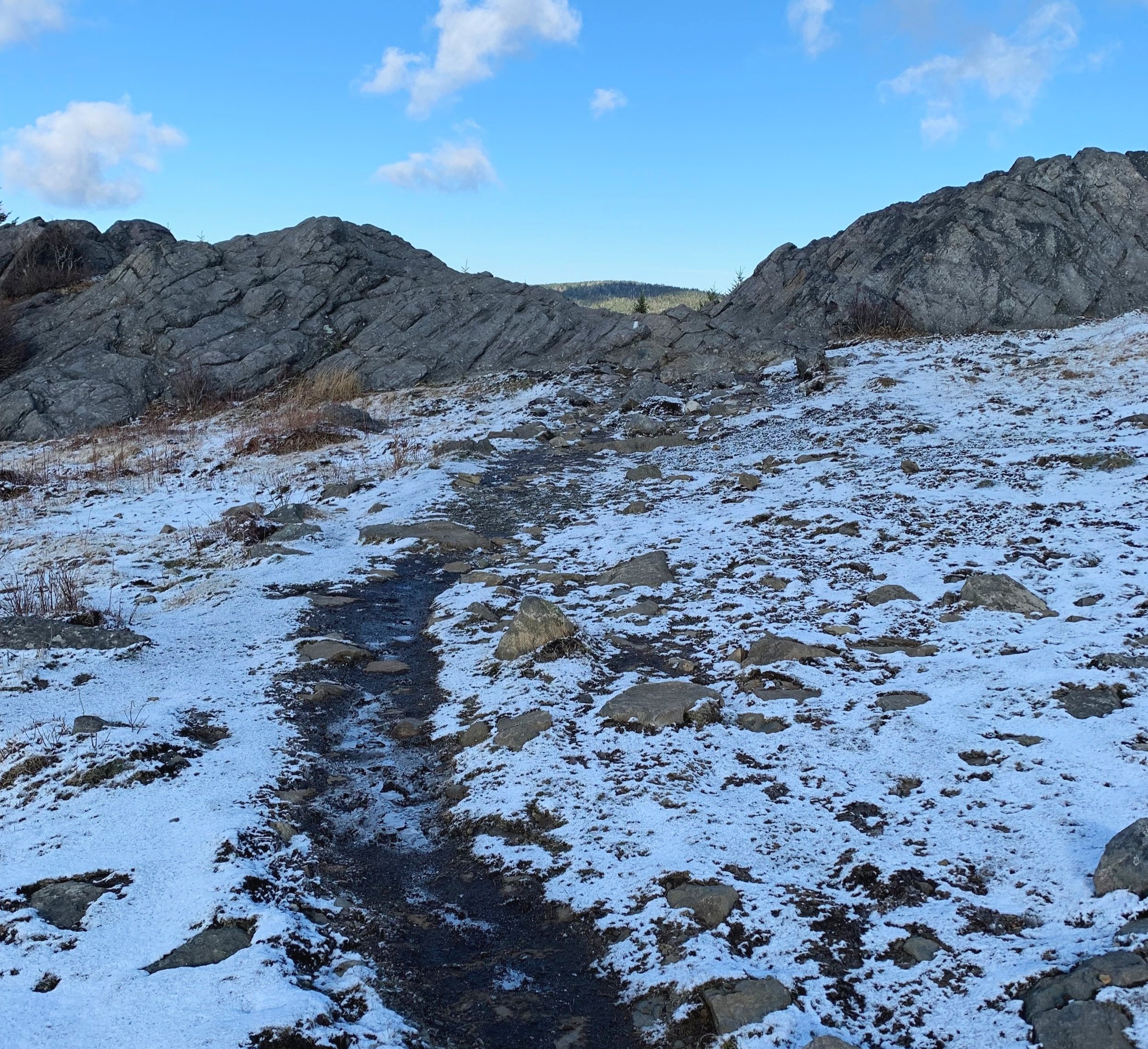
Trail work along the AT
Approaching 3.8-miles into the trek I departed the Appalachian Trail momentarily for a stroll along the Mount Rogers Spur Trail, where the surrounding moss and conifer needles were sprinkled with a fresh dusting of confectioner’s sugar-like snow, the air was fully fragrant with a forest of spruce and fir.
I had encountered only one man with his dog backpacking in the thru-hiker area; the spur trail and mountaintop - all mine. Taking in several minutes to find a pair of USGS survey benchmark discs, I roamed around the summit and rambled down every notion of a side path I could find, hoping one of them might afford a view amidst the thick conifer wall.
Making my return down the mountain, I performed my usual side-to-side gazing, assuming every up-turned root ball was a curious moose nose until proven otherwise.

Mount Rogers Spur Trail, approaching summit
I wished the lone camper and dog both a great day, who were now roaming around encampment, owner packing up with a toothbrush in his mouth. I didn’t want to leave this new place I had found but remembered the threat of snow.
Retracing my steps along the AT, it was decided I had some wiggle-room - a few minutes, perhaps - so I treated myself to a bushwhack. A bushwhack in which I could see my destination the entire time through the waist-deep pockets of wild grasses.
The highest bump of the triangular-shaped three gave a short, steep scramble. I hopped around the rocky tops of two of the humps until certain I stood atop the highest point of Pine Mountain, at 5,526’, once again I soaked in the sunshine and 360° views.
Rocky outcropping of Pine Mountain
Back in the pony pasture I stopped briefly to watch a young man, judging by his large pack, a thru-hiker, Face-Timing someone on his phone as he inched ever closer to the docile creatures; he seemed in awe at the spectacle - I couldn’t even begin to imagine the sights a thru-hiker would encounter on their 2,194.3-mile journey!
While nearing the trailhead I could overhear young hikers through the canopy of rhododendron bushes ecstatically awaiting their turn to see the famed ponies; when we all met on the path they excitedly asked if the ponies were out today, I assured them they indeed were and wished them a very nice day.
Just as I unlocked my Subaru and got ready for refreshments and a fresh set of dry clothes I watched big flakes float from the sky. By the minute my view north to the picturesque rhododendron gardens grew obstructed by a blur of white fluff; it was time to get back on the long road north.
Overall stats for the day:
8.93-miles
2hr 40minutes
1,781’ elevation gain
Mount Rogers - 5,729’
Pine Mountain - 5,526’