
Mount Shasta
Sitting on the south side of West Diamond Lake Highway I had the best lunchtime view of my life. Sitting sprawled out in the backseat of my Subaru having a lunch of red grapes as big trucks sped by, rocking my little sedan with each pass, today’s windshield panorama was the 9,184’ sharply towering spire of Mount Thielsen.
What lay between my current position in Umpqua National Forest and the Timberline Lodge at Mt Hood several days prior was one rainy attempt consisting of shit snow at Mount St Helens followed by some outstanding snowshoeing back at Hood, then I got kicked out of the parking lot of Mount Batchelor at 10:30pm as I was unaware quietly sleeping in the backseat was frowned upon by ski resort security.
I had driven to Washington, found most forest roads still closed due to snow or winter blowdown and driven back south to beautiful Oregon.

Mount Thielson; 9,182’
That mountain before me stood tall enough it appeared to be holding up the blue dome of a sky above and stretched for a good lightening jolt. I had reservations regarding climbing due to how steep it appeared from my vantage point but oh, I wanted to stand atop its point so badly!
As weather reports were checked from the bubble of cell reception that I had found at the edge of Diamond Lake, near the Thielsen trailhead, it was obvious that today was a good driving day; tomorrow was the amazing, blue-sky weather window that I was waiting for once again. I debated with myself as it was only 10am; stay parked and sleep early for an alpine start on Mount Thielsen, or explore options as I had time in my day to drive?
But, what was my other option? At that point, I did not know. Cycling from weather reports, avalanche reports to mountain and trail apps on my phone I consulted PeakBagger; PeakBagger has an interesting feature where they will display peaks contained on a hiking list visually, on a map. During my early research of Mt Hood (Mt St Helens, Adams, Thielsen, etc.) I found their Cascade Volcano list, contained on this was a name that stood out from my youth; Shasta.
The weather for the Mount Shasta area was looking the best yet and as it turns out, when I drive 14 hours for 4 days straight, a 3 hour drive south to Mount Shasta is cake. So, there is was. Decision made: I was getting back in the captains’ chair and cruising across another state border this morning.
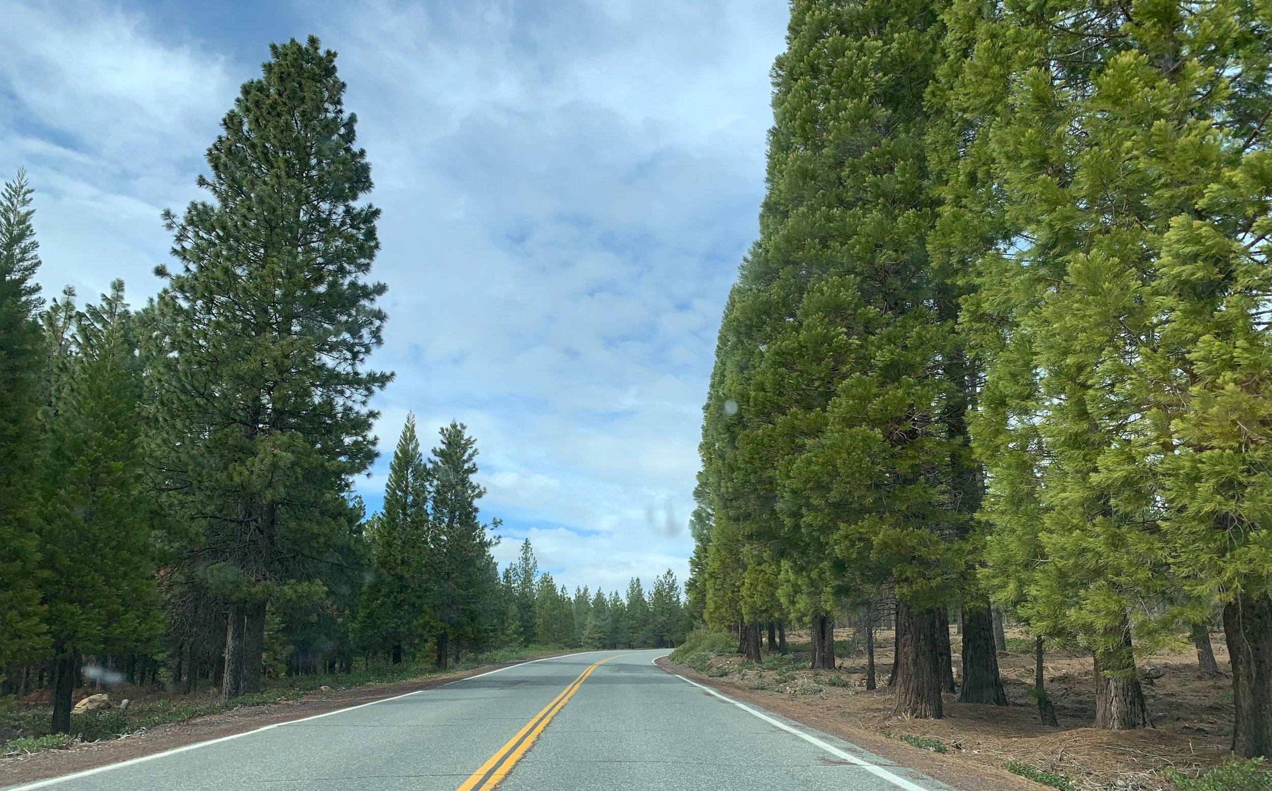
Everitt Memorial Highway; ~6,400’
The drive was nothing out of the ordinary - roadside forests sadly burned to matchsticks, often times my Subaru paced gigantic strings of yellow Union Pacific locomotives tugging coal hoppers, auto-racks or oil tankers. Upon entering California my Subaru was directed and funneled to a bay for interrogation: “Have you any fruit or vegetables??”, asked the young man who could not have been a day past his 18th birthday.
“Uhmm, I have these apples, man; and a 5lb bag of carrots. I just went produce shopping this morning back in Bend.”, I replied.
The boy chuckled and asked if I was transporting any large quantity of exotic fruit across the border that could house invasive pests. Oh, no - no stash that large. I wished him a great day as I was free to go.
I playfully pretended I had no idea what I was driving toward; all around was blue sky with a bright white cloud just south of my path - I had a feeling I knew what that cloud was stalled on; perhaps there was a tall something holding the cloud right in place, could it be… Shasta?

Sierra Club Horse Camp; 7,880’
After fueling up (half tank only as gas was $2.50 more expensive in Cali than a few miles back in Oregon), GoogleMaps directed me through the city of Weed and onto the Everitt Memorial Highway - a 3,600’ climb up to the Bunny Flat Trailhead.
Five times I had begun my 800-page biography of John Muir, constantly stalling after finishing the chapters about his early days in California exploring the Sierra Nevada, Mt Shasta in particular. I was amazed at the picture he painted while describing these woods: towering red fir with supersized lime green needles hanging far overhead while similarly colored, brilliant green wolf lichen seemed to burst from the dark brown fissure cracks in the old bark.
I was here to get lost in this world he adored.
While becoming accustomed with my new parking lot residence for the coming night I explored the US Forest Service information kiosk, paid my climbing fee, registered and proudly claimed my new hiker hangtag.
At 5:40pm, as I retreated to the warmth of my backseat the cloud which had been clinging to the 14,162’ summit of the mountain had drifted, leaving behind the most stunning view I had ever feasted upon; all my recent failed ascents and unexpected road closures proved worth it to be standing here at this moment!
I had my mastered my prep routine by this point; with a dinner consisting of pears, unsalted peanuts, raw almonds, hemp hearts, cacao and dates, I crawled into my sleeping bag around 7pm for an even earlier start for this climb. Between using the sleeping bag to shield from the remaining daylight and the racket of an old Winnebago idling next door for 30 minutes, it’s debatable if sleep ever crept in at all.
10pm; awaken at Bunny Flats
What a disillusioning experience it is waking up in such a short amount of time spent with eyes shut, at least my coffee was once again prepared and still warm. Anything I could do to streamline the waking and just perform the motions, ensuring decision making was rudimentary thus allowing my mind to sink into a Zen state.
The best part of Bunny Flats Trailhead (my parking lot campground)? Vault toilet just outside of my car door, no hiker blue bags for me today! Even at 6,900’ the air remained warm enough to leisurely slip into boots and stuff gear into the pack. With several handfuls of cars in the lot and given the outstanding weather report, I was surprised to be the only climber awake and moving by headlamp.
11:37pm; depart Bunny Flats
The Horse Camp trail was eerily quiet as my headlamp swung side-to-side, illuminating the foreign forest, searching for glowing eyes in the shadows or any sign of life amongst the trees; my still half-asleep mind considered encounters with wolves, bears, skunks, mountain lion, anything that might find this nocturnal human interesting.
At about 2-miles the stone Sierra Club camp came into view through the low-hanging mist, still not a creature or soul to be found - the only sound was the trickle from the spring water spurting irregularly from a black hose onto icy rock mid-trail.
Following other climbers footsteps on the solid crust I continued deeper and steeper into Avalanche Gulch, quickly finding out how this route was given its name: the path was literally a trench, a would be half pipe for skiers and snowboarders with its steep sides plastered with jagged volcanic rock. I quietly wished whomever was listening for no avalanching during my trek and for a safe return.
Switching from bare boots to crampons, I gave the La Sportiva’s a bit more bite into the frozen snowpack. I had found myself amidst the most favorable climbing conditions out here in the Shasta-Trinity Wilderness!

Avalanche Gulch route; ~7,900’
Still, by the light of 400-lumens, I kicked steps and took slow rhythmic breaths and gradually ascended to Helen Lake at 10,450’. Here, I saw my first evidence of other hikers - a yellow 2-person tent pitched lakeside, surely I had woken the inhabitants with my headlamp if they weren’t up already exploring the mountain!
I walked clear across the lake before noticing that what I had been standing on was in fact lake, completely frozen and drifted over, thankfully solid enough to support my weight.
My GPS watch struck 4-miles into the climb and it was time to resume the upward slog, putting the lake behind. Reaching about 11,550 I could tell something didn’t feel quite right when I could look up to overhanging rime encrusted bands of gargoyle-like rocks towering just above my head. Turns out while departing the lake in complete darkness I took off on a slightly too-far westerly bearing and simply followed along some boulders along the Casaval Ridge.
With the problem identified, I knew the direction I needed to traverse. The current obstacle, however, was now side-stepping the steep face, while simply front pointing and leaning on an ice axe was one thing, I had to either face the slope and shimmy crampon front points or try to sink into the snow slope with a few boot edges and side points as to not lose traction or break the crust and pop those 3-inch spikes out, a fall would certainly follow.

Looking up from atop Red Banks; ~12,810’
4:15am. Red Banks; 12,630’
From the parking lot the day prior this landmark was pointed out by a group of skiers when I asked how the conditions were. They were stunned that I had never heard of THE RED BANKS. Now, I was going to get up-close and nearly intimate with this band of burnt red-brown rock that looked like it had been transplanted from the Nevada desert.
I searched for a chute to ascend after hanging toward the right-side (east) of the looming wall. Everywhere I looked was damn near vertical. I picked a spot where I could stuff a crampon point and inch up, rocking my way until I could see a crusty rock far over the crest where I might be able to sandwich an ice tool pick. I placed it while mid-hop as to not apply full weight onto my elevated crampon point - in case it decided to pop from the awkward red volcanic rock.
The pick was stuck as I inched up the vertical chute as gracefully as I could. “No jerky movements”, I reminded myself now completely off the platform which provided safety below. At this point, it occurred to me that if I were to fall I’d land on the concrete-hard ice and snow below at such an angle I’d immediately proceed to a freefall, skidding back down to Helen Lake far below. For the first time on this ascent all unnecessary thought disappeared, I cannot recall a time my mind had been so silent, as if knowing instinctly just what to do to reach safety just up above.
Back on the mild grade I could stand straight once again, wanting to celebrate, my thoughts went to Misery Hill and the return climb - I had very far to go. Before turning toward my next objective I let my headlamp shine into pure black murkiness below, standing above the edge of the Konwakiton Glacier, all I saw was the jagged drop off, a continuation of Red Banks band of rocks.

Thumb Rock; 12,923’
A mix of crusty ice and snow littered with now smaller rocks made up the path while slowly ascending Misery Hill. Very reminiscent of night hiking in the Adirondacks around tree line, a very bizarre sensation to be so far from home yet feel that home was right here, all around.
Kick step, kick step, plant ice axe shaft, lean to rest momentarily for a deep breath in, exhale for another kick step, kick step, plant ice axe shaft, deep breath in - repeat, over and over again - very mechanized to ensure muscles remained oxygenized at such elevation. I never felt the traditional sick or dizzy but somewhere around 13,500’ I was growing exponentially fatigued, much more than normal. While staying well hydrated and fueled up on nuts and dates, I assumed it was simply my first real experience with higher altitude.
And there is was - the reminder that I was on a volcano once again - the scent of sulfur venting from a nearby crack in the rock. I was respectably fully enjoying my high altitude playground as the sun made its’ first glimpses of orange slivers far on the horizon. More pinnacles of jagged rocks towered from across a pre-summit plateau.
The final climb initially appeared impossibly gigantic up these towering rocks but luckily the trail followed the contour northerly around the mass of rock and hooked back around, it was a mild snow and ice chute which took spikey bits very nicely.
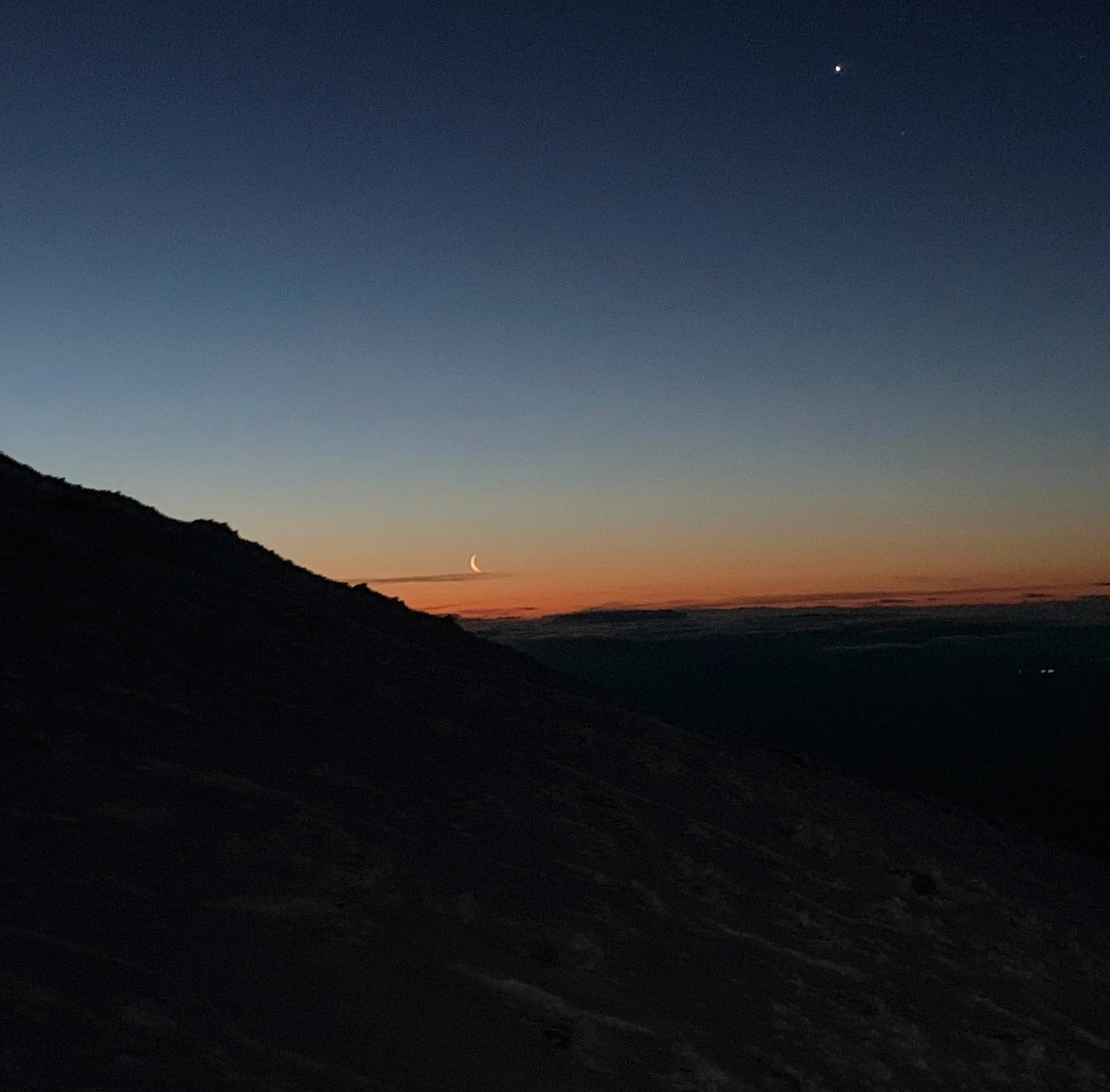
Moon rise from just below summit; 13,870’
Given the spring snowpack which remained on the summit, no USGS marker to be easily found, I concluded the true summit could have been located on any of three little peaks all within 20-feet, so I took off bouncing from one highpoint to the next.
Very satisfied this morning, I had climbed my Shasta.
I sat briefly on the summit and gazed at the city lights far below, over my shoulder the rising sun continued to creep into the picture.
As the sun crested the horizon shortly into my descent I was overwhelmed with the rainbow hues all around in my landscape, the towering mountain gave off a shadow to the west resembling a shadowy pyramid, I never had the pleasure observing mother nature.

Mt Shasta sunrise; ~11,000’
Choosing the same rocky chute to descend Red Banks I knew where to hook rocks with ice axe picks and place crampon spikes. I met the residents of the Helen Lake with a gracious “good morning!” as father and (very, very young son) were all geared up to make their push to the summit and ski back down to their tent. I spoke with folks later in the day who confirmed both made their summit and did ski back down to pick up their tent, just remarkable.
I found nothing wrong with letting a few tears fall as I bounced back down Avalanche Gulch: I had mustered up a big task and was returning safely, there was not much more in this world I could think of asking for, this brings me great joy and enormous amounts of satisfaction.
Although well spent from my over-night climb, I couldn’t help but treat myself to a roam as Muir would have similarly done after a breakfast of bread atop one of his favorite west coast peaks. I am still unsure if a more beautiful forest exists anywhere in the world.

Shasta-Trinity National Forest; ~7,500’
With soft needles underfoot and snow slowly warming with the rising sun I covered the final mile back to Bunny Flats and eagerly look a corny selfie with helmet still atop my head, the first photo-message I would send back home to relay the message that I stood atop its summit and returned safely.
The next several hours were spent lounging in my backseat, feet kicked up eating and rehydrating with nearly every piece of juicy fruit I owned.
Then I took a well-deserved long nap, it was a very good day.
Overall stats for the day:
12.66 miles
9 hours 45 minutes
7,864’ elevation gain
Misery Hill - 13,840’
Mount Shasta - 14,162’