
Saranac Lake 6er Ultra
The year was 2016, my father and our hiking partner, Wendy, and I were descending from the 4,780ft summit of Haystack Mountain; we had just become Adirondack 46er numbers 9479, 9480, and 9481. The conversation took a turn from one of anticipation on the ascent, to “what’s next?”, on the descending miles back to our awaiting car.
Over the coming months we went on to visit waterfalls, ledgy lookouts, and various interesting places we had dog-eared during our journey to becoming ADK 46ers. We began several new hiking lists, though none as daunting as the 46 high peaks with its elusive, trailless climbs. We were enjoying some shorter treks, taking the opportunity to rest peacefully at summits and soaking in views, otherwise, we continued our trend of seeking sunrise or sunset from open rock mountaintops - this was how we were introduced to the Saranac Lake 6er climbing challenge.
4:29AM - Let’s Goooo!
Six peaks around the beautiful Saranac Lake area; it was a far drive for us, but meant more peaks to check off together and more unique places to visit in our beloved Adirondacks.
Upon my relocation to the White Mountains of New Hampshire, Ben and Wendy went on to hike and complete the Saranac Lake 6er challenge over a span of weeks, while I focused on exploration and bagging peaks in Maine, New Hampshire and Vermont.
Upon completing the Cranberry Lake 50-miler, 30+ mile Taconic Crest Trail, several Pemi Loops and a 6-hour 4-minute Presidential Traverse in winter conditions. I, once again sat, looking at logistical notes I had jotted down for running the Saranac Lake 6er challenge in one 24-hour period.
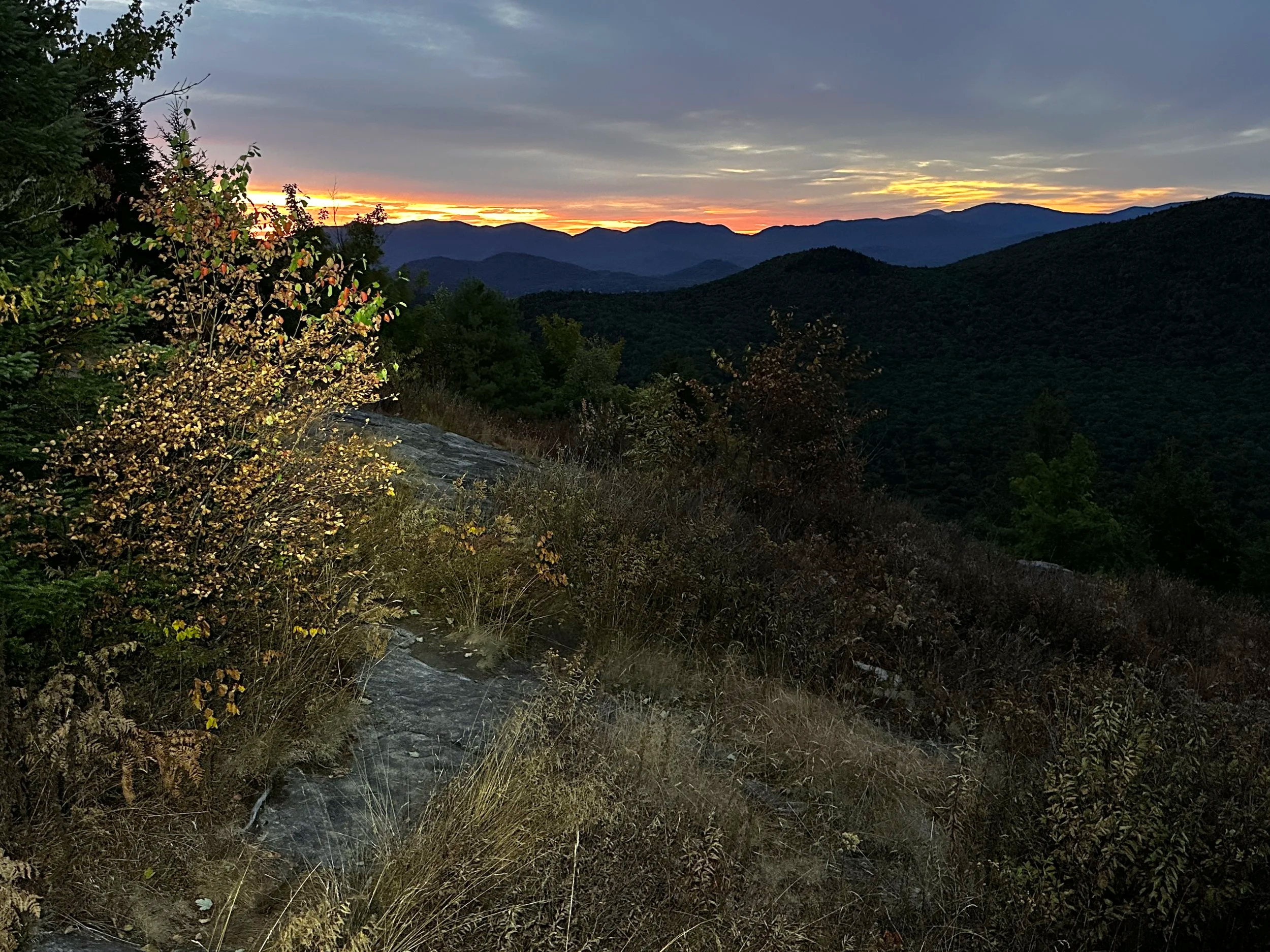
5:42AM - sunrise from Haystack Mountain
With legs freshly recovered from my first 100-mile mountain ultra marathon and weather appearing promising, the time had come to take on these Saranac Lake peaks. The 4-hour twilight commute allowed for plenty of time to consider the “what ifs” of the coming day, mentally scrolling through a list of all gear I had packed and how I could optimize each item to promote a successful (and subjectively fun) route; I was secretly toying with the idea of attempting the “sky-runner” pace, if all seemed to be going smoothly - this meant all six peaks including drive time in under twelve hours elapsed time.
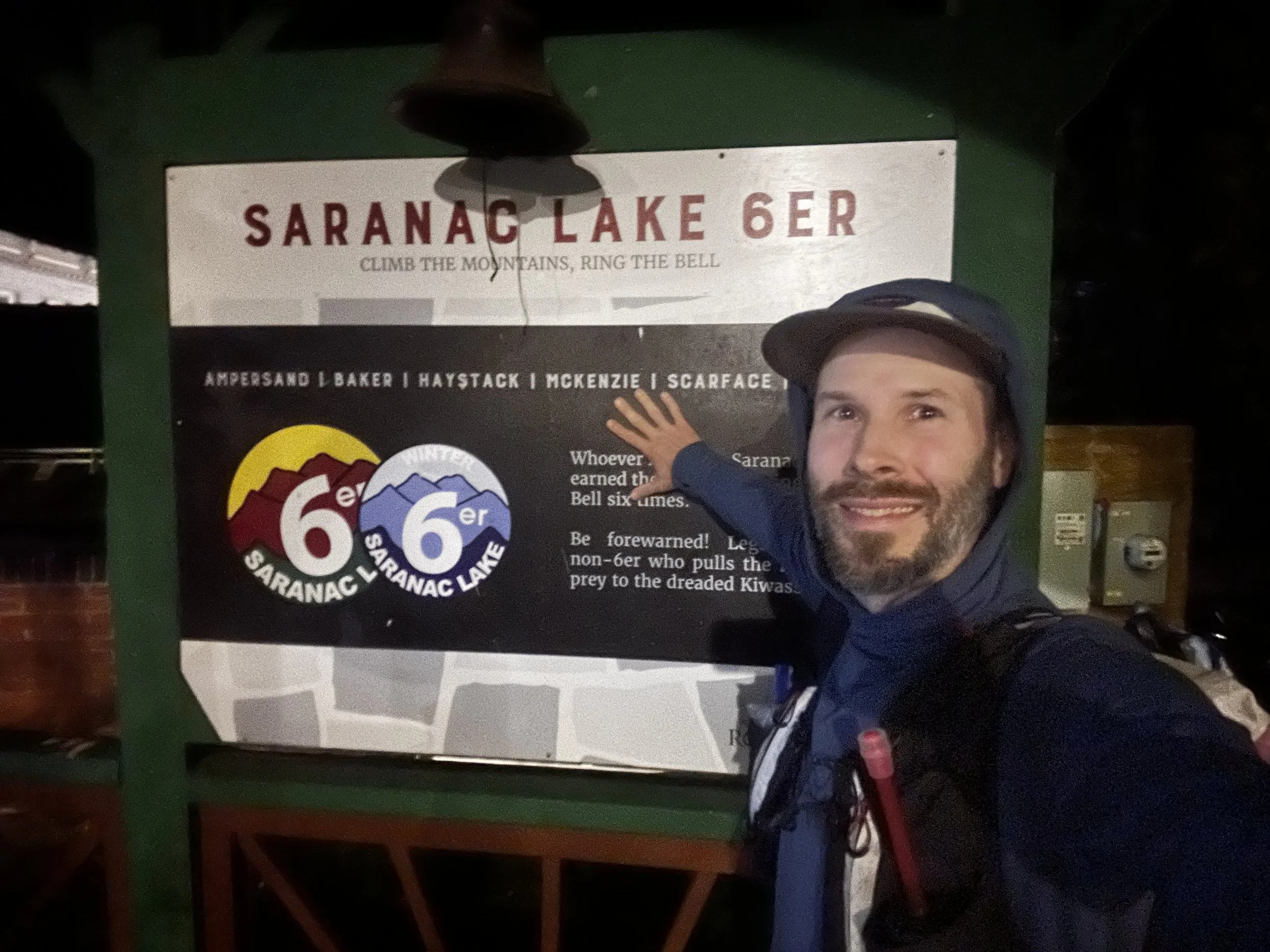
The folks of Saranac Lake had yet to stir when I pulled into town; it was surreal to be standing in the gazebo downtown, looking over the climbing posters and the bell - how badly I strived to ring that bell! With nothing left to wait around for, I prepped gear, stepped into luggy trail runners and signed in; my registered start time was 4:30AM. Go time.
Haystack Mountain (2,880ft) + McKenzie Mountain (3,861ft)
Start 4:57AM / 2hr 30min hike time / 18’09” average pace
8.30 miles / 2,736ft total elevation gain
With Google Maps loaded and directing every turn, I backtracked through town. Having read many reports of other attempts - there is no particular order in which the six peaks must be climbed, but I made a plan which suited my taste - climb the duo of Haystack and McKenzie first, with McKenzie being the highest summit of the bunch, I’d get those out of the way with fresh legs.
6:15AM - McKenzie Mountain Trail
Parked along the road, I hoped to not be in the way of traffic; with Coros Vertix2 ready to track every step and stat, I tossed on an UltrAspire Purist pack I had been testing out and began down the Jackrabbit Trail - damn, it felt great to be back in my home mountains again!
The wide, rocky footpath (ski path in winter) was illuminated by UltrAspire waistlamp, while I searched for critter eyes and scanned the trail ahead with their 800 lumen headlamp. The idea was for a quick out and back before a minor backtrack to pick up the McKenzie Mountain Trail and climb steeply northbound to its namesake summit.
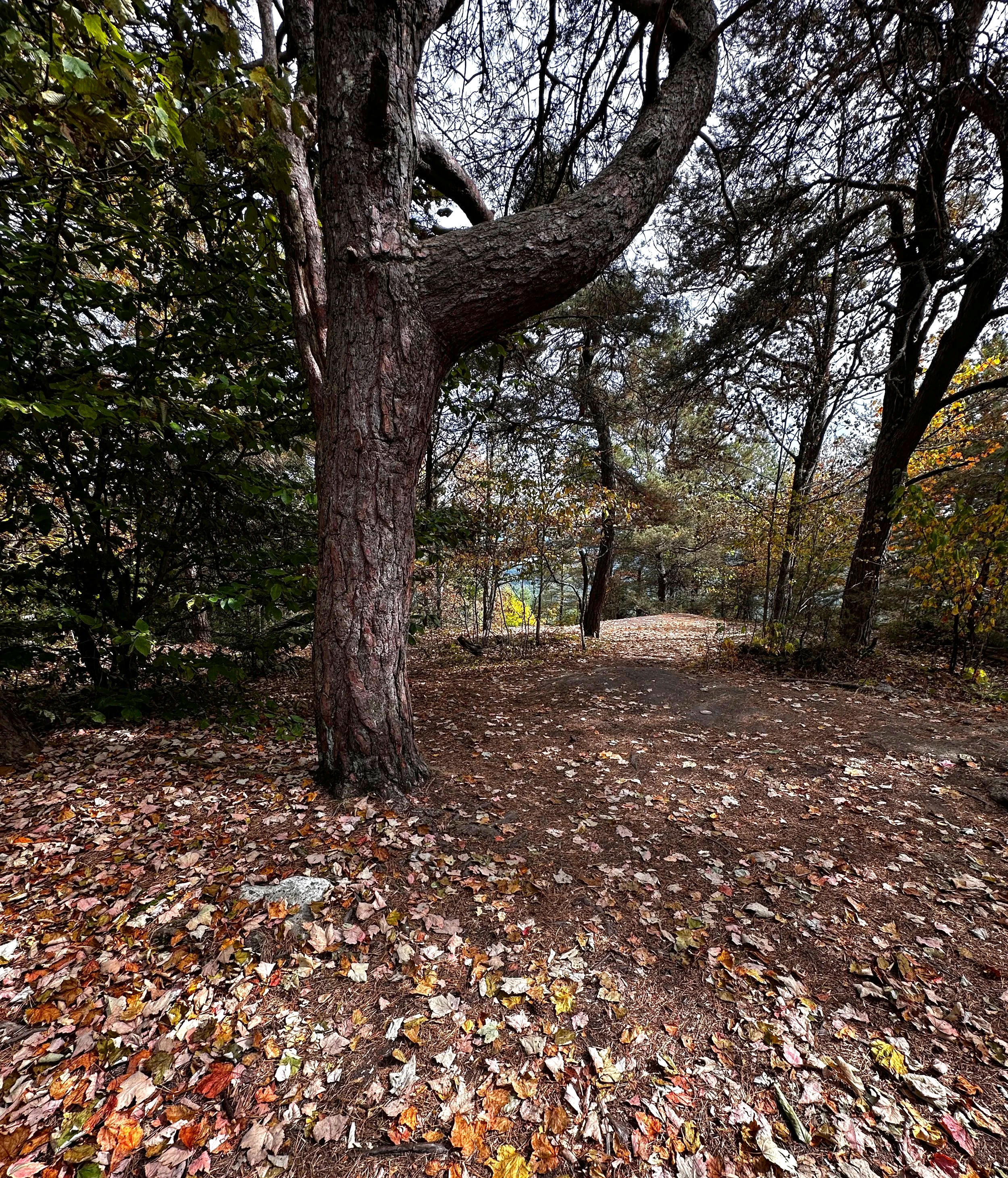
With a close eye on trails displayed on the Vertix2 screen, I caught the short, winding herd path up to Haystack Mountain, where the sky was just beginning to illuminate with glowing shades of orange and pink. With a quick glance for the summits’ height-of-land, I said my thank you’s and farewells to the mountain, retracing steps back downslope to the ski trail.
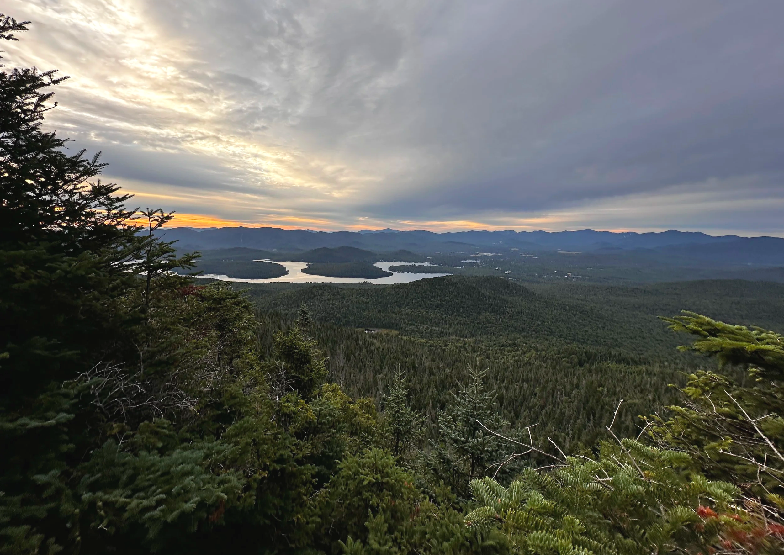
6:34AM - Lake Placid from McKenzie Mtn
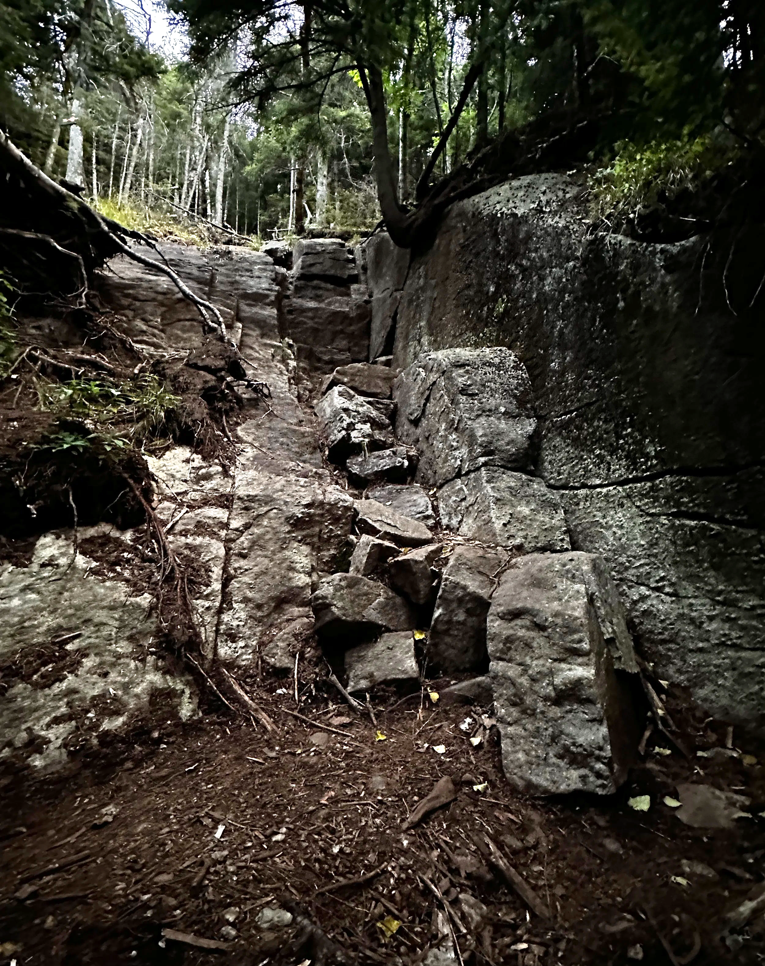
The McKenzie Mountain Trail was a completely different story, while a mild grade to start, it quickly grew harrowingly steep and seemingly widened from foot traffic during mud season; to my eyes, it appeared as if a storm had ravaged the forest somewhat, although scrambling the bare slabs of McKenzie was a total joy in the morning hours - my mind was buzzing with excitement at the thought of finally embarking on this mountain running journey.
Reaching several small lookouts, my trail dipped back into a stretch of beautiful coniferous woods before meandering over a false summit, all the while I could spot my main objective in the near distance. Following a short, steep scramble into the col and a clamber back up some craggy boulders and ledgy sections, the narrow pathway now crested atop a bed of soft evergreen needles. The summit offered a wooden sign and thermometer strung in a nearby fir bough; while I still had far to go, I felt on top of the world to have the toughest ascent now complete.
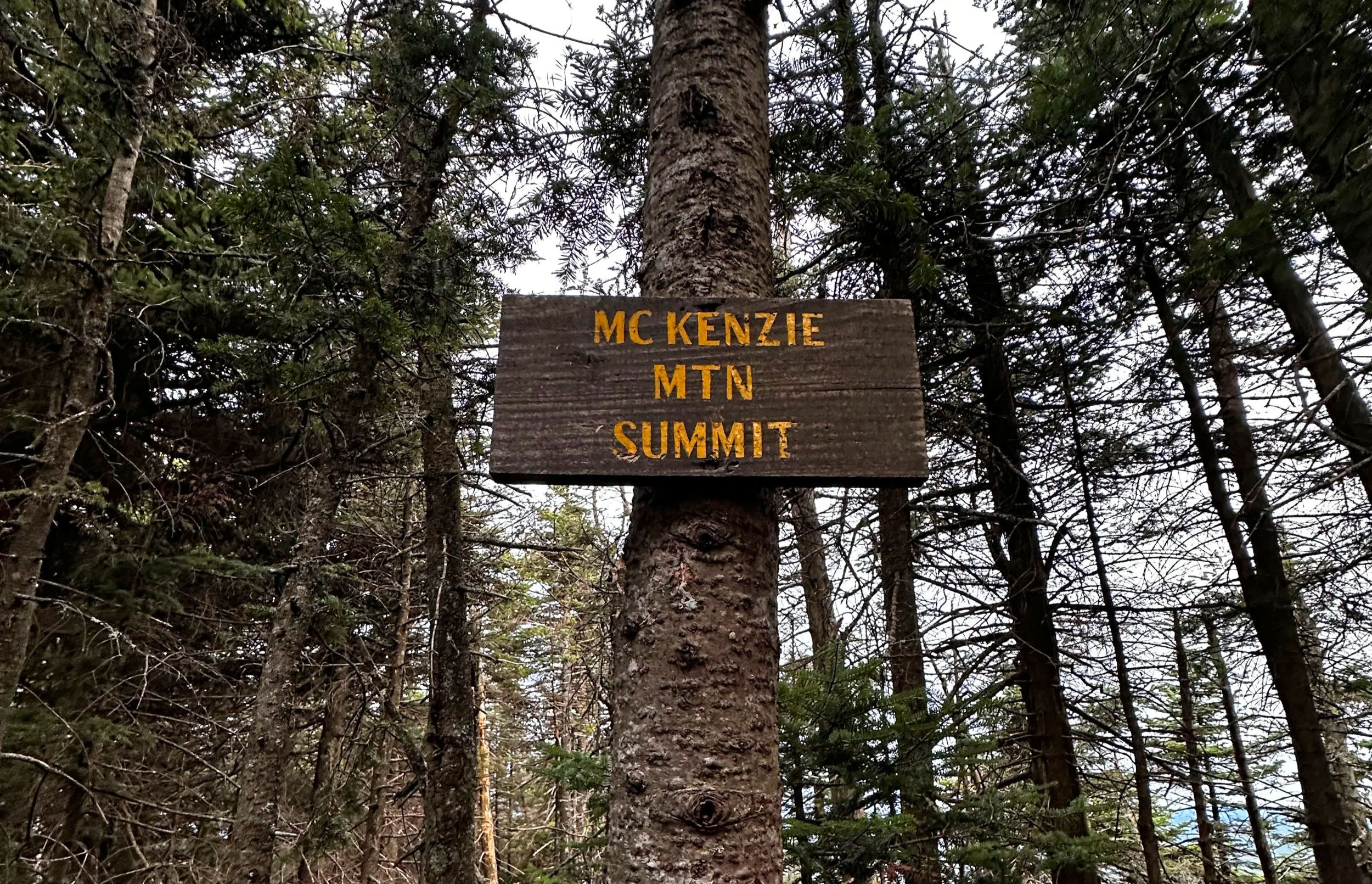
6:35AM - summit of McKenzie Mountain
During the planning stages, I considered backtracking southward, retracing steps to the Jackrabbit Trail, but leading up to my journey, I read a report of someone descending off the peak on an old trail which led due east, passing Bartlett Pond and later in its course, tracing along Two Brooks; reading the hiker claim this route was “softer on the knees”, it seemed like a fine shot. This route was a steep and narrow slot to start down the mountainside before leveling somewhat - appearing as more of an old woods road, encouraging a hasty pace, becoming a highly enjoyable solo jog through the forestscape. Departing from brookside, the path cut through private land and along a tall fence before meeting back up at the Jackrabbit trailhead. Two down, four to go.
Scarface Mountain (3,072ft)
Start 7:44AM / 1hr 54min hike time / 16’01” average pace
7.11 miles / 1,791ft total elevation gain
The plan was to travel light in the hills while not skimping on all the necessities; I would refuel during the driving sections on real food while focusing on hydration and electrolytes during the run and climb. When thirst kicked in, the snack of choice was pre-peeled clementines; when hunger set in, it was scrambled eggs, avocado, rice or sweet potatoes - something I knew worked well from experimentation during ultra running.
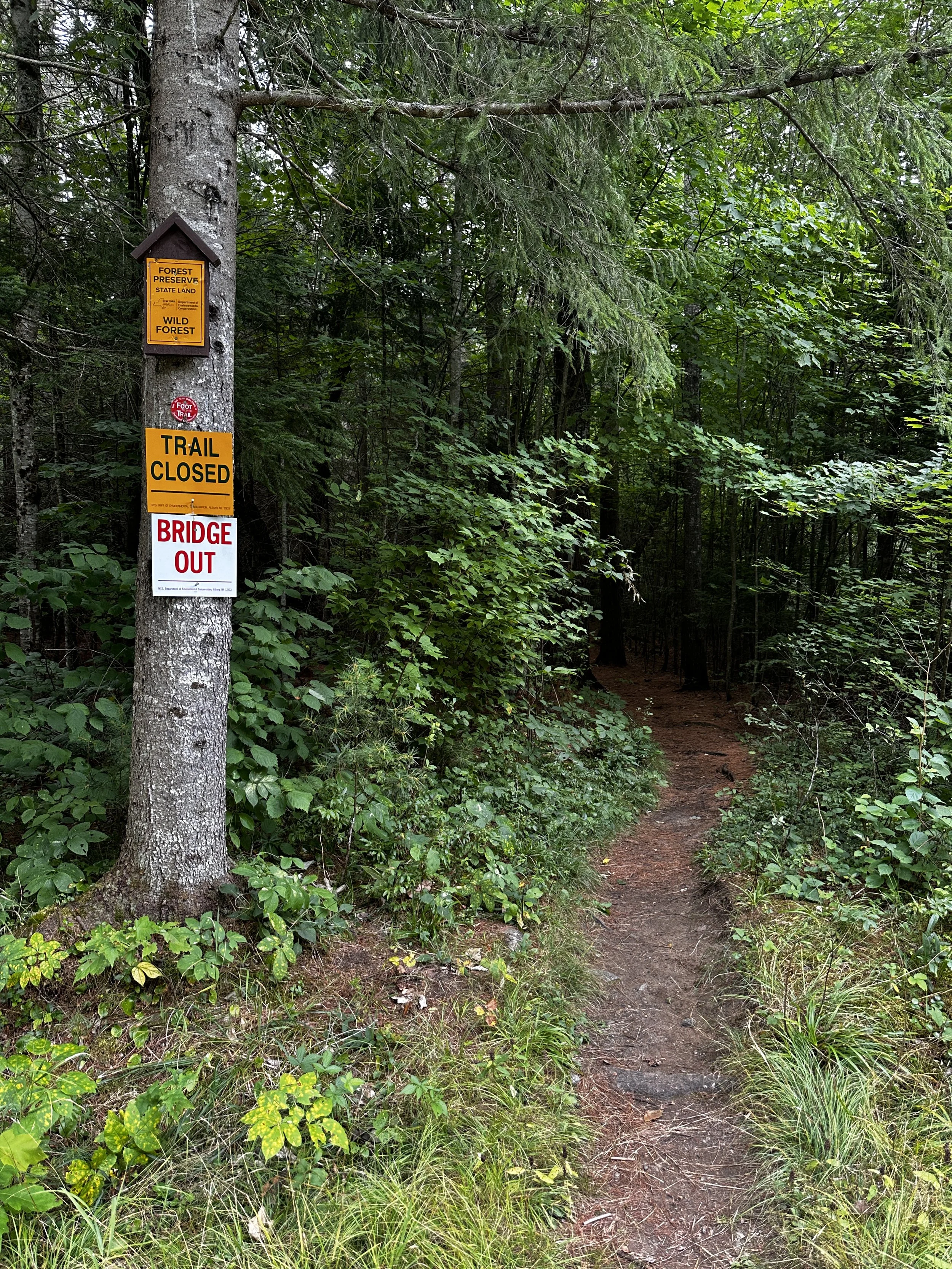
Arriving at the Scarface trailhead, I was the sole car in the lot; this did not surprise me because I had been keeping a close eye on the bridge closure spanning Ray Brook. The bridge had been technically deemed unsafe by the Department of Environmental Conservation, but recent reports claimed the bridge to be passable with care. Also, the ascent of Scarface Mountain would again be recognized by the Saranac Lake 6er committee - this bridge was a major source of why I had sat on the idea and not attempted this ultra hike for 2024.
9:35AM - Scarface Mountain Trail
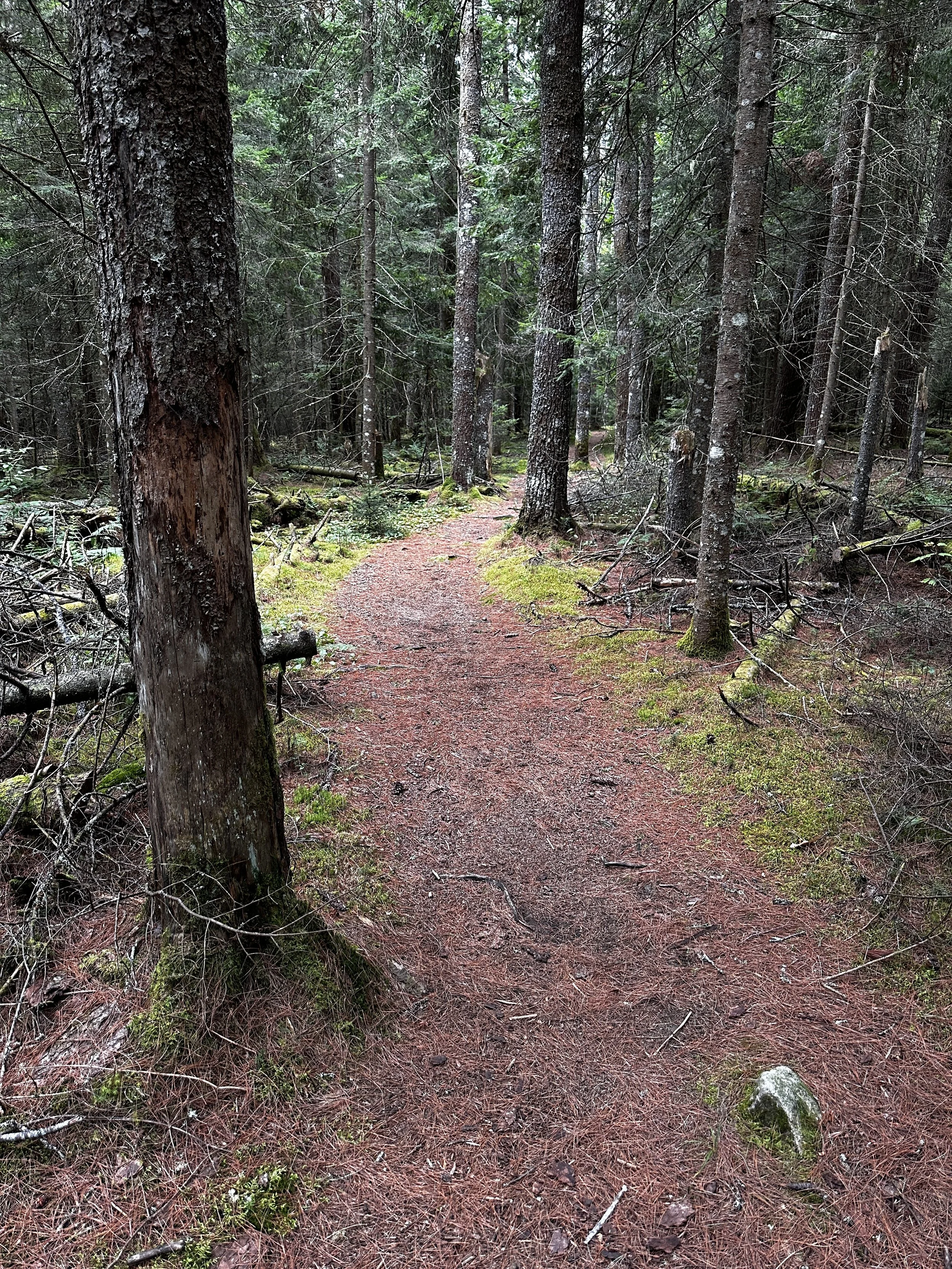
With a brief descent out of the trailhead, I was immediately in awe over such a stunning swath of white pine forest, a reminder of childhood spent in New York State and the Adirondack State Park. The bridge structure spanning the brook seemed to be intact, only missing a few pieces of wooden decking - with careful foot placement I found myself on the far side, climbing back out of the low waterway ravine and meandering toward the peak. For the first two miles, the pathway is another wide, old woods road with gentle grades cutting through more stunning softwoods - one of the finer stretches of the entire day, in my opinion.
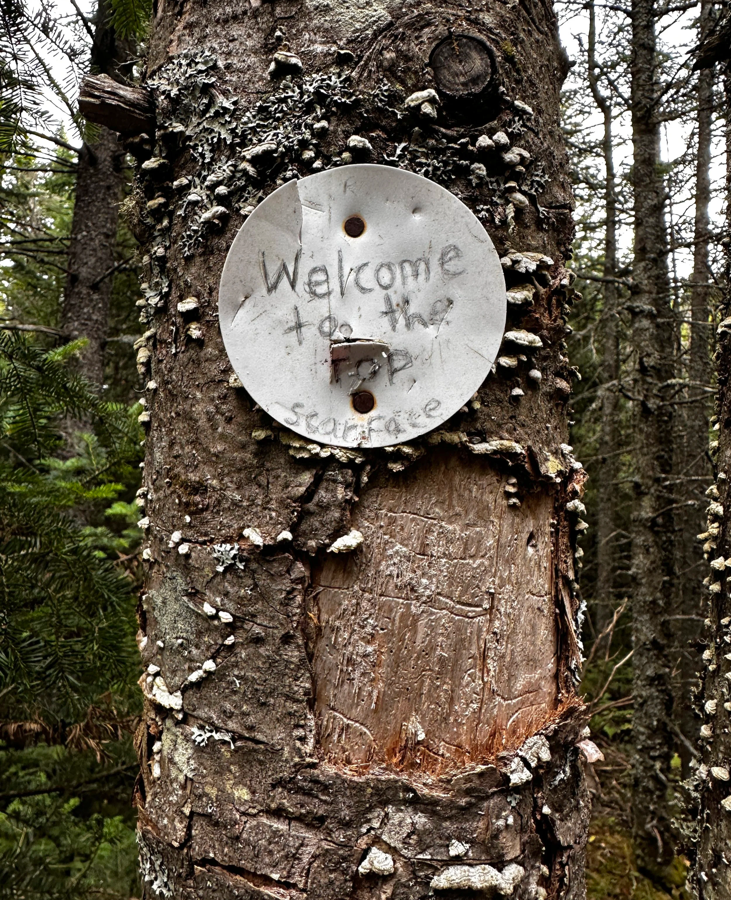
As the base of Scarface grows near, it’s unrelenting grade is clearly visible ahead; with good footing, the trail climbs the western flank and skirts a wooded ridgecrest, offering a brief lookout here and there - a momentary reminder of the vast mountainous terrain outside of the surrounding canopy of foliage. After a ledgy scramble, the trail meanders and weaves tightly across the final summit ridge, cornering several switchbacks and finally terminating at a clearing akin to a large phone booth. A recognized tree dons a plain white disc upon which has been scribed: “Welcome to the top Scarface”. From the marked summit, there are no views, so after a few quick photographs, a breath in which to enjoy my present surroundings and a swap of soft flask in my running pack, it was time to descend peak number three.
8:47AM - summit of Scarface Mountain
The old tote road encouraged a swift pace and allowed a moment to slip into an autopilot state - cruising to listen to the body as a whole. Lungs, legs, feet, fuel and hydration - a good opportunity to check-in and see how things felt thus far; I was working toward staying prepared for climbs of later in the day.
Reaching the Ray Brook bridge, there were now DEC work crews with pry bars actively dismantling the old wooden span; the trail maintenance team did not seem upset at my presence, only asking for care as I passed back through their worksite. In the days following my Saranac Lake 6er journey I would read hiker reports of the bridge completely dismantled, necessitating fording the muddy brook to hike this peak (I believe the bridge has been completed by the time of this writing, winter 2026).
8:03AM - soft footing along the lower Scarface Mtn Trail
Saint Regis Mountain (2,880ft)
Start 10:17AM / 1hr 52min hike time / 16’58” average pace
6.58 miles / 1,791ft total elevation gain
The drive from Scarface Mountain to the Saint Regis Mountain trailhead offered the longest drive of the day; using this opportunity to rest, refuel and regain energy, I could feel the mid-morning heat begin to creep into the day as I embarked on yet another new-to-me hike, one which would offer the reward of a fire tower lookout from its summit - finally some good summit views. While I tried to remain in the moment, enjoying the process of being outdoors and journeying along these glorious Adirondack trails, I think the anticipation of checking off these six peaks had my mind questioning, “aren’t we there yet??” while hiking to the summit of Saint Regis Mountain.
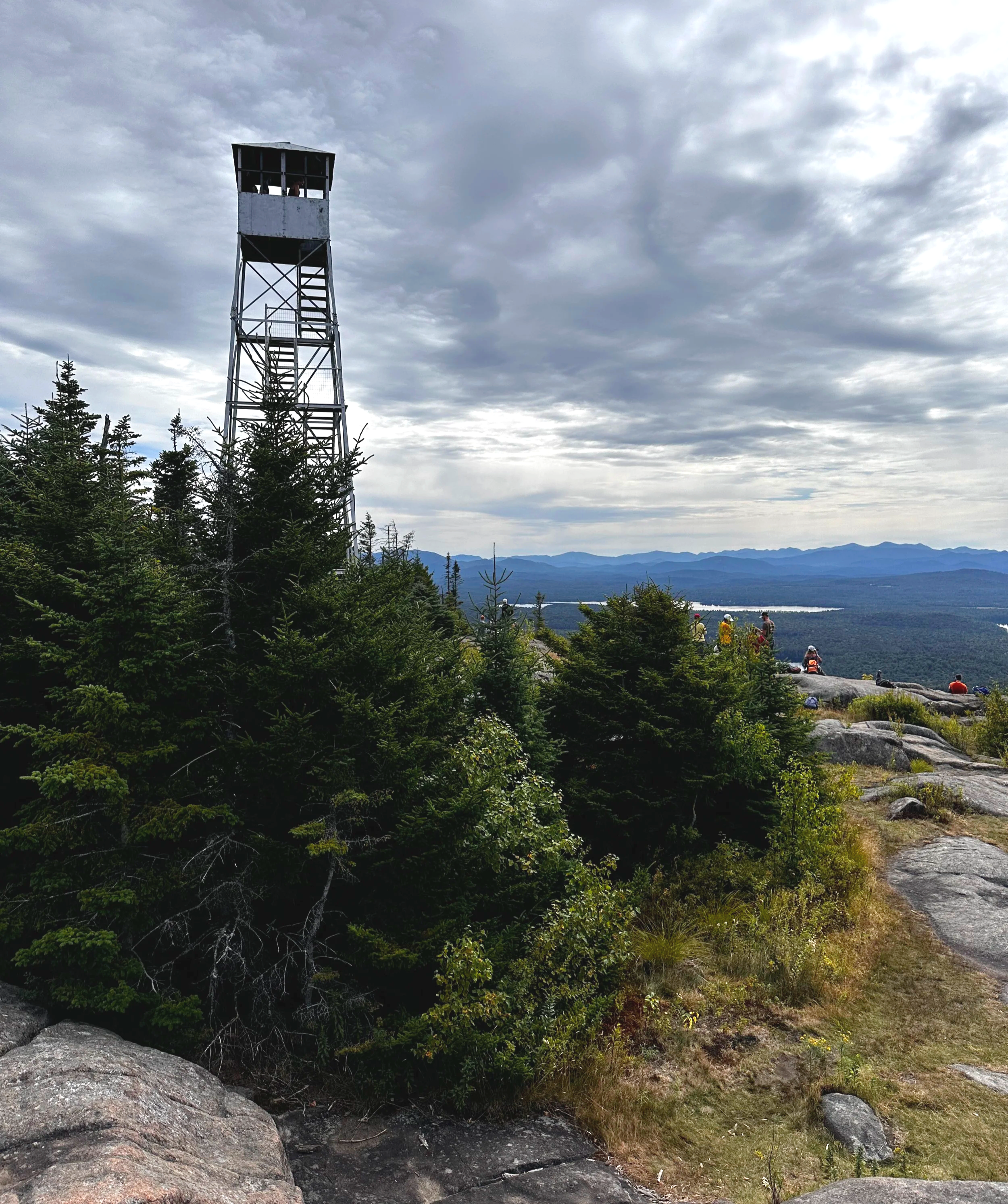
11:15AM - summit of Saint Regis Mountain
Offering a rocky footbed, especially in its later course, this trail flowed over several low rises before angling directly at, and clambering up the bouldery gully of its eastern face. The boulders were simply enormous, towering well into the surrounding tree canopy. With a final steep push, the summit crest approached and the trail swung around, hooking toward the final ledgy climb; then the steel tower came into view. While I had yet to see any other hikers on this weekday morning, the summit of Saint Regis Mountain contained what seemed like a full bus load of college folks out enjoying a lunch break. After a brief climb to the top of the old fire tower and taking a summit photograph for the hiking group, I began my trot back down to the trailhead.
Ampersand Mountain (3,352ft)
Start 12:44PM / 1hr 41min hike time / 18’47” average pace
5.36 miles / 1,877ft total elevation gain
The drive from Saint Regis Mountain to Ampersand Mountain took me back through Saranac Lake - and directly into downtown construction; one-way traffic and several surprise road closures, it was here I really began to question whether I could make up time to meet my goal of sub-twelve hours. Again, my goal was questioned when I approached the trailhead for peak number five, it seemed like most of today’s hiking traffic was parked at Ampersand. The official parking lot was stuffed with cars; more cars and trucks lined the roadside as far as I could see up Route 3.
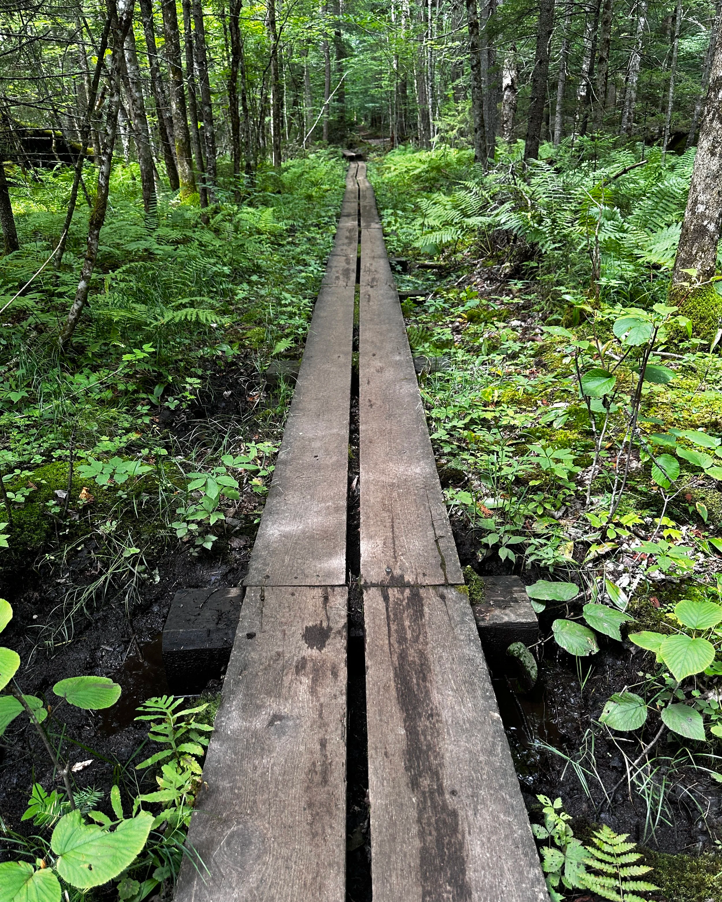
12:56PM - Boardwalk along the Ampersand Mtn Trail
Thankful for higher clearance, I parked half in a ditch and watched for traffic as I grabbed all the gear needed for my fifth climb and set my watch to record. With an eye on the time of day, I loosely jogged the initial easy grade, all the while catching glances from other day hikers, some even asking what my rush was all about! I did stop on the descent to talk with a family whose son was embarking on his 46er journey, the young mountaineer asked all about Colden and some of my favorite, classic Adirondack climbs; to see the next generation of conservationists and hikers light up with excitement when discussing places they look forward to exploring is very rewarding for me.
Perhaps it was having several thousand feet of climbing and twenty-something miles already in my legs for the day but the rocky, boulder-strewn ascent of Ampersand Mountain was a real burner. Knowing the pitch would soon ease, I pushed the pace even more, utilizing all four limbs to haul myself up the trail, which soon became a regular rock staircase. The quality of this mountain rock really fascinated my mind, the sheer size of boulders were otherworldly and almost appeared melted as I grew near to the open slab summit. Following painted blazes on rock, I soon reached the US Geological Survey benchmark disc at the peak and did all I could to soak in those precious mountain views. During my brief stay atop Ampersand Mountain, I worked to pick out familiar peaks and name places I had once visited.
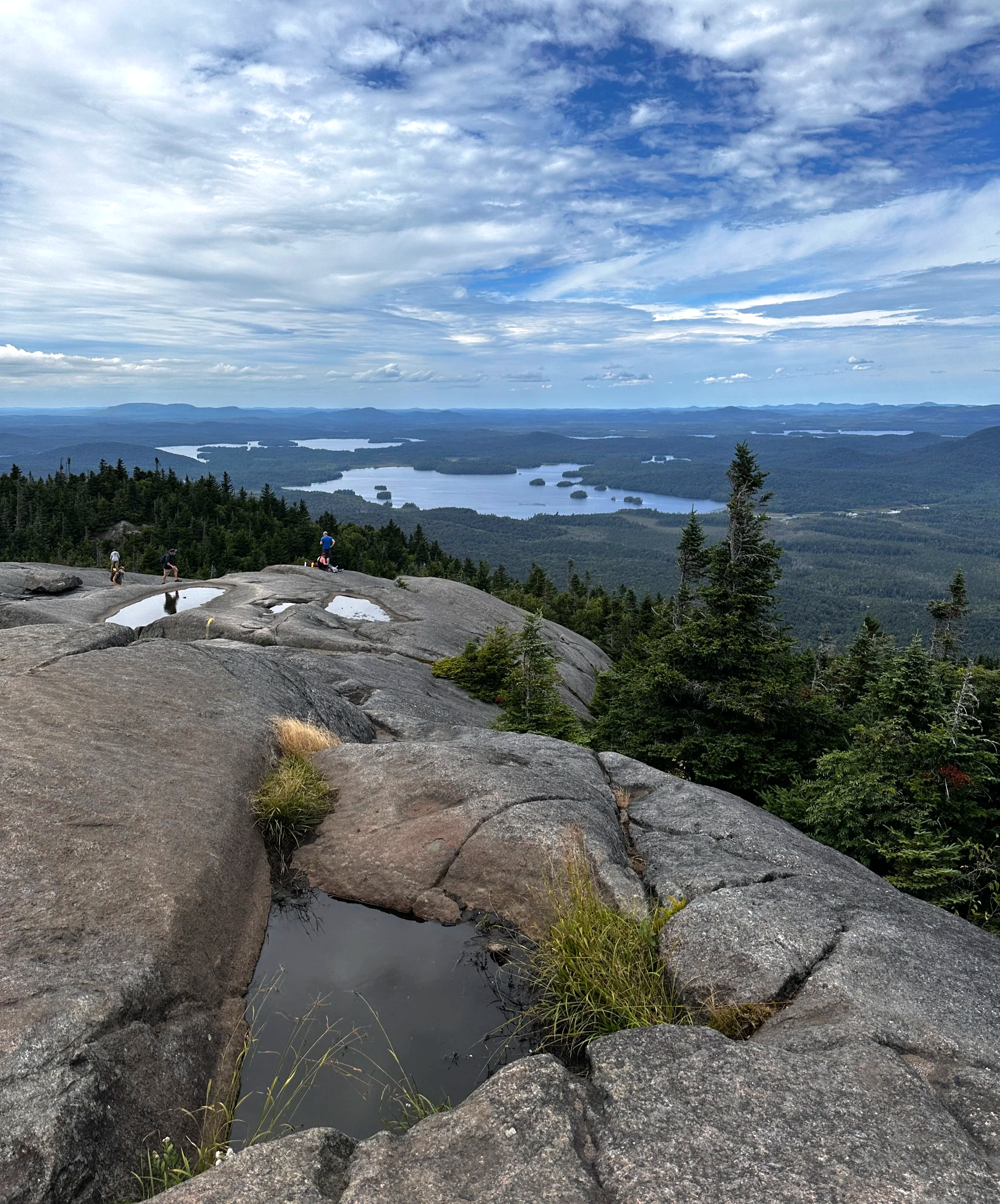
1:39PM - summit of Ampersand Mountain
Once back down the steepest sections of the Ampersand Mountain Trail, I glanced at the time remaining to meet my goal and realized, with the toughest and longest climbs behind me, this thing of sub-twelve hours was becoming a possibility. Like a NASCAR pit crew, I tossed my UltrAspire running pack in my passenger seat and sped off toward the Berkeley Green, hoping for the gift of easy parking during this time of the day.
Baker Mountain (2,459ft)
Start 2:39PM / 1hr 2min hike time / 17’33” average pace
3.54 miles / 961ft elevation gain
Finding parking at a public lot adjacent to the Green, I strolled past my start and finish point, the reality of my goal still seeming just slightly out of reach - I had one final peak to climb remaining which consisted of the shortest ascent bookended by a bit of road running; I hoped to have saved the easiest trek for the end of my day.
From Main Street, I swung onto Pine Street, passing through a residential district before tracing the northern shore of Moody Pond - finally, my final peak came into view. The pathway was more of what I had already experienced - gradual grades to start with a steep finish; conifer needles covering the bare rock slabs made for some slippery footing. Naturally, there had to be some difficulty in such a short scamper as Baker Mountain, although, none of the kids on the trail seemed to be phased by the pitch, one even ran past with a stuffed fox in hand.
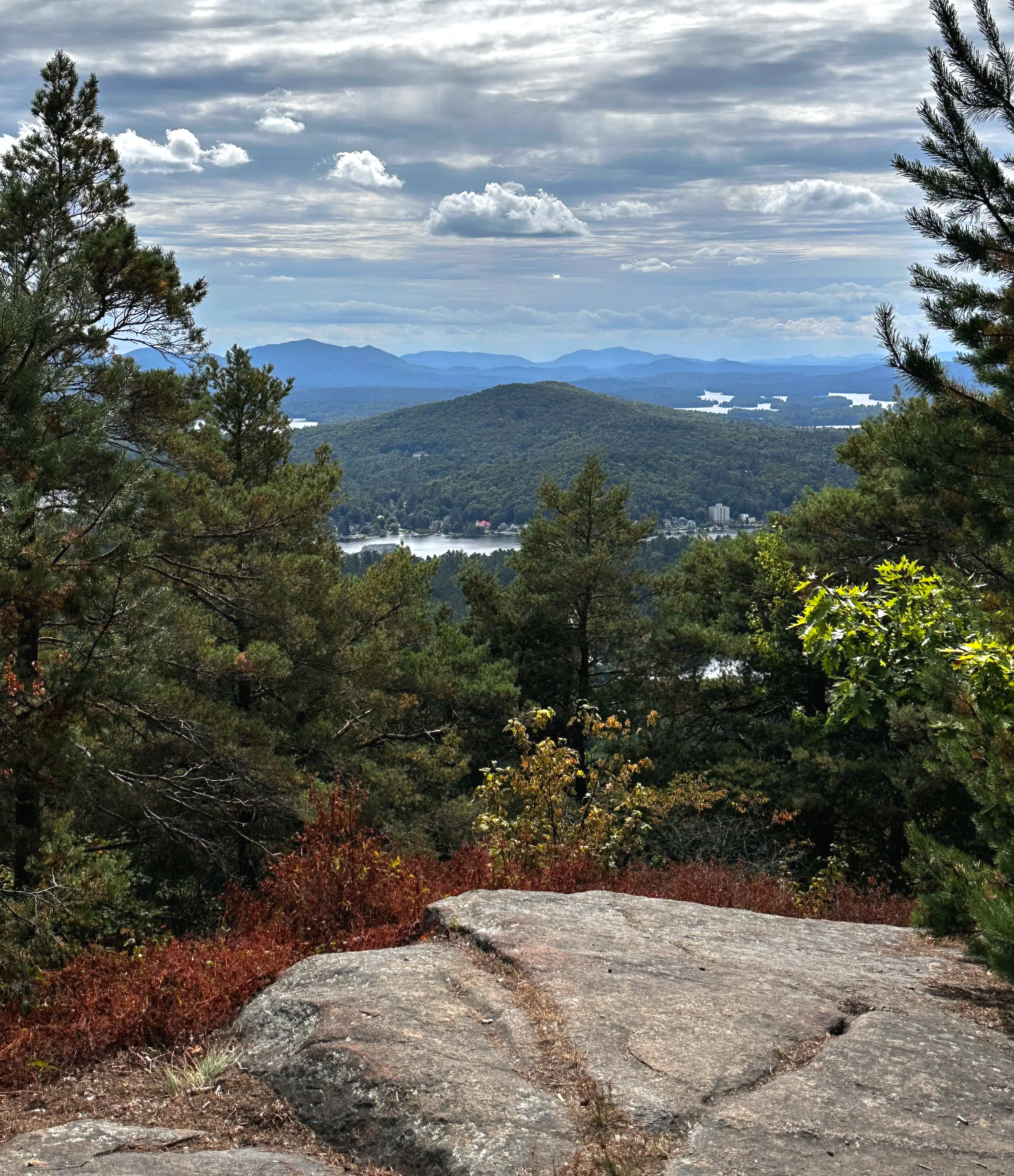
3:10PM - Baker Mountain outlook
From a restricted outlook, I could glance back toward Saranac Lake and to places I had been earlier in the day, the summit was perhaps one hundred feet beyond. The Baker Mountain summit offered no reward or signage for its guests, in a way, this encouraged me to continue along my journey; back down the trail and onward toward my real prize of the day. Careful footing on pine needles and rock slab brought me back to the pavement for a final mile of easy running back to Berkeley Green. As cars passed and Baker Mountain faded into a memory, I had several minutes to just run and reflect on my day of scaling mountains; the stunning forests and rocky landscapes, the driving segments to and from, the iconic vistas and various lookouts - all reminding me why I continue to cherish these timeless mountains of my youth.
3:12PM - wooded summit of Baker Mountain
With the Green in sight, there was no fanfare or finish line crew awaiting my arrival; in that moment, only I knew what the previous several hours of my day consisted of. At 3:41PM, I found my starting entry in the registry book and signed for my completion: eleven hours and eleven minutes - I had not only completed the Saranac Lake 6er Ultra challenge, but also under the Skyrunner cutoff time.
A lone spectator to my bell ringing watched on, she was using the free downtown WiFi. She was well aware of the feat I had just embarked on and asked about the trails - my new friend for that moment was an Adirondack Summit Steward and Trail Maintenance volunteer. With a finisher photograph taken, we parted ways, I had half of a watermelon waiting and plenty of snacks to keep me busy for the four hour ride home.
For me, this was a fine day out in the mountains.
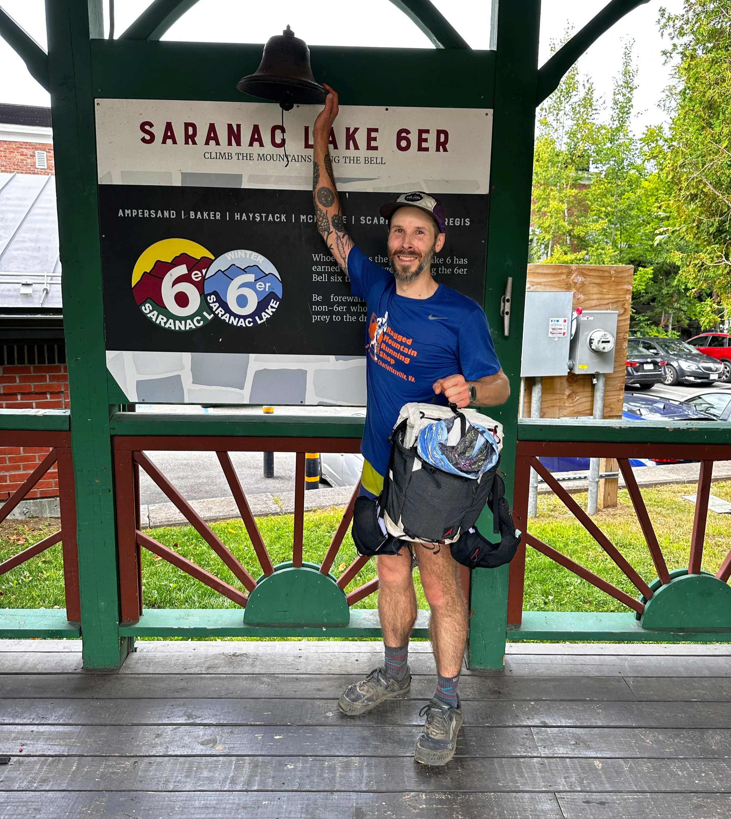
3:41PM - Successfully finished!
Overall stats for the Saranac Lake 6er Ultra:
31-miles (on foot)
9,200ft elevation gain
11-hours 11-minutes