
Groton State Forest: Peacham Bog
A 7,000-year old floating mat of partially decayed sphagnum moss, fallen trees with various other plant and animal remains, mixed in a slurry of acidic water. While other local trails remain closed due to mud-season, Groton State Forest would prove a handsome choice, its nascent forests just beginning to burst with vibrant earthen hues, its canopy once again becoming home to a cacophony of alerts, calls, shrieks and shrills.

Departing along the Little Loop Trail
Located on the northern end of Lake Groton, the hike began at the Groton Nature Center on Boulder Beach Road. At the eastern side of the entranceway, the network of soft paths begin which soon radiate into nearly every direction a hiker could want to visit, making the Nature Center a great basecamp in which to depart. With the park facilities open to the public Memorial Day - October, parking at 7:30am in early May was no issue.
Departing the Nature Center parking area along the Little Loop Trail, this initial path also leads toward the Big Deer-Osmore Pond trails, the Coldwater Brook Trail as well as the Peacham Bog Loop trail. As the Little Loop Trail encircles back to itself before branching in other directions, hikers are free to choose either side to begin along; to keep things interesting I veered right, in which to meander along the eastward side of the loop.

Trailside glacial erratic
For 0.5-miles the trail gently rolls along, passing several moderate-sized glacial erratics along the way, large boulders which had been deposited by a receding ice sheet long ago. Being that the park had yet to officially open for the season, it was not a surprise that several smaller trees and branches had toppled over the winter and had to be stepped over; smaller limbs and branches were tossed trailside while larger blowdown would have to wait for the real trail maintenance crew.
The hardpacked dirt path underfoot is softened by last years fallen conifer needles and leaf duff; all around, Canada Mayflowers bring a rich greenness to a drab, olive carpet of awakening mosses. New hobblebush leaves are nearly dinnerplate-size already as young spruce and fir boughs help bear their weighty branches.
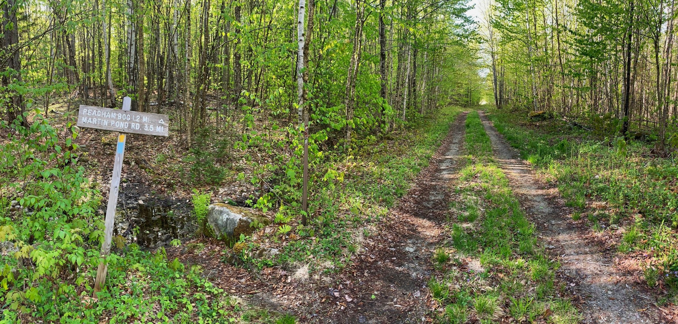
Crossing Coldwater Brook Road
As the footpath makes a northerly swing the morning sun shines bright, just up ahead is a break in the canopy as the trail passes a boggy area with a glimpse of the 2,047’ Jerry Lund Mountain just above the distant forest top; beyond a fallen spruce rests a bench which once provided a view, now seemingly grown-in and nearly forgotten as mosses take hold.
Reaching a 4-way intersection, the Peacham Bog Loop Trail diverges at the first right; trekking now eastward the trail soon passes over Coldwater Brook atop a wooden bridge. Until the Coldwater Brook Road is reached, the path ascends a gradual 110’ atop continuously soft paths, meandering between small boulders along the way.

Peacham Bog Trail
Upon crossing the old logging road, the Peacham Bog Loop Trail soon grows rocky with several wet patches, most of which can easily be avoided by stepping atop small boulders; evidently previous hikers had a similar thought as the mossy rocks display bare, boot-trampled tops.
The lime-green hues of newly unfurled hardwood leaves contrast delightfully with the array of russets and tan shades of their fallen brethren; the scent of fresh spring soil lingered in the air only to be made sweeter still by several localized stands of spruce and fir. Painted Trillium popped up trailside, several showcasing stunning white and pink three-leaved blooms.

Trailside Painted Trillium
As the path becomes mildly rugged with rocks, roots and lingering mud, spruce and balsam begin to comprise a majority of the surrounding forest, mosses continue to blanket the floor as Threeleaf Goldthread blends in, their dainty white flowers popping at foot-level as far as the eye can see. Alternating stretches of dry, soft-packed trail transitions swiftly into mossy, damp earth where exposed roots abound, sections of log boardwalk help elevate hikers above soggy sections.
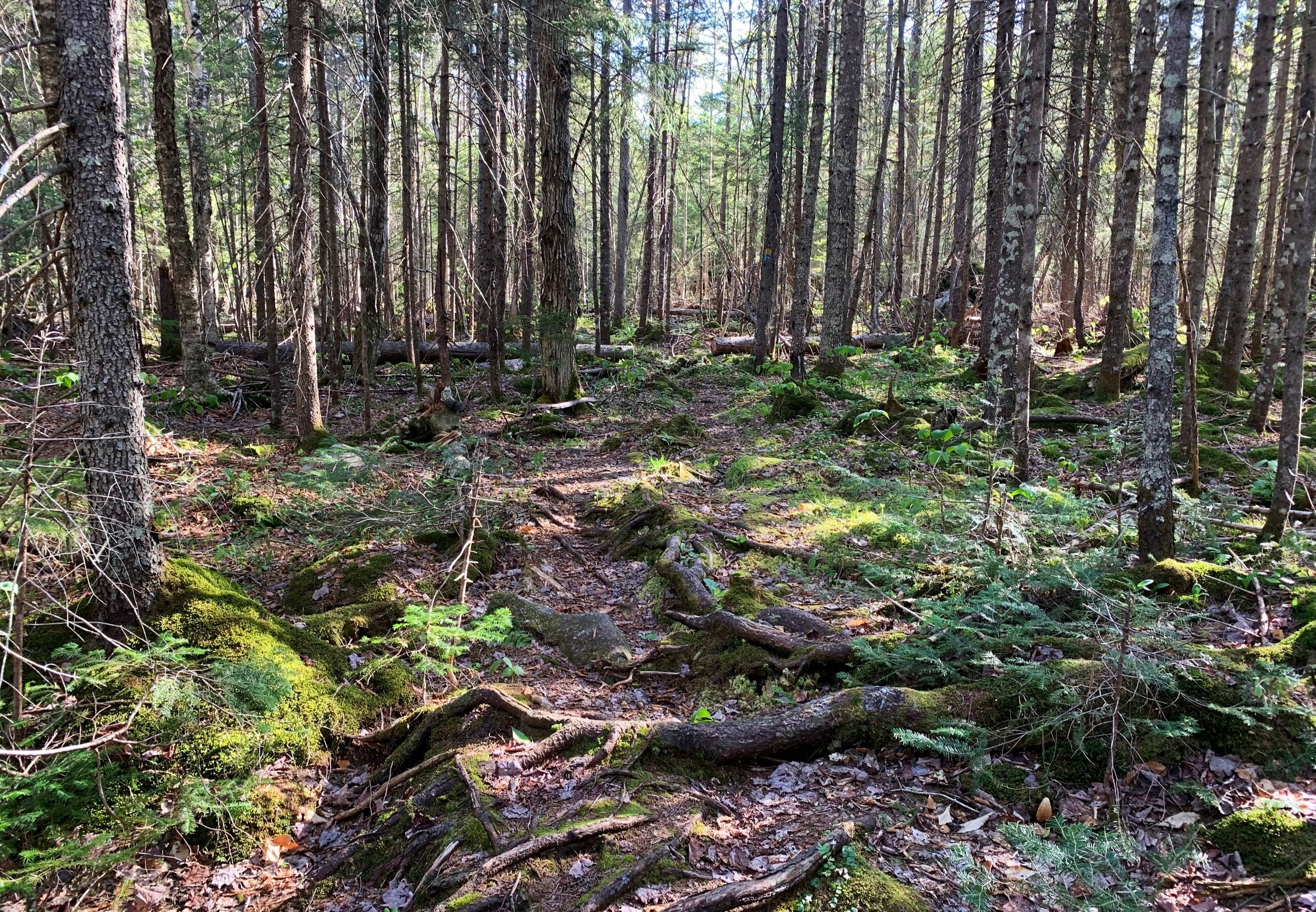
Coniferous canopy enroute to the bog
Upon reaching the ridgecrest the trail proceeds near-level for a distance along a narrow treadway; perhaps until the later in the season a relatively sparse understory allows one to cast a view far into the distance and search for the moose who left their massive imprints in the mud. At 1.3-miles since departing the Coldwater Brook Road, the earthen pathway transitions to steady string of boardwalk as one enters the Peacham Bog Natural Area; here, signs advise hikers to remain on the wooden boardwalk as to not trample the fragile plantlife.
Entering the 200-acre, domed bog, the landscape is dominated with scrappy black spruce, tamarack can be found as well, both species working to create a dense surrounding ecosystem with various scrappy shrubs mixed in. Underfoot, patches of small pitcher plants can be found, their reddish hues contrasting with the moss blankets and low bushes.

Entering Peacham Bog
At a three-way junction, an unmarked side path diverges north a short distance at which point it dead-ends at a landing, a bench with a kiosk describing the bog accompanies a stunning panoramic view into the heart of the wild area. Turning back from whence one came and proceeding southward through the junction guides hikers along the final stretch of Natural Area, where thin pencil-like spruce stand tall, nearly enveloping the pathway.
Continuing eastwardly, another three-way junction is encountered; Martin’s Pond Trail veers left while the Peacham Bog Loop Trail swings to the right - both atop an old logging road which is now a wide, multi-use trail. As the path swings south and becomes a grassy forest road, Red Brook Road continues straight and affords a vast glimpse across a wide, boggy area of Red Brook.

Northerly views into the bog
Gradually the Peacham Bog Loop Trail transitions from obvious forest road to a hiking footpath, meandering through logged hardwood forest with spotty, dark-green coniferous patches along the way. Trekking now westerly, the path contains convenient stonework which helps diverge a small waterway off the hiking path, overall the trail remained relatively dry despite mud-season being full-swing in Vermont, thanks to carefully lain stones and commendable trail building.

Southern side of Peacham Bog Loop
As the path begins a series of switchbacks, it leaves an old logging road which can be seen as the narrow footpath now intersects, weaving across several times as it switchbacks downslope; the old road having been filled in with brush and various debris remains obvious but untraversable at this point. Following a gradual descent over sturdy footing, the path exits onto Coldwater Brook Road; either direction will lead back to the Groton Nature Center, but as the sun was now enticingly warm amidst the chilly springtime air, I followed the dirt and gravel road for a remote 0.7-mile trek back to Boulder Beach Road, passing a beaver pond and several bridged streams enroute.
Overall stats for the day:
5.87-miles
3hr 18 minutes
725’ elevation gain
Peacham Bog high point - 1,565’
