
Mts Flume + Liberty via Osseo Trail
This would be my third trek along the Osseo Trail, but perhaps the first that I actually remember well; The first occurred at the end of a single day ~32-mile Pemi-Loop where I was a bit calorie deficient and might as well have been hallucinating; the second was more or less a repeat but spread out over a two-day backpack excursion along the same counterclockwise loop; 13-hours into a 16.3-hour day and was descended entirely with a headlamp beam.
Thankfully, this would be a much earlier start time and for us and a first along the Osseo Trail in winter. The old Osseo Trail (prior to a large 1983 reroute due to construction of the Clearwater Condominiums), began further west along the Kancamagus Highway (NH 112). Since, the trail begins at the large Lincoln Woods trailhead further east.

Crossing the East Branch Pemigewasset River
We knew from several days prior, while hiking the 16-mile out-and-back to Owls Head, that the Lincoln Woods Trail was packed out, today it was essentially a flume of ice down the center from days of afternoon thawing and overnight freezing.
Along the western side of the East Branch Pemigewasset River, quick time was made over the initial 1.4-miles, bringing us to the first junction along the trail. Here, the Osseo Trail cuts off left and follows the Osseo Brook west/northwest toward Franconia Ridge.

Lincoln Woods Trail
As we traced the brook along the near-flat section, Alanna and I remarked about how excited the sound of the brook made us back in September while zombie-walking the final miles of our two-day Pemi-Loop.
Passing a grove of hemlock and re-entering open hardwoods, the trail skirts the bank of the brook, utilizing an old incline logging railroad bed whose width is still recognizable. The Osseo Brook goes in and out of view twice, which I still recall from notating minor progress in the dark several months prior.

Switchbacks along the Osseo Trail
Today found me in awe of the slide-streaked domes and humps just off trail to the west, the pointed bumps composed high points of the southeasterly ridge off Whaleback Mountain.
Gaining nearly 1,100’ since departing the Lincoln Woods Trail, the 2.0-mile mark is hit from whence the path begins its long series of switchbacks, passing the East Peak of Flume and continuing to climb the eastern ridge of Mount Flume. Here, the trail becomes enclosed in a tight canopy of spruce as it zig-zags up the ridge.

The Downlook into the Pemi Wilderness
Soon, a string of wooden staircases aid in ascending or descending, today these were completely hidden under a depth of snow, glazed over smooth from hikers glissading - or buttsliding - when the snow was soft. Luckily someone had kicked steps up the steep slopes which we utilized on both ascending and descending along the Osseo, as we were the only folks to use the trail during our roaming.
I had noticed the “Downlook” sign several months prior while descending in the dark, with no view to be had I simply carried on. Today we were able to see just what was missed - such a view from ~3,600’ into the Pemigewasset Wilderness! The Bonds and Twins were all in view, Owls Head appeared massive and so close.

Mt Liberty from west-face of Mt Flume
Several other staircases are passed, more of which were under snow and ice - I recalled navigating the incline via short and steep steps while carrying a full pack of camping gear. As we began to level out, the wooded eastern side of Mount Flume came into view, showing just how far we had left to ascend.
It was so interesting to see the trail in winter as I recall very clearly how this flatter section was terribly muddy with boat-loads of roots to dodge, all this was out of sight and smoothed right over in our packed snowshoe trail.

Alanna atop Mt Liberty
As the current Osseo Trail swung toward the north, it was still possible to pick out the original Osseo cut through the forest - I’ve heard this section receives occasional maintenance and TLC from kind locals, it is on my to-do list but perhaps after ski season ends and the hoards of winter tourists vacate Lincoln for another warm spell.
The trail grew steeper once again as it made the final 0.4-mile ascent up nearly 400’ to meet the Flume Slide Trail. As this was the last sheltered place to stand on flat ground, we used this alcove to add layers and windproof jackets before taking on the exposed mountaintop, forecasts called for 30-mph winds and we certainly could hear the gusts above our heads tearing through the scrubby conifers.

Looking back on Mt Flume from Mt Liberty
The summit of Mount Flume (4,328’) has always been one of my favorite locations in the White Mountains, it exudes the raw power of nature. Despite the onslaught of wind, I couldn’t pass the narrow band of trail which looks down into the wildly steep chute and recall my ascend of this place, the west face of Mt Flume back in December.
Once Alanna and I had our fill we picked up the pace and began a trail running trot ~275’ down the narrow trail. Given how gravelly and wet this southern stretch of Franconia Ridge Trail is in warmer weather seasons, I’ll happily accept a winter traverse anytime.

Mt Lincoln from Mt Liberty
Years ago, during my first summer jaunt between these mountains, I actually thought this stretch of trail was merely a terribly eroded herd path of the White Mountains - my heart is won over by not the footing, but the narrow trail which slices through such a dense fir stand.
Bottoming out in the col between Mts Flume and Liberty (which consists of two minor sags), our pace decreased as we prepared for the ~400’ slog back up to the rocky summit of Mt Liberty (4,459’).
Thrilled that the incoming cloud band had held off for us, we roamed around and took some photos - a very white top of Washington (6,288’) had come into view above the Bonds, as well as the jagged ridgeline of Mount Lincoln (5,089’) further down the Franconia Ridge.
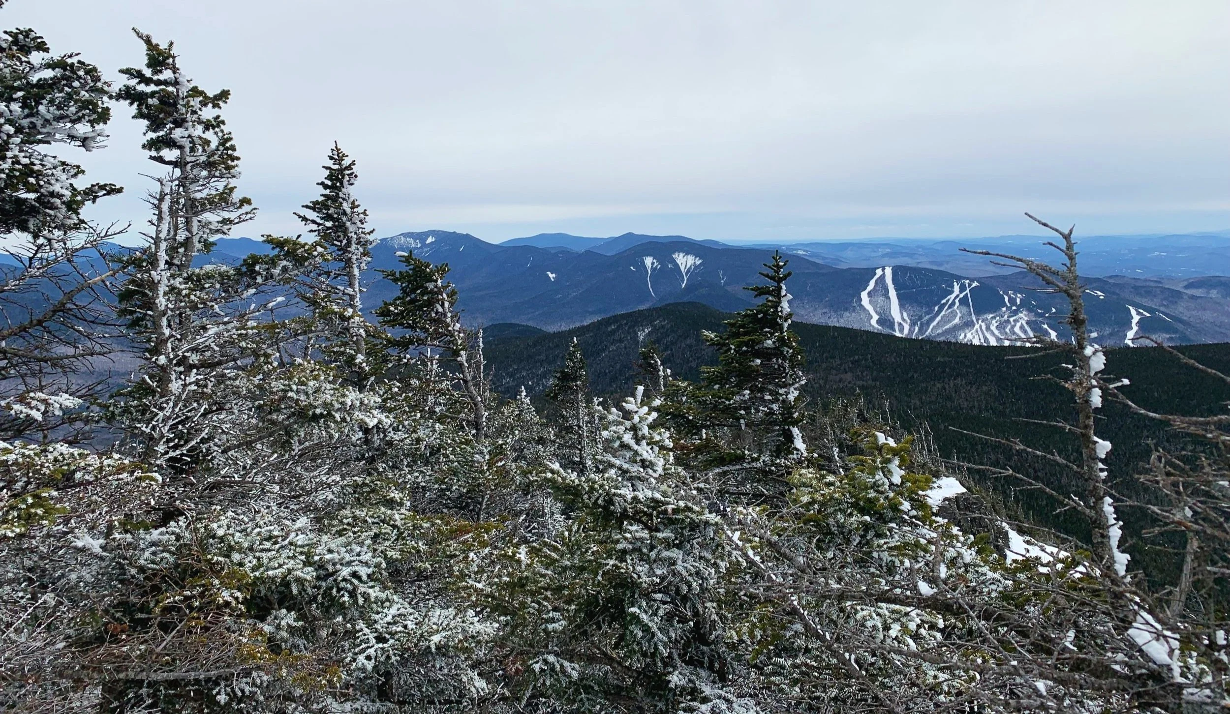
Scar Ridge and Loon Ski area
Oddly enough the winds had completely subsided while on the northern peak but we walked right back into the gusts upon returning to the bare rocks of Mount Flume. With care we retraced our steps down the steeper sections of the Osseo Trail - an unintentional buttslide here would have surely ended with a face full of spruce!
While fast-hiking our way back down the trail, we stopped to take in sights as needed. I cannot wait to come back and explore more in warmer weather, but it was such a gift to see this trail not only in daytime but in a frozen winter wonderland. This time tomorrow the mountains will likely be coated in many inches of fluffy powder; ready to fall down the neck of trail-breakers and brave winter hikers. I’m certainly ready for another month or two of winter hiking conditions!
Overall stats for the day:
13.39-miles
6hr 23 minutes
5,026’ elevation gain
Mount Flume - 4,328’
Mount Liberty - 4,459’