
Mt Dartmouth + Millen Hill
For a mountain that is noted as having a viewless peak, it more than makes up for with its nearly constant ridgeline lookouts toward the east - to the towering, white-capped Presidential Mountains. Jefferson, Clay and Washington all rise up, their higher elevations glowing a brilliant white from the margin of tree line to alpine summit top.
With conditions as favorable as they were for yesterday’s snowshoe bushwhack to the 3,671’ summit of Mount Deception, I thought, why not a visit to the other side of the Dartmouth Range - to the 3,727’ summit of Mount Dartmouth, visiting 3,376’ Millen Hill along the way.

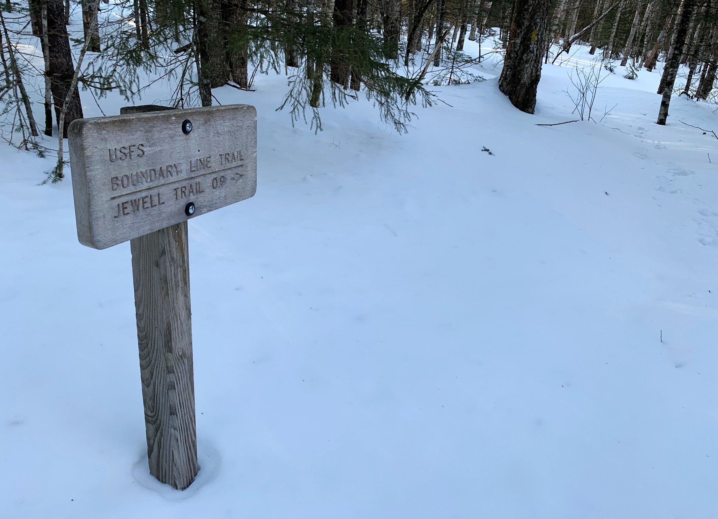
Ammonoosuc Ravine Trailhead
Beginning this adventure at the Ammonoosuc Ravine Trailhead, I was not alone on this Wednesday morning as several other hikers strapped winter gear to their loaded packs; at 7:34am my car was locked and I trekked across the Base Station Road to the Jewell Trail which departs over the road embankment. For a brief 0.4-mile section I shared the trail with Mount Jefferson’s hikers, following recent bare boot tracks across the Ammonoosuc River, which was made easier and safer by way of narrow wooden bridge.
Departing the packed trail I veered left onto a solid snow crust which had yet to see any traffic since the last snow fall. The Boundary Line Trail is essentially a straight line north-south which connects the Caps Ridge Trail with the Ammonoosuc Ravine Trailhead, perfect for what I had in store today.
Meeting up with the Jefferson Notch Road
Good time was made along this ~0.8-mile stretch of gently rolling pathway; floatation was spot on which helped with crossing some of the open, narrow waterways; wooden planks were visible beneath the 2-3’ snowpack on several minor crossings while, the wider, larger waterway, Clay Brook, was hopped with haste across a thick plume of snow bridge. With temperatures well below the freezing point, concerns of this 3’ snow bridge collapsing under my weight today were minimal, but regardless, with the sight of open water beneath, I tread lightly across.
At 1.2-miles I veered right to join the Jefferson Notch Road, which is more of a snowmobile super highway during this time of the year; upon noticing that all tracks appeared days old any concerns of playing Frogger with snowmachines diminished, I was able to roam in peace with Jefferson Brook babbling away just off to my west.

Mt Jefferson rising up
Good time was made as the morning sun rose up from behind the massive mountains ahead, here on the hard packed snowy surface, ice was not an issue. Snowshoe travel was quick and efficient as I peered into patches of open forest, hoping that I’d find myself in some of that nice forest very soon.
Reaching the switchback in the road, Jefferson now comes fully into view, taking over the vista. I followed what appeared to be fresh coyote tracks with some smaller woodland creature in the dusting of snow, at one point they both split directions and went opposite ways into their respective forest territories.

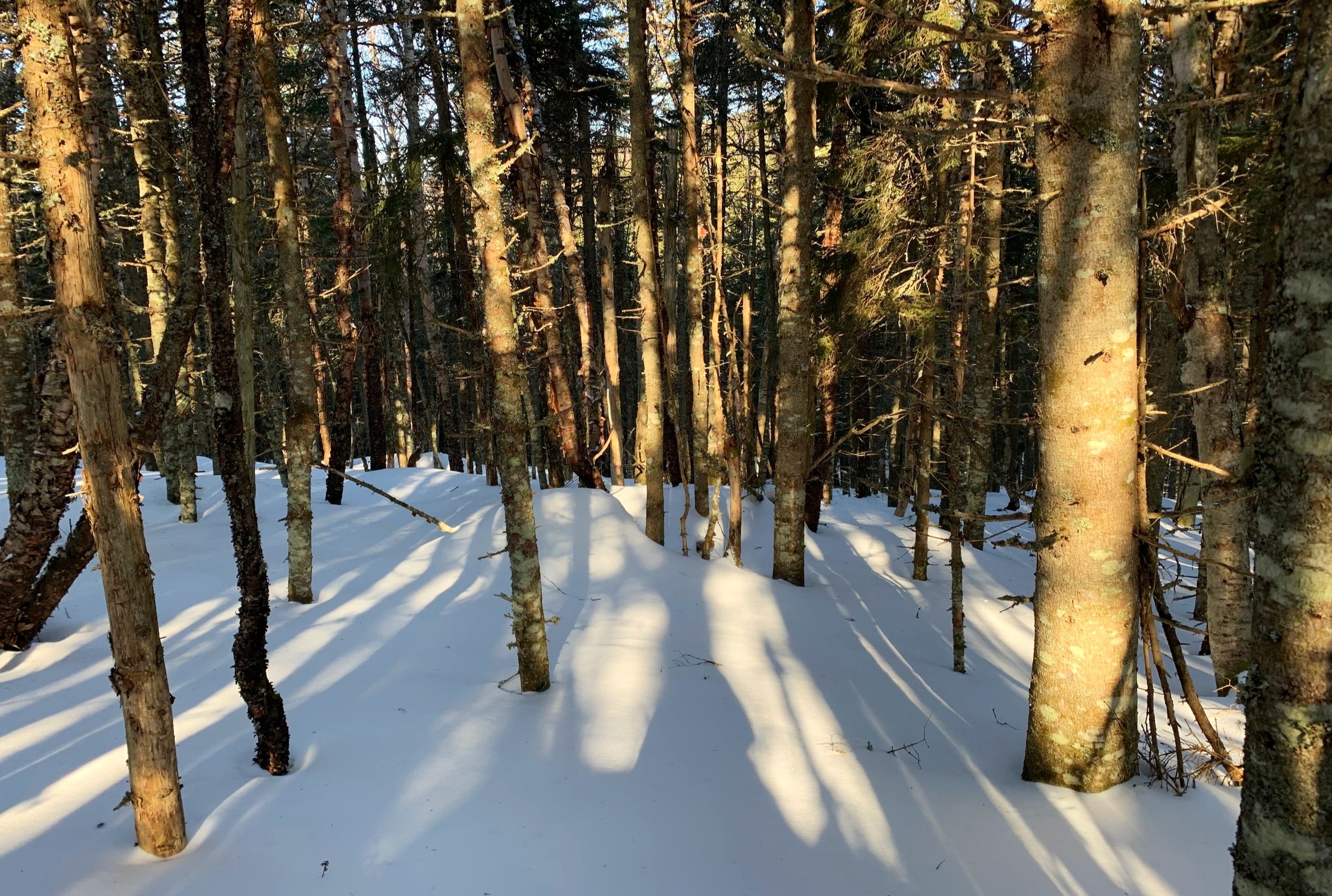
A more “friendly” blowdown patch
Reaching Jefferson Notch at 2.7-miles, I stopped to check out the National Forest signage before making my dive into bushwhacking. For the short trek out to Millen Hill I began essentially at the height-of-land and directly into a welcoming forest, I hoped for it to remain this way.
Not long into the bushwhack I met the infamous patch of blowdown, which was initially simply mature trees - some toppled while most leaned on their neighbors. All of which were easy to duck under or hop over, so I continued on my trajectory, bee-lining toward the high point of Millen Hill.

Presidential views from Millen Hill
Within several minutes I found out why it is suggested to proceed more to the north, around this patch; a scene of young conifer boughs were all I could see, claustrophobia-inducing indeed! This required some swimming and pushing through the tangled branches - knowing somewhere on the other side was the welcoming, open canopy that I desired.
Eventually, the forest did open up and the ascent turned into weaving around standing trees while watching out for pesky air pockets of nothingness alongside occasional downed trees. Once I could see further up the mountainside I knew I could safely steer myself away from any more thick sections.

Millen Hill summit
There certainly were a ton of blowdown patches on the short ascent up to Millen Hill, probably made exponentially easier with the deep, solid snowpack. Reaching a patch of blowdown just prior to the high point revealed the magnificent views out toward the middle Presidential Range; it truly felt remote on this stretch of mountain range, knowing most hikers attention was on the other, higher peaks and not where I was roaming.
Ascending toward the high point was pure bliss, meandering around mature conifer trees and never through any displeasing sections at all, this forest felt just right in that moment. Once at the high point, I located the summit register and logged my climb while thumbing through several older entries, noticing that this register had been placed 11/3/2007, replacing an older, more dilapidated model.
Descending into enjoyable woods of the col
Retracing my steps back to a location which had a northwesterly view, out toward my next objective, I left the summit area and began onward toward Mount Dartmouth. Honestly, I was in awe at how enjoyable this col really was; snowpack was solid and quick, the trees were spread out and I could just pick a line straight at the low ridge of the mountain ahead and trek straight at it.
Climbing began gradual enough as the pencil-like evergreens grew tight, forcing a wiggle-dance of sorts, weaving my way through the trees while trying to not become impaled on spruce twigs. The ascent up to the lower ridge top went rather smoothly, hitting only one minor patch of blowdown, which I was able to walk straight through on the supportive snowpack.

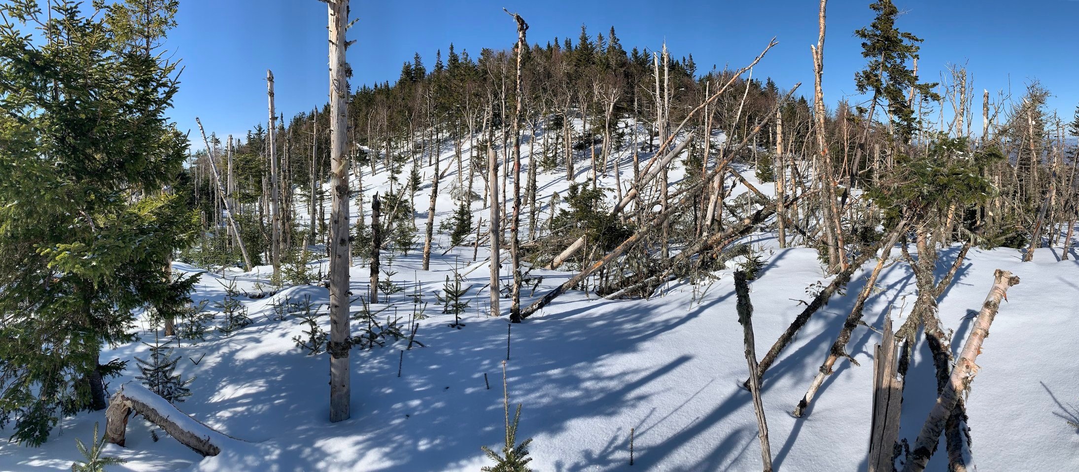
Pleasant grade ascending up to the southeast ridge
I had heard reports of other climbers sticking toward the north of the ridge due to blowdown patches but found this unnecessary; initially the ridge top opened up to more incredible views out to the Presidential’s, now several of the lesser Adams peaks also rose into view.
There once was a trail, the Mount Dartmouth Trail, which I believe ran over or near the ridge top - I thought for sure at times I could still recognize the old corridor amidst the surrounding canopy. Sure, there were times when the conifers could become overwhelmingly thick, but this was all completely avoidable by veering momentarily toward the north, perhaps this is what the reviewers had been referring to.

Mts Jefferson, Clay and Washington
I really could not believe how efficient travel across this ~3,500’ ridgeline, truly a joy to find myself here after all the thick junk I’ve “swam” through lately. Upon making the southwesterly swing toward the mountains high point, I could see the uppermost branches of some young spruce and fir sticking up out of the snowpack, giving an idea of the depth and what lay buried beneath my snowshoes.
Just prior to the final climb up to the summit of Mount Dartmouth I came to an older blowdown section that really revealed the contour of the summit dome, a very unique side-profile view of the mountain. While still atop a solid freeze/thaw snowpack I began up the exposed side and henceforth mature conifer forest, which topped its peak.

Easy going along the ridge top
Bobbing and weaving around more isolated areas of blown down conifers brought me to the canister and summit register. While signing in and logging my ascent I recalled how there was a time (recently) that this mountain range completely intimidated me - the unknown existed in these trailless hills; I considered the Dartmouth Range to be a true, untrampled wilderness amongst the popular tourist destinations next door.
Over these two days of hiking in the range, while I have barely scratched the surface of what these mountains have to offer, I appreciate the contrast from Mt Deception with its ledges and steep, rocky climbs to where I found myself today, Mt Dartmouth with a lovely ridgetop traverse, full of breath-taking vistas; beautiful forest, of which the scent of sweet balsam candle lingered in the air. I was happy to have not found the “giant bull moose guarding the summit canister”, whom, apparently, the last party to ascend had bumped into.
Final ascent up to Mount Dartmouth
After a few sips of warm tea and a pause to simply breathe in and listen to my surroundings, I departed my summit getaway; retracing my steps and making new, more streamlined routes wherever I could. The early morning sun had never felt like such a welcoming embrace than with a grand panorama of the Presidential’s.
While not wanting my journey along Mount Dartmouth to end, I’ll certainly be back to explore these enjoyable woods some more. On the trek out, instead of following my tracks through any rougher, denser patches, I took a word of advise from a prior bushwhacking report (thanks Liam), and paralleled my ascending tracks ~500’ north to deviate around the lower blowdown patches.
I followed my newer track back through recent moose activity and onward to meet back up with the Jefferson Notch Road, this time departing forest slightly past the hiker parking lot. The remaining trek out was all for fun, jogging a sub-14 minute pace with mountaineering boots and snowshoes, coasting down the snowy roadway and retracing my still-frozen steps along the Boundary Line and Jewell Trails.

Mount Dartmouth summit
On the trek out at 10am, the snow was beginning to soften just enough to gather on the underside of snowshoes, to alleviate this minor inconvenience I tried to remain in the shadows, on the more frozen snow.
While the mighty Presidential’s will always occupy a place in my heart, for their immense scale as one clambers over the jagged boulders on Mt Adams or traipses around the towering Boott Spur, becoming but a tiny speck upon a vast, rocky landscape; the Dartmouth Range contains a similar, but completely different feral side of wilderness, which has seemingly become a rarity these days. It’s vast, pathless woods do not direct the hiker to certain lookouts or places of interest, it is up to the hiker to roam free and locate these places on one’s own. There seem to be an endless supply of nooks and crannies in which to explore in this mountainscape; ledges to sit upon, lovely stretches of forest in which to roam and most importantly - an abundance of silence.
Overall stats for the day:
9.14-miles
3hr 39 minutes
2,238’ elevation gain
Millen Hill - 3,376’
Mount Dartmouth - 3,727’