
Mount Elbert (Colorado HP)
With coffee in our cups, and the mighty Tetons in the rearview, Alanna and I bade our new favorite mountain range farewell; rain fell, but only during the early miles of our 440-mile commute to the next destination: Leadville, and the Mount Massive Wilderness. Here, we would spend a restful evening at the Elbert Creek Campground; while free, dispersed camping is available throughout early Forest Road 110, we appreciated the closer proximity to the Mount Elbert Trailhead.
Good morning for a twilight ascent
Down a long, bumpy forest road we drove, as dust flew into a mushroom plume behind the Subaru; passing so many full, free camping areas had us wondering if all the actual campgrounds were also full. From the dusty road I could spot at least one vacant site; driving into the campground loop, we found the last remaining vacant spot, and grabbed it. The vault toilets were 150’ away, our new home had several mature pines to block the view of neighbors. We had a picnic table, and a fire ring which we did not intend to use: perfect set up.

Beginning along the spur to the CT/CDT
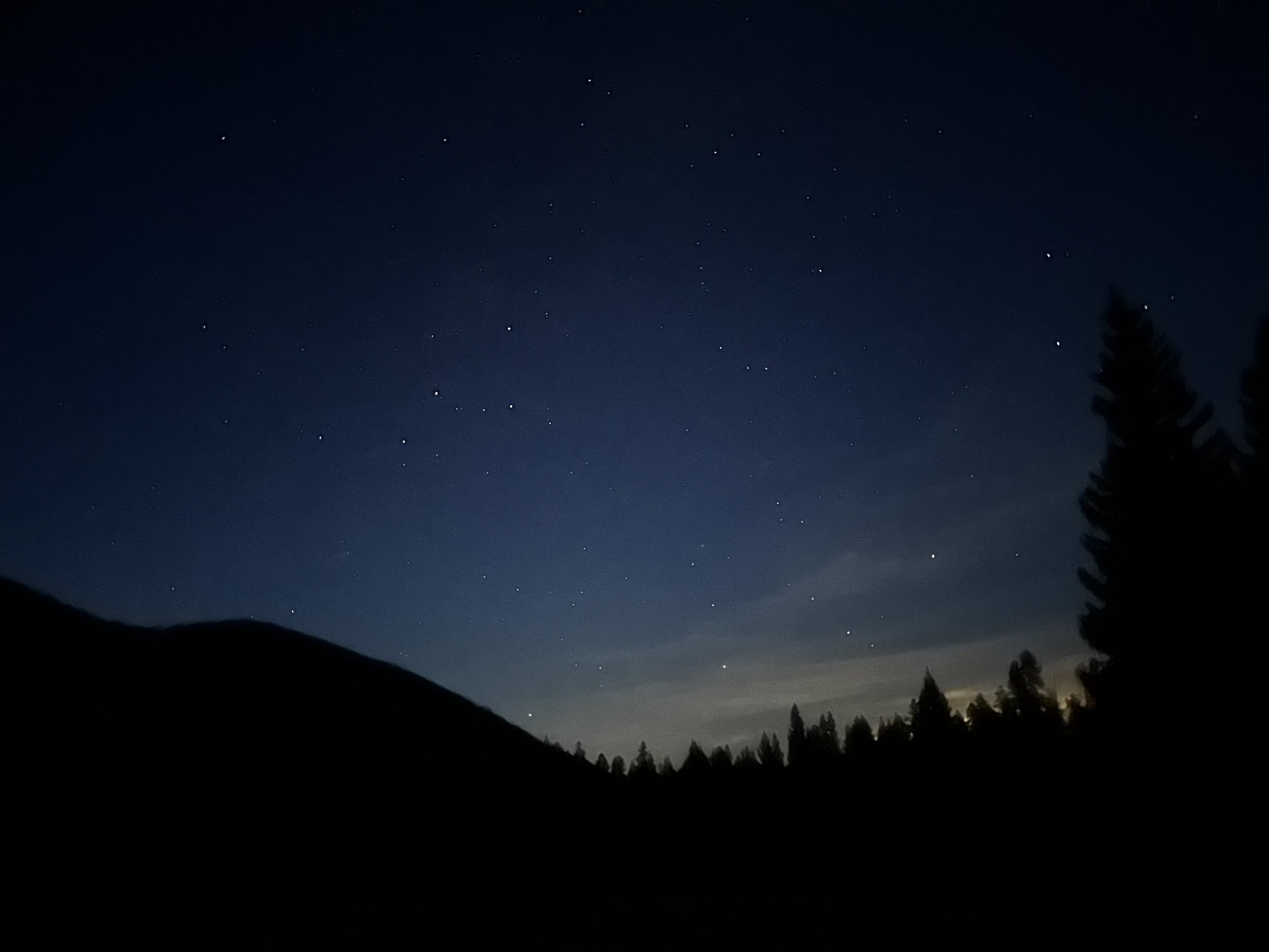
Preparing for the coming day, we ate fruit, nuts, oats - for us, dates are a nutritious food for before or during a hike or run; packs and water bladders were readied; but, overall, we rested, simply enjoying the passing of time while bodies acclimated to life at 10,000’. After a twilight ramble to explore our surroundings, we made a stop at the North Mount Elbert Trailhead, to shut off headlamps, let night vision adjust, and view the nighttime sky, with stars, so brightly lit.
4:47AM
After a morning coffee, stretch, and quick breakfast around the campsite, we walked across the road, headlamps providing a narrow corridor of light, leading toward the Mount Elbert Trailhead. Up a wide, rocky path, the North Mount Elbert Trail swings in 0.1-miles onto a much-improved treadway, this section of trail coinciding with the 486-mile Colorado Trail, and the 3,100-mile Continental Divide Trail.

Climbing steep along the switchbacks
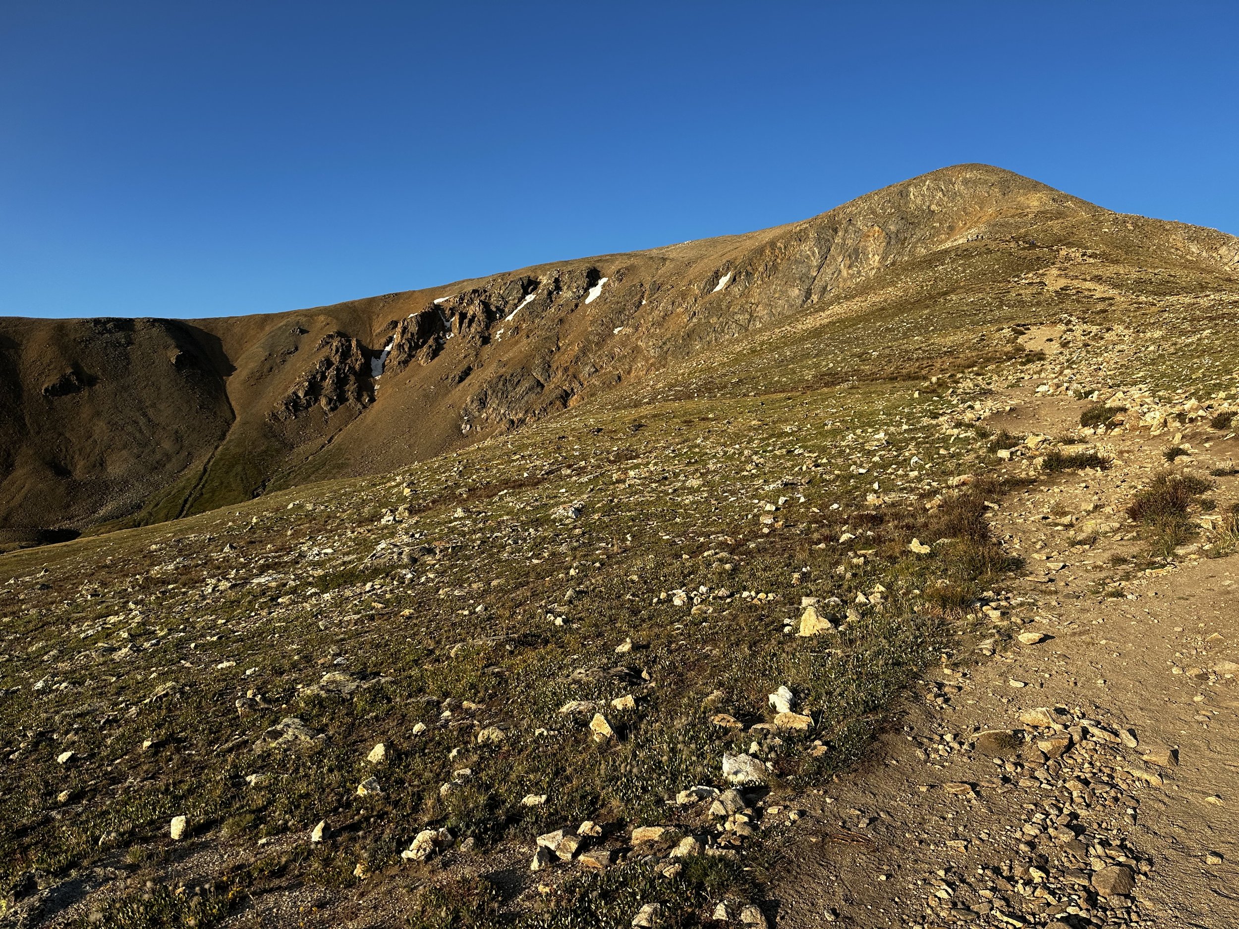
Immediately beginning a series of tight switchbacks, the wide path becomes rather narrow as it climbs; before long, lights from the city of Leadville can be seen northeastward. Passing through areas of old wildfire, or perhaps, that is just how lodgepole pine age, we swung westwardly off the Colorado Trail. The North Mount Elbert Trail soon resembles an old forest road once again; logs placed at intervals help retain the steep footpath. Nearing the treeline, the N Mt Elbert Trail switchbacks onto the ridgecrest proper, the sandy footing becomes rocky as the grade begins to taper somewhat.

Nearing treeline along the North Mt Elbert Trail
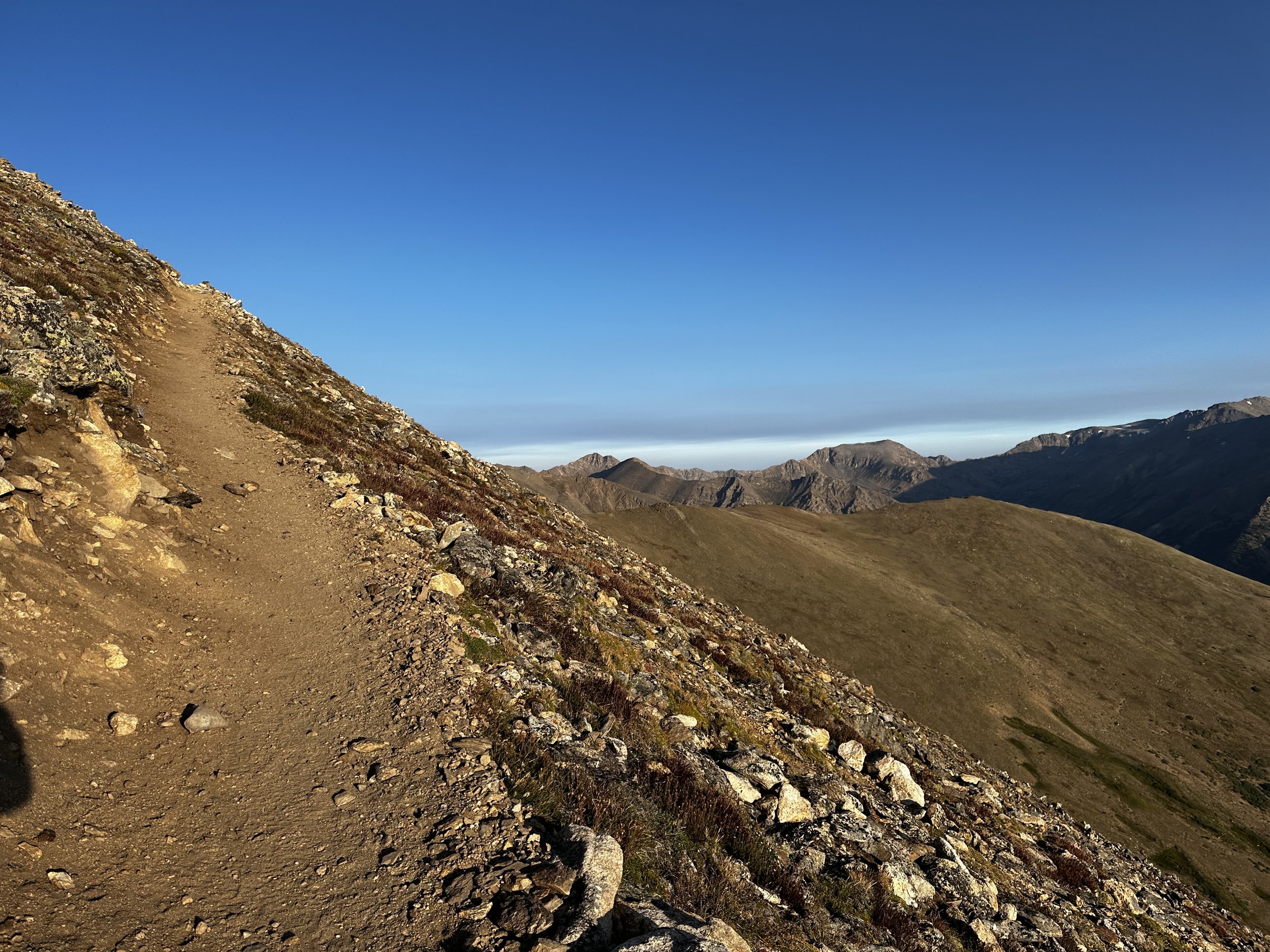
Only several paces beyond the treeline, excellent views in nearly all directions are rewarded - the only degrees missing from the panorama are blocked by the very mountain we were climbing. As the low conifers fail to persist up the rocky mountainside, a relatively wide, earthen footpath veers upslope, all around becomes a sea of angled talus-boulder and alpine grasses.
Oftentimes, hikers can find the exposed trail lined with rocks, encouraging foot traffic to remain only on the designated treadway. During most of the early ascent, hikers are greeted with a stunning glimpse of the Box Creek Ravine headwall, the summit lies not far beyond. At the base of the first rocky scramble, I chose to follow the older, obvious foot traffic route straight up the ridgeline, unaware that this was the location where a side spur deviates around these loose boulders, ascending by a better built path than what I ascended; I descended via this side spur.

Sunrise, leaving treeline behind
From high up the rock pile, I could look back and see the line of trail zig zagging down the alpine lawn, what a view. Once over the crest of the steep climb, I saw this was only a false summit; hearing other climbers drag on about the endless ups and downs, I welcomed the opportunity to spend more time atop Colorado’s highest. Time, and distance seemed to pass extremely fast while traveling in the rocky sag from the crest of the false summit to the base of the final, brief ascent.
A gorgeous trail with good (loose in spots due to dusty, dry soil) footing for most of its course, the final several rods of the North Mount Elbert Trail were perhaps the finest of all: to the southeast, the low grade slipped into Bartlett Gulch, while, conversely, the northwest aspect dropped away precipitously steep toward the South Halfmoon Creek.
Mt Elbert + the headwall of Bartlett Gulch
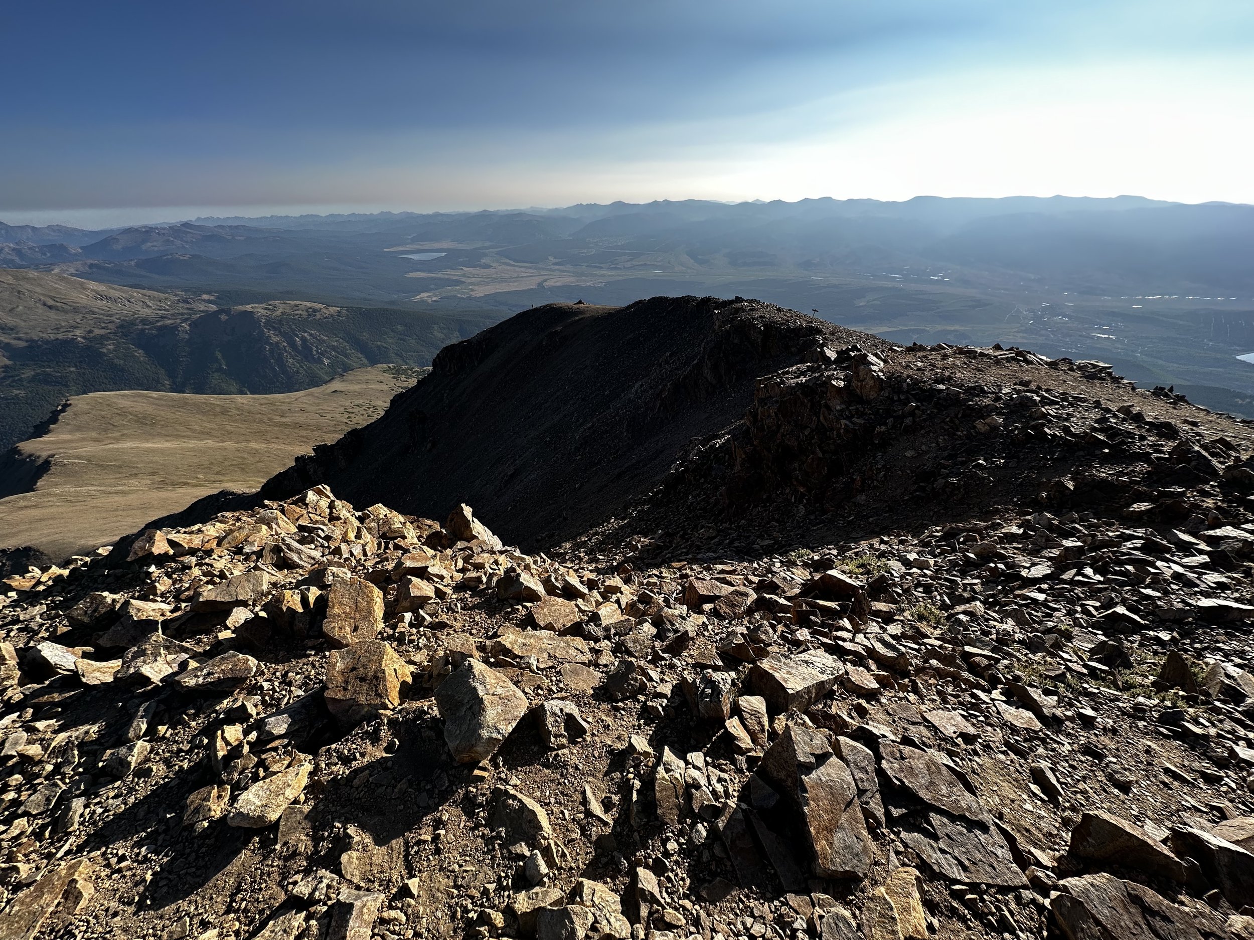
A narrow pathway guided along the final ridgecrest; reaching the main summit area, I met several climbers who were shielding from the strong, chilly winds in a crude, stone shelter. Beyond this crew, I found two others who had been encountered earlier in the ascent. Greeting the couple, we offered to exchange summit photos before making our descents. Just southwest of what I would declare the true high point of Mount Elbert, I located the small US Geodetic Survey benchmark disc - the other climbers were happy to have the marker found as well, as they lined up to capture their own photo of the monument disc.
The altitude of Mount Elbert was certainly noticeable, for a New England climber who rarely gets above 6,288’; the final feet of elevation gain was accomplished with a modified rest-step. Taking a moment to look around, I could not believe the sight before me - how long had I craved this view, the first time seeing a vista over 14,000’ in daytime, it blew me completely away.
Climbing steep on a smooth treadway
Hikers are rewarded with some expansive vistas in both the Adirondack, and White Mountain ranges, but never had I gazed upon such a panorama: endless bands of saw teeth mountains rose up, never seeming to end, just continuing until becoming an entirely indiscernible haze.
Before departing the summit of Mount Elbert, I gazed at the most magnificent, craggy bulk of mountain I had ever witnessed; it seemed to rise to a point parallel with this state high point. This was the image of Mount Massive which remained in my mind throughout the remainder of the day, all evening I ruminated on that massive mountain.

The final climb to 14,440’
Turning to bid my new summit friends farewell, I began a slight trail run-shuffle back down the sandy pathway. Around bends and corners, passing many uphill hikers who were shocked to see folks descending so early in the morning, we wished them a pleasant hike as the slope of the mountain encouraged a hastened pace. For a moment, my mind cleared, and I could envision myself descending hills of the Leadville 100, which took place near here, only two days prior.
Once back in treeline, the switchbacks passed very quickly; both of us sensing increased stamina as we lost altitude. Noticing burnt logs along the way, it is always interesting to see the ascending trail once in daylight. There were many spur paths veering off in various directions, we even saw a mountain biker stopped for lunch, riding the length of the Colorado Trail!

Author atop Mount Massive, Colorado State High Point
Back at camp, we were thankful not to have to rush into the car to drive anywhere. To complement the mid-day sun, we took a dip in Halfmoon Creek, a brief walk north from our tent site, followed by cold, red grapes in a hammock. We spent much of the day lounging around and exploring the campsite. However, when this all became mundane, Alanna and I took a drive into nearby Leadville, CO, where the famed Leadville 100 ultra run had just wrapped up - it seemed the town still buzzed from such an event!
The ridge from whence I came
After a pleasant stroll for coffee, and a search for the notorious Leadville 100 boulder (turns out - it does not exist, I did manage to confuse much of the townsfolk by asking around for its whereabouts, however. I had mistaken this event with the boulder from the Hardrock 100 race). During most of the drive back to the campsite, Mts Massive and Elbert were in sight; with warm food in hand, we returned to our campsite table to discuss options - I would be waking early for a moonlit start up 14,428’ Mount Massive.
To… Be… Continued… on Mount Massive…
Overall stats for the day:
10.05-miles
5hr 49 minutes
4,616’ elevation gain
Mount Elbert - 14,433’

Post-Elbert hammock session