
Mount Cabot via Unknown Pond Loop
In an area that has built up a legend of isolation and mystery one can find the most magical forest of seemingly ancient, lichen-draped fir, which once within, shadow even the brightest of skies.
It was pointed out recently that there is no “Mount Cabot Loop”, technically this is correct, as there are no trails designated on modern maps to notate such a loop; however, there are trails which, when connected in such a way, form a loop involving the 4,160’ peak, a matter of wordage, perhaps.
While there are several trailheads to begin such an endeavor into the remote Kilkenny forest, we decided to park on York Pond Road, just beyond the Berlin Fish Hatchery. I prefer to park in the larger of the two main hiker lots - at the Unknown Pond Trailhead on the right, but room for 3 vehicles can be found right at the York Pond Trailhead. Even with the recent snow the area received, the roads and lots were all well plowed.
We began in a clockwise direction, which, when viewed appears more like a triangle around Unknown Pond, with Bunnel Notch Trail making up the southern portion, Kilkenny Ridge Trail making up the western section and finally returning back to our cars in a southeasterly trajectory along the Unknown Pond Trail; for a 10-mile circuit through the northern Pilot Mountains.

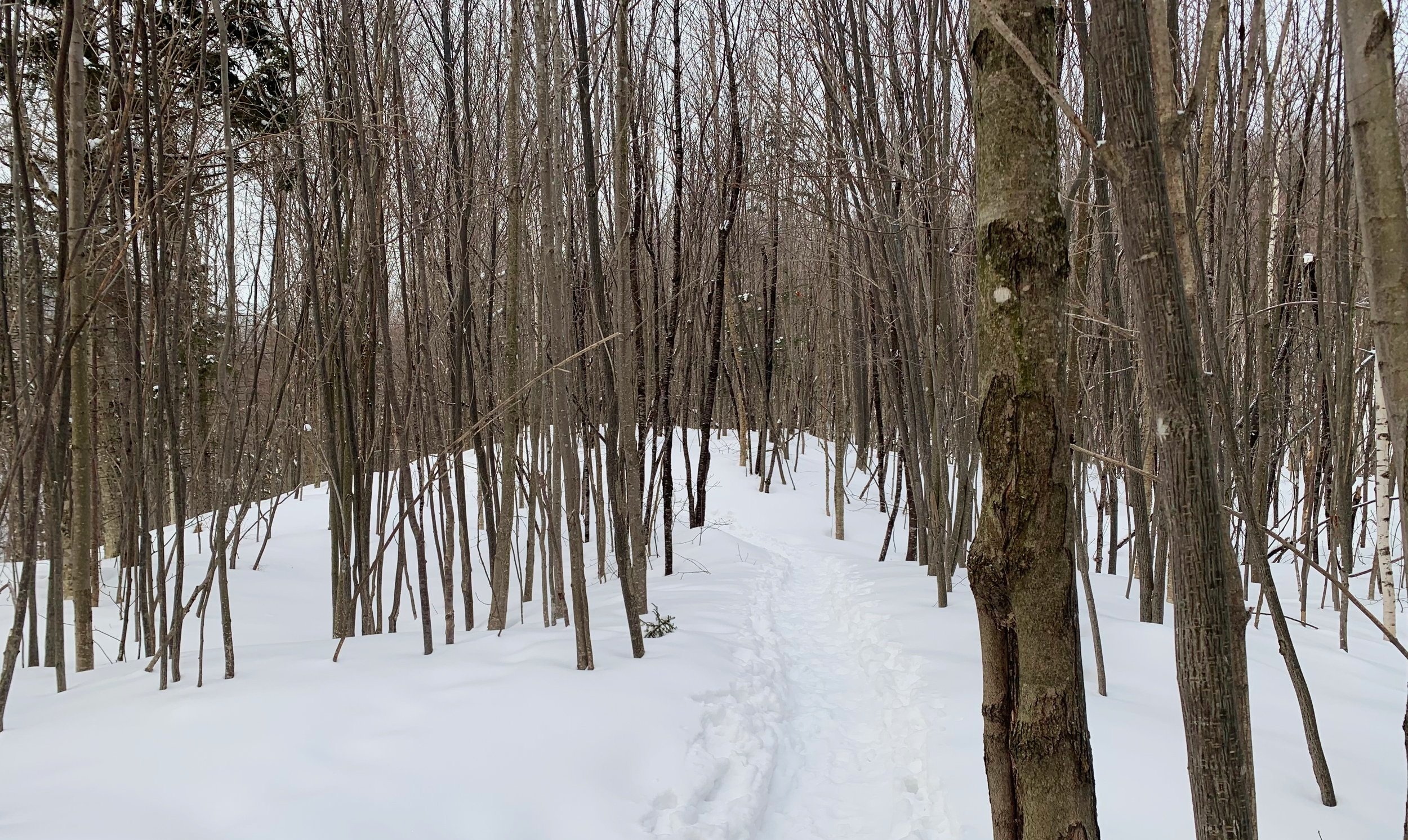
Departing York Pond Trailhead
Following an old railroad grade, the Bunnel Notch Trail and York Pond Trail coincide for the initial 0.3-miles (distances will be given using Unknown Pond Trailhead as starting point), almost immediately crossing the West Branch of the Upper Ammonoosuc River. In summertime, this area is filled in with tall ferns and grasses which form a tight, narrow path which opens slightly at the first intersection.
At a sign the York Pond Trail veers left while we followed the Bunnel Notch Trail to the right, over gently rolling old logging road grades with several minor water-crossings, all bridged in wintertime to the point a hiker would merely feel a dip in the path. The long abandoned Willard Notch Trail grade was discernable during this past winter trek.
At about 1.0-mile the path makes a noticeable swing left, dipping into the forest canopy and ascending into the notch. The 1917 AMC Mountain Guide made note of the “bare, fire swept Bunnel Notch”, perhaps this beautifully uniform hardwood forest is natures attempt at healing the once scarred land.
Entering Bunnel Notch
Meandering along the northern slope of Bunnel Notch, the path traces along Second Brook with countless minor tributaries along the ascent - in most seasons this is a lovely but rather wet stretch of trail, however, in winter these crossings were hardly visible, merely dips amidst a wandering path.
In 1980, the Bunnel Notch Trail was closed by the WMNF temporarily as they planned out their new longer-distance trail, geared more toward backpackers and folks who wanted to hike away from the busier paths. The Kilkenny Ridge Trail first entered the AMC guidebooks and maps in 1987 and (likely utilizing old bushwhacking paths) with that, finally a trail stretching beyond Mount Cabot was formed; in 1992 the Bunnel Notch Trail was beginning to see the light of a re-opening but had yet to be marked or signed.
Nearing 3,000’, the surrounding forest gives way to primarily mature fir, creating a dense, enveloping canopy over head. At 2.9-miles the Kilkenny Ridge diverges left to ascend the northern peak of Terrace Mountain (3,638’) which was home to several Helispots, or emergency helicopter landing pads.

Sign found in the woods
On our most recent winter snowshoe along Bunnel Notch Trail, we spotted an old wooden sign which read, “Mt Cabot Trail No Longer Maintained”. Perhaps this was a heads up to hikers of the Bunnel Notch Trail (prior to the 2004 wet trail reroutes) warning of the trail down to Lancaster being closed in 2000?
From this old sign spotting off trail, it was another 0.3-miles to where the old Mount Cabot Trail would cut left to descend to Lancaster. With access being cut off in 2000 by the landowner at the base of the trail, we were both surprised to find fresh snowshoe prints ascending, perhaps a hiker simply trekked down for a view and back.
At this point, 3.4-miles into the roaming, the trail swung right to ascend more steeply to the northeast for 0.2-miles before a hard swing southeast. This stretch has always been wet and with rather loose footing when I have come through, today in winter though, it was smooth sailing with a steady grade to keep the legs and lungs warmed up in the -10° air.

Panoramic view from Bunnel Rock
Shortly after a decent view back over-the-shoulder toward the conifer covered summit cone of Mt Cabot, perhaps the best view yet is reached. A few paces off-trail to the right (at the small sign which reads “VIEW ->”) brings hikers to Bunnel Rock; a great place for a snack, complete with a grand view into Bunnel Notch and across to the northern slope of Terrace Mountain, many other peaks can be picked out from this ledgy spot.
The path continues, zig zagging through stands of fir before leveling out near the shorter southeastern peak, just through a final wall of evergreen the old fire warden cabin can be found with the outhouse back off to the right of the WMNF signage.

Old fire warden cabin
Just beyond the cabin (around the back), the Kilkenny Ridge Trail continues to the clearing where the old fire tower (taken down Nov 1965) once stood; generally, good views to the east and west can be found.
Rolling down the path over a shallow sag the freshly painted yellow blazes guide the direction as one meanders through a massive fir grove, whose top branches are often caked in thick snow and rime from the gusting winds hitting the highest trees in the mountain range.
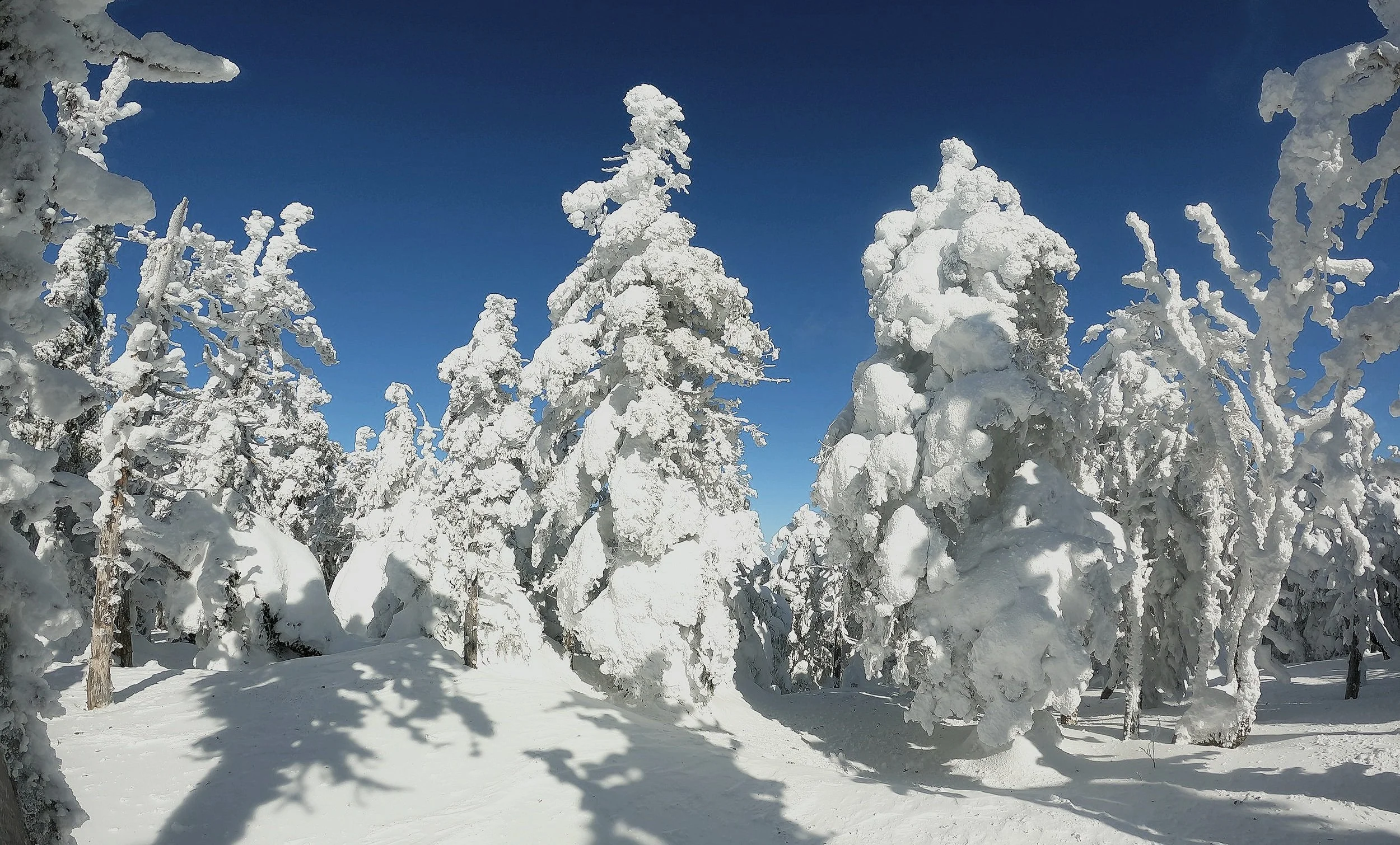
Heavy snow & rime encrusted conifers; (ascent: February 14th, 2021)
Reaching the junction, there was once a sign (bolt holes are still visible in the tree) to designate this spot as the Mt Cabot summit, it has unfortunately been several years since this has been gone. Anyway, the “true” high spot of the mountain can be found just 30-yards beyond this intersection, further west, where a small cairn has been placed.
Continuing along the Kilkenny Ridge Trail will next bring hikers over a rough and rugged trail with loose footing, which I have found to be wet on most occasions, to The Bulge (3,940’) and The Horn (3,905’).
Until the formation of the ridge trail, it was suggested that hikers bushwhack either from Unknown Pond and trek southwesterly, or from Mt Cabot summit and continue northerly along the ridge of peaks - it was noted that the southern slopes generally consisted of hardwood and northern slopes spruce.

A misty morning ascent of The Horn; ascent: July 10th, 2021
Now, the Kilkenny Ridge Trail essentially follows this very orientation, likely following herd paths from past bushwhackers. The summit of The Bulge is marked by a small cairn and has no views (I’ve heard of obtaining views by bushwhacking off the summit in a direction but have never yet ventured to find if this is true); The Horn is reached via the 0.3-mile Horn Spur Path whose ascent is short and steep. Reaching the high point by way of broken boulders, some of the best vistas of the trek can be taken in and a golden USFS disc can be found.
Continuing around the northwestern slope of The Horn through perhaps some of the most glorious lichen-laden evergreen forest of the journey, the trail gradually becomes wet as it nears the waters edge and several drainages trickle by, never becoming a boggy mess, however.
Finding many old herd paths which meander down to the pond, many areas are now designated Forest Revegetation Areas, requesting hikers and campers to avoid these areas. There is, however, an appointed tent site on the other side of the pond which offers several tent sites with a nearby stunning view of Unknown Pond.
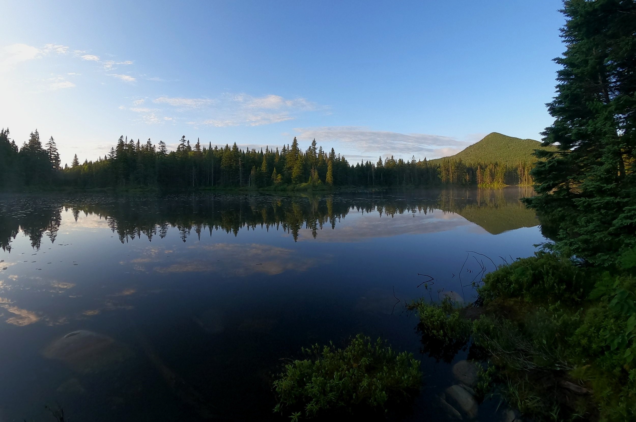
Morning rises on Unknown Pond; ascent: July 10th, 2021
Passing the northern end of the Unknown Pond Trail on the left, we continue tracing the edge of the pond, heading east as the Kilkenny Ridge Trail soon also veers left; once again we continue tracing the pond, now hiking along the Unknown Pond Trail.
It is recommended to take a moment and go down to the pond; If weather permits, to soak in the sights and sounds of Unknown Pond and gaze upon the sharp peak of The Horn. A lazy, early morning coffee is best spent at this spot in which to watch the mist dance and rise off the ponds glass-like surface.
Debuting in the 1940 Mountain guidebooks, the Unknown Pond Trail, like so many other trails of the White Mountains, utilizes old, abandoned logging roads and railroad grades; maintenance took a short hiatus on this stretch beginning in 1975, but it remained a well defined path.
The AMC Mountain Guide books of the 1980’s make no mention of the once abandoned trail, perhaps maintenance resumed with the opening of the Kilkenny Ridge Trail.

A break in the foliage for a view south; ascent: July 10th 2021
Following the eastern side of Unknown Pond Brook, the path travels through several sandy and rougher footing stretches before giving way to a restricted yet beautiful view out to Terrace Mountain. Wild flowers and ferns fill in, almost swallowing the path in warmer months while massive and very interesting white birches can be found trailside.
Passing several off-trail cascades, the brook is soon crossed several times while continuing to gradually descend before finally leveling out onto old railroad grades. The trail was historically wet through the final stretch but has been relocated and was dry and pleasant to trek for us back in August 2022.

Standard Kilkenny Ridge Trail beautiful forest; ascent: July 10th, 2021
As the trail levels out the anticipation within grows just the same - knowing the safety of a car and all refreshing treats it contains is just around the next bend.
The sensation of dropping packs and kicking off boots for the final time of the day is an unforgettable celebration - but of course, as is the variability of forests and incredible memories in the mountains to be made; From trekking over trails containing such vast history, sitting at Unknown Pond with no man-made sounds, to finally topping out high on Mount Cabot - it’s funny how the highest places often don’t give us the best views, sometimes they are found where we least expect them.
Overall stats for the day: (loop last hiked: 8/14/2022)
10.96-miles
8hr 43 minutes
3,264’ elevation gain
Mount Cabot - 4,160’