
Hedgehog Mountain
In an attempt to remain below the persistent snowpack above 2,800’, which I had found to be completely unsupportive in most areas of the White Mountains at this point in the season, Alanna and I opted for a morning stroll around a peak we had reserved on the back burner for just an occasion as this - and it certainly did not disappoint.
Hedgehog Mountain may be familiar to most hikers of the White Mountains due to its placement as #52 on the New Hampshire 52 With A View list; Fifty-two peaks which are popular destinations due to their expansive and often impressive mountaintop vistas.

Beginning the UNH Trail
Beginning off the southern side of the Kancamagus Highway (US Rt 112), just east of the Passaconaway Campground, or 13.5-miles west of Conway, NH, the 2,532’ ledgy peak is located in the Swift River Valley, northeast of its taller neighbor Mount Passaconaway (4,019’), between Downes Brook and Oliverian Brook.
Surprisingly, we were the first car at the often busy Downes Brook Trailhead, from which the Downes Brook Trail also departs, bringing hikers either south to the East Sleeper/Mt Whiteface col or a shorter distance to the Potash Mountain Trail, whose namesake summit also shares a spot with Hedgehog on the 52 With A View list.

Old railroad corridor of the lower UNH Trail
We departed the large trailhead (which is often plowed in winter) toward the east, immediately picking up the UNH Trail, which was named in the early 1970’s (first appearing in the 1972 edition of the AMC White Mountain Guide) after the University of New Hampshire Forestry Camp, which could at one time be found nearby.
The UNH Trail begins through a narrow evergreen corridor, along the near-flat grade of an old logging railroad bed for 0.2-miles before veering off toward the south, following an old woods road; here had been the terminus for the old loop before the newer stretch had been cut further up trail.

Allen’s Ledge junction
Shortly after departing the old railroad grade, the UNH Trail bisects the Downes-Oliverian X-C Ski Trail West Loop, which would bring skiers westerly in which to meet-up with the Downes Brook Trail. We continued straight along the UNH Trail for 0.5-miles through hardwood, consisting of large, glowingly bright patches of birch off to our west.
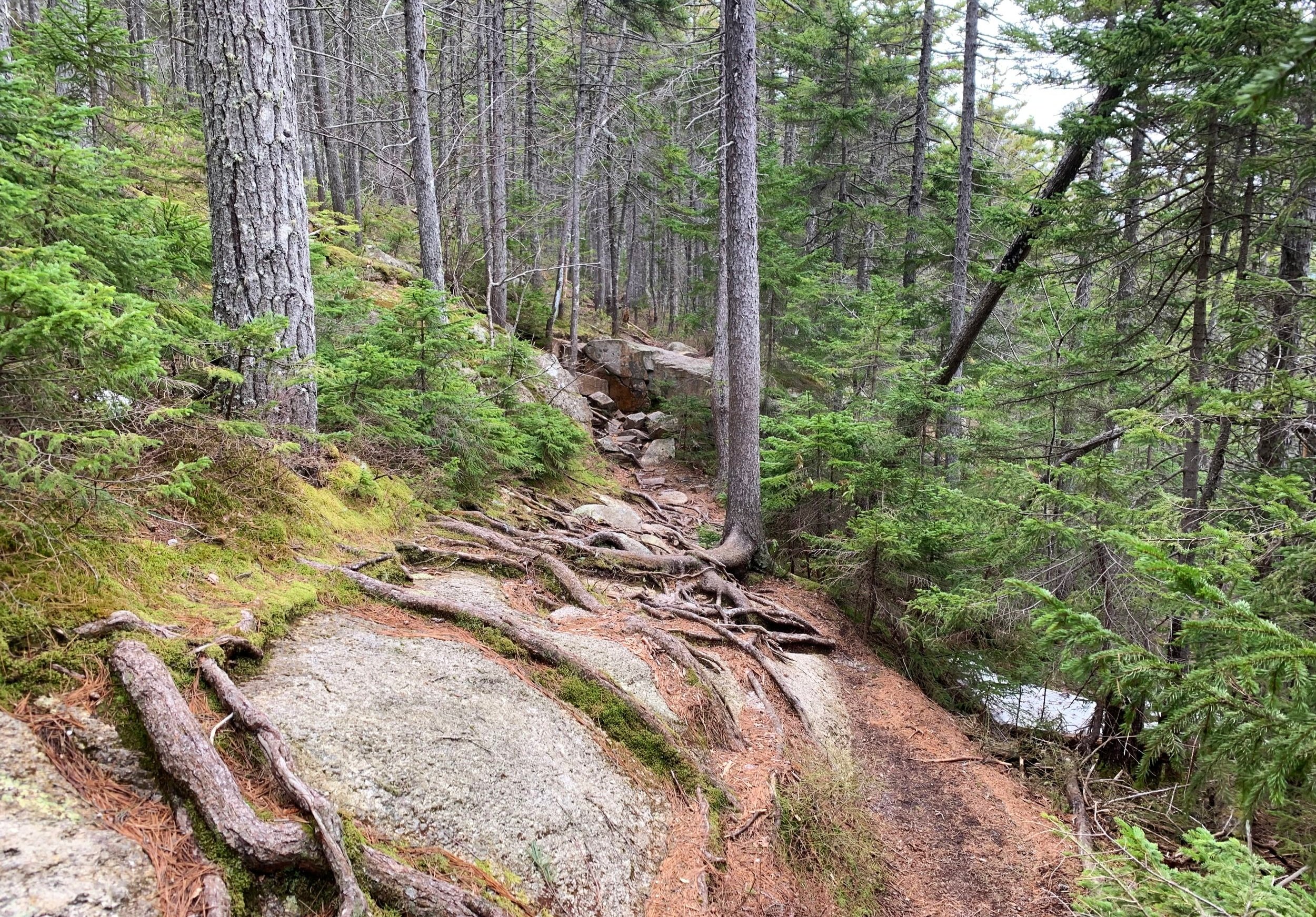
The UNH Trail begins to climb through hemlock, white pine, striped maple, and more white birch, becoming moderately rocky and showing signs of erosion as massive roots occasionally stick up out of the pathway.

Northeasterly panorama from Allen’s Ledge
Reaching the junction for the loop, for no particular reason we decided to veer to the right; along the western branch which would guide us first to Allen’s Ledges and henceforth to the rocky summit of Hedgehog, saving the East Ledges for the descending trek.
Beginning to ascend along the north/northwest-facing ridge, we began trekking through a mixed conifer forest comprised of primarily mature spruce at this point, the footway made even softer underfoot with a fine layer of old, tan/orange evergreen needles. As we ascended, large spruce trees now became prevalent as the trail became increasingly rocky underfoot, as if nearly climbing atop a natural stone staircase in places.

UNH Trail through a brief blowdown patch
Reaching the next junction we could not turn down a short side-trip to Allen’s Ledges, whose rocks we could just about see from the intersection. If time allows, this short trek should not be missed - the lower ledge toward the northeast providing a beautiful panorama of not only our hike to come but a sweep of Owl’s Cliff (2,920’) and Tremont (3,371’), Bartlett Haystack (2,960’), the elongated dome of Bear Mountain (3,200’), the Moat mountains, Chocorua (3,480’) and Mount Paugus (3,198’).
Back on the UNH Trail, we passed a thick yet brief section of sprucy blowdown, thankfully this had been cut and cleared from the path so was not an issue - just a tangled mess of trunks and branches remained along both sides of the trail. Erosion increased as we continued to climb, often trying to tread lightly atop the exposed roots - luckily, our Hillsound spikes went for a ride today and were not needed, our soft-soled trail running shoes not even leaving a mark on the thick yet fragile root system.

Westerly views toward the Tripyramids
Eventually, while continuing southeasterly toward the mountaintop, views begin over ones shoulder - a narrow glimpse of the stunning views to come. Trailside becomes a carpet of various mosses and lichens as the trail is often tread down to bare rock slab or soil; just prior to reaching the high point of the mountain a very short spur path leads northwest to an open ledge with fine westerly views.
Even more breath-taking lookouts in varying directions can also be had from the many ledges atop the mountains high point; Mt Passaconaway dominated the southerly view. At this point we had yet to encounter a single hiker along the typically popular hike, making for a very nice mountaintop to rest briefly for a tea break and to soak in the views before dipping off the ledges and back into the forest.

Enroute to the east ledges
From the exposed summit ledges we could look down upon the east ledges just ahead; eager to feast upon even more views, we departed the mountaintop and began descending atop exposed rocks by a series of short switchbacks, guiding us down to a more gentle grade which would make a northeasterly swing around the southeastern shoulder of Hedgehog Mountain, in which to access the east-facing ledges.
Large spruce continued to comprise the forest while thick, vibrantly green moss lined the understory; to our north was a wall of fractured rock-face and strewn boulders which ranged from car-sized to that of a small house - the sight of small, young spruce taking root and opportunizing any cracks in the massive boulders was a marvel of nature.

Looking back to the summit from the east ledges
Passing a rocky drainage between the two mountain bulges, we quickly climbed up and along the east ledges; from here we had even more magnificent views toward Mt Passaconaway, with its coniferous cone and hardwoods which had yet to fill in with colorful leaves.
The path across the ledges is streaked with yellow blazes but the bare rock appeared like a spider-web of sidewalks, veering in many directions from whence we could either look back upon the summit ledges we had just descended or out through the surrounding scrappy conifers to more mountainous views.

Mt Passaconaway
Continuing along the exposed rocky ledges, we tread carefully at several sheer drop-offs, eventually finding our way back along the north/northeast-facing mountainside. Through another band of mixed-age conifers we descended back into hardwoods and past a final section of twisted, bent and stacked-up blowdown which lay just off trail.
Perhaps it was simply remnants of the springtime thaw, but the UNH Trail became rather soggy as we neared the White Brook crossing, a well-worn herd path had even been created which rerouted hikers around a very wet section of trail. Appearing to dry out following the brook crossing, it was a quick 0.5-mile trek atop an old logging road in which to reach the junction from earlier this morning, thus completing our loop; we veered right to head north along the UNH trail, guiding us back to the easy railroad grade and onward back to our car.
We found such a beautiful wilderness out in the Swift River Valley; with the incredible views from atop the low Hedgehog Mountain and its gorgeous east ledges. While most guidebooks state these views pale in comparison with those of its taller neighbor, 2,680’ Mt Potash - we cannot wait to make our first excursion to that nearby open top summit as well.
Overall stats for the day:
4.8-miles
3hr 6 minutes
1,821’ elevation gain
Hedgehog Mountain - 2,532’
Hedgehog Mtn East Ledges - 2,320’