
Greens Cliff
With a four year old pair of broken Tubbs Flex Alp snowshoes resting in my backseat (snapped metal ascending Gore Mountain last week), I tossed around ideas for a shorter adventure, a trek to take full advantage of the bluebird forecast. With moderate winds affording a good reason to remain sheltered; all the plotting, planning, and exploration of route options kept bringing a beautifully unique peak to mind, which has been on my to-visit list for several years.

Greens Cliff viewed from Mt Tremont
The continued lack of snow into the New Year certainly played a huge role in selecting where to explore - as it seems White Mountain trails are still plagued with flumes of ice and nasty trail conditions, I was certain to enjoy my time ten-fold off-trail, tucked in the trees and remaining at a lesser elevation, as to not catch the full -20° wind chill that was predicted for nearby Mount Carrigain (4,680’).
Driving out of Lincoln, NH, I watched the outside temperature gauge in my Subaru begin dipping incrementally, from 15° to 11°; upon passing the height-of-land the gauge was reading 5° - the lowest I would encounter this morning. The air had warmed somewhat by the time I had navigated the turns beside Mount Kancamagus (3,762’), all the while I stared at its ridgeline and imagined being back in those woods, traipsing along the open spruce-fir ridgecrest.
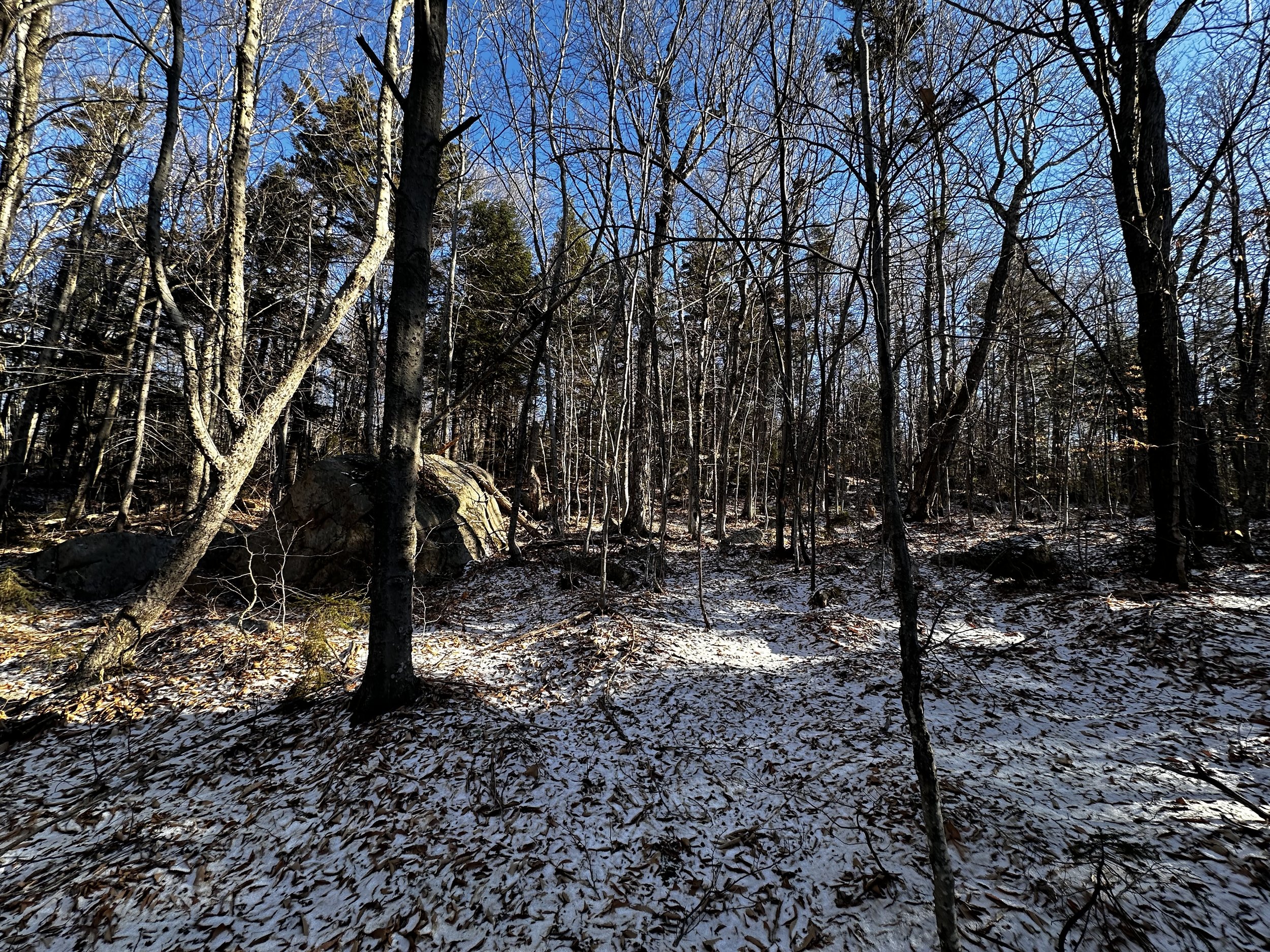
Beginning along the Sawyer River Trail
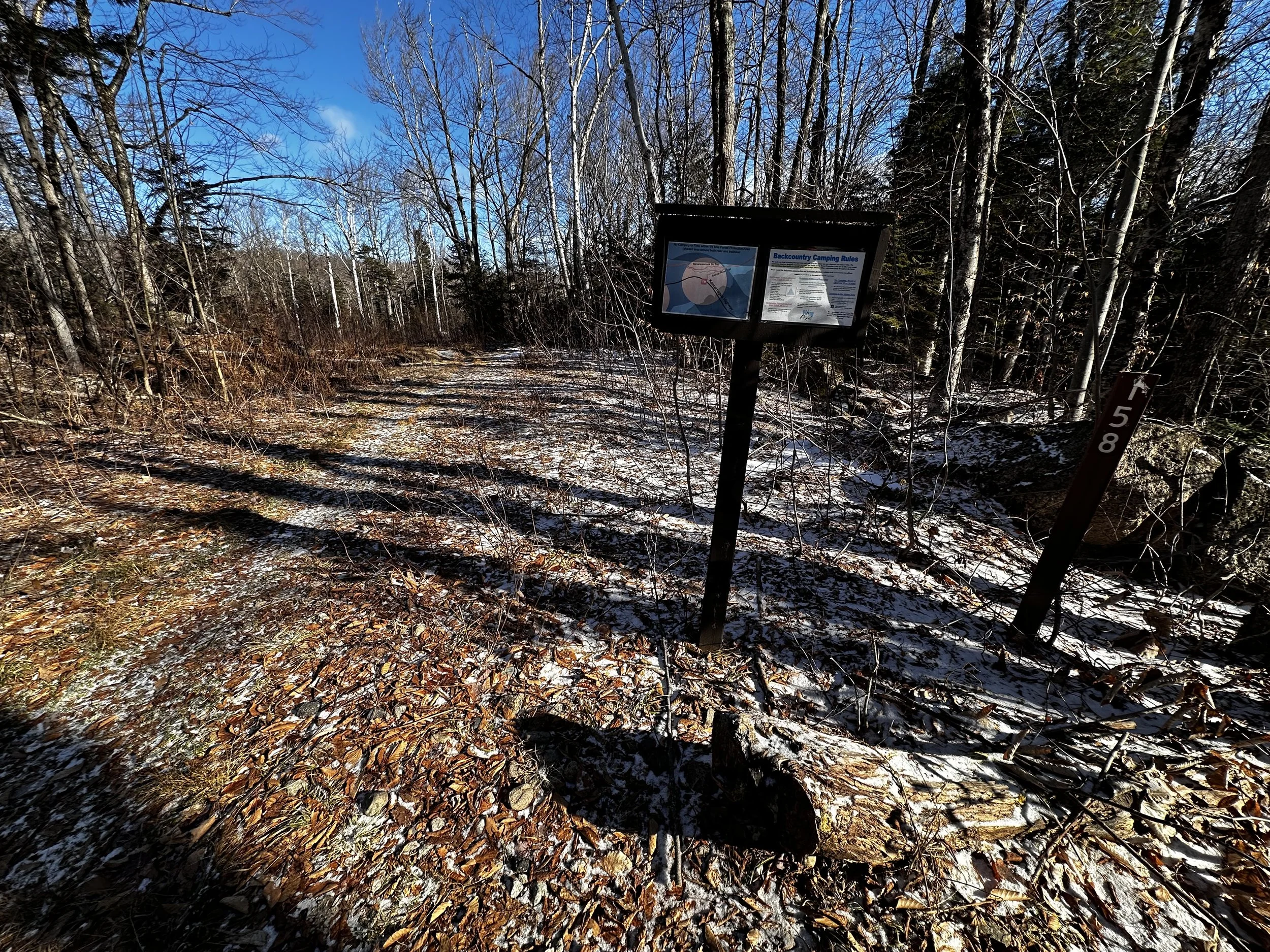
Nearly all snow had been plowed or decimated by rain and unseasonably warm temperatures from the Sawyer River Trail parking area. Today, the gravel surface was even showing, enabling one to park well off the roadside. Unsure of what interesting conditions I might encounter, I packed the entire gamut of winter hiking and bushwhacking gear. A full change of clothes, emergency alpine bivy, half-broken snowshoes, Hillsound spikes all came for the ramble today.

A dusting of snow covers Sawyer River Trail
Beginning in bare mountaineering boots, I trekked down Sawyer River Road (FR 158), following arrows as they direct traffic toward the right, while a well-beaten herd path proceeds straight ahead. Stopping just long enough at the initial waterfall viewing area to check the status: water height, speed of flow, rough percentage of frozen vs slurry - now content that the crossing ahead may not actually be doable without any frozen surface or rocks to hop, I casually trekked on, until finding myself at the edge of the Swift River.
Not a chance this river could be crossed from where I stood, even though I had hopped icy rocks only several weeks ago at this exact location with no issues. Following the waters edge for several rods, I visually connected rocks in my minds eye, pondering whether the icy mounds were close enough to safely cross upon. Here, I donned the Hillsound spikes for maximum nimbleness - knowing from experience how treacherous crossing a river with snowshoes and no snow can be.

Exposed corduroy logs - not snowmobiling here anytime soon!
With the aid of a riverside stick for balance (conditions had yet to warrant me packing my typical ice axe, although I will be bringing either poles or ice axe for balance, from now until early Summer), I crossed on patches of visibly solid and thick ice - surrounding ice was a hazy slurry of in between states - not frozen, not liquid, definitely not load bearing!
Once on the eastern shore of the Swift River, Hillsounds came off and were packed away until the return crossing - snowshoes simply went for a free ride all morning, oftentimes getting snagged in spruce or hobblebush of the hardwood grove - I much prefer snowshoes on feet than a pack.
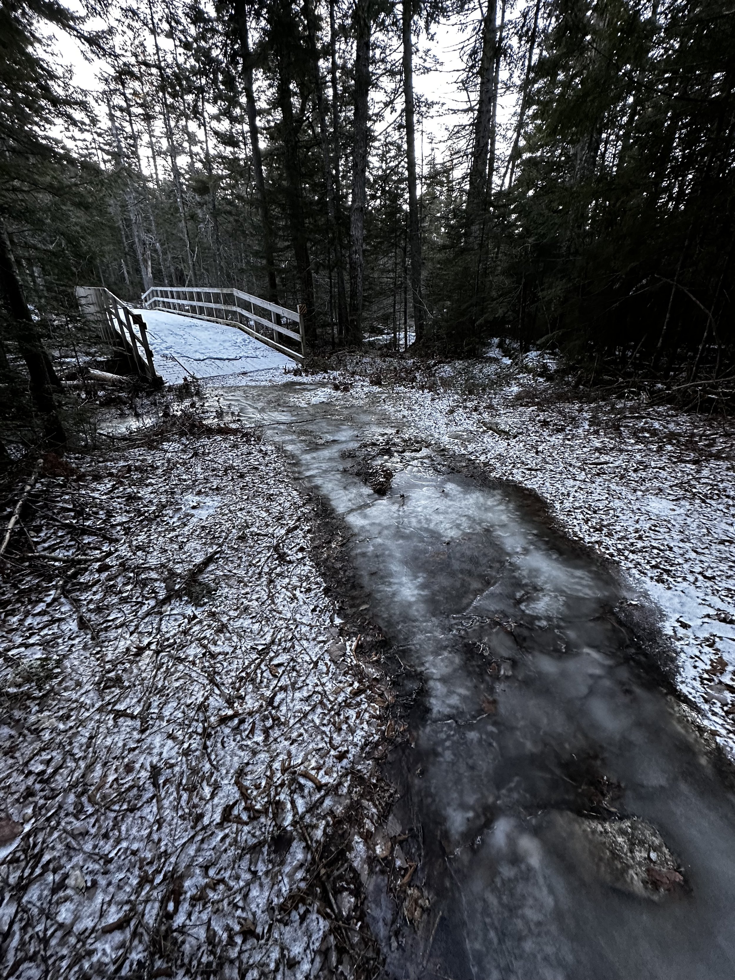
Bridged crossing of Meadow Brook
Continuing along the Sawyer River Trail, the footpath became a deep trench, scoured and stripped right down to underlaying rocks and boulders; ice flumes covered much of the treadway itself - exactly why I currently prefer off-trail, no ice to be found, and conditions in the backcountry are leagues better than what I have experienced for recent trail conditions in the White Mountains.
Reaching the first main junction with the typical snowmobile corridor, this trail was also void of snow, with ice flumes meandering between exposed corduroy. Quickly, I bounced down corduroy logs and turned a slight bend in the trail which led to a bridged crossing of Meadow Brook. Beyond the crossing, I knew I could enter the woods at virtually any location I wanted, and within several paces I would be scaling up the W/SW ridge of Greens Cliff.
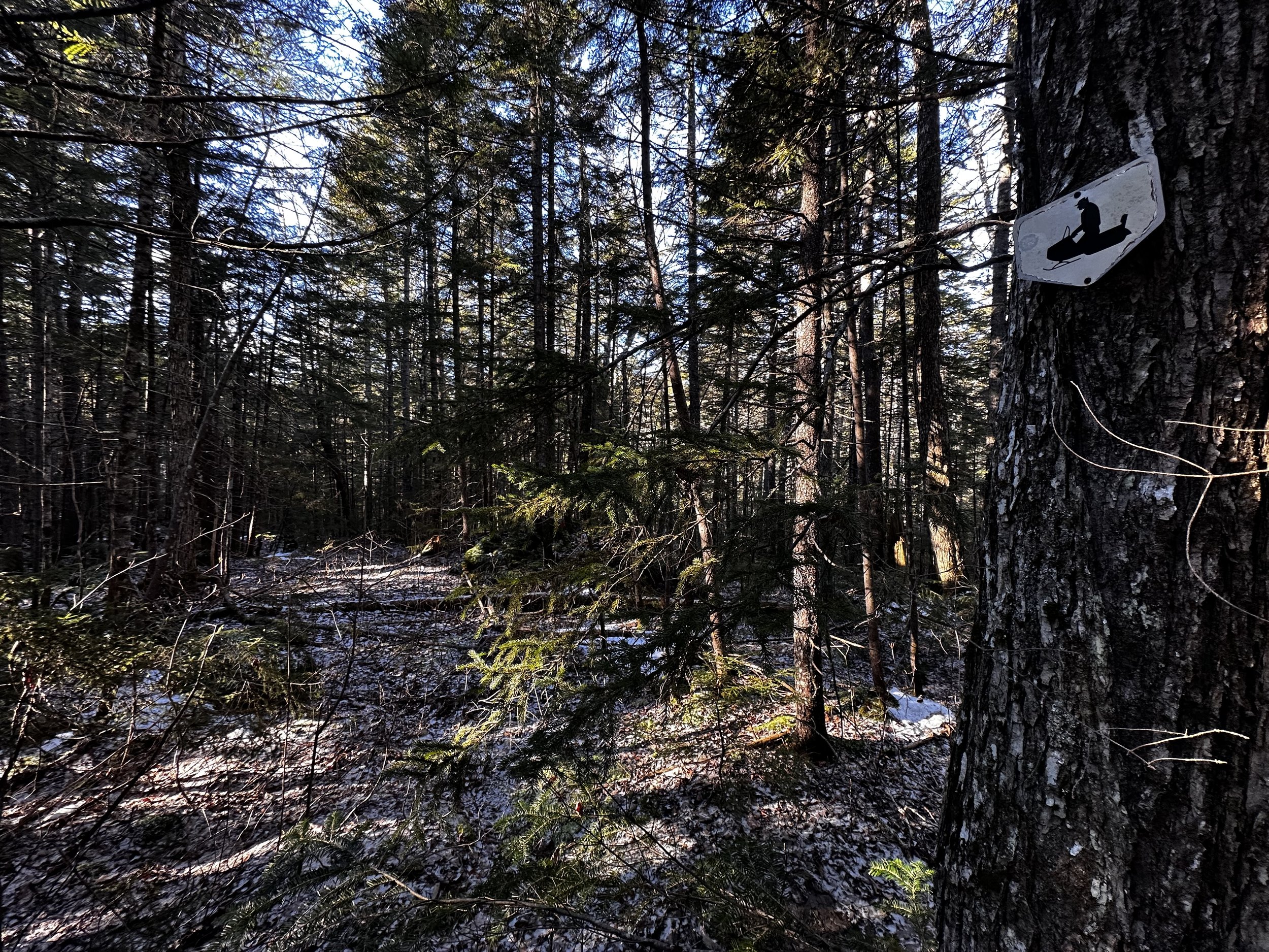
No longer wondering what this old corridor was for
Perhaps “scaling” is not the most accurate word for this bushwhack, while I certainly did scale some rather steep terrain just below the summit ridge, my route early on was simply a pleasant stroll. Locating what appeared to be an old logging or woods road corridor, just beyond the Meadow Brook bridge, I entered the section to see how far it could take me before becoming too arduous. Unaware that I had passed a small metal sign tacked to a tree, this white and black hexagonal shape caught my eye on the descent - this old, way overgrown corridor had served as a snowmobile trail long ago.
As the path I followed noticeably arced back toward the west, or so it seemed, I departed the hardly discernable old snowmobile corridor and began trekking alongside moss-blanketed boulders. A few downed trees littered the forest floor as hobblebush and young beech worked to clog the understory, all were easy to breeze around, or gently nudge out of one’s way.
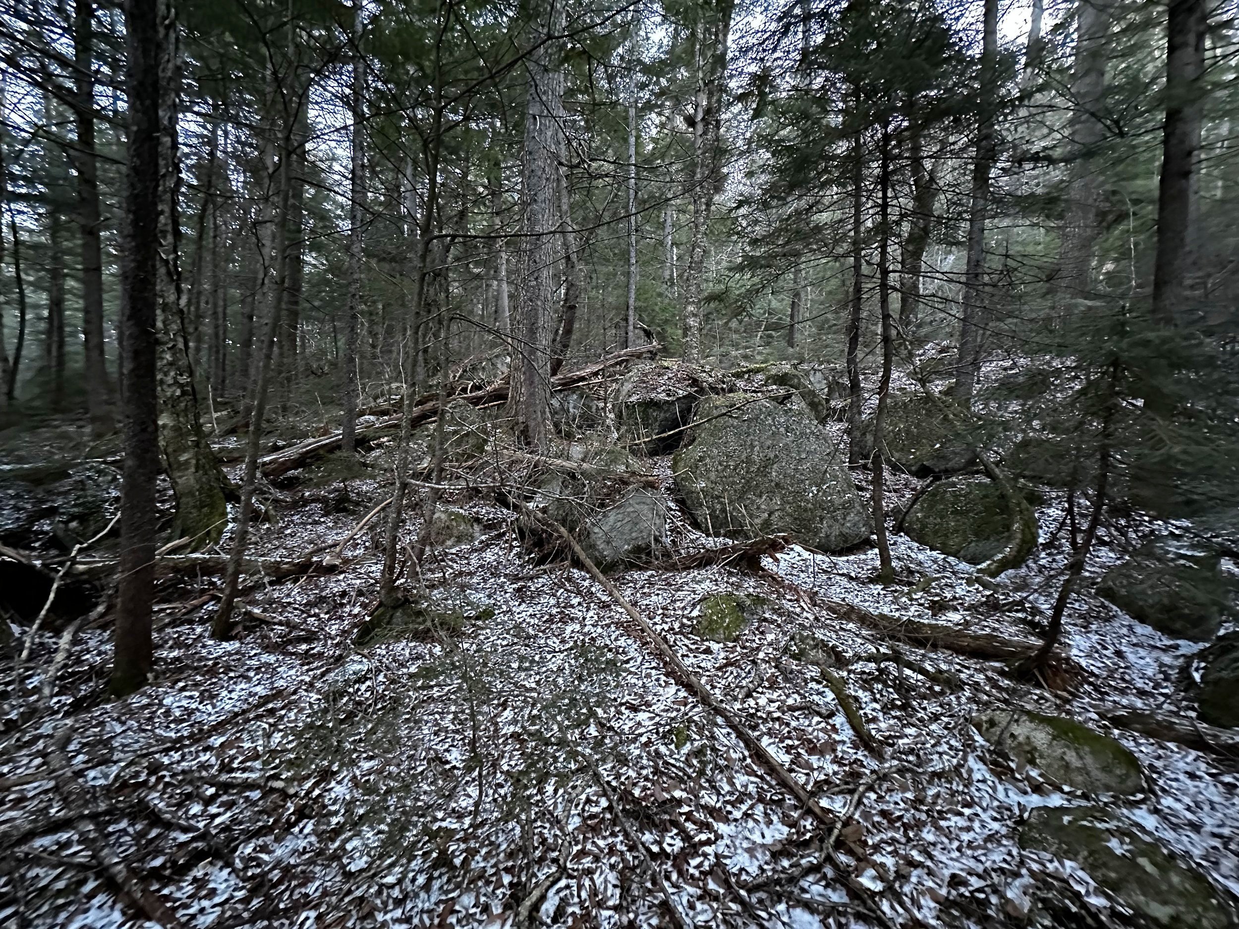
Encountering lots of boulders early into the bushwhack
Knowing that most of the hillside was composed of spruce and oak, I also weaved around birch, hemlock, balsam, and pine - the few examples of old white pine I had encountered this morning appeared to have been blown apart, their massive upper limbs evidently lobbed off by extreme winds, now lay littered all around the base of their parent trees. It seems the white pine has not fared well on the western slope of Greens Cliff!
Occasionally, I would encounter a brief wall of evergreen boughs, some more dense than others, none of the conifer patches were terribly thick or pokey, I primarily only needed to “swim” through the boughs as to not bend or snap as many as would be damaged by just bluntly pushing through. It appeared to me obvious that, as I climbed, the open and easy to navigate hardwoods (all hardwood stands had some spruce sprinkled in) were to be found to my left, or right - straight ahead were dark, dank conifers, where the dull morning light struggled to penetrate.

Navigating along a wall of evergreen
If I pushed too far right (SE), I would probably have ended up on the actual south-facing cliffs of Greens, not what I was in store for today, so I simply pressed into the dark wave of softwoods. Thankfully, a push through any tangled conifers never lasted long, I could always see white snow or open forest just beyond.
Passing several small patches of frozen bog, it was obvious to see from the deep blanket of oak and birch leaf cover, that high water had rushed down these slopes as well, pushing aside leaves and leaving tell-tale signs of minor flooding. From one small opening in the forest canopy, I could see the frosty Signal Ridge with Mount Carrigain rising tall; looking straight ahead, however, I could now spot my objective: the summit ridgecrest of Greens Cliff could be seen - so close, but with most of the ascent still remaining.

Thick, but not too thick
As the terrain begins to pitch around 2,400’, I began encountering a moderate supply of blowdown. Slowing my pace somewhat, I now had to pick a route around either end of the toppled trunks or climb up and over; I crawled under none of the downed trees here. Even the upper hillside began to appear as a wash of logging slash; shards of broken and shattered tree limbs were strewn all along the mountainside where I found myself climbing, an interesting sight of devastation for sure!
Recalling the tight contour lines of what lay ahead, I recalled my original plan, which was to angle way north, to approach a slope with a much gentler pitch - well, here I was ascending into the steepness. Before long, boulders which rival Goodrich Rock could be seen just ahead. The mountainside grew very steep indeed. For a moment, I just stared up at my options, of which there were many - if comfortable climbing steep, exposed rock in the backcountry.

And the climbing begins
Picking a route between the massive slabs, it was really not terribly hard to look ahead and select a relatively safe route, or one to minimize a fall, at least. Perhaps three pitches of precipitous rock led onto a more casual grade; here, spruce grew tight and thick, although it was not impossible to find a fairly decent route. During the final ascent, I could see the continuous rise of the mountain - until the mountain could rise no more.

False southern summit has a new register notebook!
Finding myself at a glass jar, I knew this was the southern canister; without interest in signing into this salsa jar, I took a good, long gaze at the narrow window of vista before turning to follow a very lightly beaten herd path, which led to the suggested (true) high point of Greens Cliff, an orange canister whose threads seemed seized shut from all the orange spray paint that chunk of PVC was dressed in (today, I do not believe this cap was stuck due to ice or cold).
Recalling reports of a noble view slightly northeast from my current location atop Greens Cliff, I continued along the ridgecrest for several more rods, until I was satisfied with the ledge upon which I stood. From this vantage, I had a fine glimpse of Owls Head (which appeared glacially shaped, similar to Greens Cliff), the partial bulk of Mt Tremont (3,371’) could be seen just left of Owls Head (2,920’), with Bear Mountain (3,200’) filling the frame to its right.

Owls Head (left) in the trees, Bear Mountain rising center
After a quick burst of sunshine upon the cheeks, I turned to retrace my steps - a secondary visit to the lower summit was not my intention, but as this formed the easiest logistical route, I reluctantly ended up standing at the glass jar register once again. This time, I thought I would sign into the register, as the time had yet to reach 9:15am. Unscrewing the lid off the glass jar, I removed its measly contents and immediately thought to myself, “that’s it?!”
A sole Ziplock bag contained two pencils - both in working order, some old paper, some new paper, all of which was scribbled on, none of it stapled - what a mess. By now, the wind had found me and my tattered wool-fleece jacket; with nowhere to sign in, I put the shameful contents back in the jar and screwed the lid back on.

I spy…
I was still in eyeshot of the secondary summit when I was seemingly stopped in my tracks. Taking a moment to quietly observe the plethora of lovely spruce which blanketed the upper slopes of Greens, I knew I would be frustrated if I drove home and still had a brand-new summit register in my pack. Turning back toward the false summit, I dropped pack and dug out a shiny, new, pocket-sized Composition notebook.
I had been carrying this spare book around for months now, I would be utterly disappointed with myself if I did not leave it in the canister for the next ascensionists to log their climbs into. Finally, content, satisfied and now becoming chilled, I slung the 75-liter pack with snowshoes dangling back onto weary shoulders, to make my way cautiously back down the precariously steep western slope.

Picking across the summit ridge of Greens Cliff
Not following my ascending route completely, I found an easier (less-steep) descent, although not over any fewer chunks of exposed Conway granite. Much of the descent was a repeat of the ascent, in reverse; from steep slopes of spruce, to evergreen dotted hardwoods, to birchy glades, and finally back to a mossy boulderfield, before stepping onto the old, brushy snowmobile corridor.
Quick work was made of the remaining distance, but now, my thoughts had switched back to my final obstacle: Swift River. Knowing that waterways are at their lowest in the morning, the surrounding mountainsides now had several hours of full sun in which to shed melted ice and snow, thus adding more consequence to an already tricky crossing.
Easy going on the trailless descent
Upon reaching the location (downstream several rods from trail) where I had crossed earlier, I glanced at the icy rocks as the murky, half-frozen water flowed all around. Several of the rock tops I had used earlier had become completely submerged, now with ice water flowing well over top - the river had come up at least three inches since my first crossing.
Thankfully, had I needed to get wet, my car was hardly a quarter mile away, but if this were to happen many miles in the backcountry, with a significant trek back out, attempting a crossing as this would come with much more weight.
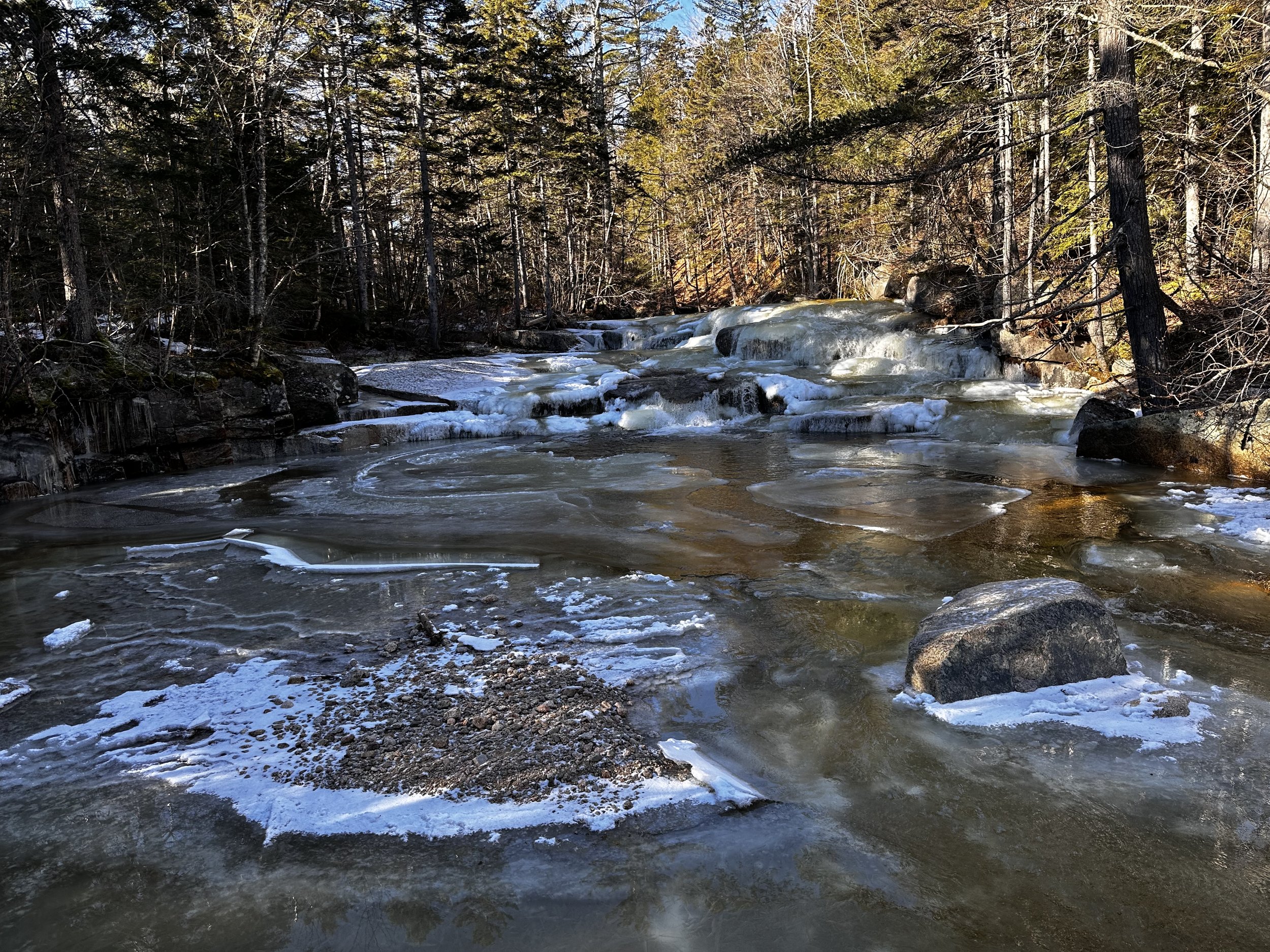
Swift River: some frozen, some liquid
With my stick in hand, I placed one spiked boot on an icy boulder, it held. Using new rock tops to pick a safe route across, I breathed a deep sigh of relief once standing on the sandy, western shore of the Swift River. Fingers trembled from residual adrenaline as I removed the Hillsounds for the walk out.
An uneventful 0.2-mile trek brought me to my awaiting Subaru. As I watched vehicles speed by, in either direction along the Kancamagus Highway, I wondered how many drivers had spotted the wedge-shaped Cliff of Greens and wondered, “without trail, what could possibly be up on that nub?” This morning, just me.
Overall stats for the day:
5.26-miles
3hr 26 minutes
1,867’ elevation gain
Greens Cliff - 2,926’

My gift to the summits