
Blackmount Rail Trail
Along the graded bed of the long gone, Boston, Concord, and Montreal Railroad, a 3.7-mile Rail Trail connects the towns of North Haverhill with Woodsville, to the north. The line, built from Concord to Woodsville, NH in the 1840’s and 1850’s was used primarily for freight, with brief, failed attempts as a tourist railroad. This length of abandoned rail bed has been repurposed as a snowmobile corridor in winter months (when winter allows), connecting the towns of Warren and Woodsville, with option of linking the route to the Ammonoosuc Rail Trail, as well.

Southeasterly views of the Benton Range from the Blackmount Rail Trail
Beginning from the Blackmount Railroad depot, this site is now a vacant parking lot comprised of crushed stone, featuring a sheltered picnic table - encouraging guests take a “quik break”; across US Route 10 is Aldrich’s Mobile Convenient store and gas station. The spacious gravel lot offers free parking to many vehicles, a trailside kiosk is also set up to alert users of trail conditions, rules and regulations, as well as local trail maintenance clubs with their volunteer schedule.

A brief trailer park stretch of trail
While, it cannot be argued that this stretch of trail is much better suited to winter recreationists, the footing, initially from the south, is frequently loose and choppy - which would make travel on foot or bike equally frustrating and treacherous. While the Blackmount Rail Trail technically begins from this parking area, proceeding generally northward; alternatively, the trail corridor could be followed southbound for a distance. In this southerly direction (toward Warren), the trail takes on the personality of a snowmobile corridor, with chest-height awareness signage and trail boundary markers. Some of the usable corridor has been rerouted to cross agricultural fields, as the original railroad bed had been obliterated by newer house construction.

Passing the Grafton County Offices + Farm Stand
From the current trailhead, located on Clark Pond Road and Route 10, the trail is unmistakable as either a groomed snowmobile corridor, or - as in today’s case - a loose, gravel pathway. For the first 0.2-miles, the trail is sandwiched between roadway and corn fields; the newer, expanded Hatchland Farms dairy store is passed on the right, known for producing the best chocolate milk around, although, their ice cream would make a fantastic reward once the out-and-back jaunt is complete.
Reaching 1.0-miles into the completely exposed rail trail, the path finally dips into a shaded, wooded area, away from the highway. Fortunately, the footing transitions from loose, angular gravel to packed dirt; the unfortunate part of such enjoyable footing is that the Blackmount Rail Trail now slices directly through the Oak Ridge Trailer Park. While the trail surface itself was highly enjoyable throughout this stretch, running merely several rods off someone’s front porch is indeed a bizarre experience.

Now tracing west of Route 10
Luckily, this trailer park stint only lasts about 0.3-miles before exiting the wooded area and finding open sky yet again as the pathway now passes the Grafton County farm stand building and agricultural fields. Across the highway the main complex, court house, and nursing home can be found. Following the unmistakable, old railroad corridor, it climbs briefly before crossing Route 10 - care should be taken here, especially with young ones in tow as the roadway is now within a 50-mph zone, with minimal signage indicating to motorists, that recreationists even cross the road here. It would seem, ensuring a safe passage across this busy thoroughfare has been left completely up to the recreationist.
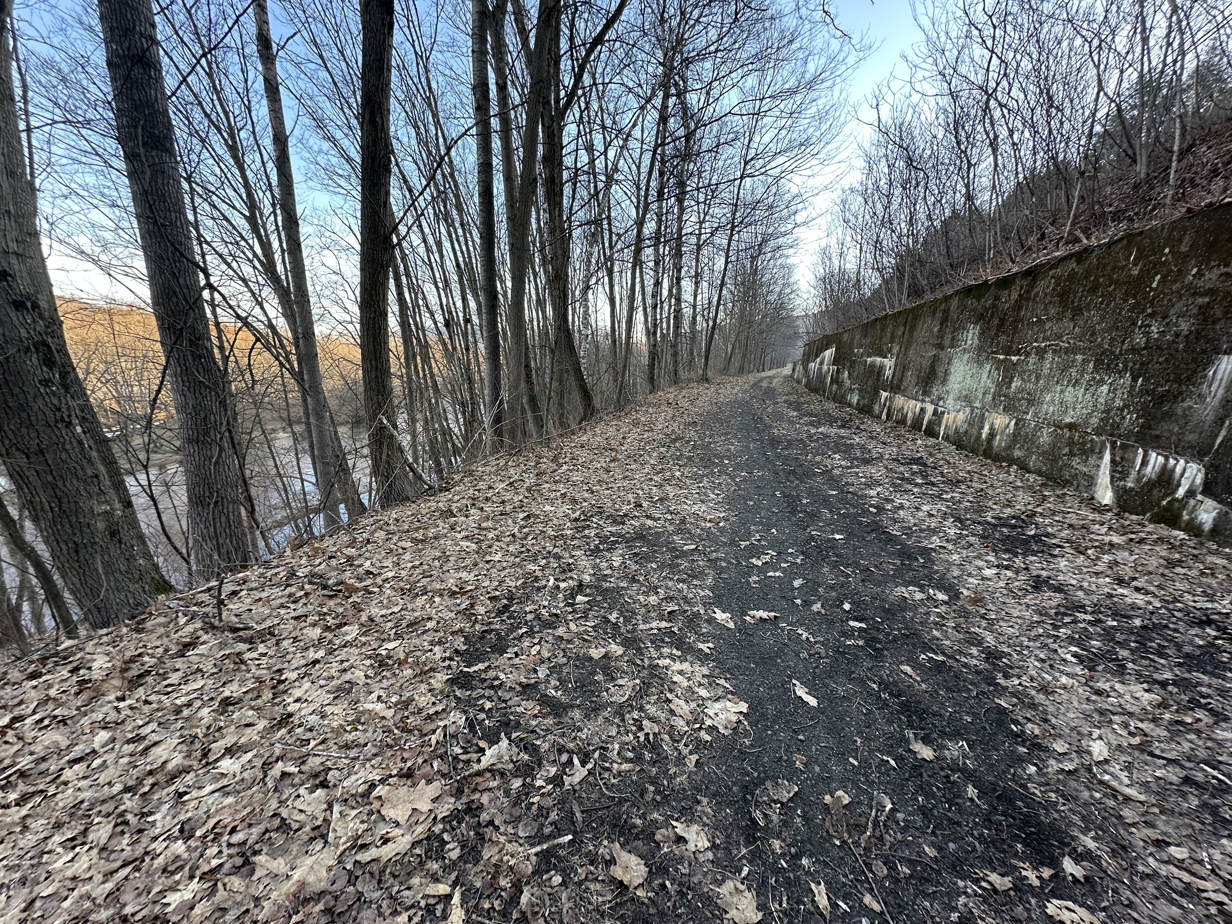
Connecticut River: left, US Route 10 on the bank: right
Across the roadway, the old railroad grade dips back downslope to meet its original grade; with the roadway elevated significantly from the rail trail corridor, road noise and pollution is much improved from previous segments of the Blackmount Rail Trail.
While heading northbound, westerly views spill out across the Connecticut River Valley flood plain, this view should be captured and appreciated in any manor possible, for, if one were to cast their attention eastwardly, toward the highway momentarily, they will be greeted with a most depressing scene of brightly colored plastic containers, cans, bottles, televisions, couches, and more. While there are efforts by locals to clean up the roadside and nearby woodlands, this side of the Blackmount Rail Trail showcases the gross dumping ground that this stretch of trail has become.
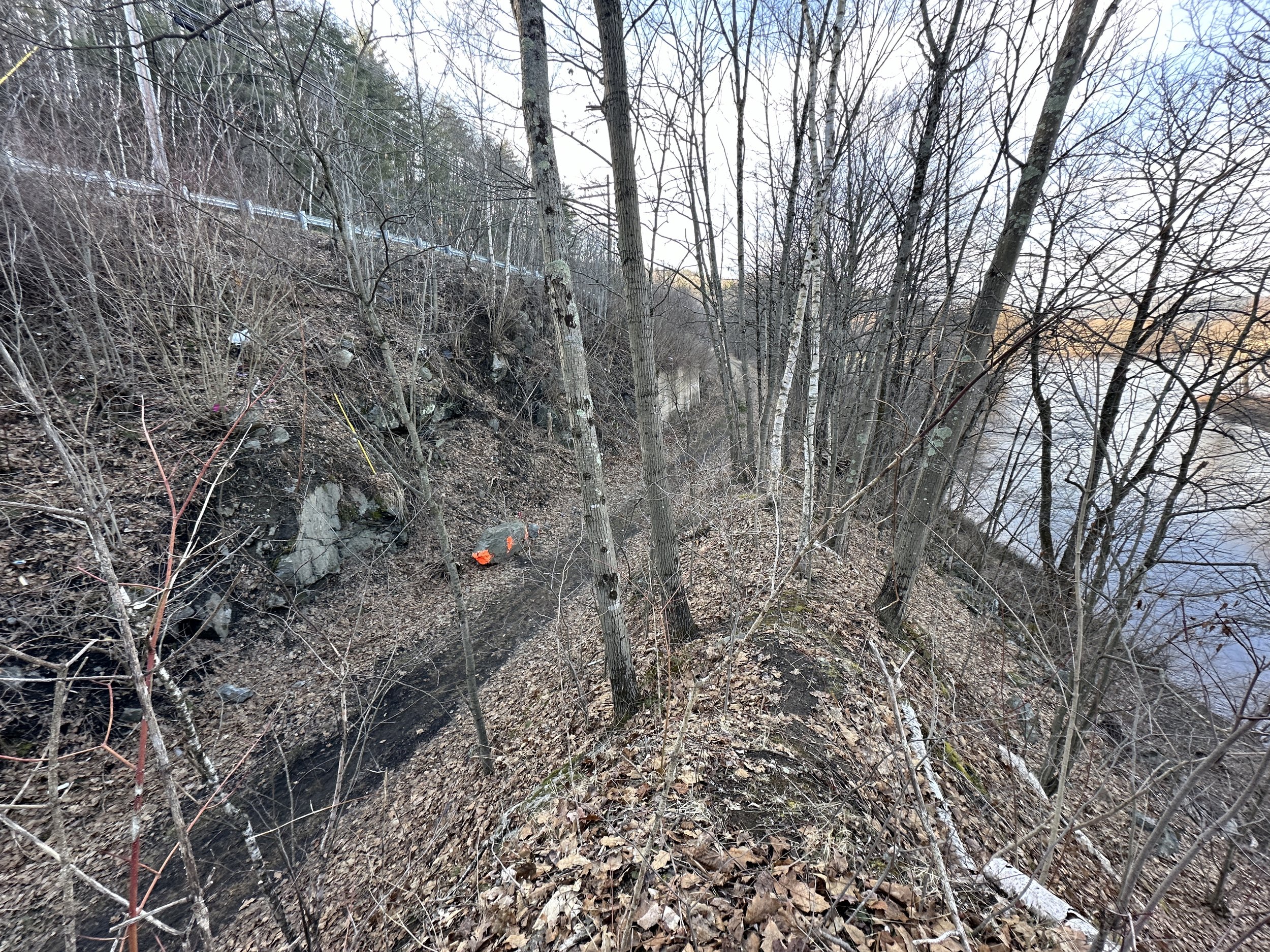
Rock fall alongside the Blackmount Rail Trail (viewed from above)
While, thankfully, the footway of the trail was completely clear of any trash, I did have serious reservations about continuing further in trail running sandals - I have found hypodermic needles in this area of NH/VT along roadways, and with some of these remote stretches easily accessible via farm roads or bootleg trails, it is only a matter of time, I think, before more attention is placed on where I run in sandals.
That is not mentioned to discourage anyone from embarking on a stroll of the Blackmount Rail Trail from either direction, simply awareness to what I encountered on this journey. While away from the roadway, several rocky cuts are encountered, one earthen cut had lost a massive boulder, sending it toppling from high on the embankment - local trail clubs have appropriately painted much of the boulder hazard orange, as it has almost landed on the trail.

Blue Mountain Wilderness rising above trailside vegetation
As Woodsville creeps closer, the trailside terrain becomes less precipitous, with several residences found through the adjacent woods. Here, again, old building materials and mounds of various trash can be found just off trail; attention should be kept toward the west/northwest, as the picturesque Connecticut River spills out toward lush, dark farmland. The rolling mountainside of eastern Vermont rolls in gentle dips and rises, often reflected in the placid waterway.

Across Rt 135; Blackmount RT: left; Log Yard: right
As the Blackmount Rail Trail crosses US Route 135 (aka South Court Street), the old railway proceeds along a rather straight corridor with many stately, white birch which line the pathway. This final stretch of rail trail follows along tall stacks of timber as the trail traces the T.R. Dillon Log Yard. As one makes their way toward the northern terminus of the rail trail, a set of brushy tracks drift off toward a log yard siding before eventually rejoining the main path, with Smith Street in sight.
From the quirky end of the Blackmount Rail Trail, a rough path can be navigated by continuing north/northeast along Smith Street, crossing US Route 302 just west of the large Ocean State Job Lot building, a narrow pathway can be found between OSJL and O’Reilly Auto Parts. This pathway can be used to connect the Blackmount with the Ammonoosuc Rail Trail, for a longer adventure, otherwise, turn around here and check out the stunning views out across the Connecticut River flood plain while venturing southbound.

Soft footing along the log yard
Following the completion of this short out-and-back, I drove to several other points and locations where the old B,C&M railroad corridor has yet to be appropriated into usable Rail Trail. While this length of railroad bed is somewhat choppy in places, overall, it seemed to hold some potential for an enjoyable trail corridor, perhaps more appropriate for wider tire, or foot traffic. Once the snow fully melts from this old path, I would like to see about tracing the old Boston, Concord, and Montreal mainline from East Haverhill, through Pike, as the old route swings northward to greet the residents of North Haverhill. Perhaps this too can someday be an enjoyable, wooded pathway, thus linking even more rail trails across this great state.
Overall stats for the day:
8.3-miles
1hr 25 minutes
280’ elevation gain
Blackmount Rail Trail - 3.8-miles (one way)

Approaching the northern terminus (sandy)