
Big Bickford + Scarface Mtns
With longstanding intentions of visiting the Skookumchuck Trail in Franconia Notch, today seemed like a good enough day to get on trail for a quick spell before diverging into the woods - a bushwhack loop up a few lower peaks at the northern end of the Franconia Ridge.
Explaining why I have had my eye on Big Bickford Mountain for such a long time is a difficult task - perhaps it got stuck in my thoughts while researching Eagle Cliff several years ago. The idea of bushwhacking this 3,261’ peak stuck in my mind ever since; I read accounts of autumn ‘whacks and winter ‘whacks, but summertime bushwhacks did not entice, with understory growth impeding travel and likely black fly clouds.

Skookumchuck Trailhead
Perhaps I really just wanted more open woods to roam following a beautiful couple of days breaking out deep-snow routes to Cushman + Kineo mountains last week; if that is the case then I may have well struck it rich with beautiful forests this morning.
With the call for another winter storm in several hours I was pleased to drive into Franconia with the low cloud layer glowing bright orange and pink at 6:45am. Parking at the Skookumchuck Trailhead, my car was alone in the large parking lot.

Crossing the Heritage Trail (snowmobile path)
On trail at 7:19am and immediately I longed for the beautiful snowshoe trails of the Adirondacks from this past weekend, it’s a shame the White’s cannot also enforce snowshoes. The trekking was surprisingly fast and efficient with snowshoes atop the choppy frozen slush.
The Heritage Trail was empty this morning as the mud streaked the north/south snowmobile path; the Skookumchuck Trail passes over the snowmobile trail and continues toward Jordan Brook, passing several small streams along the way, all easy to step over while using the snow-topped rocks.

Along Skookumchuck Brook
I’ve heard of folks beginning their bushwhack from Jordan Brook and following uphill from here, my original plan was to follow the Skookumchuck Trail for about 2.5-miles, reaching 3,350’ and cutting northerly, toward the trailless peaks.
I ended up following the trail, tracing the Skookumchuck Brook until reaching ~1.5-miles and found a nice gully which looked fairly open, mostly hardwood forest and began bushwhacking generally northeast and following the taper of the mini-ravine basically up to the summit.

Ascending Big Bickford Mtn
Initially, the woods were open on the eastern side of the tributary but the ~8” of snow was crusty and tough going, upon switching to the western side of the drainage the forest and snow layer were both spot on, totally enjoyable to trek.
Following the tacky 4” of snow onto the spine of a little ridgeline, the spruce and fir forest was neat and open, easy to climb and make efficient progress upslope.

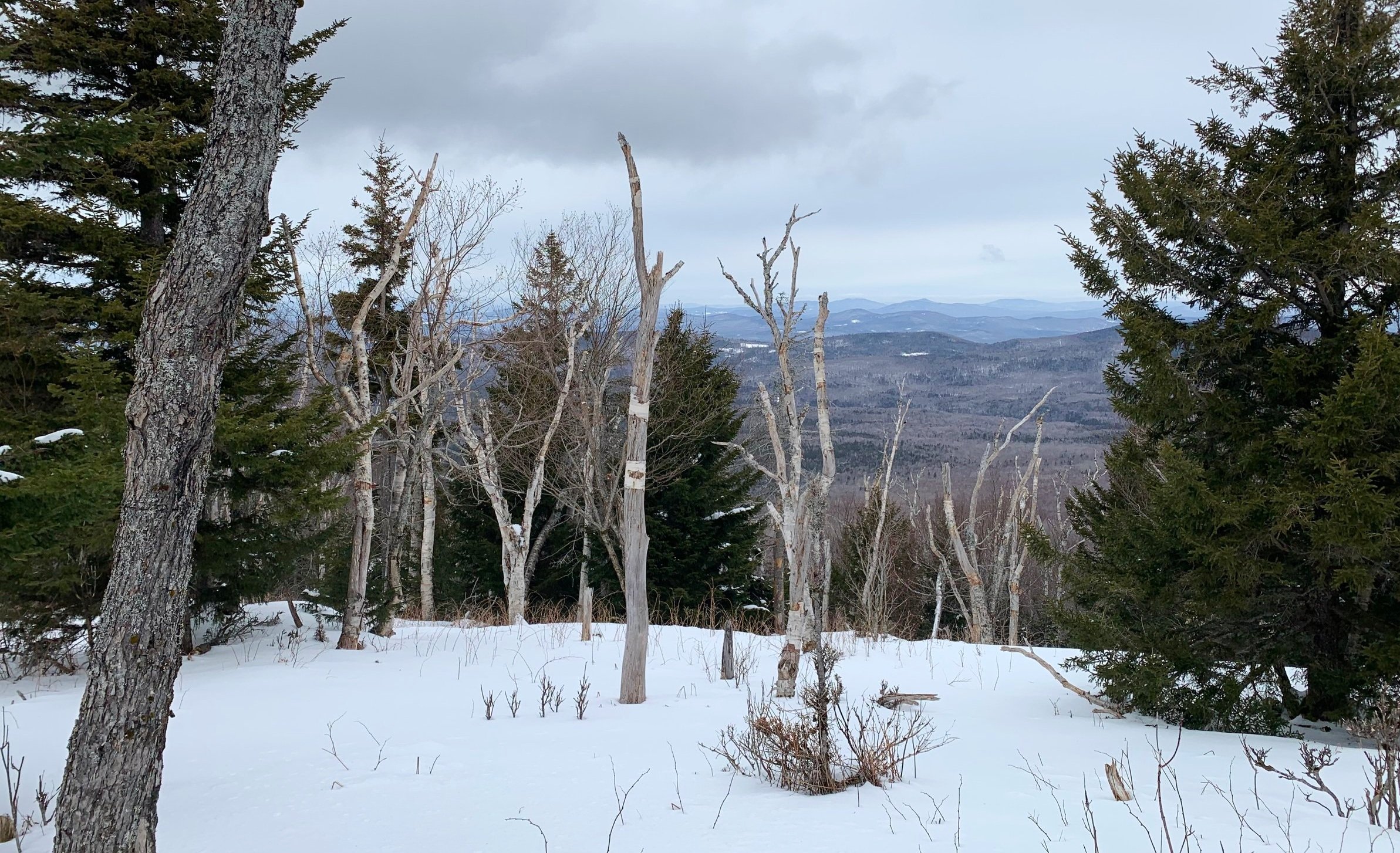
Open birch meadows nearing the summit
Reaching ~2.0-miles I tracked more northerly now than the northeast path I had been ascending, the forest opened up further still to a lovely birch glade, the snow varied from a crust which held my weight to 7-8” of powder.
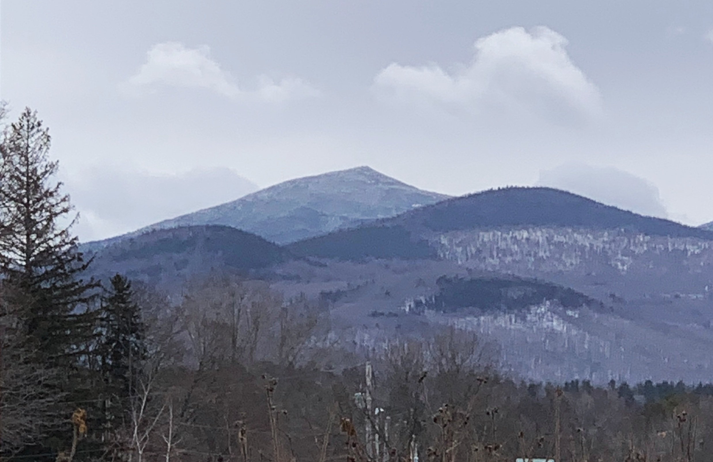
Over my shoulder, back southwesterly, the views to a cloud-topped Cannon Mountain (4,080’) became framed by the wind-torn birches of Big Bickford Mountain. Gazing to the south, a frozen Lafayette (5,240’) rock mound towered jaggedly, untouched by the tumultuous, churning cloud which seemingly stalled upon Cannon’s upper slopes; these are my kind of skyscrapers!

Lafayette from Big Bickford Mtn
The birches at this altitude were like nothing I had ever ventured through, their twisted frames embodied the screaming winds from a century of Franconia’s worst storms. Boulders and rocks poked through the snow, making the surrounding hillside appear even more inhospitable.
Despite all this, fresh moose tracks meandered nearly over the summit, passing from the Notch toward Garfield Mountain (4,480’) at ~3,190’. Within two minutes of following these moose post holes toward a lookout east I stood on the 3,261’ summit of Big Bickford Mountain, at both an old glass canister and a (relatively?) newer black plastic canister; the latter of which contained the summit register and I signed in; the last ascent was made by a party 12-days prior.

Descending Big Bickford
With a check of the direction I departed the beautiful, broad summit area - next stop was Scarface Mountain, a sharp cone on the topographic map which tops out at 2,802’. On the northwestern slope of Big Bickford I was in a state of bliss, snowshoeing and gliding through 8-14” of soft, untouched powder, coasting nearly effortlessly down the steep hillside with each pillowy step.
Somehow, with all of this fun, I ended up tracking a bit too far east - thankfully not over-shooting Scarface. A quick reroute in my direction brought me through a thick spruce wall and into an old logging cut, comprised of a fairly open and easy to traverse birch stand.

An old logging cut on the slope of Scarface Mtn
Gaining the summit by a generally westerly direction, I found the second canister of the day and registered my ascent once again; this jar was made of light blue glass and hung on a cord; 10-years of entries were all contained within this one, small notebook - such remarkable history.
Continuing in a westerly direction, I had to dip and dodge around pockets of tight conifer growth and into more open hardwood; this was the name of the game for much of the bushwhacking today - pockets of thick evergreen were always avoidable by looking toward either side.

Scarface Mountain summit
While descending Big Bickford had been facing northwest and contained beautifully soft, deep powder, dropping off Scarface Mountain was more open toward the southwest to catch the afternoons warming sun. This snow was a punchable crust, not the worst to snowshoe but not the most favorable of today’s outing.
At least the navigating toward Bickford Mountain (aka Little Bickford Mountain) was easy through a nice, open mixed forest - beech began sprinkling into the blend along the plateau.
Restricted views from Scarface Mountain
Searching for a 3rd canister that I wasn’t sure existed, I walked along the high point of the land mass and continued right on over. I had considered trekking straight west, right off the minor peak and back to my car but was stopped in my tracks at rocky, snow-covered boulders and a massively dense wall of conifer.
Another brief reroute toward the south helped to avoid the jumbled mass of boulders and tight forest. Descending back toward the Skookumchuck Trail was over a thick thaw/freeze crust which coated the forest floor (rocks and blowdown) like a sheet of fondant icing, on top of which traveling was rather easy.

Scarface + Big Bickford from Little Bickford
I rejoined the hard-packed trail for about 0.2-miles and was immediately reminded of how much I did not miss the frozen bare-boot tracks, give me some good off-trail winter bushwhacking anytime.
Back at the trailhead I was still the only car in the lot, cooling down with some warm moringa tea, I watched a woman release a chipmunk from a Have-A-Heart trap - the world just keeps on going while I traipse around these far removed White Mountain forests.
Overall stats for the day:
4.76-miles
2hr 45 minutes
2,129’ elevation gain
Big Bickford Mountain - 3,261’
(Little) Bickford Mountain - 2,360’
Scarface Mountain - 2,802’
Garfield towering above today’s 3 peaks