Mt Moosilauke: Beaver Brook Trail
A morning spent hiking and roaming a cloudy mountainside, to me, is never a day wasted. Instead of glimpses to distant peaks and ridgelines, the attention is often reserved for nearby observations - to mosses and wildlife, geological rock formations, and waterfalls - should one be lucky enough to meander near to glorious chutes of cascading white water. One thing this trail has plenty of is history - trail reroutes and suggestions of bygone corridors make an outdoor enthusiast like myself pause to flip through the rolodex of old maps contained within one’s memory.
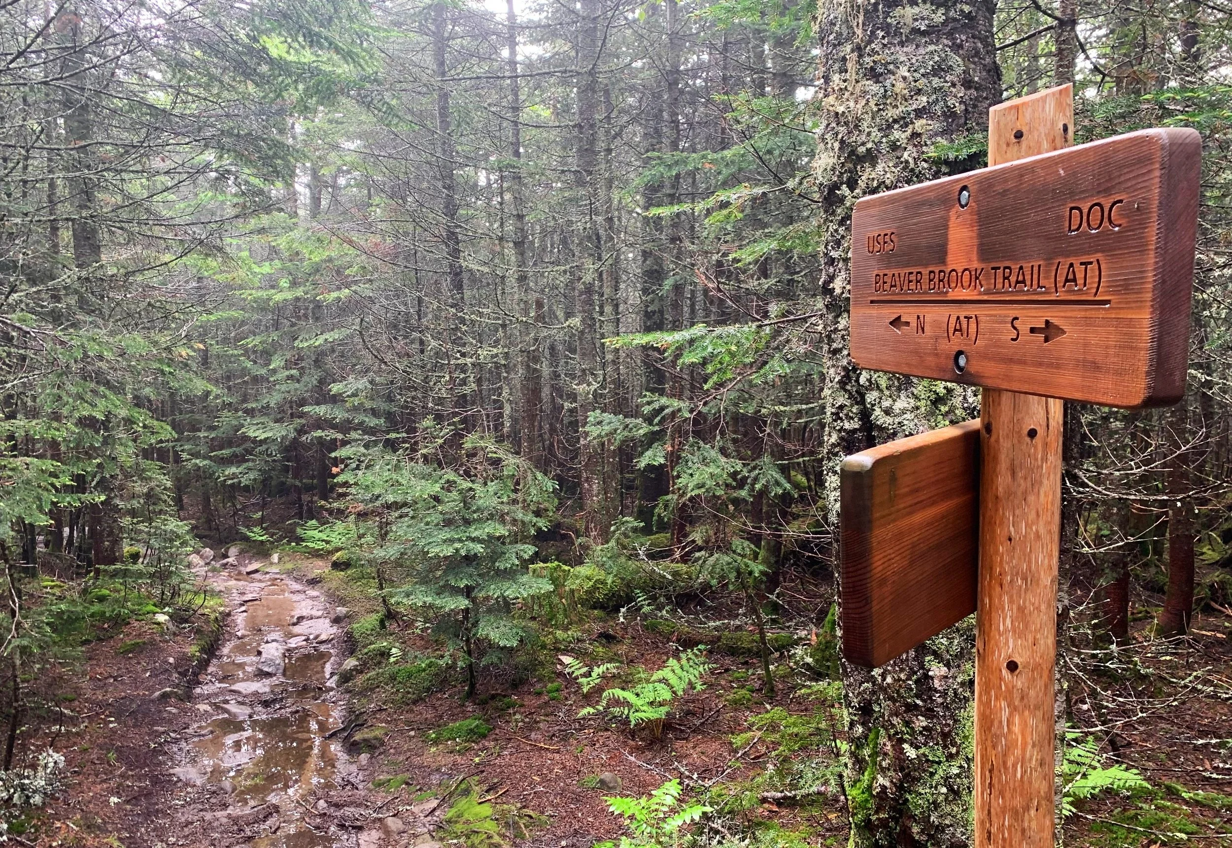
Beginning along the Beaver Brook Trail (AT south)
The Beaver Brook Trail guides hikers up the steep, east-facing gully of Mount Moosilauke. From US Route 112, the rugged old trail climbs abruptly, ascending beside deafening crashes emanating from the Beaver Brook Cascades during the initial mile; the pathway levels off somewhat in the Mount Jim-Mount Blue col and winds its way along the edge of the Jobildunk Ravine headwall. Finally, after uniting with the Benton Trail and departing the forest threshold, hikers are in for a truly unique alpine ramble to the 4,802’ summit, atop the bare rocks on which the old Tip Top House once stood.
Bridged crossing of Beaver Brook
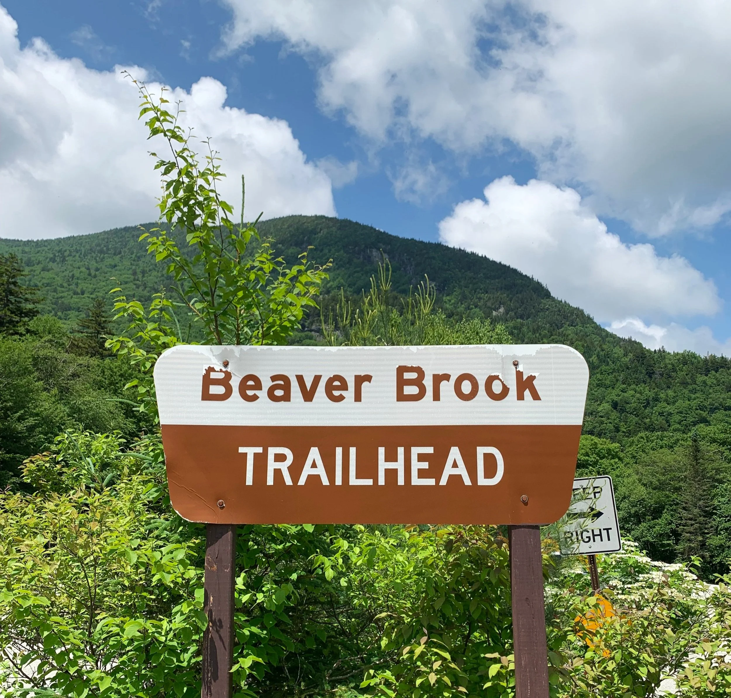
Parking along the west side of US Route 112, near the height-of-land in Kinsman Notch, hikers can now find a large trailhead parking lot - the Beaver Brook Trailhead. Beginning on White Mountain National Forest lands, there is a $5 day-use fee to park one’s car here; obtaining an annual National Park pass can greatly simplify parking fees in the White Mountains.
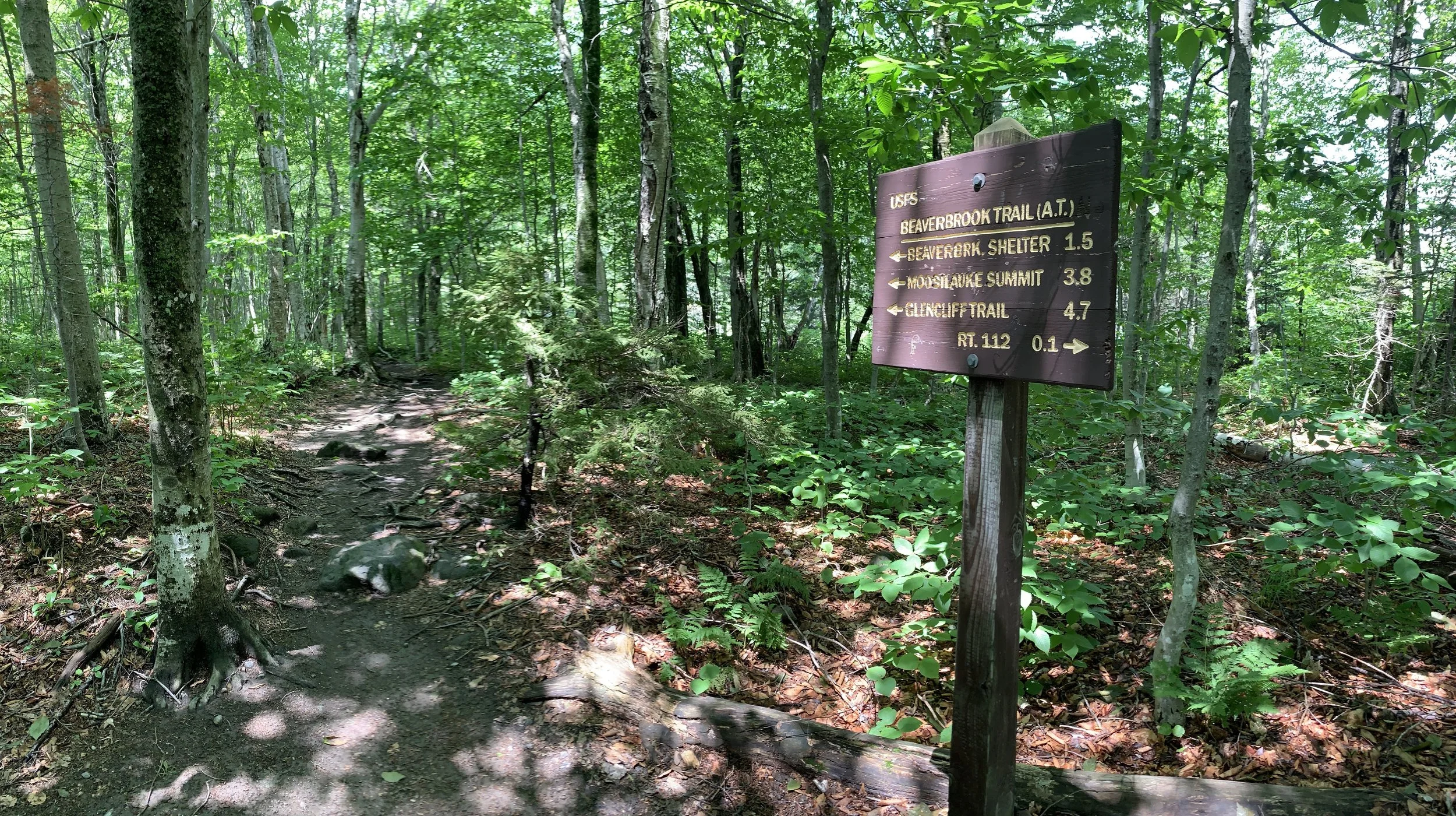
Beyond a welcoming trailside kiosk, the parking lot spur quickly joins the Appalachian Trail; a turn right here will guide hikers northward, toward the Kinsman mountains and inevitably Katahdin many miles later; the Appalachian Trail south veers left, overall traveling primarily westward to reach the summit of Mt Moosilauke - this is the Beaver Brook Trail.
Ascending ledges beside Beaver Brook
By way of old logging roads, the path navigates through a hardwood forest dense with hobblebush at lower elevation as it traverses around - south of Beaver Pond - with the pond in sight all the while. Before long, hikers reach an unbridged crossing of Beaver Brook, which was flowing energetically following a day of steady rainfall. To our surprise, we found several hefty sticks leaning against a nearby tree which were used for balancing during the crossing and once across, deposited on the far side; stepping atop rocks which emerged from the brook, we made the crossing while collapsible trekking poles stayed attached to our packs.
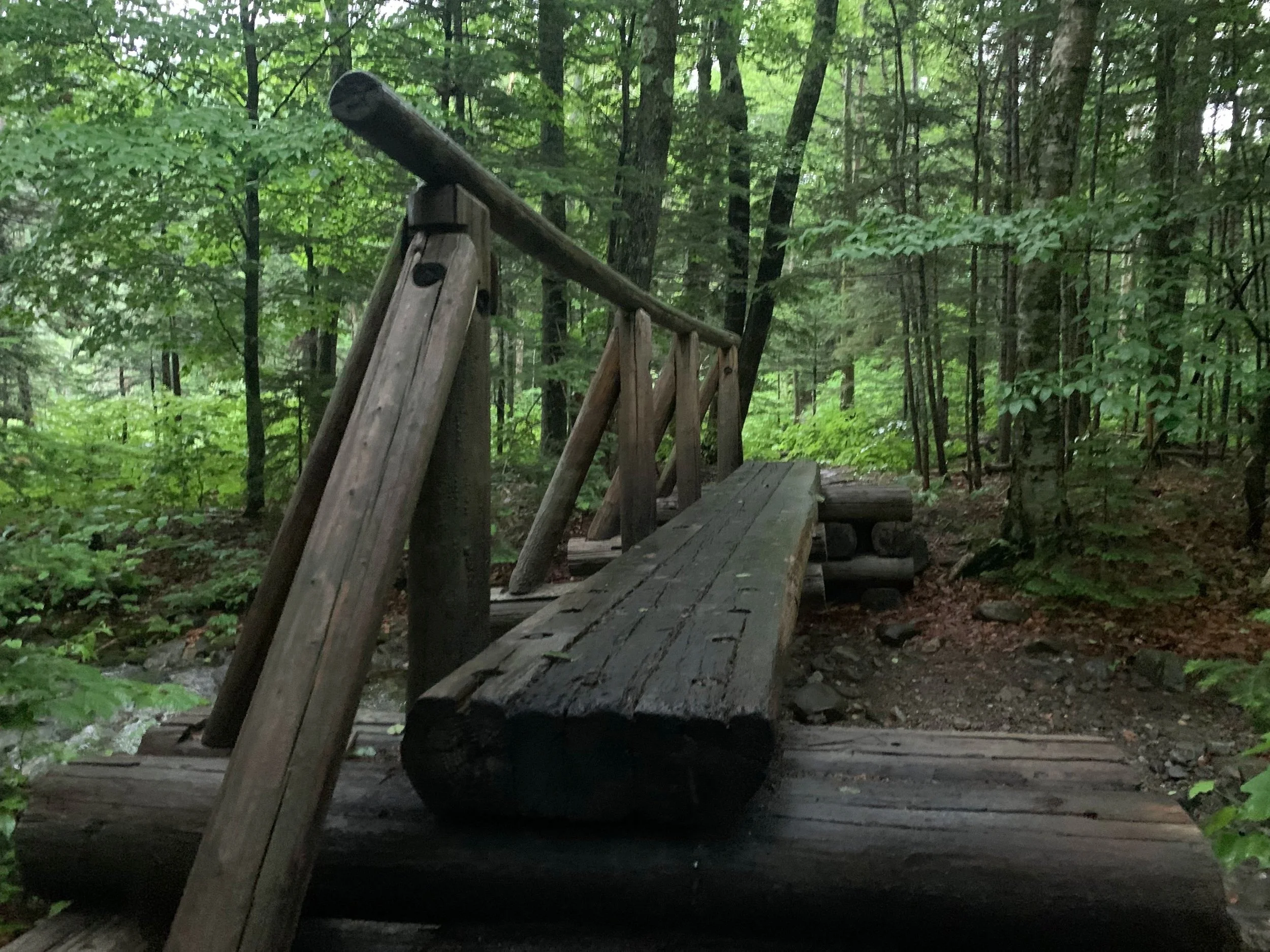
The acrid scent of bitter creosote filled the air for the next several rods as two subsequent crossings are made atop burly bridges, three wide logs bridge Beaver Brook, with the water flow far below - perfect for times of high water. Before the trail begins its steep ascent along the cascading brook, it is still possible to locate the old, fading path which would have guided weary hikers to the long-retired Beaver Brook Shelter; removed and relocated to nearly 1,800’ upslope along the Blue Ridge, the lean-to shelter and tent pad now welcomes all backpackers and Appalachian Trail thru-hikers higher up the mountainside.
Ascending old, weathered ladders
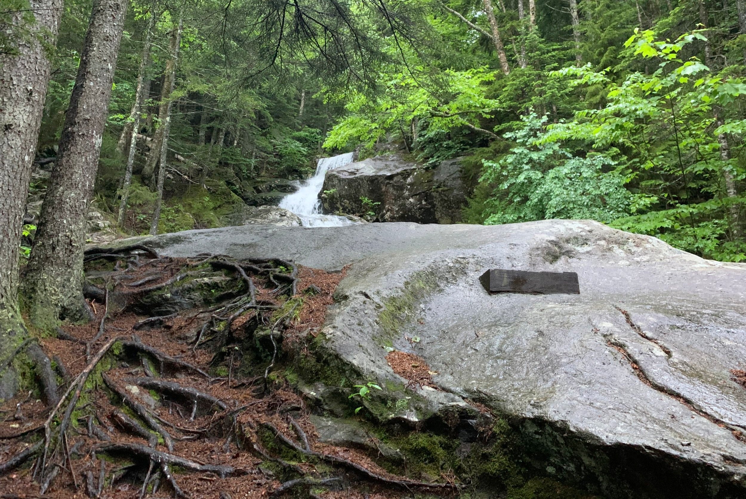
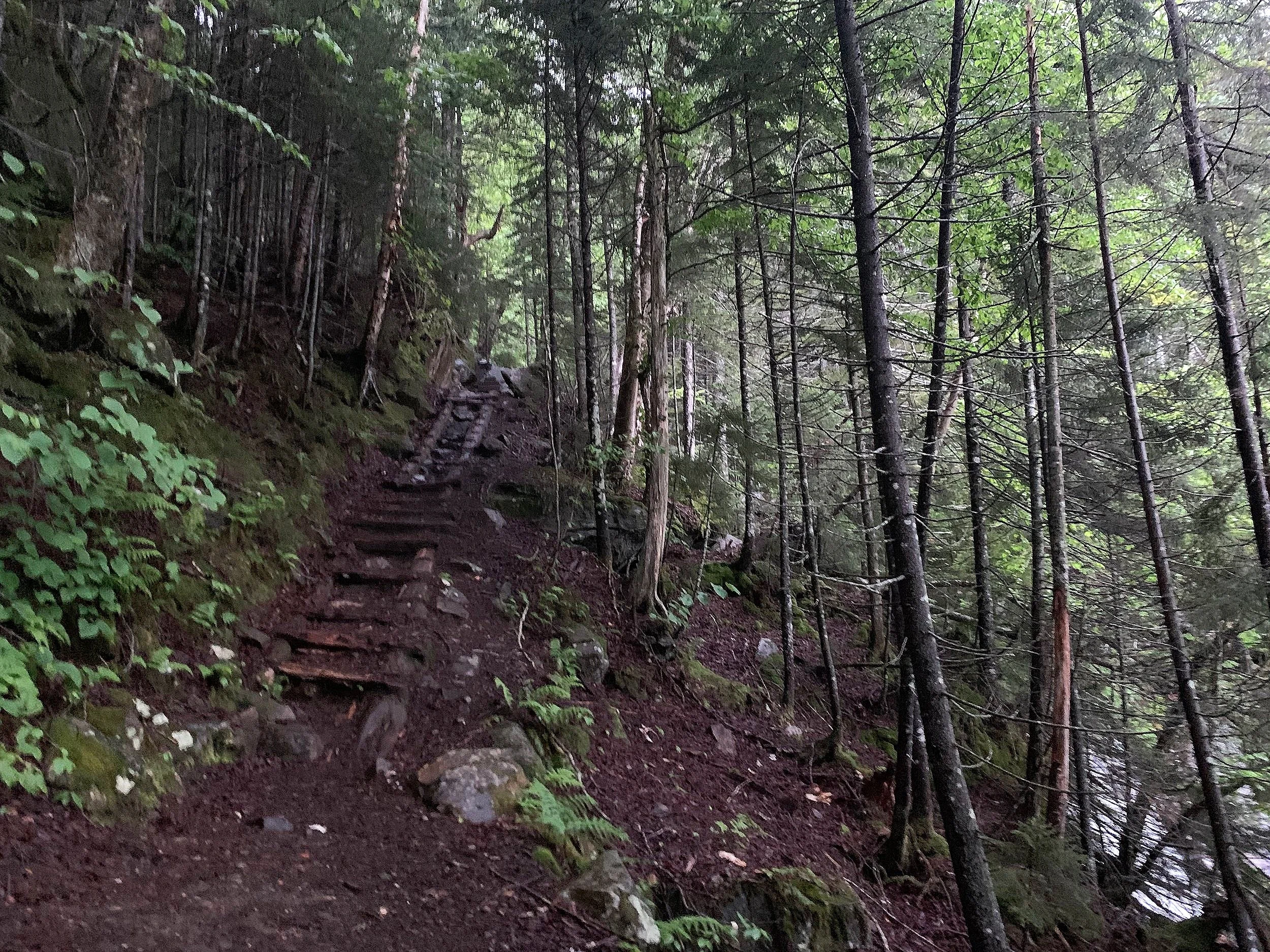
Wasting no time, the Beaver Brook Trail quickly becomes rugged and boulder strewn as it begins to climb. A lush, green understory opens up as the first bare ledge is encountered and the cascading streak of white water comes into view; making for one of the finest, most scenic ascents in the White Mountains. Today, the water was flowing with intense force, crashing onto the rocky clefts and actively eroding the rock (albeit over eons) as we observed from a safe distance.
Substantial slick, bare rock ledges are scaled which once featured several ladders acting to aid the steep ascent; now, wooden steps drilled into the mountainside can be found winding their way in many of the exposed areas. Several sections of rebar can also be found, which provide helpful handholds in which to ensure a sturdy and secure climb; in other areas, roots or rocks can be crimped and held onto for a full-body climbing experience - our favorite!

Wooden steps winding up the ledges
A narrow bridge spans a severely precipitously washed-out section as one can peer down into the short landslide and spot a hulkingly massive boulder which has careened downward, almost reaching the brook. During the ascent, Beaver Brook Cascades remain in view. Several short spur paths have become worn into the forest floor just off-trail, which get hikers closer to the waterfalls for a better glimpse through the trees; care should be taken, however, as the mossy rocks are wet with spray and invariably slick as ice - a fall anywhere along the waterway would certainly be catastrophic.
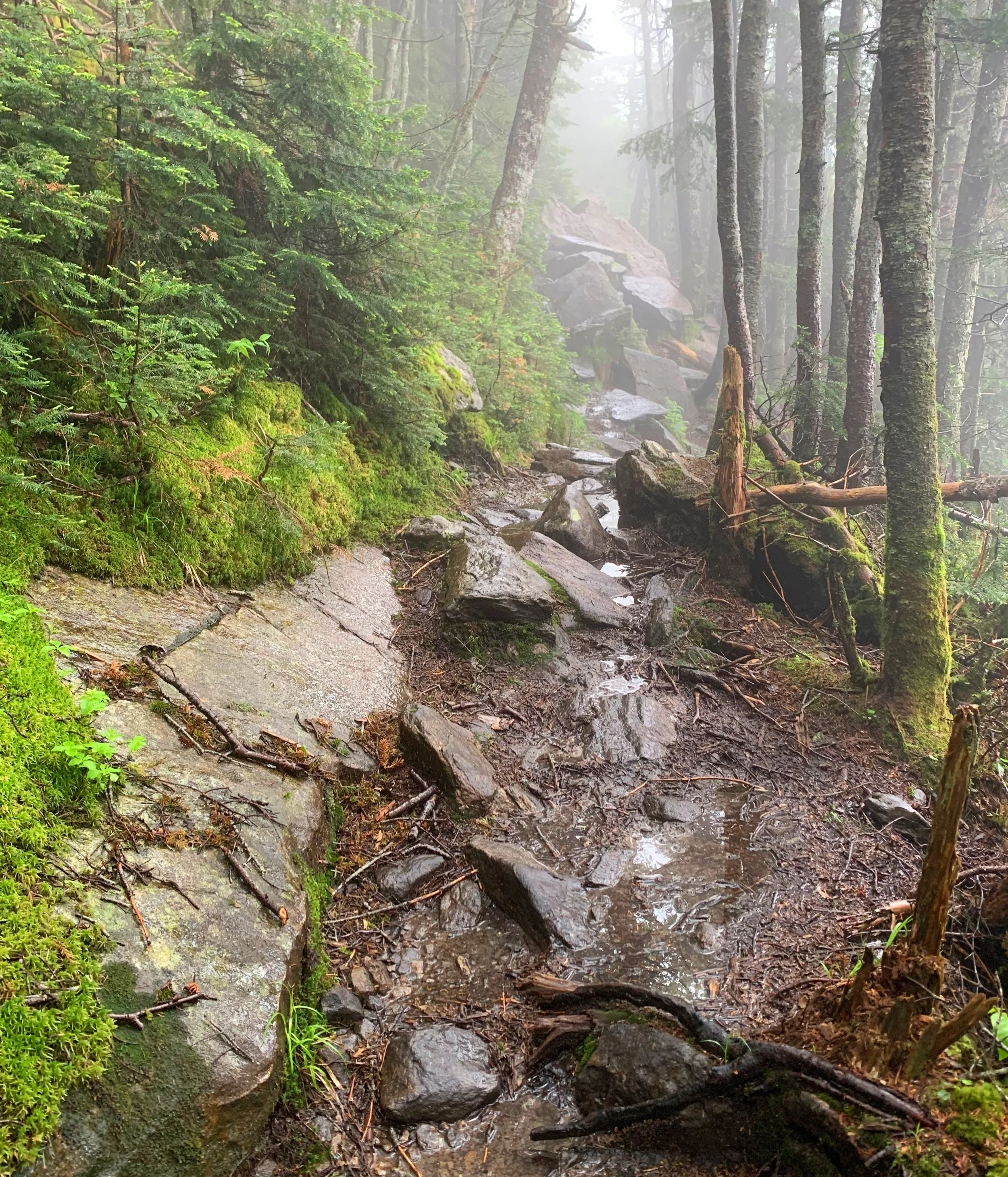
From brookside, back into the forest, the trail winds its way upslope; atop ledges, up and over boulders, using exposed root systems as if to be a natural staircase, and of course, through occasional mud. Higher up, water can even be heard flowing beneath the jumbled mass of rocks which comprise the trail. Entering a classic boreal forest of spruce, fir and white birch, the trail begins to mellow out in grade somewhat, and before long - 1.2-miles into the climb - the spur path for the current Beaver Brook shelter is encountered.

Spur path to the Beaver Brook Shelter
Built in 1993, this Dartmouth Outing Club (DOC) lean-to features a nearby tent platform, a water source just beyond, an elevated privy just prior to - a commode which filled the surrounding, dense, foggy air with a stench I had hitherto yet to encounter in the wild - the northeasterly vista was, however, stunning beneath the cloud layer.
Remaining rocky underfoot, the Beaver Brook Trail continues to climb, gradually yet ruggedly for the coming 0.4-miles, until reaching the main junction in the Mt Jim-Mt Blue col. Here, the Asquam Ridge Trail diverges southeast, toward Mount Jim (4,172’) before dropping down the wall of Jobildunk Ravine and crossing the Baker River enroute to the DOC Ravine Lodge.
Mount Blue-Mount Jim col junction
Finding only suggestions of the old DOC trail which would have dove steeply down the headwall of Jobildunk Ravine, we proceeded northwesterly, along the Beaver Brook Trail which would guide us along the edge of the precipitous ravine and around the southwestern shoulder of Mount Blue (4,529’).
In other seasons, it may be possible to obtain glimpses of the craggy headwall of Jobildunk Ravine, but today, being late spring, the mountainside contained such a lush verdant understory, the downlooks into the ravine remained hidden from sight. An impressive area of blowdown was passed through, thankfully all toppled trees had been cleared from the path, yet a patch of leaning and partially knocked over trees remained, tilting away from the ravine edge as epic winds had careened upslope, funneled into an incredible force, and over the headwall edge.

Leaning fir stand atop Jobildunk Ravine
The trail remained soggy through most of this near-level stretch, but while utilizing rock tops, it was possible to place careful steps and keep feet dry. At one point along the trek, we even found a natural spring of water shooting up from exposed bedrock, other places dripped lavishly with crystal clear mountain water, although I may still be inclined to filter or sterilize the drippings, if one has the tools on hand.
Beaver Brook Trail nearing the reroute swing at 4,420’
Atop strewn and jagged boulders, the trail becomes increasingly rugged once again, and at 0.65-miles from the previous junction, the Beaver Brook Trail swings a sharp right, heading due north briefly as the old Beaver Brook Trail which contoured the edge of the Ravine can still be seen. Rerouted away from the precipitous edge in the mid-1990’s, the path now follows more of a topographical contour along the hillside, all through a narrow conifer corridor. On a clear day, glimpses from Mount Jim and up toward the high point of Mount Moosilauke can be taken in, today, we remained in a low-hanging fog.
Atop bare rock, the trail passes several wet patches, which, to my knowledge, remain soggy nearly year-round. Before long, the ledgy pathway transitions to a smaller aggregate; pebbles, rock and sand comprise the footpath around exposed slabs. Stopping briefly for a sip of water I looked off into the forest and questioned a relatively wide corridor; devoid of mature trees, the old cut was likely the original Beaver Brook Trail which once led toward the mountaintop.
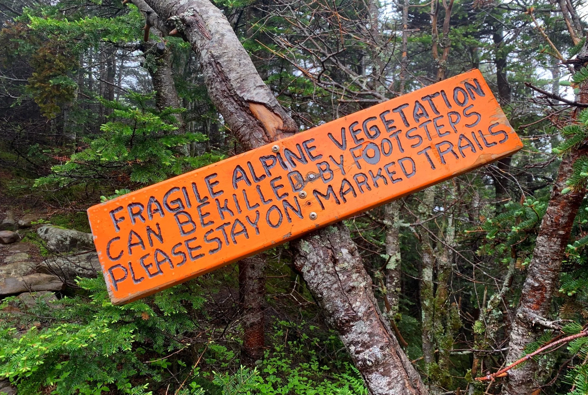
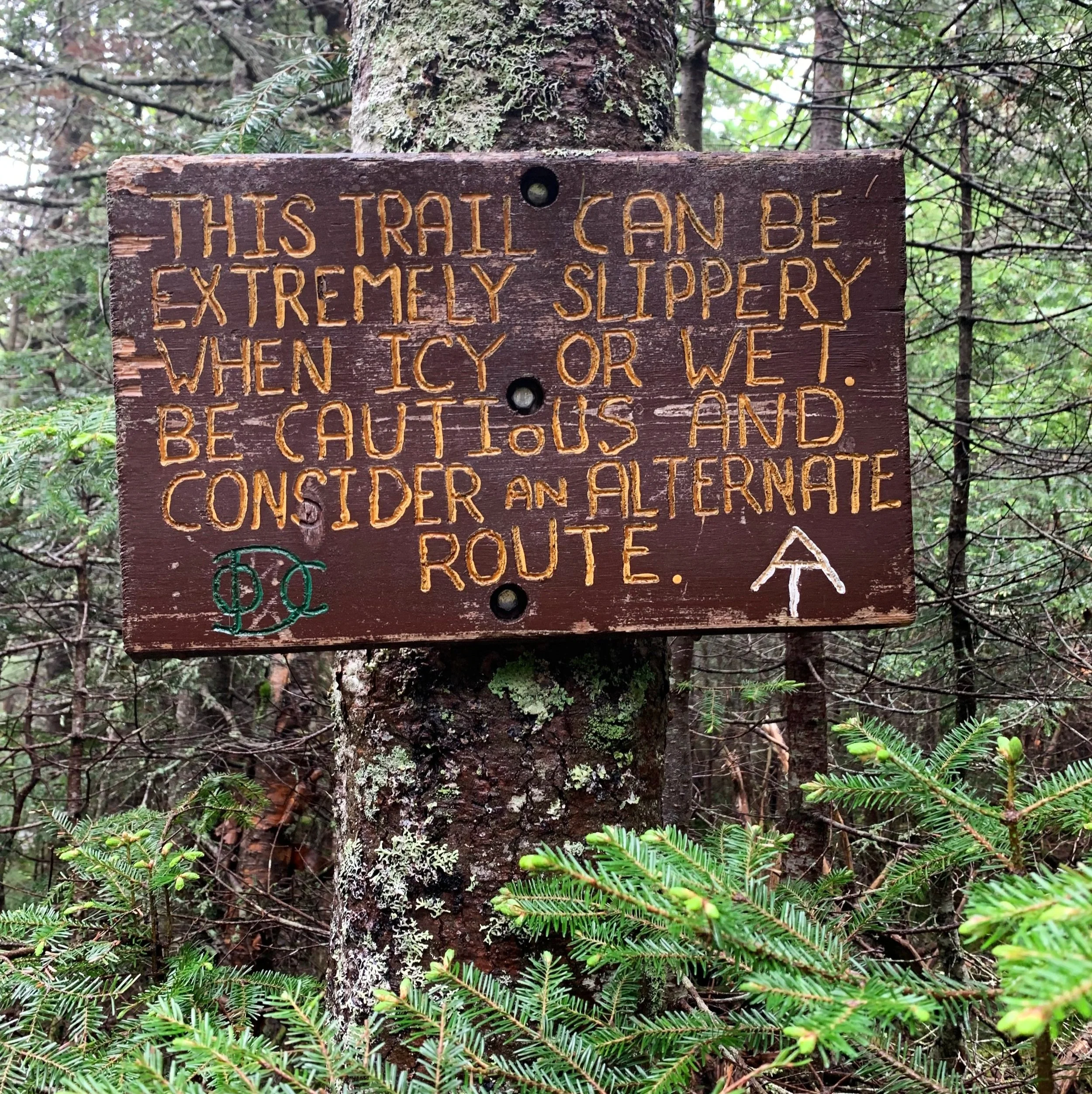
Awareness warning from the Dartmouth Outing Club
Also rerouted in the mid-1990’s, the Beaver Brook and Benton Trails now coincide for the final 240’ ascent toward the summit. Departing the junction, still in the shelter of dense forest canopy, an orange and black DOC sign warns hikers to remain on the footpath to avoid trampling the fragile alpine vegetation. Once out of the treeline, it is advisable to be prepared for increased winds due to the constant exposure; today, we could witness the cloud layer being torturously whipped around, up and over the large landmass which is Mount Moosilauke.
With waterproof jackets on, we comfortably made our way through the low velocity, constant gusts. Following within the boulder-lined pathway, massive 4-5’ rock cairns mark the pathway up the ridge crest - perfect for times such as these, when in a dense fog or white-out conditions.

Ascending the summit crest of Mt Moosilauke
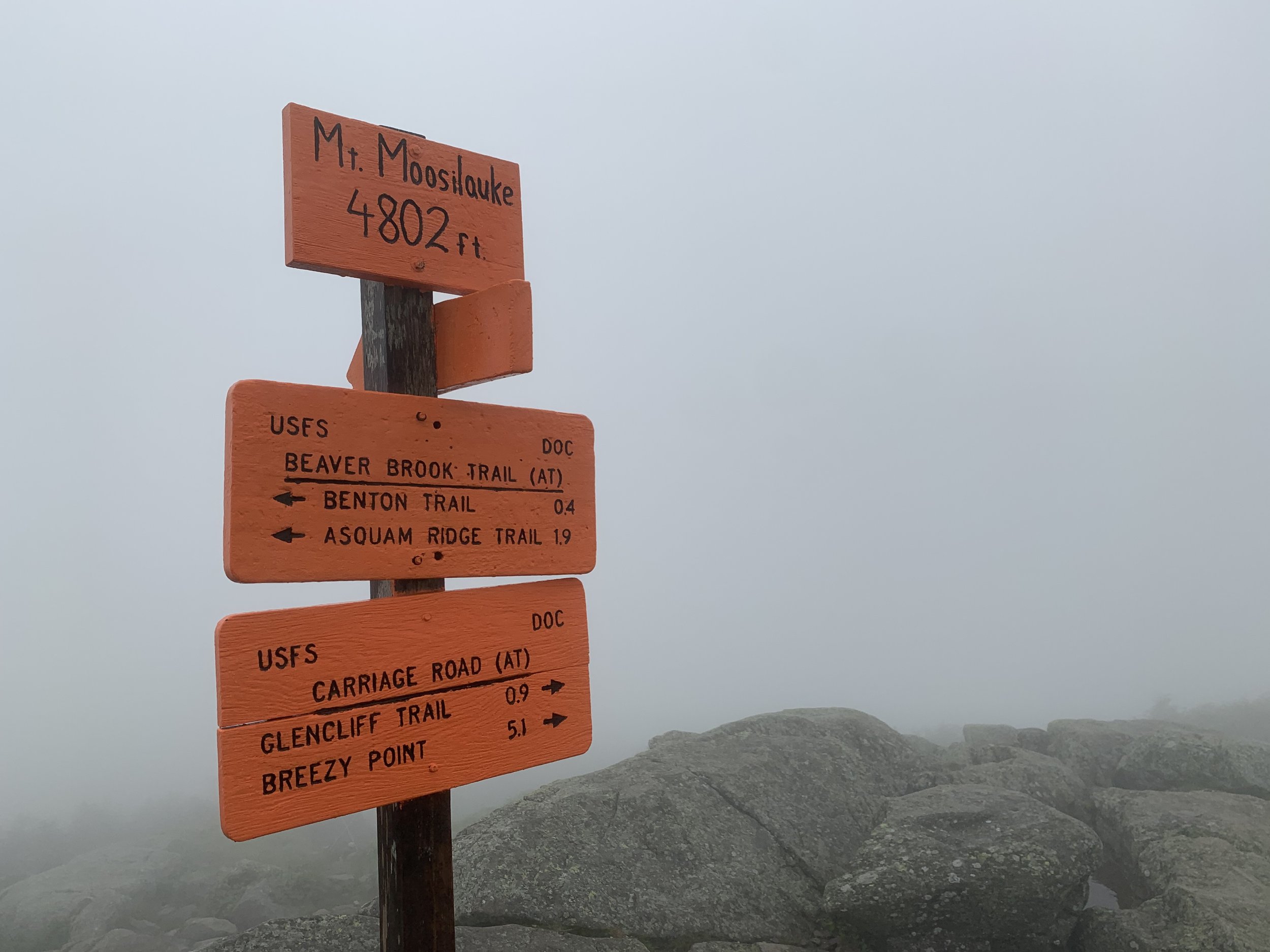
With visibility limited to perhaps 25’, and our focus down at foot level as to not twist an ankle on boulders, we quickly reached the high point of the mountain, the summit shelters fading into view like an earthen ghost. Glancing up we could now see the bright orange “Mt Moosilauke 4,802ft” sign atop the highest rocks.

Old foundation stones now a summit shelter
With occasional sheltered reprieves from the constant exposure, we moseyed around the summit area, reading plaques and finding several US Geological Survey bench mark discs. A plethora of scraps remain on the mountaintop from the old summit house: nails, glass, various pieces of metal can still be found. The shelters which dot the summit area have been constructed using many old foundation rocks, most of which still display concrete and mortar.
Summit of Mount Moosilauke
Great care should be taken while descending from the summit of Mt Moosilauke as three trails depart from here, and within a short trek can locate a hiker far from their intended direction. Shortly down from the summit area, orange trailside signs indicate which trail the hiker is on, but in times of foul weather, may not always be visible.
Once back in treeline, the constant moan of blowing wind ceased and we could stand fully upright once again. On the hike back down the Beaver Brook Trail (being 8:30am), we began encountering both northbound and southbound Appalachian Trail thru-hikers, all of whom were extremely pleasant to share the trail with and to share a brief chat with.
Descending Beaver Brook Trail
While ascending the Beaver Brook Trail was certainly steep, we find it much easier to have a mountainside to lean into; descending this pathway is extremely tedious and foot placement must be intentional as many of the boulders rock slightly and are slickened by a fine layer of moss and algae. The Beaver Brook Trail is perhaps our favorite route in which to ascend this local mountain, we may next time spot cars or make a circuit out of the trail network - descending down perhaps the Benton Trail, as was suggested to us by a mountain running friend - thanks Chris!
Mount Moosilauke is often viewed as a good “beginner” climb and introduction to the White Mountain’s. While this is certainly true, the mountain climb should not be taken lightly - while blue skies may be found in the trailhead parking lot, it is not uncommon to find extreme weather shifts upon reaching the exposed 4,802’ summit; gusting winds, blinding white-outs and cloud cover, extreme temperature drops at any time of the year are not uncommon for this mighty monadnock of a mountain.
Overall stats for the day:
7.55-miles
6hr 33 minutes
3,412’ elevation gain
Mount Moosilauke - 4,802’