
Baxter State Park: The Brothers
Baxter State Park, Maine – Day 1
As if I never even drifted to sleep, I jumped out of bed at 2am to the sound of Led Zeppelin blasting from the four 16″ JBL’s directly beneath my pillow.
This was how the Hamilton’s knew it was time to shovel in some apple cinnamon oatmeal, wash it all down with several tall glasses of fresh orange juice, lace up our Merrill boots and pack like sardines into the ’91 Toyota Corolla with all of our gear.
Our weekend routine looked a little something like this for many years, making the trek to our secret hiking and camping destinations that my father would give tantalizing clues about; with names like “Giant” or “Hurricane”, my 6-year old brain would run wild – assuming these were the hidden spots where dinosaurs still ran wild.
Our hiking adventures back then all took place pre-internet, so the bookshelves where I was known to nap (I would fit myself behind the books!) were filled with huge manuals and text books; one could find my fathers college books, early writings of astronomy – and also by far my favorite cluster of books: the Mountains.
He owned books on climbing, backpacking, snowshoeing, a small library of maps and Appalachian Mountain Club trail guides, and several books recounting early expeditions up Everest; tucked neatly next to the Everest texts, one could find the 1992 AMC Mountain Guide to Maine trails along with crisp maps of Katahdin.
Back in those days this mammoth pile of rock was no different in my mind than.. say.. the book it butted up against, Everest. They were both beyond my scope of understanding – I only knew each mountain as one and the same: they were big, scary and they killed those who did not respect the high hills.
Fast forward nearly thirty years later and still no one in my family had attempted this hike (turns out my father climbed Mt Katahdin several weeks after my ascent), granted it was quite a drive to get to, pushing +11hours one way from where I grew up, there were so many other summits to relax on and lovely trails to explore in our own backyards!
I drew up a list of ‘goals’ for 2019, wrote these goals on pieces of paper and tacked them on the wall where they hung out in plain daylight to glare me in the face, as if mocking for not attempting them yet. One of my recycled pieces of paper simply read: “Katahdin, 5268ft”.
Honestly, it was a reminder for myself that I had always wanted to stand atop its summit, but knowing that it was still a 7hr drive from where I now called home, in New Hampshire, I did not consider it to be a likely goal for 2019.

Teardrop Pond along the Marston Trail
By checking various online sources such as mountain-forecast.com, and baxterstatepark.org, I found a decent weather forecast for Sunday. Reading maps and finding my trail head, I found one parking lot where the three main Katahdin trails initiate. I jumped on a $5 parking pass for the Abol trailhead as the lot where I had done all of my research thus far was sold out well into the future, every day.
I was happy with my decision; it signaled my trip to Katahdin had officially ‘begun’, knowing that I, if nothing else, now held a parking pass for Baxter State Park – should the cards align in my favor and I actually make the long drive north.
This literally was the only planning set in place up to this moment: well at least I had Step One checked off – so pumped to actually be the proud owner of a Baxter State Park parking pass! I assumed that I would simply sleep in my car, or better yet, drive up the night before and not have to find a place to rest – just drive up, hop on the trail, summit this behemoth and drive back home, seemed easy enough to me if I turned on my stubborn genes and just get the task done!
The following day I decided to look around for a small tent spot. Finding all of the campgrounds were booked to the max within the State Park itself, I ended up with a $30 site at the New England Outdoor Center – despite having no campground map or being able to choose a particular site, it looked promising based solely on the quality of the website. I would find out if this still proved true upon my arrival Saturday evening, assuming the plans continued to unravel in this positive direction.
Continuing to check the weather daily, almost obsessively as the clouds turned to rain which then turned to ‘chance of t-storms’ Sunday afternoon, I still remained hopeful as the weather never seemed settled for even 5 minutes leading up to the weekend.
When a shiny new, waterproof National Geographic map landed in my Post Office box Thursday evening, I think this was the realization that things were getting pretty serious. My pilgrimage to northern Maine would indeed be taking place.
Friday evening all I wanted to do was teleport home from my work day to begin the task of packing; I foraged through all of my running, tenting and backpacking gear – throwing anything and everything that I thought might be useful in an “organized” pile. If I thought there was a chance I would want a certain piece of gear out on the road, I packed it. I had my entire Subaru Impreza for all of my junk (very important gear), so I filled that sucker up with anything to make my weekend top-notch, and a successful one!
The drive was literally 6 hours and 47 minutes from cabin to entrance at Baxter State Park, which consisted of one stretch of asphalt upon entering Maine that my GPS rattled off in the robotic-SIRI-esque voice “continue straight for ONE HUNDRED and EIGHTY MILES!!” - all I can say is, thank the good heavens for the Rich Roll Podcast and for snacking on peaches, apples and my 5lb bag of carrots that I had picked up in Plymouth, NH during my grocery run earlier in the morning!
Saturday was most definitely the better weather day. The Subaru read 91° outside and sunny with mild humidity. Not bad! Driving straight to Baxter State Park and informing the gate attendant of my parking pass for Sunday, he asked “are you sure you still want to enter the park today??”, heck yeah I still wanted to enter the park today! It was just barely 1pm, which meant my day still had plenty of time for exploration.

Rocks atop North Brother, 4,151’
I held secret a desire to scope out several other summits should I arrive in time on Saturday, which I did, so bring on the dang mountains! Being on my internal radar for days prior, I researched the loop beginning at the Slide Dam trail head which would take me up to and over North Brother, South Brother and another I had never heard of – Mount Coe.
From the gate house the parks Tote Road began west, circling under and around the massive bump in the earth known as Katahdin. I was able to see the other parking lots as I drove the loop road. Found the Abol campground and day-use lot where I would begin the next morning, as well as several ponds that all looked rather lovely for a picnic.
“What the actual hell is that?!“, I exclaimed to myself – peering through the trees at a slab of gray rock that appeared to be pushed up damn-near vertical rising up from the forest floor. Immediately I pulled to the side of the road, checked the map and guessed it to be an anomaly in the topography marked appropriately on the map as ‘Doubletop’. Remembering that I had heard its name tossed around in some trail guides or text somewhere or another – the climb looked epic!
I began to fall deeply in love with this part of Maine and the forest where I now found myself.
I must have been wearing my lost puppy face as the State Park Ranger left his truck and walked over to my side of the car. Being totally prepared for him to break the sad news that this lot was full and that I would unfortunately not be able to adventure in the forest surrounding these Brothers that I had read so much about after all, nope! I found myself speaking with one of the kindest Rangers yet as he talked highly of the campground where he was caretaking (in the park) and how special these mountains and trails were to him.
Asking if my intention was to climb North Brother, I sighed and confessed that it was and I could clearly see that I showed up just a few minutes too late. He pointed to a spot of grass next to a white BMW and said “there you go.. just don’t hit the trees!”
My love and respect for Baxter State Park continued to grow.
Quickly prepped the gear, filled all water flasks and hit the trail before the sun could get any higher or hotter in the sky.
Instantly, I stepped my Altra’s onto what I might claim to be the ‘sweetest’ trails I had ever run on. Of course, they had their share of rocks, roots, and streams running underfoot – these northern Maine trails had me reminding myself that I was indeed still in the east and not running graded west coast trails, what a truly magnificent place!
I stopped in the sun to watch a beaver drift by with absolutely no sense of urgency around his pond, craving my own switch to a more relaxed mindset, perhaps the zen-state of the floating beaver.
Departing the pond I continued up the Marston Trail climbing beyond the 2400ft contour line, passing several descending hikers. Finally, found myself catching up to a gentleman heading up to the summit rocks of North Brother who said hello and immediately directed his complaining to the “bushwhacking” that he found himself doing to make any progress up the trail, this was where he confused the heck out of me, as I found nothing but smoooooth sailing up these incredible Maine trails.
The summit of North Brother at 4143ft is completely exposed with open boulders making for a scramble that would have made any agile youngster on the playground screech with joy! The Altra’s clearly giving ample traction as I leapt from one rock to the next, making my way to the weathered wooden sign at the high point of the mountain.

Mount Katahdin, 5268’
After soaking in the views, getting my first real glimpse of Katahdin and thinking “ehh..it really isn’t that mean looking!”, I retraced my steps, wished my new bushwhacking friend an exceptionally great day and continued due south to my next Brother of the day.
Within what seemed like minutes I reached my next destination, the signage indicating that I now take the spur trail and cut southeast to the 3942ft summit cone of South Brother. Again, I leapt boulder to boulder (admittedly, I was searching for any signs of an old USGS survey marker) taking in the sights, soaking up the vitamin D and attempting to outwit the blood suckers of the mountaintops.
Between South and Coe is where the trail really showed any signs of blowdown or insecure footing, but still I grew fonder at each footstep of these mountains and trails.
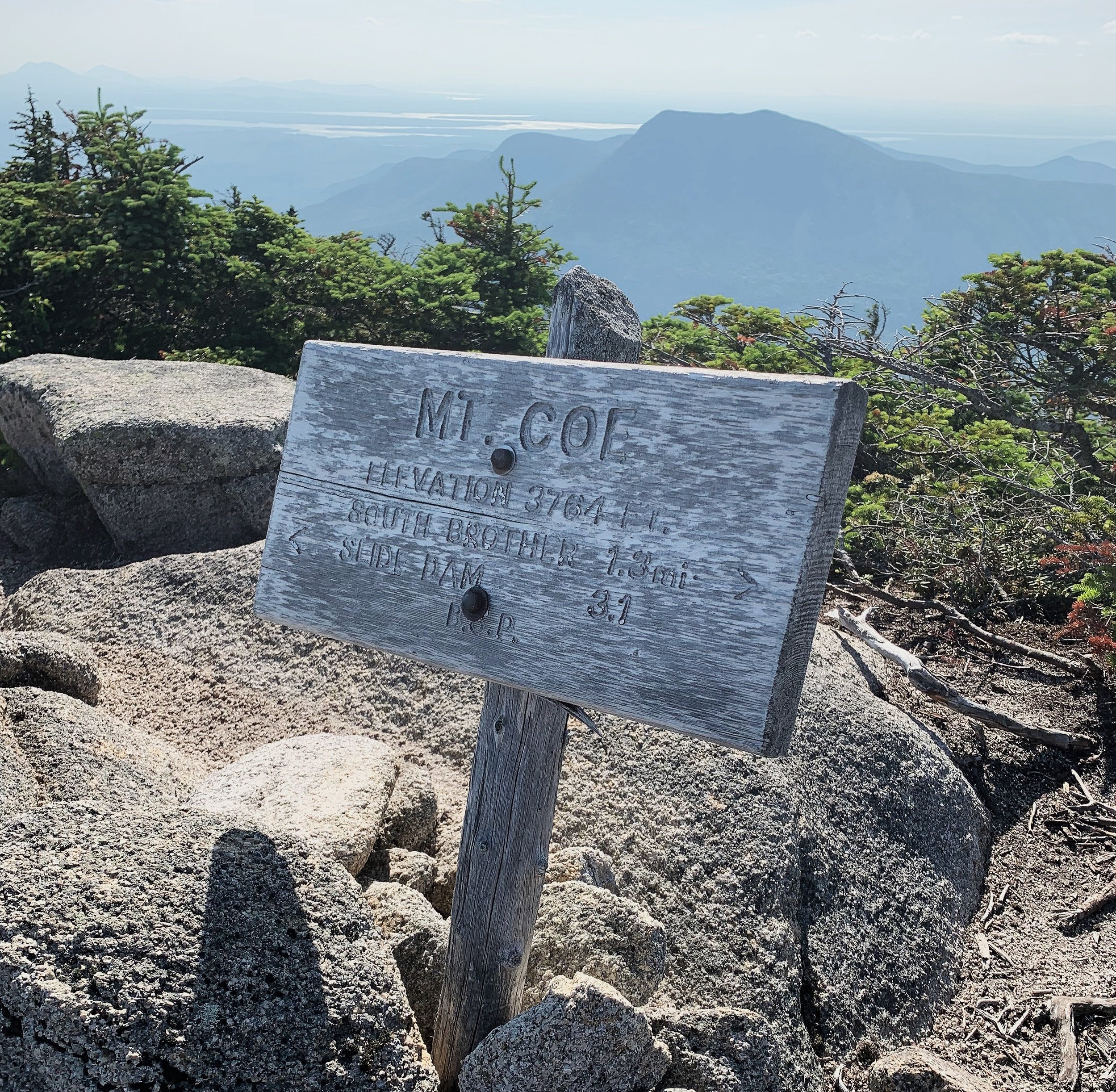
What I knew was that the loop trail basically passed directly over the peak of Mount Coe, and that was all. Despite being a mere 3795ft at its high point, Mount Coe’s views definitely did not disappoint!
Peering back to where my toes had taken me, the sights were simply breathtaking! Glimpsing off to the east at tomorrows task, the views were completely reminiscent of the Presidential Range of the White Mountains, these ginormous beasts of mountains spiking up above tree line and their green and grey ever-reaching shoulders seemingly stretched for miles and miles in either direction.
Not long after leaving the summit rocks of Coe, I found myself standing tall among the scree and bare slabs of an enormous old rock slide (perhaps the ‘J’, of the O.J.I trail, aptly named for its neighboring slides). The slide had its share of mini-waterways trickling down the bare rock which set my mind on high alert before trusting any footsteps.

Descending the Mount Coe Slide, ~3400’
Believing that all of my epic ‘west coast style’ trails were behind me for the day, I reached the end of the slide and yet again onto an even more beautiful trail heading back to the junction. This time I was graced by the calming sound of rushing stream running directly next to my feet, an even more welcome perk amongst this mid-summer heat.
What was a joy to run on during the beginning of my trek heading in was now an extreme blast to let loose and cruise for the final miles of my day, I somehow had soaked both feet traversing North Brother to Coe, so by this time I was in a playful ‘go-mode’, splashing and cooling off in the fast flowing mountain streams.
The parking lot was near-empty as I finished my first day of running the mountains of Baxter State Park. Drippy shoes were ripped off and strewn out in my backseat with hopes that they would dry ever so slightly before stuffing stiff feet back into them tomorrow morning.
Following the dust storm from a pick-up truck heading back to the main entrance of the park, I couldn’t help but notice how sore my face had become – that’s what a day of laughing and smiling will do to a person!
My park exploration of day #1 had come to a close as I pulled onto the NEOC campground road and tried dearly to figure out how this place operated. Convinced that it was a ‘free-for-all’, ran by high schoolers – yet I was happy enough to have a flat piece of earth in which to watch the sun drift to sleep behind the mighty Katahdin.
Tomorrow would be an even more epic day…
Overall stats for the day:
10.56 miles
3hr 59minutes
4,163′ elevation gain
North Brother, 4143′
South Brother, 3970′
Mount Coe, 3795′