
Live Your Dream
“Throw the damn axe!”, I beckoned Alanna, as the once infrangible glacial ice deteriorated into slush, quickly becoming a four-inch-deep, wet avalanche under our twelve-point crampons; as the seconds ticked by, and dawn grew near, the conditions grew perilously unfavorable. In a sense, we had become incredibly lucky that morning on the southeast face of Mount Ritter, for, at 10,600’ above sea level, it took every ounce of practice, patience, and knowhow to retreat safely back to ground level when Alanna’s crampon refused to seat properly on her boot.

9,182’ summit of Mt Thielsen, said to be: “as big as a small closet”
I have grown to appreciate hard things: the push to kick out that final mile of a long race; stretching that extra inch to reach and latch onto a secure hand hold; standing in front of a crowd to lecture them on the Leave No Trace principles when I fear I’ll forget the simple art of forming words; to commend oneself for remaining strong - for staying committed to five and a half years of sobriety when temptation lurks around every corner. Life is full of hard choices - how do we push through adversity when the question of “why?” is stuck ringing in our heads? It comes down to making decisions in the present moment in hopes that tomorrow’s you will thank you ten-fold; I have found that doing difficult things generally reaps the most satisfying rewards in life.
Perhaps this is what the American Alpine Club saw when I applied a second time for their Live Your Dream grant. I am in no way a sponsored climber or runner - I simply love life more while in the mountains. From growing up in the High Peaks of the Adirondacks in my home state, to traipsing the glacially scoured rocks of the east coast White Mountains, where I currently reside, it is safe to say I can appreciate exploring and climbing just about anywhere I’ve found thus far - any new place always offers up a new discovery. From stunning views, to socked in a cloud; scrambling jagged, broken rock to trail running wide, well-graded switchbacks; even plants and animals contribute to the overall beauty and splendor of any environment!

Nevada highway, 3:21am
While not winning the 2022 Live Your Dream grant came really as no surprise to me, I was still encouraged to take the time and little sum of money I had amassed to drive 3,000+ miles to the Timberline Lodge in Oregon, where I would stand proudly atop Mount Hood, alone to bask in a glorious sunrise. Two days later, I recreated the spectacle on Mount Shasta of northern California as the winds whipped all around; for the long, arduous trek up to the 14,162’ summit, I was rewarded with not only a beautiful sunrise, but the sight of Mt Shasta casting its shadow across the valley floor. Needless to say, I quickly fell in love with viewing the sunrise from atop various high places, such as California, Nevada, Utah, Oregon and all along the Appalachian mountain range.
- The Approach -
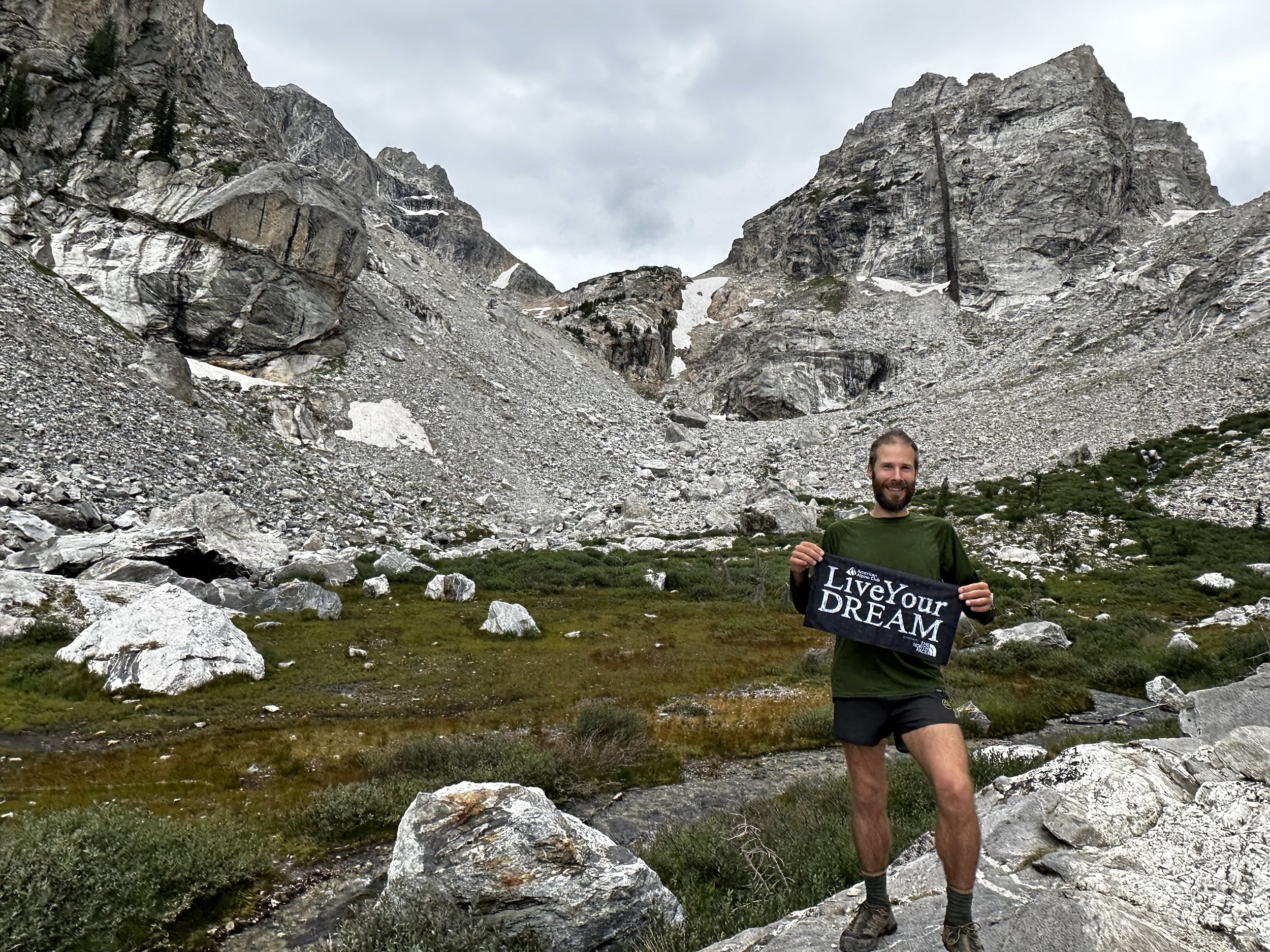
Alanna and I were making plans to finally thru-hike the 273-mile Long Trail of Vermont when an email landed in my Inbox. “You’re not going to believe this…”, I dragged out the suspense while reading and re-reading the text before me: “The American Alpine Club (AAC) and The North Face (TNF) would like to congratulate you on being awarded a Live Your Dream grant!”. From that moment, our summer plans shifted dramatically. We tried to keep the big news a secret but with each waiver signed, the reality of venturing together to the Sierra Nevada mountains was becoming tangibly real.

Scrutinizing the map
While brainstorming climbs and adventures which would promote growth and challenge our abilities, I recalled a mountain I had read about - first ascended in 1872 by John Muir, an explorer whom I had recently been studying. It was a stunning peak adjacent to Mount Dana - a mountain my parents had ascended nearly 30-years prior; in a region I had heard countless tales of, all which beckoned us to pay a visit. While drooling over photographs of Mount Ritter, I pitched the dream to the American Alpine Club in my 2023 Live Your Dream grant application.
Finally, with all waivers signed, permits procured and the Live Your Dream banner folded neatly in my pocket, the dream was swiftly becoming reality. Alanna and I packed any bit of gear that we might need into her 2019 Subaru Impreza, ready to celebrate and experience this beautiful thing called life and go climb mountains.

By the end of Week5, we became car-packing experts
Last summer, while nursing a pesky knee injury back to health, Alanna and I inadvertently began a project called A Talk in the Woods. Stuck indoors and unable to hike during the healing process, we took time sitting at our local Appalachian Trail crossing. Together with watermelon, apples, oranges, seltzer, and a slew of energy bars, we would sit for Trail Magic sessions, providing supplies and listening to stories from our new friends. We met some truly amazing folks from all over the world passing through our little town. Once healed and back on trail ourselves, we continued to meet hikers as the opportunities arose - a tradition we hoped to continue while venturing westward as well.
Departing at 6:15am under foggy skies, we began our 5-week long journey with a visit to family back in Upstate New York where I got to meet my niece for the first time. Along the westwardly trek, we made stops at several state high points - to make coffee and keep the legs limbered up. Mount Davis (Pennsylvania) and Hoye Crest (Maryland) were climbed the first day, the latter being under a brilliant full moon, allowing headlamps to be optional once atop the summit ridge. The second day we found the beauty of true exploration when we decided to make a sudden pitstop at Seneca Rocks (WV) for breakfast. Here, we climbed and scrambled as the vultures rode the morning thermals nearby. Spruce Knob (West Virginia), Black Mountain (Kentucky), Taum Sauk Mountain (Missouri), and Mount Sunflower (Kansas) were all summited as we continued to tick off more state high points while winding our way westwardly… to California!

High point of Kansas State, Mt Sunflower
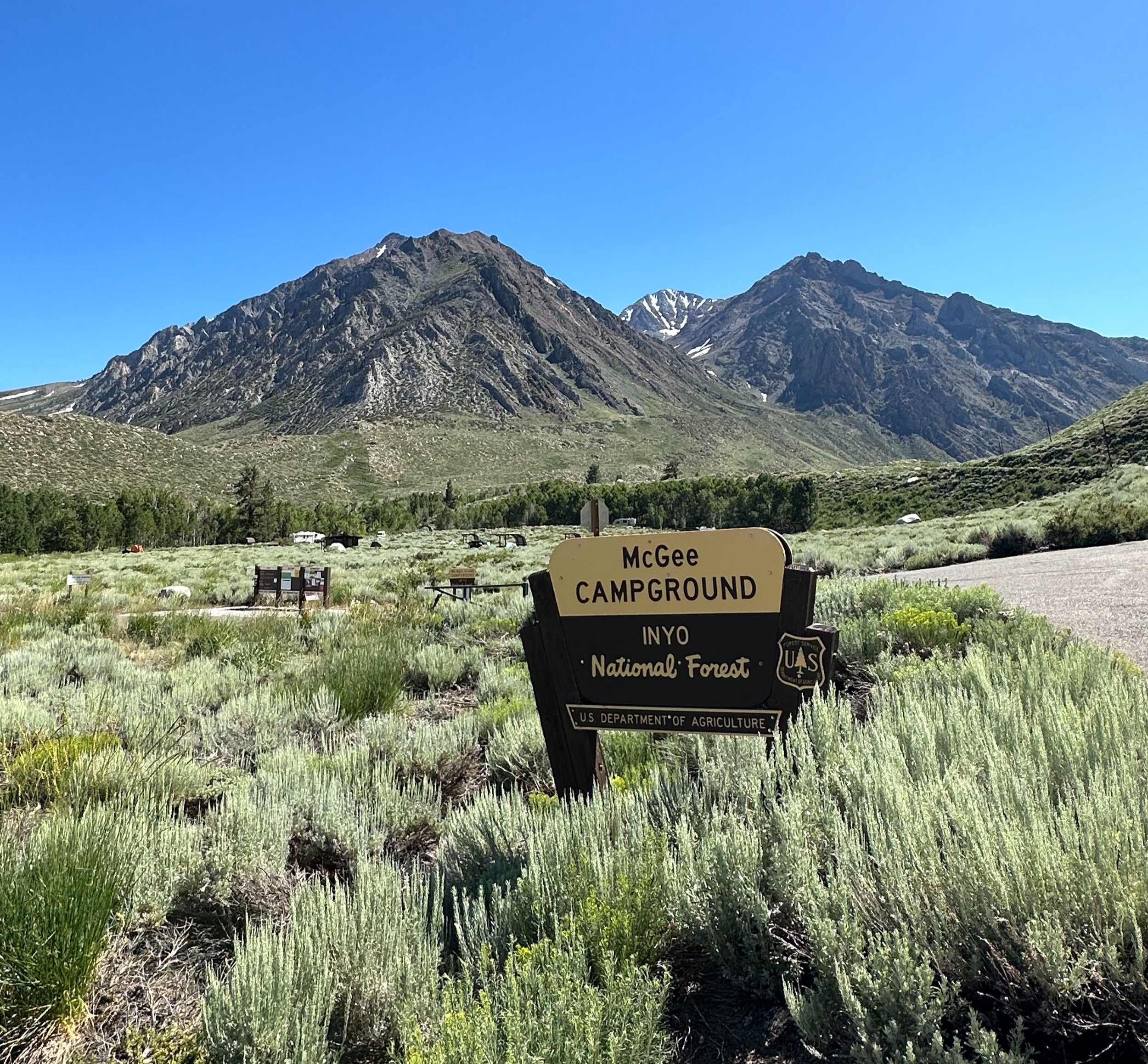
In the planning phase of our road trip, I had acquired a backcountry camping permit for the Shadow Creek area of the Inyo National Forest for Sunday. This would allow six days to explore and meander while continuing toward the Sierra Nevada’s. We weighed the options: simply trail running to Mt Ritter with much lighter packs would free us from needing a backcountry permit or camping equipment, although, we lavished the idea of having a base camp to call “home” at Ediza Lake. For an overnight stay, we would need a backcountry permit and a bear canister, along with heavier packs to tote all the camping and climbing gear into the wilderness. In hindsight, we adored our camp spot in the Ansel Adams wilderness and wished we had stayed just a bit longer!
Looking up the Nevahbe Ridge from camp
With tired eyes, we drove through a smokey Nevada haze, up a series of tight switchbacks, to find ourselves for a quick layover at the base of Mount Morgan (13,005’) and Mount Stanford (12,838’) - neither of us could think of a more stunning location to find ourselves. The peaks were hulking and massive, chunks of granite remained streaked white with residual snowfields. This was one of the few settings we could see ourselves moving to: wildflowers of all colors, jagged spires of broken mountaintops, and fast flowing flumes of blue-green alpine water felt just like home to us.
As a million stars illuminated brightly overhead, we quietly packed up camp, each focusing on our own set of tasks, a routine we had developed over the preceding week where we knew what each other was doing. We worked very well together, navigating from place to place, setting up and breaking down camp, we laughed an awful lot too - the air felt frivolous as we performed tasks now on “our time”.

Camping under the stars
While signing for a backcountry fire permit at the Ranger’s Station the morning prior (we had no intention of having a fire, or even bringing a stove for that matter - we cold-soaked all beans and grains), I asked about the shuttle service and learned that, by arriving before 7am, we could avoid the shuttle and simply drive ourselves directly to the Agnew Meadows trailhead - this would free us from racing to catch the last shuttle out of the park, we could remain here on our time.
The mosquitoes quickly found us in the morning as we strapped sleeping bags, tents and bear canisters to our hefty packs. Whispering a few good morning’s to the horses who inquisitively inspected us over the pen’s wooden wall, we trekked by in search of the John Muir Trail, the Pacific Crest Trail and the Shadow Lake Trail, all of which would guide us to our next home for the evening, seven miles away, at Ediza Lake.

Navigating a pass enroute to Shadow Lake
Immediately, on the well-graded horse path, we were in awe at the sheer magnitude of the conifers - the scale of nature out west was simply daunting, life miraculously appears much simpler while in the presence of such enormous creatures. The intoxicating vistas seemingly stretched on for miles across those clear, blue skies. With every bend of a switchback, we gained more elevation, each step always offering a better glimpse than the last. The Shadow Creek cascades were deafeningly fast-flowing, at times kicking up a plume of mist sky high, from which every color of the spectrum might then emerge. Knowing we would reach snow sooner than perhaps in prior years, we remarked at how ferociously the melt water was flowing and how seemingly easily it had sculpted the canyon through which it flowed. Trekking through, we bore witness to a mere snapshot of its lifetime achievement: the never-ending task of re-sculpting the Sierra landscape.

Shadow Creek Trail running alongside Shadow Creek
Passing many parties on the trek in, several folks carried ice axes and mentioned their attempts to scale the Banner-Ritter Col; all endeavors cut short as they were turned around prematurely by the unnavigable bergschrund shrouding the headwall. This was in fact the second (a back up) route I had considered attempting as well, but upon hearing this, I decided to focus our efforts on our first choice - the southeast face. At this point, I was not even sure that route would be doable either. Onward we trekked toward Ediza Lake in good spirits, although we desperately wanted to ditch our packs and set up camp - mostly to vacate from the onslaught of persistent mosquitoes.
We neared Ediza Lake and could see our objective across the calm, blue-green water. While searching for a sign to indicate where to begin backcountry camping (all we found was a sign stating: No Camping), we located the water crossing a fellow hiker had warned of: “waist-deep, but slow moving, you should be good!”, was said in a French-Canadian accent while waving us farewell.

Stream crossing near Ediza Lake
Back and forth, we scoured the edges for the safest place to cross. Alanna went first and made quick work on the algae-covered boulders. I stepped into the torrent and immediately my calves and shin muscles went numb; only moments earlier this fast-flowing brook had been solid glacial ice. Several paces upslope from the brook, we found a forested spot which appeared to have hosted many tents throughout the years. From our new home in the woods, we had both water nearby to the south and a short scramble up a rocky outcropping to the east, when we wanted a breezy spot to grab a bite to eat.
- The Ascent -
After a brief stay in the tent to catch up on some journaling and escape the blood thirsty bugs, I was ready for a midday exploration with a lighter pack. With a simple 8-liter running vest, water, snacks and some light first aid gear, I scrambled up our nearby rocky outcropping to give a wave to Alanna back at the tent far below, before continuing for some recon toward Mount Ritter itself.
As the previous climbers had noted, the cracks in the droopy Ritter-Banner saddle glacier kept that route out of my radar. Momentarily, however, I had considered ascending the saddle by way of a boulder field to the east before shuffling a tight ledge of ice and snow which would allow access to the upper col, but quickly determined the risk was way too high without ropes and a plethora of other protection.
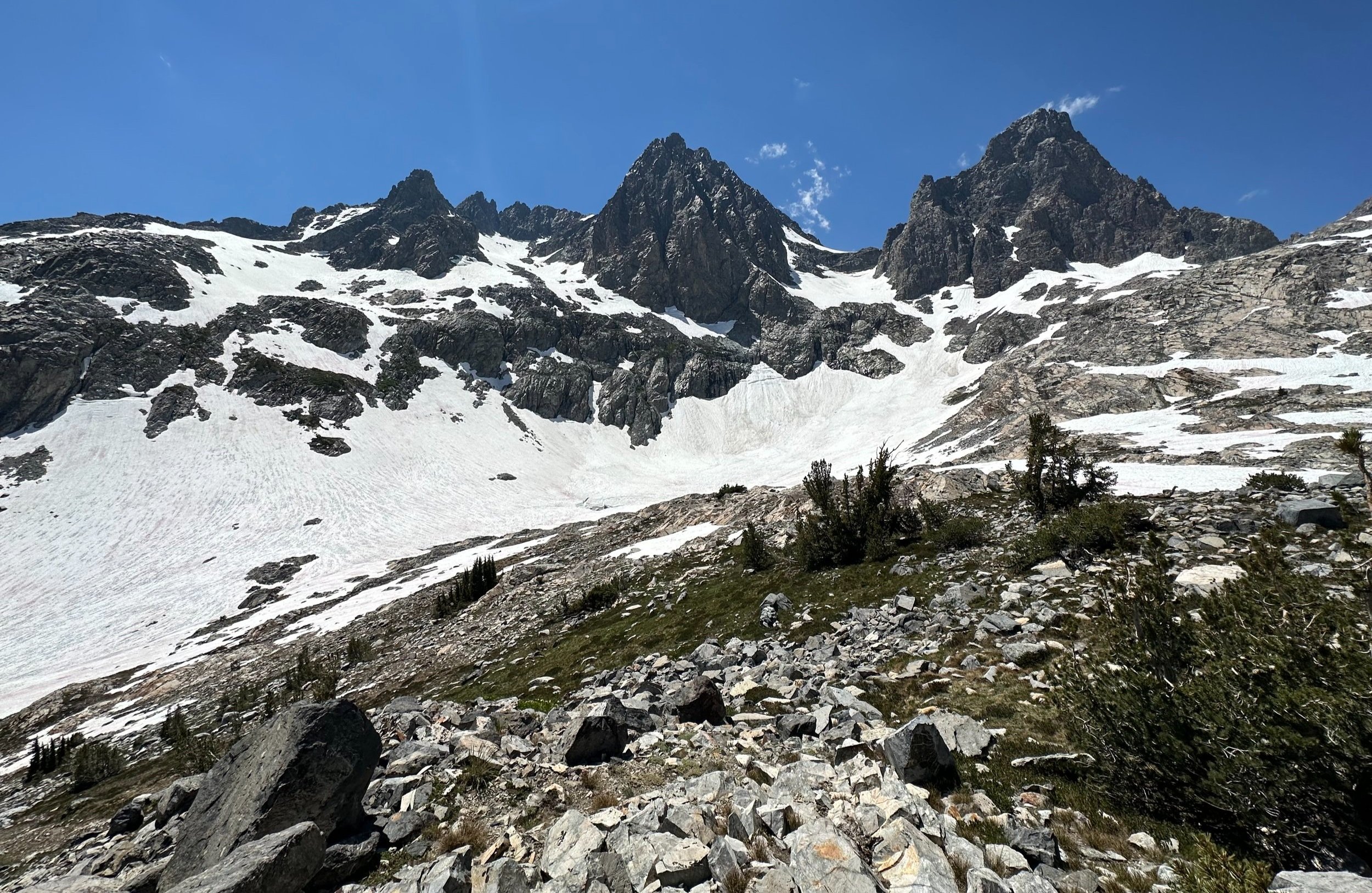
Scouting the route up Mount Ritter
My attention then shifted to scouting the southeast ridge, it looked questionable but likely a doable route so as long as we could ascend and descend before the snow became sloppy in morning sun. What I had been slogging through during this 3pm recon was already four to six inches of slushy mess. Knowing the forecast called for mid-thirties overnight, I hoped for a deep freeze that our crampon points could purchase, providing quick, efficient, and safe travel.
With answers to most of my questions, I retreated to camp to disclose my findings - of course, not before scrambling and summiting a 10,400’ knob for a good, uninterrupted look at my surroundings. The main issue remaining for the currently proposed route was crossing the freezing ice water drainage - the same rushing brook which was waist-deep near camp would need to be crossed even higher upstream. I didn’t place much trust in a snow bridge this time of the year and the mere thought of being trapped under ice and snow had me exploring other options. As I stared at the landmass of mountains and glaciers before me, I grew to assume we would have to hike an extra mile to safely trek (westwardly) around a sketchy, sunken basin of blue-green glacial melt water, from which the icy torrent originated.

Snacktime in the Sierra’s
As our first day in the Ansel Adams wilderness drew to a close, we packed food and clothes into climbing bags, helmets and miscellaneous sharp items were checked over as well, all readied for the coming day. Certain that we could find a safe path up and down this massive chunk of rock, we sat calmly telling stories and noting how incredible our surroundings were based solely on the patterns we found in nearby wildflower petals and the deep glacial scratches displayed in the bedrock atop which we sat. The Sierra’s have a peculiar way of making cold-soaked food actually taste delightful at 9,350’.
Sleep was remarkably light before the 3am alarm went off on my watch; 42° ensured we did not want to exit the warm cocoon of synthetic sleeping bag. While trying to trace my recon route from several hours prior, I inadvertently took us over what I donned “the sketchy route”; scrambling over and down every bouldery outcropping that lay in our path as I strained to remember my route in the dark - any sign of footprints in the snow had completely melted since yesterday’s blaring sun.

Putting on crampons for a twilight snowfield crossing
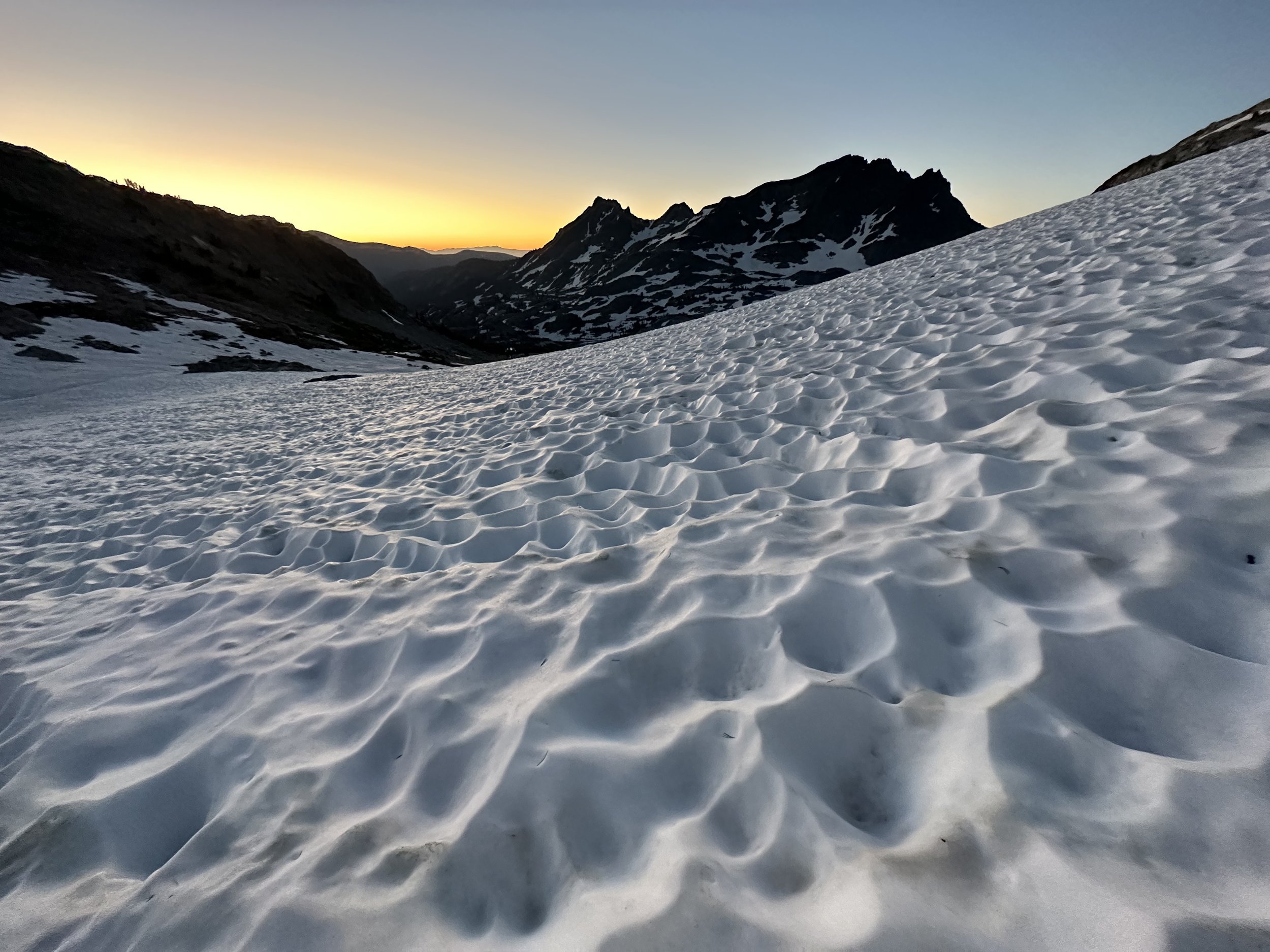
As we began to trek primarily on hardpacked and refrozen snow, we stopped to add crampons onto mountaineering boots, very pleasantly surprised that yesterday’s slush was now fully supporting our traversing. The collapsed basin of glacial runoff lay about 350’ to the west. Between us and the alpine pool there appeared to be a 15’-thick snow bridge, perhaps frozen enough to be scrutinized further. In a slow, yet efficiently smooth pace, we inched across, testing every step first with ice axe. Surprisingly, the mass of snow and ice refused to let out a single creak or groan upon bearing our weight!

Across the snowbridge and climbing the SE ridge of Mt Ritter
Once safely across the snow bridge we began methodically picking our way up the southeastern face, albeit now in a much more direct route than I had been scouting the day prior. We stopped briefly at each rocky outcropping to catch up with how we were doing and feeling, between each bouldery reprieve spanned a smooth, steep wall of ice and snow to clamber up. Just as the morning sun began to glow orange and red behind the eastern peaks, I scurried to the next rocky ledge, sat on a jagged rock, and looked to check Alanna’s progress. What I saw almost knocked me off my perch. She was stuck on a 50° wall of ice and snow with one crampon just dangling off a boot. With one ice tool and one set of crampon spikes in the southeast face of Mount Ritter, we determined she could move neither up nor down in her current state.
Carefully, as the 6:05am daylight was turning the wall on which we stood to murky slush by the second, I crept downslope, nearly hugging the wall and kicking steps as carefully and securely as possible, back to her location on the steep face. With a ledge just wide enough to stand kicked into the mountainside, I hesitated as I now had to convince my fingers, one by one, to release my own ice axe to get Alanna’s gear in the best shape as possible for the nerve-wracking descent. I cranked on her crampon and reattached it the best of my ability - given the precarious circumstances.

Sunrise in the Sierra
Not wanting to see me give up my dream of summiting Mount Ritter, Alanna told me she would get back to the last rocky outcropping and proceed to wait for my return at that point. To me, the option could not have been more obvious. “Let’s go down together.” I suggested.
The descent off Mount Ritter was agonizingly slow as the snow took no time to become melted and treacherous. Despite trying to make the situation as simple as possible by kicking deep steps into the mountainside below Alanna, there were several quick instances where I’d hear her start to slide, at which time I’d fear the worst and, out of pure reflex, kindly instruct her to “throw the damn axe!” A phrase said several times that morning, which we are now able to laugh about.
Passing a sea of suncups
Before long we had descended back through a sea of deep sun cups to pick a winning trajectory across the precarious snow bridge of earlier. Finding our clawed footprints from when we had donned the crampons, we now removed them and stashed the higher altitude, cold-weather gear.
As we snacked and soaked in the stunning view of the shark tooth-shaped peak, I took the attention off my bag momentarily while stowing mittens to locate the small, handstitched box which I had secretly stashed the day prior. As we rested and dried base layers in the steadily rising morning sun, I crept onto one knee and nervously opened the box. Before long we both had tears of joy running down our sweat-soaked faces. A full spectrum of emotions found in the mountains this morning!

An engagement in the Sierra’s
Prior to attempting Mount Ritter, obviously I wanted to stand atop its summit, but looking back now, this adventure was about so much more than simply bagging a peak. For me, it was learning how to trust your instincts when it comes to route finding, knowing how to read a situation and to get everyone down safely before circumstances turn worse. It is interesting to me that, perhaps if Alanna’s crampon stayed on for even a few more steps, we would have been in even worse snow conditions and possibly would have witnessed a harrowing slide down the slushy surface while attempting to descend. I don’t like to think about how serious this climb could have been, had we made any calls against our intuition that morning. All of the events during this climb occurred at exactly the right moment, in perfect sequence to allow us to make educated decisions which invariably allow us to climb another day.
- The Descent -
As the day grew hotter, our pace slowed to a crawl as we trekked back toward camp, both well aware of the long slog ahead of us. We could not escape the thought of the icy brook crossing and wet feet to begin our exit from the Inyo National Forest. The mid-morning sun and lakeside mosquito onslaught kept a haste to our pace. With heavy packs keeping us bent over, we longed for the Subaru to get us out of the oppressive heat. We had forgotten about the days of long miles in the car as we both collapsed into its seats with a cold seltzer on our minds.

Departing the Ansel Adams wilderness
Only days later, we found ourselves lining up a visit to Crater Lake National Park and during our short stay, went on to summit one of the most satisfying climbs of my life - the old, 9,182’ shard of volcano which is Mount Thielsen. While the middle of Mt Thielsen is certainly a loose scree-fest, the upper section was one of the most fulfilling rocky scrambles I had ever scaled. The next day I stared, as if mesmerized by its unmerciful shape and splendor, from the summit of Mount Scott (highest in Crater Lake National Park at 8,929’), in my mind I could completely depict the original shape and scale of the now defunct volcano. What a dream it was to have stood atop its highest reaches!

Ascending Mount Thielsen
We then slept at the Alpine Campground at 5,450’ on the shoulder of Mount Hood; with warm coffee in hand, we watched the sun rise as we did similarly on many other days. We had ideas of places and sights we might want to visit or climb, but overall, the itinerary was freeing and non-restrictive. With no last-minute climbing permits available for Mount St Helens, we roamed the nearby trails, seeking out waterfalls and other picturesque vistas off the beaten path. Stopping in the Enchantments of Washington, we basked in what seemed to be an entirely dreamt up world of jagged peaks and lofty spires. Lunch was enjoyed at Upper Snow Lake the first day of exploring, with a morning trail run to Colchuck Lake the second day.

Lunch view from Upper Snow Lake
While these places are exquisite and entirely magical examples of natural splendor - what shocked us the most about these beautiful destinations we visited was the constant evidence of human presence. While I share a deep passion for teaching and sharing the Leave No Trace principles, it greatly saddens us to see self-proclaimed nature enthusiasts inadvertently causing harm to the environment or disturbing other visitors - all in the name of getting their next social media photo. It has become obvious that nature and the wild places we enjoy simply cannot support the volume of visitors who are ignorant of the damage they inflict by hiking off-trail, leaving debris behind or disturbing wildlife.
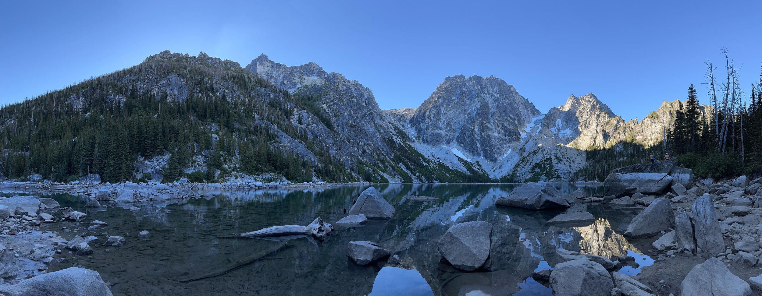
Colchuck Lake + Dragontail Peak
We began seeing daytime temperatures well over 100° in Washington, arriving back to the trailhead one day to a stifling 118°; needless to say we swam a lot in the chilly rivers of Washington. While ascending Mount Defiance of the Cascade Range, we stopped on the descent for a dip into an alpine lake to cool off from the mid-day sun. As neither of us were wearing sunscreen (we use sun shirts and various other methods of sun protection), we were not too concerned with contaminating the lake - we were just really sweaty and perhaps a bit smelly.

Entering Garnet Canyon during sunrise, Teton Mountains
Making our way through Montana and into Wyoming, we drove through Yellowstone and paid a visit to see its offerings of natural splendor. With mountains still on our mind we hurried southward, toward the Tetons where I had scored the last available campsite not far from the Lupine Meadows trailhead. High above the shore of Jackson Lake, we sat together on a rocky escarpment, watching the sun dip behind Mount Moran and the subsequent Teton mountains.
Spending quality time with Middle Teton
With another early start in headlamps, we made good time watching sunrise from the switchbacks along Garnet Canyon Trail. Both of us were completely struck with awe upon entering the canyon. A place where such mighty blocks of multi-colored gneiss rest, as if having been knocked free from the mountaintops above. We could clearly spot our initial goal from the pizza parlor the night prior; with a massive linear basalt dike cutting through the face of Middle Teton, it is unmistakable from many easterly vantage points. So close, we could reach out and touch the bulk of mountain, but when the first of many rain drops came falling and the westerly clouds grew dark upon cresting the col, we knew it would be best if we did not linger long. With cool rain on our faces, we trail ran down the switchbacks, greeting folks who determinedly continued to ascend in such weather.

Right at home at the AAC Climbers’ Ranch, Teton Mountains
Another climber, who was heading toward the Grand that morning, had made mention of staying at the American Alpine Club Climbers’ Ranch in several days; on a whim, I called the kind folks at the Climbers’ Ranch and booked a second night in the Tetons. In a seemingly remote and picturesque setting, we moved into our cabin for the night and inevitably took a barefoot walk into the historic AAC library, which can be found in the rear of the Main Lodge.
Alanna and I had a most enjoyable stay at the AAC Climbers’ Ranch; we met lots of kind, like-minded hikers and climbers, ate some darn good food, and had a great place to call home for the evening. In the dull, pelting rain our final morning in the Tetons, I donned the Gore-Tex layers (which had thankfully stayed packed away for most of the trip), for an exploratory trail run originating at the AAC property. Both Bradley and Taggart Ponds made picturesque and highly enjoyable destinations, before packing up and continuing along our cross-country route.

Rainy morning trail run to Bradley Pond in the Tetons
What was most interesting to me, all along this five-week journey I had the sensation of having just experienced the best of life’s offerings each time we found ourselves packing up camp, as if, perhaps the good times were indeed over and that was that. Little did I know at each of those low points was that the very best times, climbs, and experiences lay just ahead. I found I had to insistently remind myself of this fact throughout the adventure - that our journey is not written by anyone but us, it is never over until we say it is. We can easily choose to go here or there - at which point we are stricken with a much more difficult decision - do we choose to make a good time or a bad time out of our circumstances?
Upon starting this massive journey, I could never have predicted the voracity with which I would fall in love with the Rocky Mountains. While scrambling up steep and craggy rocks or shuffling along precarious knife-edge routes can prove to be the crux of any climb, as a trail runner from the east coast, to be forced to deal with the altitude as an additional element was extremely compelling. The reminder to pace oneself up to and beyond 14,000’ is a factor not often associated with hiking, climbing or running on the east coast.

Atop a very windy 14,443’ Mount Elbert, Colorado state high point
While camping at Elbert Creek Campground, we ascended Mount Elbert with a standard headlamp start, as if to avoid the heat of midday. Breaking out into the high meadows as the sun crested over the horizon was truly breathtaking. Following several false summits, to stand atop Colorado’s state high point at 14,433’ was another dream checked off - many years in the making for that cherished moment among the high peaks. The following day, I could not pass up an opportunity to explore the state’s second high point: Mount Massive at 14,421’. Strange, inquisitive eyes tracked my progress as I ventured along the smooth Colorado Trail before once again breaking out into a postcard-worthy alpine meadow. Similarly, just as the ball of sun crested over the surrounding peaks, the alpine lawn was aglow with pink, orange, and yellow hues. Being in that moment, present with the whipping winds as a family of mountain goats watched on was pure magic; perhaps by regularly tackling such grueling mental challenges in the mountains, we can help our minds build up strength and fortitude to be allocated back to our every day, hectic lives.

Navigating the summit ridge of Mt Massive
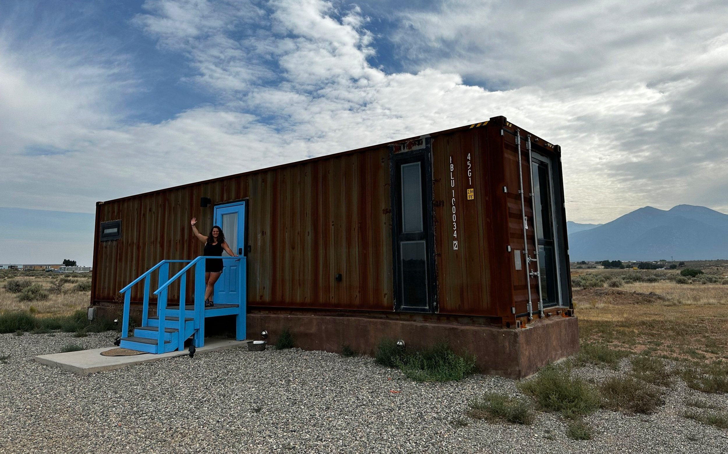
As we exited southbound along the Rocky Mountains, we had the opportunity to reside overnight in a upcycled shipping container located near Taos, New Mexico. After living in a converted 34’ school bus for nearly 3 years, I had often wondered about the similarities of renovating a shipping container. Simply a magnificent experience; given the wide windows of the master bedroom, we could take in the stunning rainbow of sunrise hues as they streaked across all 12,291’ of Pueblo Mountain.
An overnight glimpse into the Shipping Container-life
All throughout our road trip we had discussed ascending Guadalupe Peak, the state high point of Texas. However, as our roaming focused primarily northerly, toward the Cascades, Tetons, and Rockies, I did not want to innocently assume a visit to Texas would miraculously transpire - especially with recent ruminations of “storms in the Gulf!” Needless to say, I did not want to expose my overwhelming excitement for hiking in the Guadalupe range until standing atop a summit.
Good news poured in once the “Welcome to Texas” torrential downpour subsided. We scored a secluded tent spot in Pine Springs Campground and were greeted by the most animated Campground Host couple - up to that point zero US Forest Service campground hosts even waved or acknowledged us. Driving across America, it was interesting to observe the current National Parks and National Forest Service; many of the campgrounds we encountered appeared neglected and overgrown - or just plain unsafe with the lack of authoritative presence. Many of the roads are becoming impassable for less than the burliest off-road vehicles, as we discovered firsthand in Mendocino National Forest of California.

Monument atop Guadalupe Peak
Here, we found a welcoming Campground Host duo who were knowledgeable and eager to share weather forecasts, trail reports, and even warn of the infamous “green rattlesnake” - which evidently only comes out at night, we later learned after our twilight ascent. Beginning once again in headlamps, we concluded neither of us could determine the time - with no cell phone reception and our tent residing directly atop the time zone delineation, neither our phones nor GPS watches were of any help, until, as we neared the 8,749’ peak, the skyline began to glow. Just in time for a 6:24am sunrise, we stepped onto the summit plateau to a stunning display of alpenglow emanating from the ball of orange and red on the horizon. Timing could not have been better to summit Guadalupe Peak - such is the reward sometimes for just letting events unfold around us!

Atop Guadalupe Peak, high point of Texas
We took our time soaking in the vast vistas from atop Guadalupe Peak; cotton candy-like clouds folded and rippled in the valley far below, eventually becoming forced up and over El Capitan - a flat-topped rock tower before us, which rose abruptly from the valley floor in the south. Once we had our fill, we trail ran to our awaiting food and gear back at the campsite, only once misjudging and assuming a twisted root to be an awaiting rattlesnake (thankfully, zero snakes/scorpions were encountered in Texas during our morning ramble to the state high point).
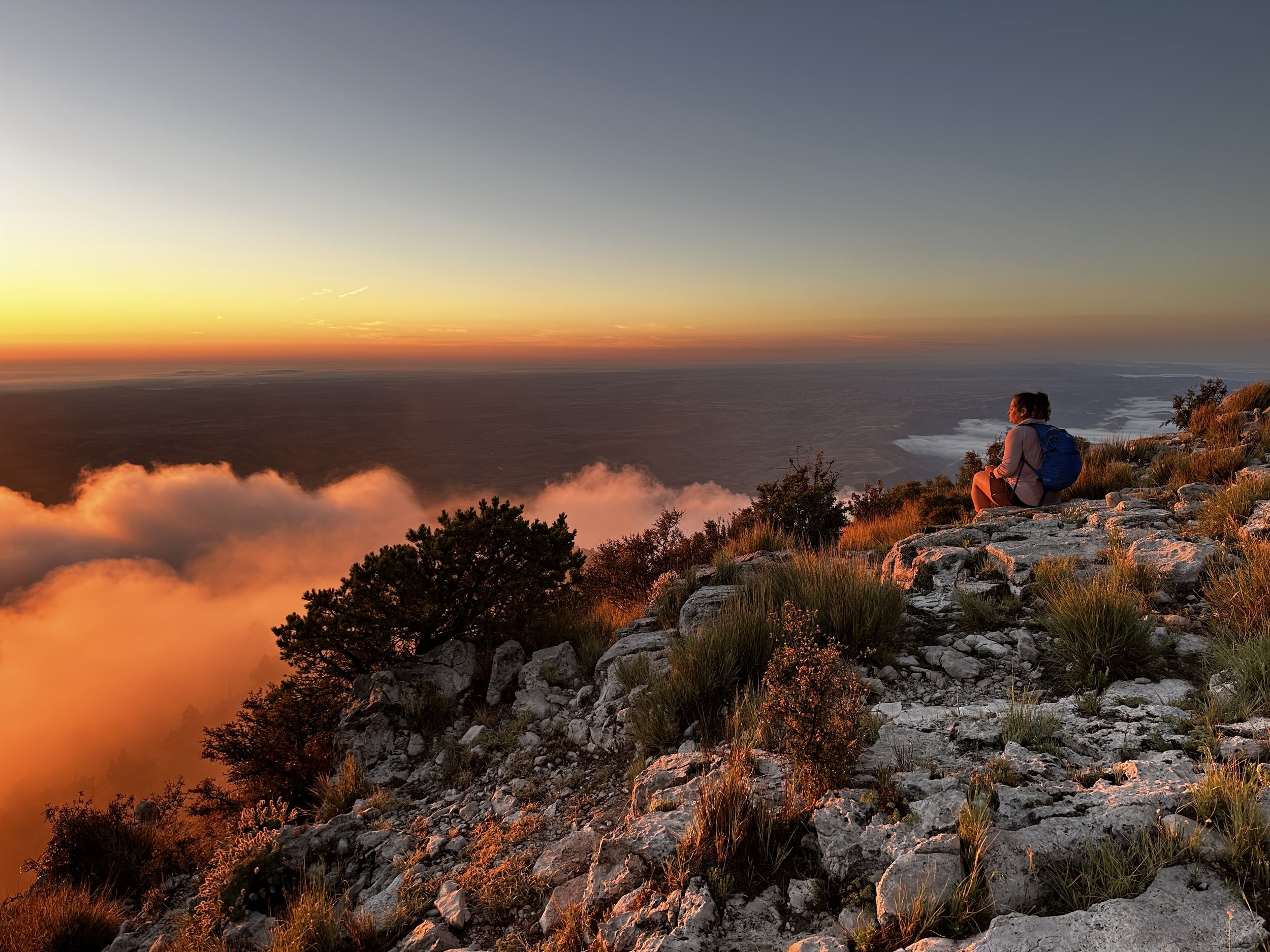
Alanna soaking in sunrise from 8,749’
With a stop planned to visit Alanna’s family in Myrtle Beach, SC, we committed once again to driving too far each day - stopping to stretch our legs and stand atop the state high points of Arkansas, Mississippi, and Georgia along the way - even sleeping in the front seat of the Subaru during our last stay on the road (the remaining sleeps would take place in real beds, not ours). Myrtle Beach was a dream that I did not know I had been longing for: Gold Rush-themed mini golf, 6D theater rides, saltwater swims and mouthwatering restaurant food (even homemade plant-based dark chocolate Oreo ice cream) were among a few of our indulgences. The longer we remained in Myrtle Beach, the more I remembered what it felt like to be a carefree kid again.
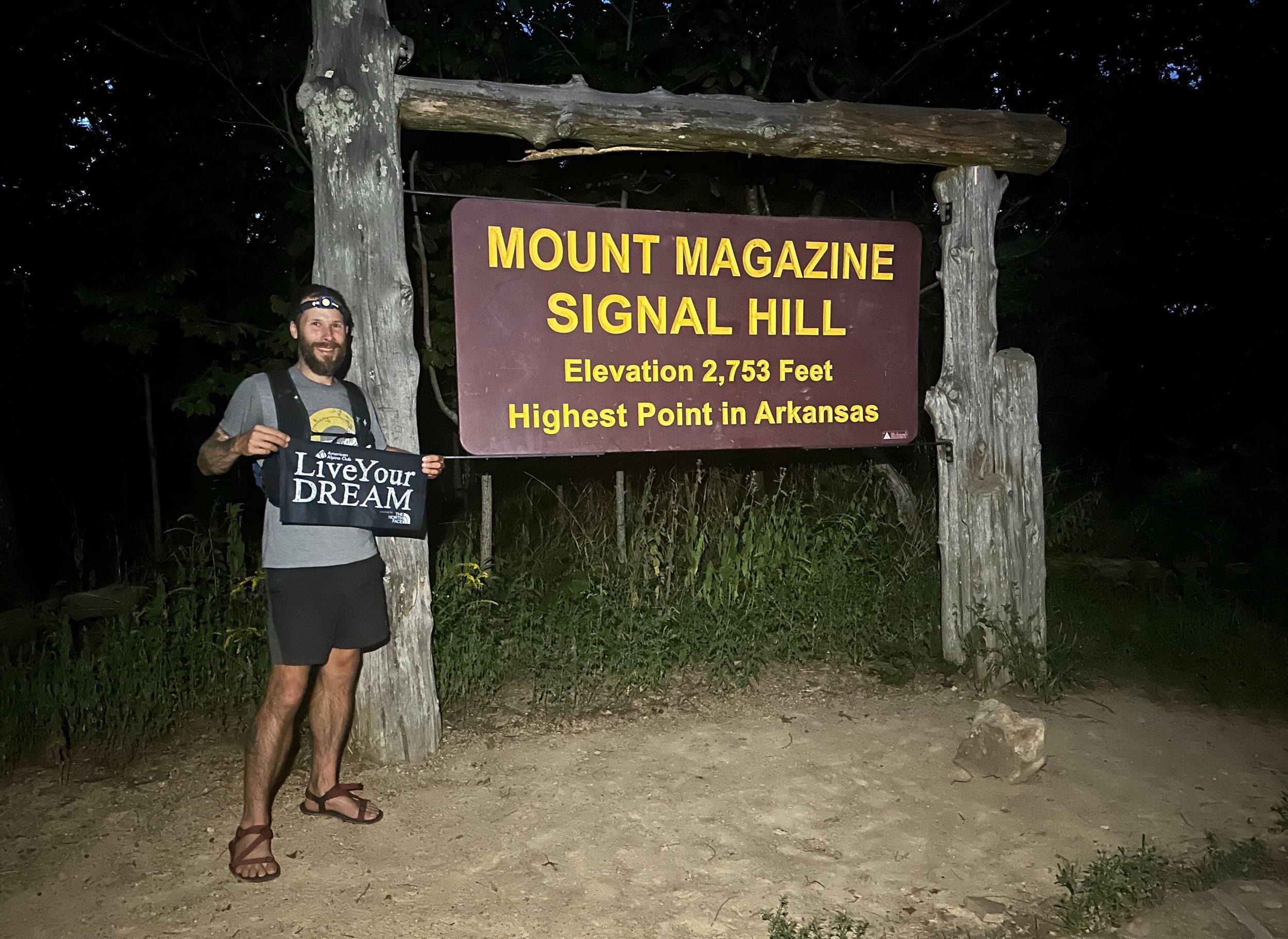
Nighttime summit of Mount Magazine
With one final stop to stand atop the 450’ state high point of Delaware, we made our way back through New Jersey to New York and finally, Vermont, which would guide us the remaining distance northward, to our awaiting home in the western White Mountains of New Hampshire.
So many times, along this five-week journey, I was reminded that the goal is never any one particular destination. The goal was not to be found at the summit of Mount Ritter. The destination was witnessing and taking part in a fantastic journey; a journey called life, where we slept on the side of roads, ate cold beans, and climbed to new heights - and because the destination was never one narrow speck of time, we were entirely infatuated with the process of experiencing our dream come to fruition.

In awe at the mighty Redwoods
It took 11,240-miles to discover that I am always Living My Dream, every moment of the day. Sure, we can’t be climbing steep slopes 100% of the time, just as we cannot do anything 100% of the time - even breathing needs its “on” and “off” cycles. It’s all the little decisions, the smiles, the kind gestures exchanged which lead us to such memorable and remarkable highlights of our lives. In those precious moments we spend such a short amount of time, but living your dream starts with each and every decision, no matter how minute; all of which will lead you to where you want to be, helping with what you want to see accomplished.
The destination is never the final note at the end of the sonata, just as the peak is merely a place in time during the climb - the true destination should encompass the entire adventure - soaking in each and every moment along the way; the laughs, the cries, the highs and the lows - even the time spent in Humboldt County when you just want to snap your fingers and be back anywhere in the Sierra’s.
Live Your Dream.
Erik Hamilton
co-founder: @atalkinthewoods / atalkinthewoods.com