
Stinson Mountain - Northeast Peak
The last time I stood upon the 2,840’ summit of Stinson Mountain was on a hot and sticky May day; so sticky, in fact, that clouds of summit blackflies stuck to sweaty faces. Not today, not on this cold and windy wintery ascent; no bugs, no foot nor snowmobile traffic - just the tail end of some gusty weather.
Today’s forecast called for a high cloud ceiling which would gradually drop around 10am, perhaps I’d have time before precipitation rolled in for a local ascent. While the regular Stinson Mountain is another which has made its way onto the NH 52 With A View list (#36 highest spot), I’ve had my eyes on its northeastern sub-peak for some time now.

Stinson Mountain Trail; 1,500’
The trailless peak, standing at 2,806’, caught my attention when I learned years back that it had a summit register canister atop its highest point. Originally rumored to be an AMC canister, in the past few years it seemingly was replaced - either way, I had hoped to find and sign into the canister while getting some proper snowshoe bushwhacking in.
Beginning the hike at the standard trailhead on Lower Doetown Road (start of FR 413), I was pleasantly surprised to see both the road and hiker lot recently plowed. Another welcome surprise was the sight of a snowshoe track departing the trailhead; upon testing the snowpack with a single boot step, there was no mistaking the conditions - with the warm afternoons since the weekend snowfall - it was clearly still snowshoe weather.

Stinson Mtn Trail; a lovely old farm road
What a contrast today was from the lush understory of ferns flowing out as far as the eye can see through a springtime hardwood landscape. With only a handful of beech leaves remaining on branches, sight now seemed to stretch even further down the old farm road; as per my usual solo hiking game, eyes swung side to side, looking for moose or deer, all the while picking up and tossing fallen branches off trail, casualties of the still on-going winds high above.
Quickly reaching 0.4-miles from the trailhead, a snowmobile path is crossed, relics of an old tractor road. Continuing along the snowshoe track, I was thrilled to see no heel imprints from bare boots; snowshoes and ski tracks made for a very solid base in which to traverse.

Leaving snowmobile trail for hiker path
Swinging left at 0.9-miles, hikers merge onto a snowmobile path temporarily. Trekking the Stinson Mountain Fireroad/tractor road for a mere 0.2-miles before signs indicate the hiking trail diverges to the right, just after a bridged water crossing.
Slowly, spruce mixes into the surrounding hardwood forest while gaining elevation. At about 2,450’, the wind began tearing through the tree canopy, covering the snowshoe trench with a hard-packed powder layer, the trail breaking helped to keep warm.
Snowy, pillow-topped rocks
Entering the eastern boreal forest, beech was replaced with balsam fir to join the spruce and birch, creating one of my favorite forests in which to trek.
Swinging clockwise toward the mountain top, reaching 1.7-miles, the hikers path merges once again with the snowmobile path and makes a loop up and over the summit of Stinson Mountain. On this wintery day, the old fire tower concrete foundations were visible through the deep snow, even a few open patches of packed powder let the metamorphosed strata shine through, giving a small image of the unique rock layers hidden below.

Restricted panorama from the Stinson Mtn summit ledges
Even a small display stands atop the mountain to showcase some of Stinson’s prior fire lookout history: “Established in 1911, one of 6 towers constructed by the NH Timberland Owners, it was a 16’ wooden tower. in 1927 a 27’ steel tower was built. It remained in service until after 1967, and was dismantled and removed in 1985.”
Pausing to briefly take in the views, I considered myself lucky to be where I was. Peering southwest toward Mt Cardigan, Smarts Mt or other points west, all was hidden in a haze of snowfall; mountains to the east and southeast appeared to actually have lovely skies this morning.
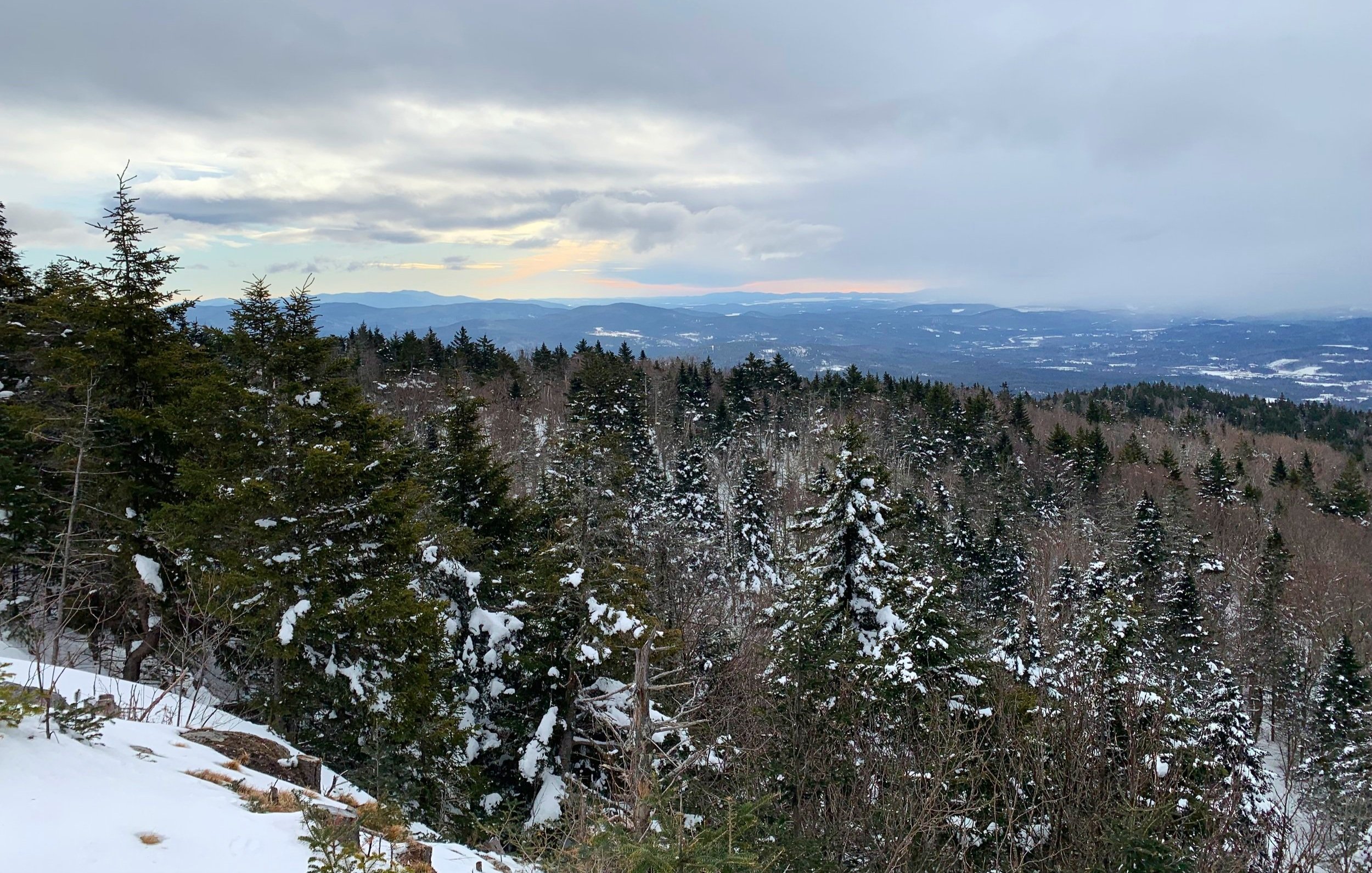
Easterly summit views
After poking around for several minutes and unable to find the short, unmarked spur path which would normally lead to a cleared view of Moosilauke and Stinson Lake - add that to the list of warm-weather rambles!
Following the snowmobile path around the summit lollipop, I continued following this past the hiker trail, descending with a nice northeasterly view, toward my next objective.

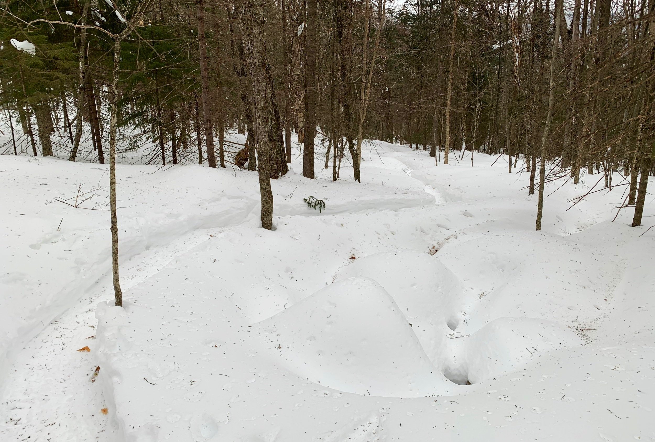
Fir grove atop the lower hump of Stinson’s NE Peak
Reaching the low spot of the col (prior to the snowmobile path angling west and continuing down slope), I stepped off trail and into a luxuriously open mixed forest. Passing many dead, standing logs in a low meadow, I kept an eye out for recent moose tracks but only found older hoof depressions in the snow.
I had heard reports of bushwhackers side-hilling around the first knob but preferred the idea of gaining the ridge and riding right along its spine. This plan worked well, although contained a very steep initial ascent involving knee-deep powder. Once atop the ridge, the meandering was tremendously enjoyable and quick, weaving a path between balsam before cresting over to descend into more open woods comprised of spruce and dead, standing logs.
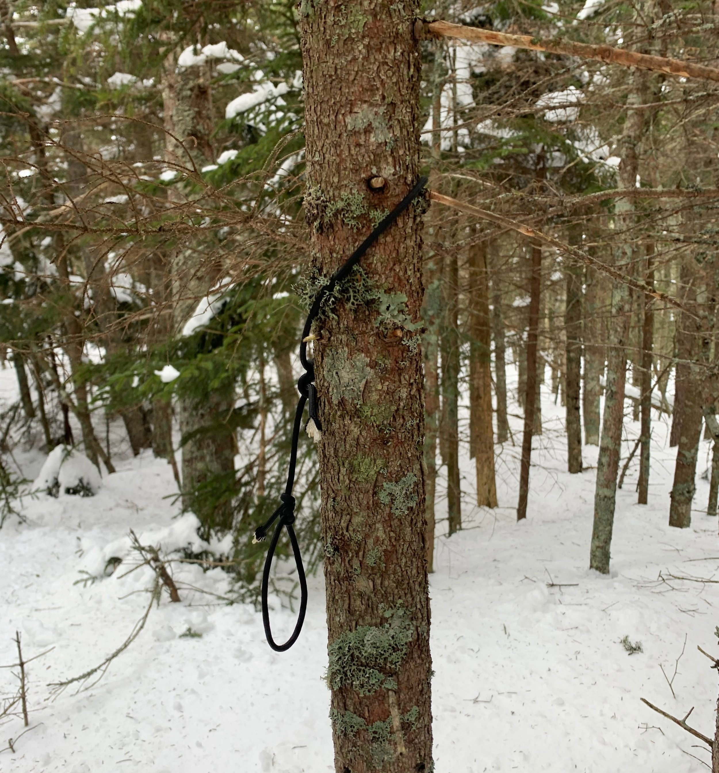
Cord that should be holding the summit canister
Out amidst the open air, while there were remarkably fewer branches to dodge, the snow became deeper with the occasional spruce trap to hoist oneself up and out of. Occasionally, little snippets of views opened up through the nearby tree wall, quick glimpses of blue skies and of higher peaks off to the east.
Reaching the further knob, I knew I was near the summit; while I had been navigating primarily with the topographic maps contained on my 1.4” watch screen, I did break out the AllTrails and Peakbagger Apps (which were running in the background of my phone on Airplane-Mode), just to ensure I did in fact nail the high point.

Open woods give way to a view of Stinson Mtn
Confirmed with both of those electronic maps; I had also found the fir tree on which the original canister once hung, and 10’ northeast of that tree I found the black cord still tied to the spruce tree of which the newer canister was once strung.
Struck out, no signing in for me today. Perhaps the canister got knocked off the cord during any of the wind storms this winter - I was not digging down to ground level to find it!
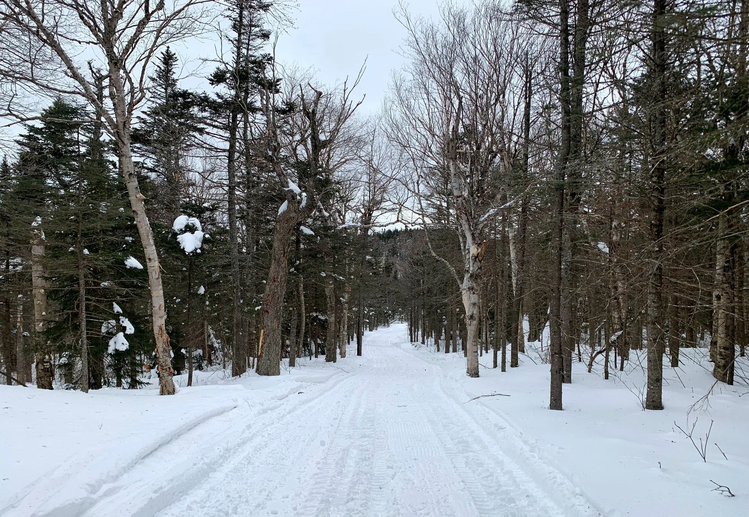
Heading home along the snowmobile path
Simply following my snowshoe tracks on the trek out, at least in this direction I would know where the spruce traps were. I watched a bright white and blue cloud churn atop Carr Mountain (3,453’), to the northwest and figured I’d come back to hang around in better, warmer weather in the future sometime.
Continuing down the snowmobile path was quick, no snowmachines were out and I ran into no one for the remainder of my hike out. Very pleased to have finally ventured over to that little Northeast Peak and through some more incredible forest. While I am thoroughly enjoying exploring new places in winter, I am beginning to anticipate some spring scents, soft soil and to watch all the plants burst back to life.
Happy Climbing!
Overall stats for the day:
5.07-miles
2hr 28 minutes
2,178’ elevation gain
Stinson Mountain - 2,840’
Stinson Mtn Northeast Peak - 2,806’