
Northville-Placid Trail
Growing up a New York native, the Adirondacks were a childhood playground; climbing the high peaks, watching ski jumps in Lake Placid and camping all through the forested backcountry of the vast, 6-million-acre tract of land. Upon moving away from the state in 2018, I’d revisit some of my favorite places to climb, hike and camp - but there was one extensive stretch of pathway which beckoned me to visit - The Northville-Placid Trail.
This pathway was one of the original trails blazed through the mountainous terrain, having been cut and constructed between 1922-’24 by the Adirondack Mountain Club (ADK); it stretches 135-miles in length from the languorous village of Northville to bustling Lake Placid; topping zero high peaks along the way, the route meanders by way of many old tote and logging roads, through some of the most remote and historical backcountry in Upstate New York - a perfect opportunity to revisit the Adirondacks mountains.

Northville trail register
The Northville-Placid Trail would prove to be a test of mental and physical endurance as well as one’s ability to judge gear and food allotments. With innumerable hiking and trail running miles on my legs leading up to the departure date, I had done all I could to prepare myself for the endeavor - what was out of my control was the weather, trail conditions and how my body would react to the constantly oscillating elevation.
Coming off from several months of eating a strictly raw, plant-based diet, I knew continuing that tradition on-trail would prove near-impossible, as carrying the necessary daily caloric intake of raw fruit and vegetables was just not feasible; most meals were cooked at home and then dehydrated prior to getting on-trail - thus saving fuel and time while reconstituting - most could just have hot water added for a quick and easy meal as needed.
- Day 1: Waterfront Park to Woods Lake -
Upon waking to the pitter-patter of rain beating down on the roof overhead, the last thing I wanted to do was begin in Gore-Tex layers and don a heavy pack, knowing non-waterproof Altra trail runners would soak up the tempest like a sponge.
Mile 0.0, departing Northville
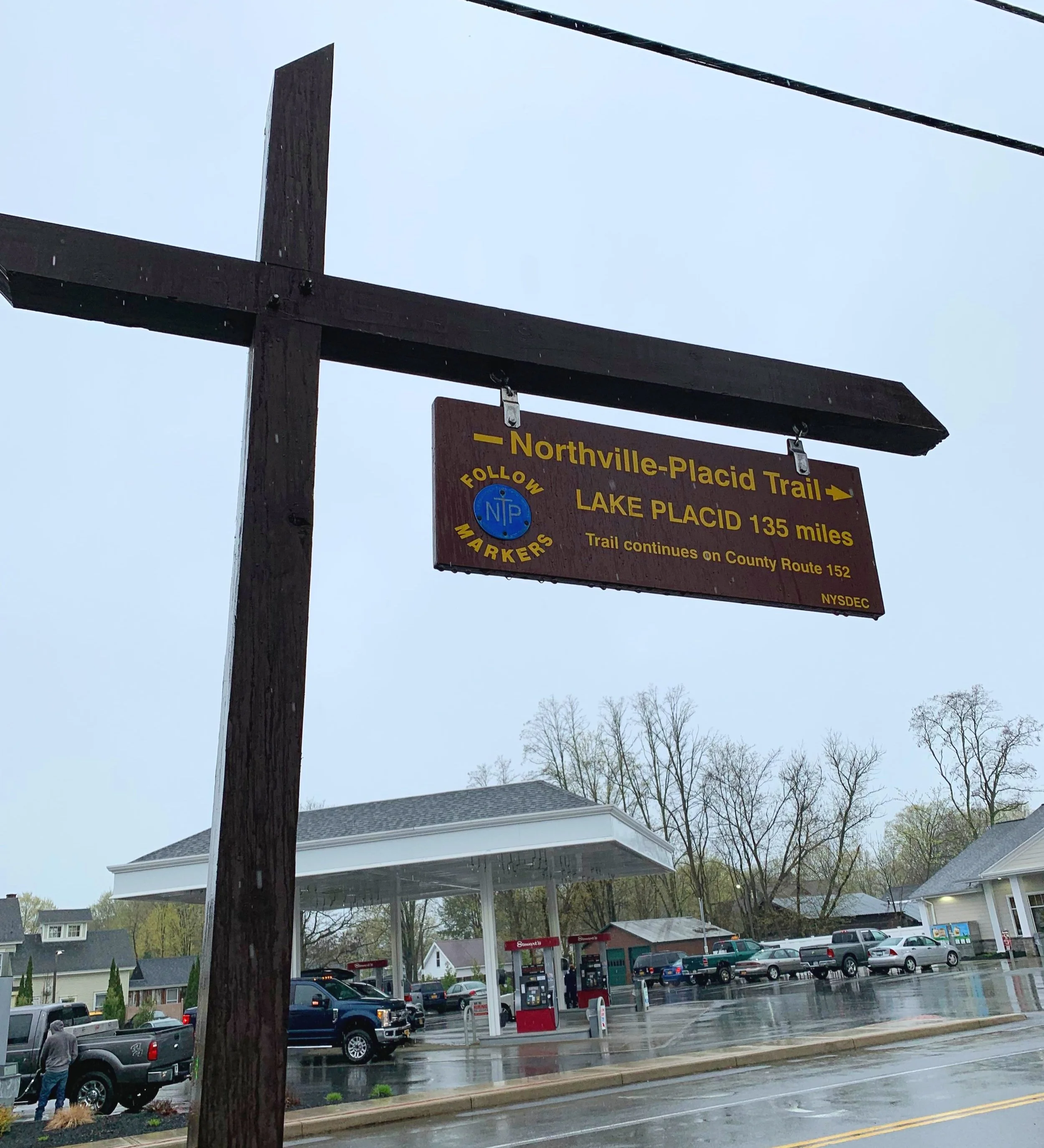
Arriving in Northville, there was no mistaking the southern terminus from the gigantic, wooden NPT carving. Just beyond the archway I huddled under the sheltered kiosk to add my name to the trail register, another line item in the long list of folks enroute to Benson, Piseco and various other charming, northerly destinations.
At 10:26am I began a multi-day journey of a lifetime, trekking hither and thither completely by foot, to see the lesser visited side of the Adirondack Park. Kind motorists stopped to allow me to cross the road as I made my way northward, what had been an onslaught of rain initially, had begun to taper to a light drizzle before long. A gentleman even stopped to roll his window down and inquire how far I intended to travel, “all the way!”, I replied with a friendly wave.
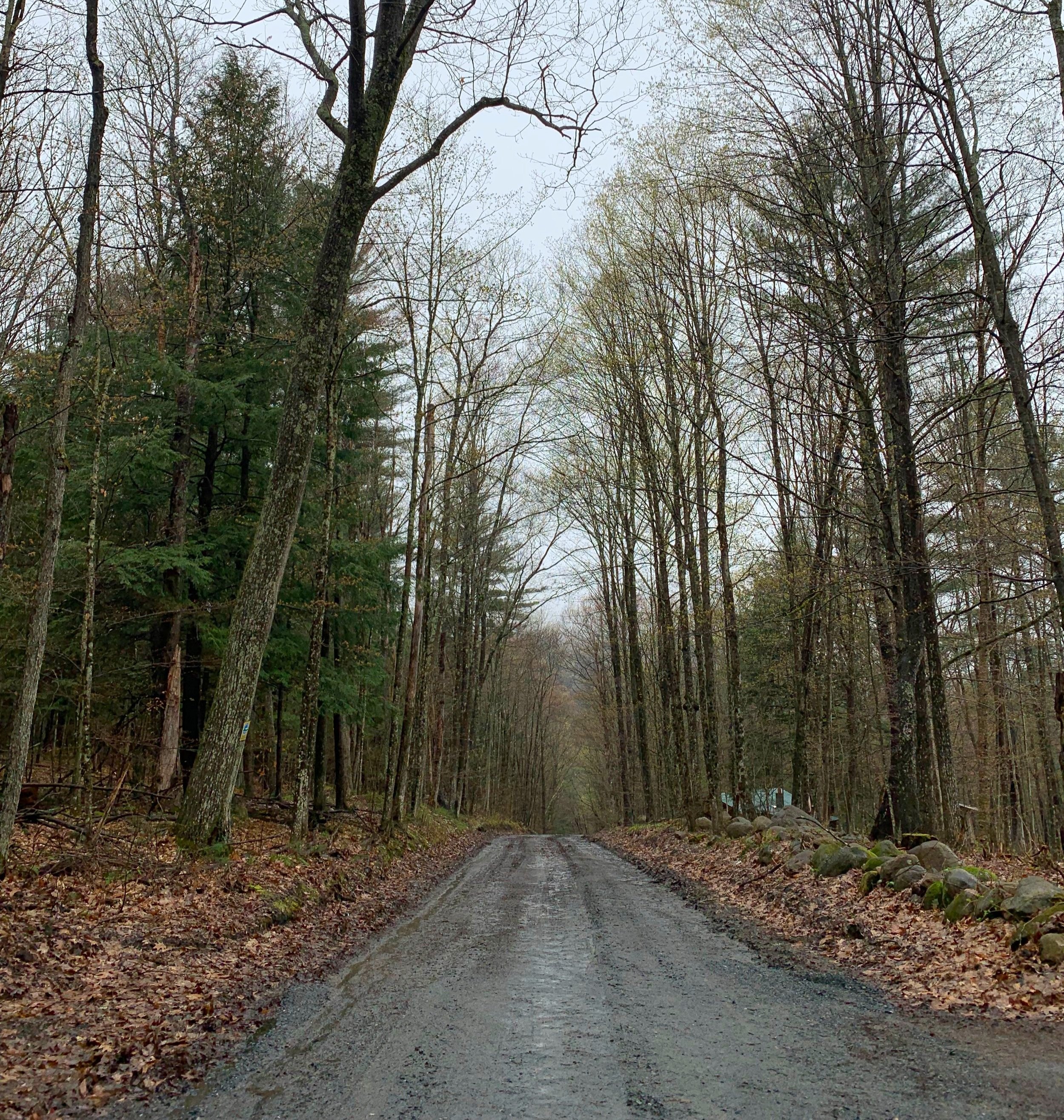
A muddy forest road leads to the forested trail
The initial road miles drifted by quickly as I fiddled with GoPro buttons and admired old, trailside farmhouses. Before long, the asphalt pathway transitioned to one of dirt and gravel, which would guide hikers over low, rolling hills to the DEC trailhead parking lot for the Shaker Mountain Wild Forest.
Despite the recent downpour back in town, the soft path here was moderately dry, perhaps the dense leaf-duff layer from last autumn directed the rainwater from the trail; just off trail, what appeared a mere trickle now churned downslope fast and silty. Exposed roots stretched across the narrow pathway as a low plateau was crested; localized dense fog now lingered over the hillside, giving the landscape an eerie sense of something lurking in the mist, watching from just off trail.

Eerie fog along the NPT
Winding along, Mud Pond was soon encountered; still shroud in the haze, decaying stumps and relics of dried reeds poked up through the surface of the blackened water. Finding what looked to be a small spring, I took the opportunity to fill up on water and snack, remarking to myself how well the pathway had been marked thus far - standing at any given point on the NPT, a hiker could peer north or south and generally locate 4-5 blue trail marker discs emblazoned with the classic “NPT” text in white.
Just before reaching 10.0-miles into the first day of hiking, the southern shore of West Stony Creek was encountered. Glancing up and down the wide waterway, I searched for a route across. Recalling a sign back in Northville which had suggested a 100’-water crossing, I wracked my mind for an answer to this predicament. I desperately did not want to turn back already.

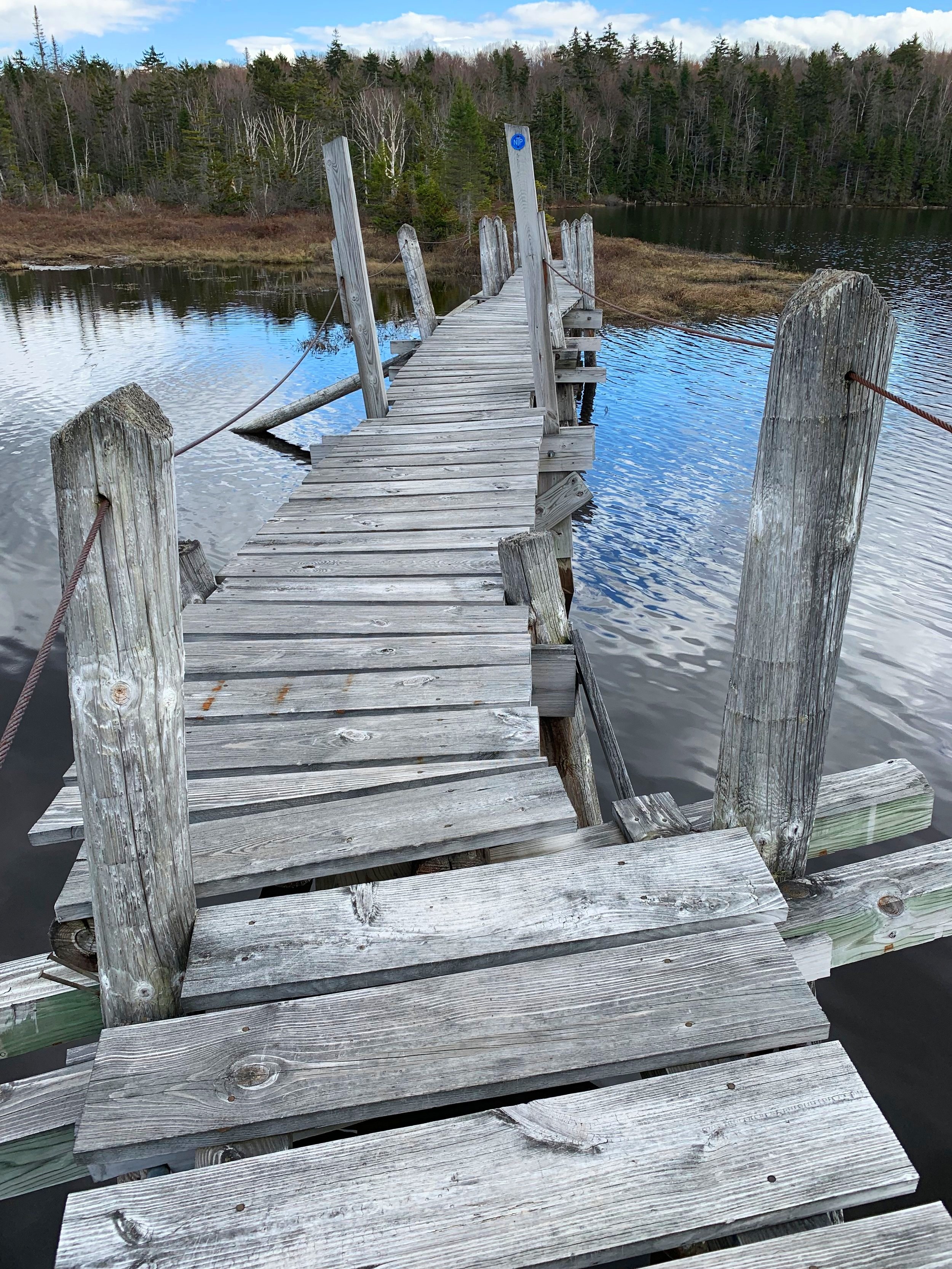
A hefty crossing of West Stony Creek
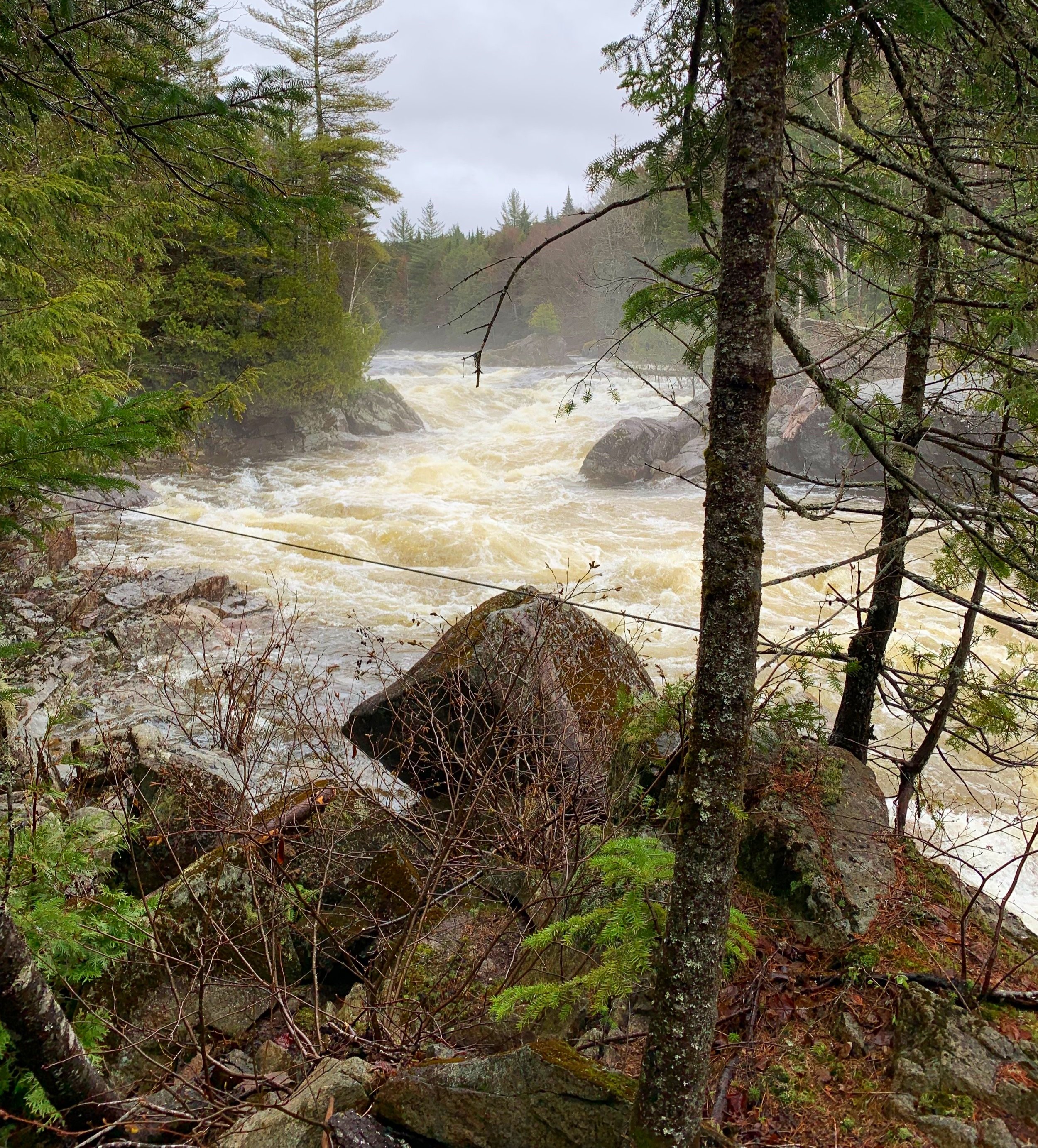
Keeping shoes on my feet, hoping they would provide the grip required to stay upright while traversing the slick river rocks, I unclipped the waist-belt on the 75-liter pack and stepped into the rushing river water. By an initial glance I had assumed the river, swollen by both the springtime thaw and the previous hours of downpour, to be perhaps knee-height in the channel.
With trekking poles splayed out to form a wide tripod base, it is safe to say I had hitherto experienced the most terrifying moment I’ve ever had on trail; each step into the freezing flow brought the water-level higher. Reaching the center of the river, the icy torrent was crashing around my stomach, standing upright took every ounce of reserve energy, taking another measly step forward seemed utterly out of the question.

Woods Lake trailhead
Completely sure I’d capsize below the waves, I crept one inch at a time, often just shimmying toes across the algae-covered boulders for fear of picking them up would send me off balance. Jamming my feet at wild angles into the crevasses between the slick rocks became my only way to not get dragged by the swift current. The thought of a week worth of gear and supplies on my back brought an eagerness and determination to reach the far side; once across and out of the water I dropped my pack and lay silently. For a brief moment I did not want to move, I just watched the white caps of water crest, spray into the air and collapse back down into itself.
With soggy feet, eventually I proceeded down the pathway hoping for no more water crossings today; I considered the option to reside at the West Stony Creek lean-to for the evening but with the sun now shining I pressed-on, hoping to dry out some while continuing to cover ground. The forest grew lush and peaceful: mosses and lichens worked to blanket all around, with the events of the day thus far, certainly I could have drifted to sleep anywhere I rested my head.
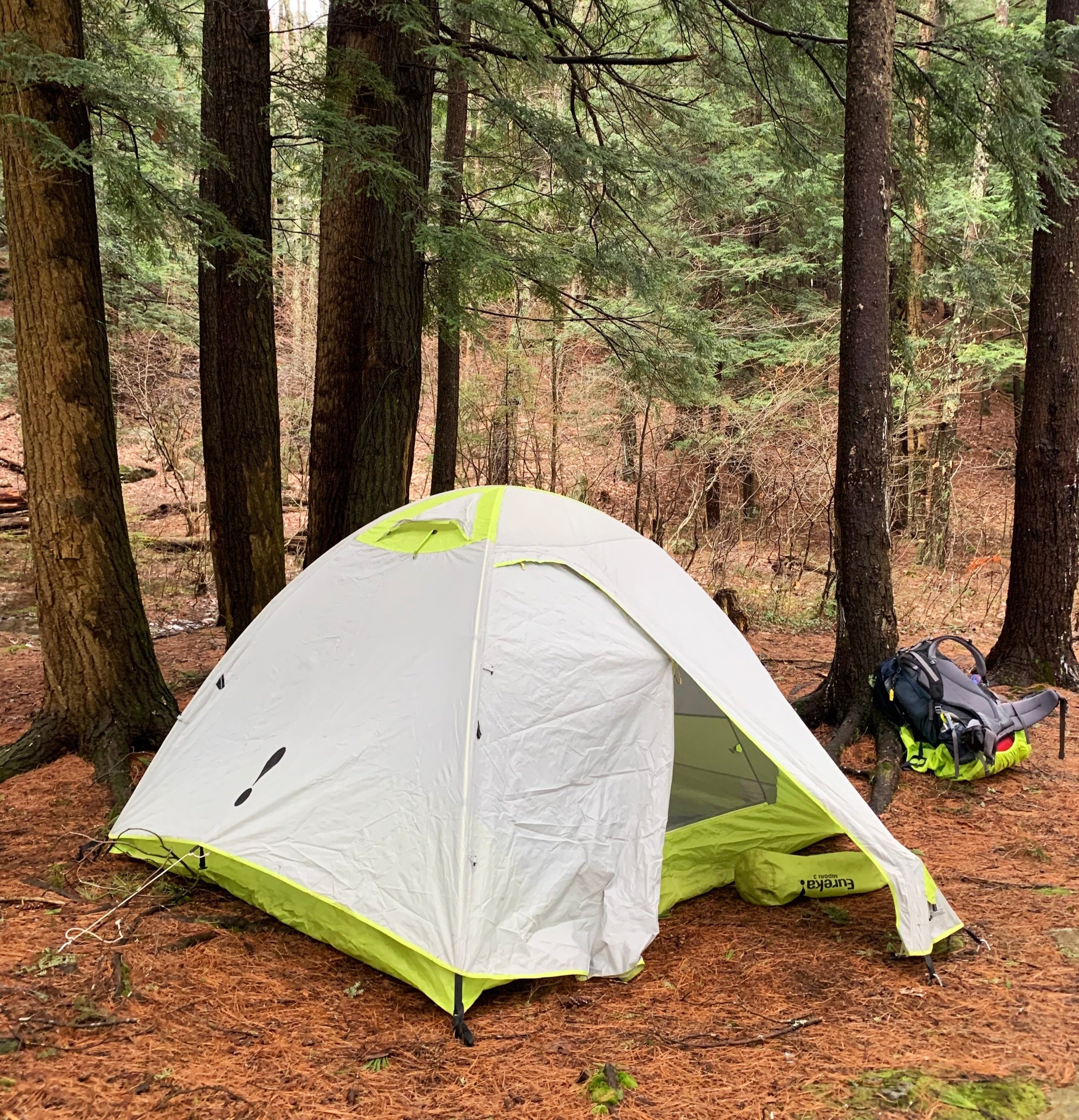
Camp along the NPT
Crossing Benson Road I signed-in at yet another trailhead register, a pre-hike ritual that New Hampshire does not partake in. Following still more well-marked Northville-Placid Trail, I hiked for a mile further until the shore of Woods Lake was reached. Here, several obvious campsites were encountered but at the sound of a rowdy bunch near water’s edge, I bade them in search of a quieter pasture.
Finally, locating a spot in which I could promptly perform all the long-distance hiking chores, the heavy pack was dropped, tent was assembled, water was filtered and gathered. Sitting pondside atop a rock slab I listened to a haunting loon call drifting across the hazy surface of the pond - echoing like a century-old steam engine whistle, their hair-raising song always inducing waves of frisson.
Camping on Woods Lake
As I tried to put the tense events of the previous several hours behind me and drift into a slumber, the neighbors broke the silence when their dog proved maniacally uncontainable, their screams echoing louder than the loon - that is, until I awoke at 11:20pm to the sound of their chainsaw. That night I dreamt of solitude which I would soon find deeper in the heart of the wilderness.
Overall stats for the day:
14.7-miles
7hr 24 minutes
2,356’ elevation gain
- Day 2: Woods Lake to Canary Pond -
The next time I stirred the sun was just beginning to illuminate the ghostly haze spiraling off the quaint pond; my watch read 5:49am. I had survived my first day along the Northville-Placid Trail and the source of last night’s chainsaw escapades. The air was inviting me out of the warm sleeping bag cocoon; a cool, overcast morning was to be found outside. At some point during the evening an older gentleman and his golden retriever had moved in next door, setting up camp before embarking on a day of brush clearing and trail maintenance further down trail - for no reason other than self-entertainment, I had dubbed them “Truman and Ricketts”.
After packing up camp, filtering water one last time and indulging on some rehydrated coconut curry, I performed a light overall stretch to the body and its already stiff and achy muscles.
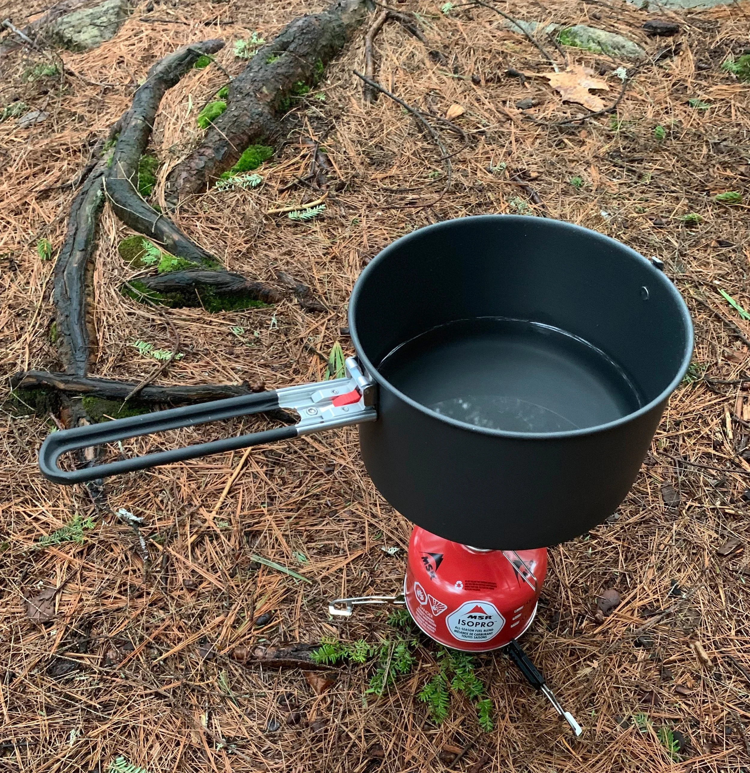
Cooking water along the trail
A routine I would follow until the completion of the trail, I opted to simply consume a basic diet of nuts, seeds, dates and other such snacks which did not require cooking upon arriving to camp each afternoon, saving all of the cooking for morning; my thought was I’d be hiking away from any lingering scent of cooked food (albeit sans meat-products), thus hopefully not attracting wildlife of any size overnight.
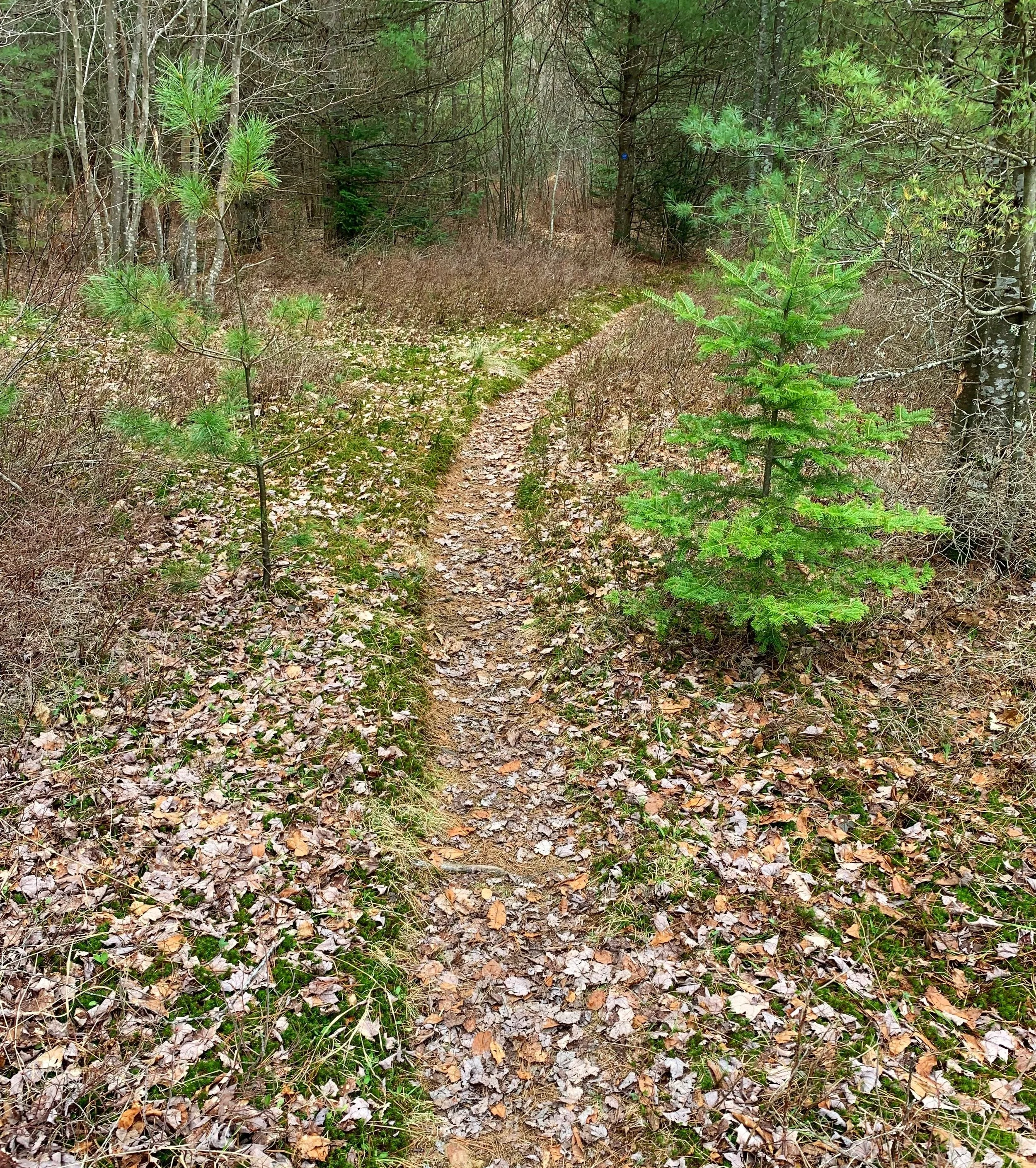
It felt good to be back on the remote stretch of trail; made soft underfoot thanks to a dense layer of leaf litter and conifer needles, my arches were thankful for this while becoming warmed-up over the first mile or two. Shortly into the trail I encountered evidence of what my friends back at camp would be out clearing; small patches of brushy blowdown lay mid-trail, often forcing one to dip (with heavy pack, of course) under or climb over, occasionally as a last resort I’d go around the downed limbs but did not want to risk widening the path any further, already it resembled an old forest tote road cut through an ancient, oaken woodland.

Hand-hewn log crossings, slick when wet
Soft beads of rain began falling once again as trying to find routes through the fallen brush was eating up copious amounts of time. No sooner than layering up with a Gore-Tex shell and pack-cover had I run right into my old friends, Truman and Ricketts, out in the drizzle, working to clear the fallen brush, he stopped his work to comment on a recent re-route in which I would be encountering up ahead.
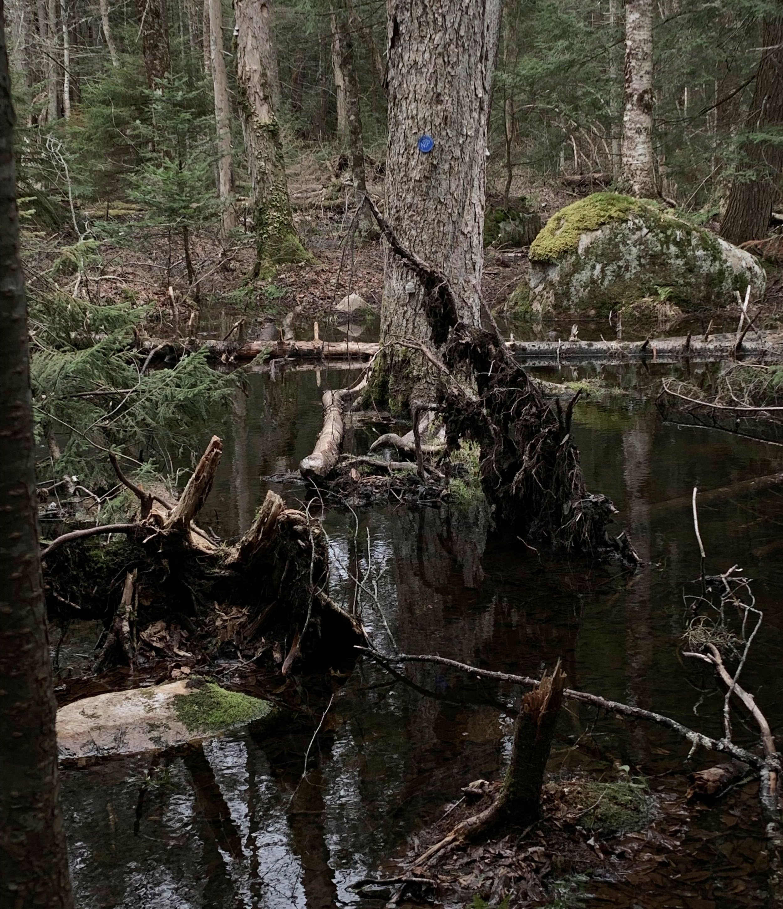
Consulting the waterproof map I had, which featured a highlighted NPT route, it did not take long to realize even an up-to-date map which showcased where bridged waterways were located was now rendered obsolete due to newer beaver activity. In places of old trail, it was certainly helpful to have all of the massive, beautifully constructed log bridges, even in recent re-routes one thing that did not faulter were the abundant blue discs blazing the way.

Once across the Northern Branch of West Stony Creek I had devoured a bag of dehydrated apple slices. Beyond what was once the original start of the Northville-Placid Trail along Godfrey Road, I watched the trail maintenance duo diverge; alone once again on the seemingly endless forest path. Next stop would be Rock Lake; an unintentional divergence to the Rock Lake campsite, which appeared to also have blue-blazes and whose trail appeared more well-travelled than the NPT itself; needless to say, I got off-trail.
Upon consulting the paper map, then finally AllTrails (I had the route downloaded to be used in airplane-mode, in times such as these), just to be absolutely certain of my current location, it turned out I should have proceeded along the overgrown trail which I spied inquisitively a little way back. Perhaps I would continue the shallow descent toward Rock Lake and cut straight uphill, to intercept the NPT by bushwhacking. What I had found appeared to be a roughly-travelled herd path - evidently I had not been the first to make this navigational error!
What a sense of relief to find the familiar blue discs denoting the Northville-Placid Trail. Staying true to the earlier theme I quickly encountered more blowdown, at least the rain had ceased, and the air was warm. The clogged trail soon opened to feature several rocky stream crossings, wasting minimal time I glanced in either direction before simply trekking straight through, concluding that the constantly soggy shoes would probably never fully dry until arriving back home anyhow.

Canary Pond
Through the dense canopy, a shimmer of reflective water sparkled like a thousand honed diamonds. The forest grew thin around the shore of Silver Lake; affording a place to drop the heavy pack, I rested briefly at the lean-to and topped off water bottles. Homemade trail mix featured coconut flakes, cashews, cacao nibs and a plethora of seeds became the fuel for the coming miles.
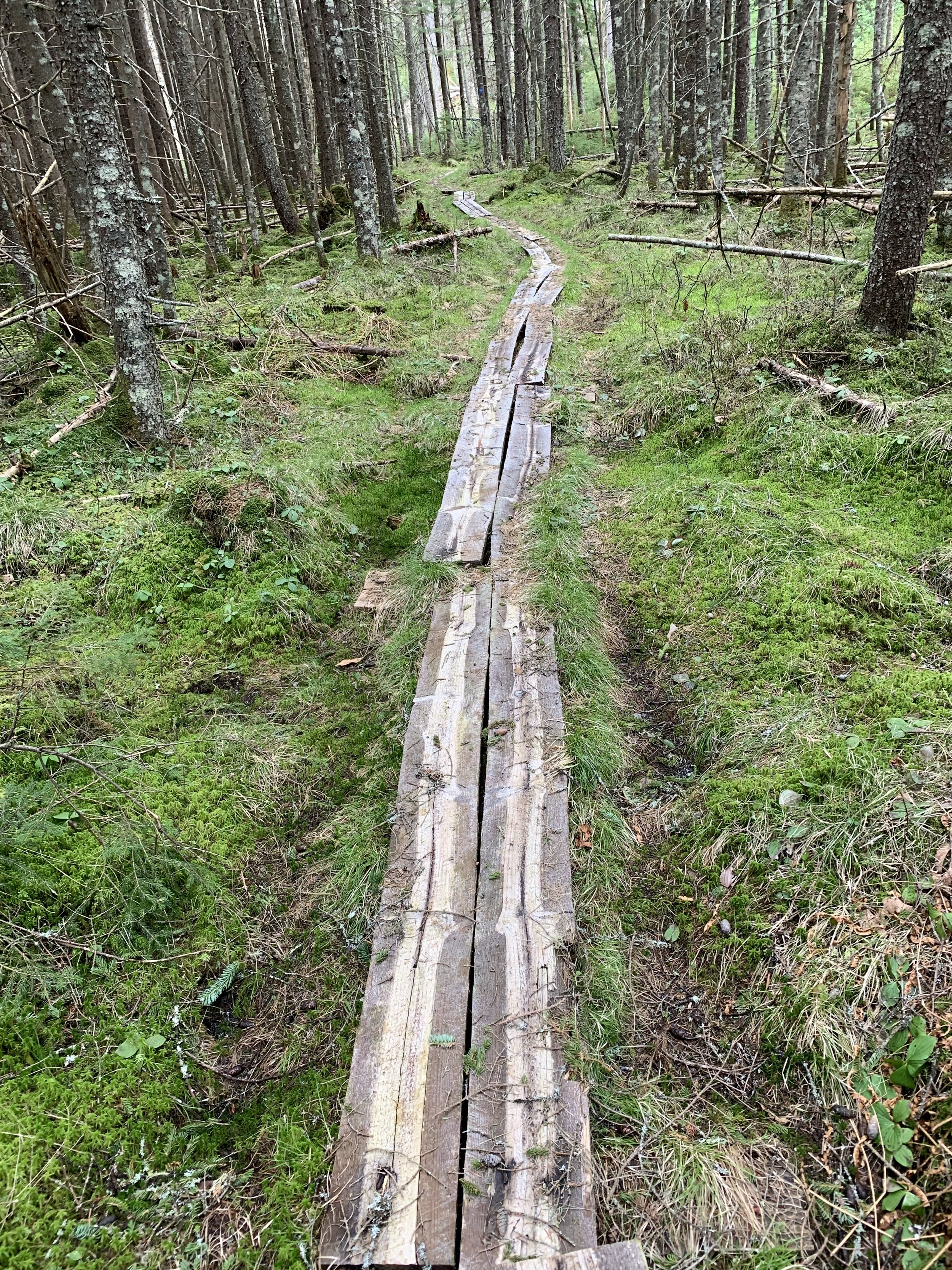
A smooth pathway comprised my future; wooden boardwalk planks (some old, some new) meandered as far as I could see, cutting through the low shrub of a boggy area. Sun-bleached grasses swayed gently in the breeze, laughter broke the silence anytime one of the planks dipped at a footstep, casting a plume of muddy water straight in my direction.
While alternating between gazing upon the scenery and watching carefully placed footsteps, I must have lost track of mileage as I came upon a narrow spur trail on the left. Taking it led to a most pleasant surprise - the home of a picturesque, waterside campsite at Canary Pond. My curiosity had been rewarded with a spacious tent spot complete with a large stone fireplace, handily crafted stone benches adorned the firepit and nearby was water for filtering - this was home for the evening.

Pondside spruce surrounding the camp site
Immediately, the soggy trail runners were peeled off and left aside to dry in the remaining sun while toes were pleased to now be stepping in natural grasses. A smoked fig bar became the entrée as water was filtered; several rods across the pond, loons dove, spending what seemed like minutes under the surface of Canary Pond before emerging elsewhere and repeating.
As the diminishing daylight cast long shadows across the pond I drifted off into a most pleasant slumber; overnight, calls from nearby barred owls resonated across the treetops.
Overall stats for the day:
16.8-miles
9hr 28 minutes
2,408’ elevation gain
- Day 3: Canary Pond to Piseco -
By now I had developed a morning ritual: from the sleeping bag I’d reach through the tent zipper for the tiny MSR Pocket Rocket stove and while still coming to terms that I found myself deep in the backcountry of the Adirondacks, fire up 32oz of water - 16oz would go into a Nalgene bottle with a scoop of Alpine Start instant coffee, the rest would be used to rehydrate and cook breakfast.

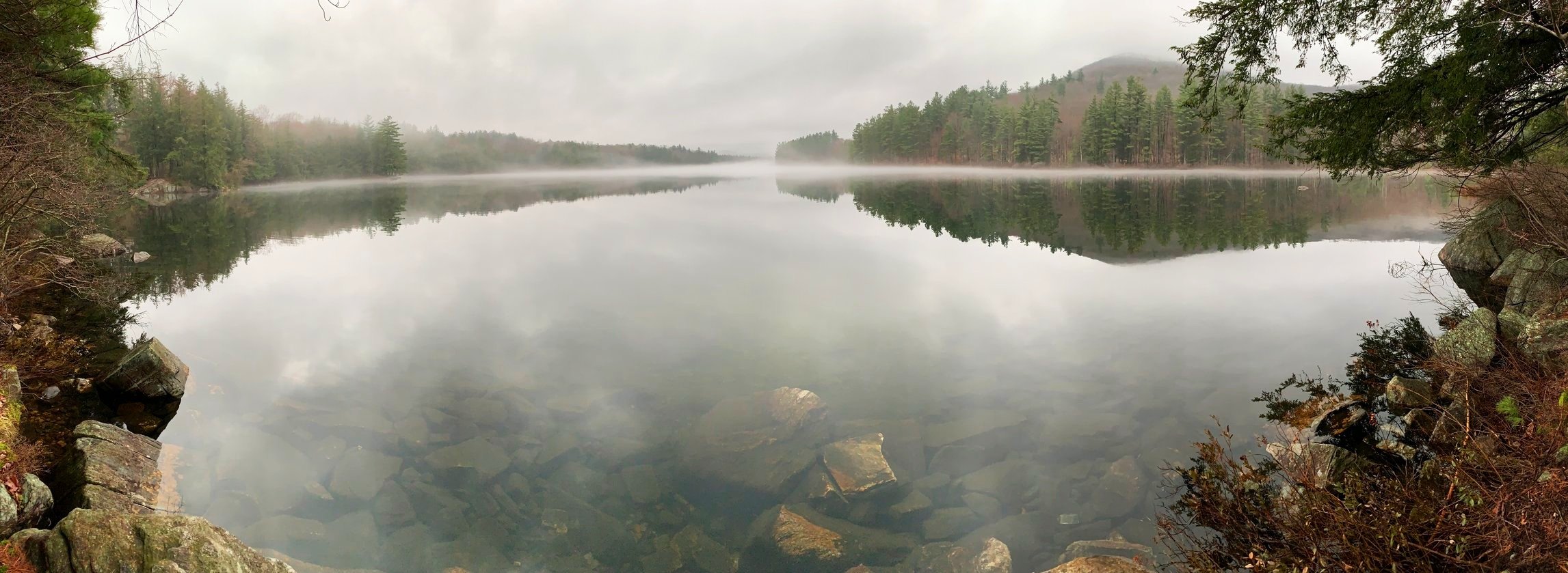
Canary Pond; breakfast with a view
Back on trail, the morning was spent crawling over and through more blowdown; particularly large evergreen this morning - one massive, old spruce with a rootball the size of Manhattan was but one of my early morning obstacles. After lunging over tree trunks nearly as tall as myself, the trail opened up to an area in which I had studied on the map the previous evening in camp. Simply listed: “Beaver Activity”, I had my reservations that perhaps I’d now be swimming along the Northville-Placid Trail. Thankfully, the water-level remained low as the trail navigated directly atop one of their dams.
Stopping briefly to gaze at the stunning scenery, Moose Mountain could be spotted westerly. The trail was guiding me directly through a low valley from which several smaller mountains rose; while I had grown accustomed to recognizing jagged, slide-streaked peaks of the higher hills, these were all new and unfamiliar to my eye at this point.
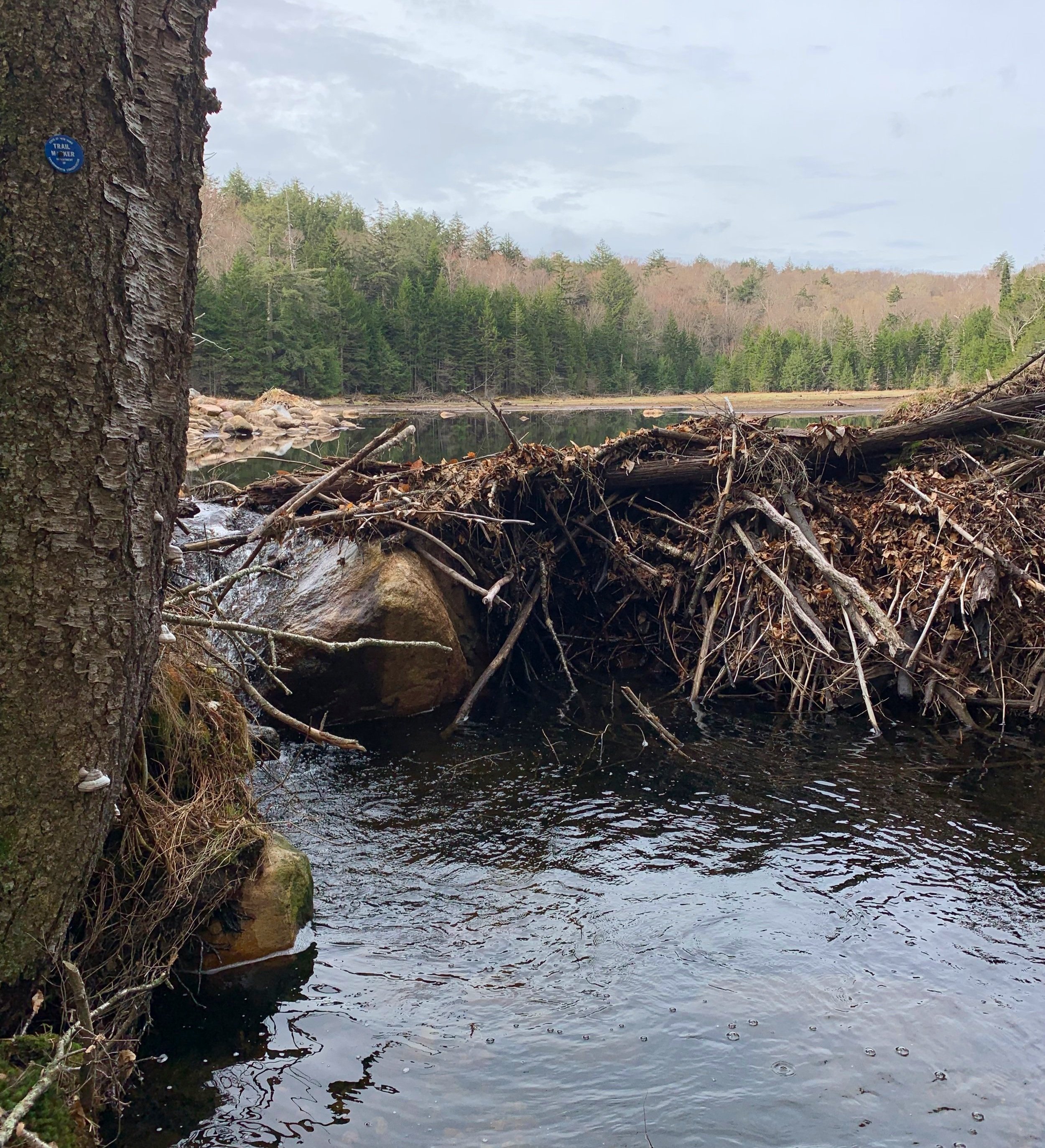
Beaver activity on the NPT
Stopping briefly at the second Mud Pond of the journey, it was here that I found more wooden, brown-painted DEC signs which I had grown to appreciate along the hike, sure I had a map and guidebook but these destination signs had a knack for popping up at opportune times - often when I needed a boost to remind me that places are really not as far off as they might seem, as a one roams the seemingly endless wilderness, hour after hour.
10.8-miles to the town of Piseco - likely the only inhabited place I’d encounter along the wilderness excursion. Assuming I could cover the miles before sun-down, I secretly hoped to find a fruit cart overflowing with ripe watermelon for sale. Heck - I’d take a lone plum at this point.

Enroute to Piseco
Rounding a bend in the trail I passed over the Whitehouse steel suspension bridge and pondered its history as I crossed the West Branch of the Sacandaga River. Departing the bridge on the far side of the river I found remnants of an old stone fireplace and throughout the coming mile tried to picture it in its heyday as the recreation building it once occupied for the local summer camp.
Approaching the Hamilton Lake Stream #1 lean-to, I took another brief reprieve from walking; a snack break with the intent to filter water, but alas! The beautiful shelter sat high on a hill overlooking its namesake water. Additional mileage and climbing that I deemed unnecessary - water could wait until a more convenient offering.

Whitehouse suspension bridge
Just before breaking out of the forest and into the forthcoming town of Piseco, the trail gifted me with a black-water bog unlike any I had henceforth experienced. The trajectory of the pathway was confirmed upon finding more blue NPT discs in the middle of the murky liquid. Finding more trail markers indicating a slight re-route, I followed for 15-feet, skirting along the bog. When it came time for the wetland crossing, I attempted first a log-balancing technique of which I had practiced often in the high hills of the Adirondacks.
Once this method proved time-wasteful I opted for a crude secondary plan: walk right through. Upon lifting my blackened pant leg and shoe from the murk, I got a wave of what lingered, rotting far below the surface of the water; plant-life and possibly animal-life alike coming together to send a knock-out punch to the senses.
A very boggy NPT
A single-track, narrow pathway beyond the bog guided through the final stretch of woods as the sound of cars and society could now be recognized. Passing yet another trail register box, the main road into town was located and followed into a shell of what I had hoped would be a savior from the trail - despite it being Sunday evening, there were no stores to be found here.
Asphalt seemed completely unnatural to step upon, so I chose the roadside sand and gravel. Several townsfolk cast waves, one even stopped by to have a quick chat, offering a ride into town to re-supply and inevitably asked where I intended to camp. Politely declining the ride as I had an adequate supply of food remaining on my back, I admitted of knowing no place in which I’d set up camp, assuming somewhere back on-trail, out of town.
Soft paths to Piseco
The kind old man went on to tell of a plot of grassy land in the direction I was heading; he was the proprietor of a small hiker rest stop along the NPT. He owned the land at the end of Haskell Road (where I was heading anyhow), had a picnic table to use, there was a small brook along the property edge and even… a hatchet throw game? From our conversing I gathered that he is trying to grow a relationship with the local Department of Conservation (DEC) to have a sponsored lean-to built on his property, encouraging thru-hikers to utilize his land.

Welcome to Bob + Matt’s
Excited at what I had learned from a random run-in with a stranger, I hurried down Haskell Road and completed the day of being on my feet. Signed as “Bob & Matt’s”, the heaven-sent grassy yard even featured a standard hiker register box to sign into.
With camp set up and clothes drying on the picnic table, the mosquitoes quickly found their choice of dinner - with that I climbed into my tent and watched the sun set on another day on-trail.
Overall stats for the day:
17.75-miles
9hr 20 minutes
1,660’ elevation gain
- Day 4: Piseco to West Canada Lake -
Thanks to the streetlight which shone bright throughout the night, I awoke throughout the sleeping hours and was immediately plunged into a state of blank confusion. From the abnormally illuminated tent fabric it was impossible to tell the time of day or night outside, thus necessitating my phone to perform the wake-up call.
Hoping to get an early start on the trail, I sunk back into my sleeping bag at the sound of rain softly landing on the tent fly, knowing the instant I would remove the outer shell, all which lay beneath would quickly become soaked. Opting to eat quickly and defer cooking until later in the morning when the rain let up, I downed several date and chia seed energy bars - which had congealed into one cohesive unit at this point in the trek, after being tossed around and squashed in my pack for several days.
Departing Piseco, this initial stretch of Northville-Placid Trail was perhaps the smoothest encountered yet. Several water crossings even happened without incident, for a brief moment in the morning I enticed the idea of remaining trail being so friendly, well-maintained and dry - I did not get my hopes up.

Mid-trail survey bench mark
With the light breakfast I found it necessary to supplement several times during the morning until something substantial could be cooked later on. The snack of choice was a sweet potato/oregano Muir Energy packet, boasting real ingredients and no-added sweeteners or preservatives, I was glad to have packed a few of these on-the-go snacks.
Reaching the border of the Jessup River Wild Forest and the West Canada Lake Wilderness, the pathway remained smooth and easy-going, thus keeping my mood elated. After following what I had assumed to be dog tracks in the dried mud it occurred to me that these were in fact of a bear, freshly placed since the overnight rain, it and I meandered along in the same direction.

Lunch view from Spruce Lake
Passing a group of four who had just come from Spruce Lake, they confirmed that the third lean-to along the lake was indeed the prime choice as they had just finished up a two-night stay at the camp spot. Over the coming mile, lean-to’s #1 and #2 were passed, all the while I could spot the glistening lake not far through the trees and as I walked grew hungrier by the moment, knowing sustenance was not far away now.
Conveniently, lean-to #3 was the only of the bunch to be found right on the lake, an easy decision when I knew filtering water was a must while stopped. This lean-to would have made a perfect camp had it been later in the day - it featured a tent pad near the lean-to, a stone fireplace with a fire ring nearby, convenient water access, both a canoe and a kayak, and benches on which to sit.
Wet clothes, socks, shoes all got dispersed to dry in the warm morning sun. While lunch was being cooked, loons called and made dives into the still lake. During the warm lunch I signed into the lean-to guestbook and read through previous entries, stopping to laugh when I read the four I had just passed actually carried the canoe all the way from Piseco.

Thankfully this was a bridged crossing
Taking about an hour to bask in the heavenly sun, digesting before moving on and topping off water bottles before departing; on the map I looked ahead for icons of bridges, as I now gauged forward progress on how many crossings were made. Counting off the bridges as I crossed, I could mentally recall how far down the pathway I had come. As the shoes had just begun to warm and dry while out in the baking sun, I thanked every aided crossing as to keep toes dry a bit longer along the trail, while knowing that good fortune would not last forever.
Upon passing the West Canada Creek lean-to, I knew my penultimate destination of the day was growing close. Trees began parting westwardly as I encountered a short stretch of black sand beach, looking out toward South Lake. By far my most enjoyable and photogenic bridge of the trip lay just beyond, crossing over the outlet of this lake, the old sun-bleached bridge appeared as if it survived a century of earth-shattering quakes, bent and twisted to the brink, it appeared akin to a fun-house ramp. It tested the balance of its patrons as they bore the weight of full packs - the lake vista was otherworldly and beckoned me to remain in place.
Crossing South Lake
Against my will I pressed on, searching for a small plot of flat earth in which to distribute my tent; several sources advised such a site would be encountered just up ahead.
Signing into the West Lake Trail hiker register, I followed the narrow path through a grassy opening through which other paths diverged, until 1987 this was site of an old ranger cabin, re-entering the forest beyond the overgrown clearing. While looking for a tent spot, all I found initially was thick, blowdown-riddled, spruce trap laden forest.
Managing to find the first snow of the adventure thus far, it was some of the worst - completely unsupportive and rotten springtime snow covering the trail, the only way out was indeed through. Knee-deep I plunged with each step; shins quickly became bloodied from the sharp, refrozen snow granules. To make the situation even more less-than-enjoyable, each footstep plunged into a hidden cavern of icy meltwater, roots worked to seize ankles with each step.

One of the less sketchy water crossings of the afternoon
Fighting to gain access to an area which was signed - indicating a recent re-route and hoping for a positive change of any type, my effort was rewarded with a deeper snowpack bookending a dicey brook crossing. Atop boulders I managed the water crossing, with wet feet, any movement was necessary to keep warm blood sinking down into toes.
Stopping to gather my haggard self on the one flat patch of earth which I found to be devoid of springtime snow, I checked the map to find this exact spot labeled as a tent site - sold! With a wall of thick conifer encircling the landing I set up the tent and went about exploring my newly adopted home for the evening. While I found nothing to indicate this location to be an actual tent site, it had a small brook out back in which to filter water - that was all I needed for a good evening.
Having never been so happy to remove frigid, sopping-wet shoes, I set them aside hoping a few stitches might dry overnight. Before long I was in the sleeping bag trying to reheat chilled extremities - if any wildlife had roamed by, outside the tent during the night, I never heard it through the deep sleep I had quickly slipped into.
Overall stats for the day:
18.98-miles
11hr 14 minutes
2,605’ elevation gain
- Day 5: West Canada Lake to Browns Brook -
The still air brought another night of restful slumber; frost rained from the tent walls when I finally coaxed a muscle into twitching back to life. The well-established morning routine helped ease through the frigid moments of the early morning: warm coffee, warm food, and a slather of balm on dry, weathered toes - while the shoes had done anything but dry out, I could not have been happier stepping into a pair of dry socks to start the day.
With camp packed up and slung onto my achy back I began down the trail in frozen, stiff trail runners, within eyesight of departing camp I had already plunged into a soggy trail. Then, a light drizzle arrived to welcome me to another leg of the Northville-Placid Trail.
Watching the rain rhythmically bead up and drop off the corner of the blue Gore-Tex hood, as distance was put between camp and I, I felt the dampness creep up pant fabric; I moved to stay warm, I moved to find the next camp.
Crossing Mud Creek I soon entered a meditative state within the cool recesses of my mind, thoughts drifted from topic to topic as I watched the earth pass underfoot, occasionally shifting the weight of a loaded 75-liter pack across my shoulders and adjusting the hip belt. Before long, any standing water or mud was once again traipsed right through, at least the feet stayed dry for a record twenty-minutes this morning.
One by one I passed memorable landmarks which I had traced with my finger over while consulting the map during the previous evening. The beating rain ensured no photographs were taken, I walked hastily down trails of old boardwalk, down sandy paths and through pockets of beaver activity, water was high this morning as it continued to drum down from the dull, gloomy clouds overhead.
The pace slowed as I reached the Cedar Lakes lean-to which sat perched along the edge of Cedar River. Taking a moment to stare in disbelieve at another swollen river in which I may need to ford, the relief was tangible when I located the next set of brown DEC trail signs - remaining alone in the wilderness, I thanked anyone listening as I learned the pathway followed alongside the raging river.
The overgrown, grassy trail soon transitioned into an old tote road, two obvious tire ruts which I could follow. It was nice to have been gifted wide wooden bridges, atop which I could cross any waterways, but still as the trailside brush bore the weight of today’s rainwater it sagged in and over the trail, hanging at eye-level as it seemed obvious that was the first to walk this stretch of trail in some time, knocking rainwater from the dangling evergreen canopy as I passed beneath.
With nothing to do but continue walking through the doldrum of steady rain, I continued until reaching a bulletin board - the map which was pinned indicated I had travelled all the way to Wakely Dam in the Moose River Plains Wild Forest. Shrugging my shoulders at how fast the miles had been consumed, when there is nothing to do but explore one’s mind; I had the large camping and picnic area to myself.
Entering the open recreation area around Wakely Dam the rain began to taper, the sky cracked in places as if it might offer a glimpse of the sun on the far side. Remembering my planning from before embarking on the long trek, I considered momentarily dropping my pack and running up to the Wakely Mountain Fire Tower, 1,650’ above; the option of finding tonight’s resting place and henceforth crawling into a dry sleeping bag enticed me more, however.
Along a road of crushed stone I followed, noting all the day-use areas, tent sites and gathering spaces which normally would be occupied, it was like walking through a ghost town as there were no signs of human life anywhere in sight.

The only photograph taken on an otherwise rainy day
Away from the recreation area I turned now onto Gould Road, hoping ahead to find water before the day was through; filtering at Wakely Pond had crossed my mind as it rose nearly into the roadway, but with bottles remaining near-full I pressed on. The sight of Wakely Pond campsite was awfully tempting to disembark for the evening, however, the notion of sleeping on a concrete slab kept my feet hustling down-trail.
Back into the woods, the path entered a 2009 re-route and rolled along a beautiful hardwood hillside as clouds continued to part; a clear, blue sky began to warm up all in its path. As it was still relatively early in the afternoon, I figured I might walk myself dry until finding a proper place to set up the tent for the evening.
Recognizing this bridged crossing from the paper map, I heard Browns Brook before I saw it; a beautifully crafted wooden bridge spanned the rushing water; this was home. With not a soul in sight I opted to camp right on the wide forest road and string up a few lines in which to continue drying clothing and gear for the duration the sun remained above horizon.
Another smoked fig bar, albeit dry as desert sand, became a tremendously flavorful dinner. Stopping my watch for the evening I stared in disbelief when I saw 22-miles for the day, walking in a downpour sure is one way to cover ground efficiently while on trail.
As I went to rotate my drying Gore-Tex shell like a flapjack, I noticed the massive indent of a moose hoof in the mud and leaves, a mere 15-feet beyond rest my lime-green tent. Hopefully the beast was not planning a return trek overnight.
Overall stats for the day:
22.87-miles
10hr 48 minutes
22,51’ elevation gain
- Day 6: Browns Brook to Salmon River -
Part One.
Immediately upon waking today I checked all limbs, thankfully there were no tramples by moose overnight and I could safely trek on. From the comfort of a warm sleeping bag I began the process of heating water on the little MSR stove for coffee. The sky outside appeared white which would soon deepen to a stunning blue hue; a fair-weather day in which to make the trek to Durant Lake where I had a planned re-supply.
Over a soggy trail I walked, the map indicated 4-miles until reaching Stephens Pond lean-to; I covered the miles nearly devoid of thought this morning, but exclamations sung as the wooden trail signs came into view. A short distance down a spur path the lean-to could be found, while the shelter itself was not the objective per se, it merely indicated a scant 0.6-mile trek until reaching Lake Durant. From where I stood, the low-laying lake shimmered in the morning light, blue sky reflected through the thin haze which rose in tight whirlwinds from the surface of pond.

Nearing Lake Durant
During the final 0.6-mile trek to Lake Durant, the sound of workers now broke the silence, the lakeside campground was working to ready itself for the onslaught of Memorial Day campers by trimming trees, laying gravel, and posting signs; workers in golf carts sped around the campus like busy bees in a flower garden. One of the employees yelled over a raucous of chainsaws that the campground water was on if I wanted a quick fill-up, another worker soon returned from his truck with two water bottles in hand, both outstretched in my direction.
While making my way out to Route 28, I was early and could not turn down a quick detour to witness the beauty of Lake Durant. The lake, which was named after the famous railroad barons’ son, the Durant who had developed the famous Adirondack style in which some of the grandest camps of the day were constructed, glistened as the sound of saws and woodchippers were well behind, for a moment I found peace in not walking.

Drying out soggy gear
With a perfectly timed rendezvous I unpacked everything to be baked in the morning sun; tent and clothes were laid out in the grass; the scene looked like a yard sale of backpacking gear - even a state trooper drove in to inquire of my intentions. Before long, synthetic materials dried out - some for the first time since stepping foot on-trail.
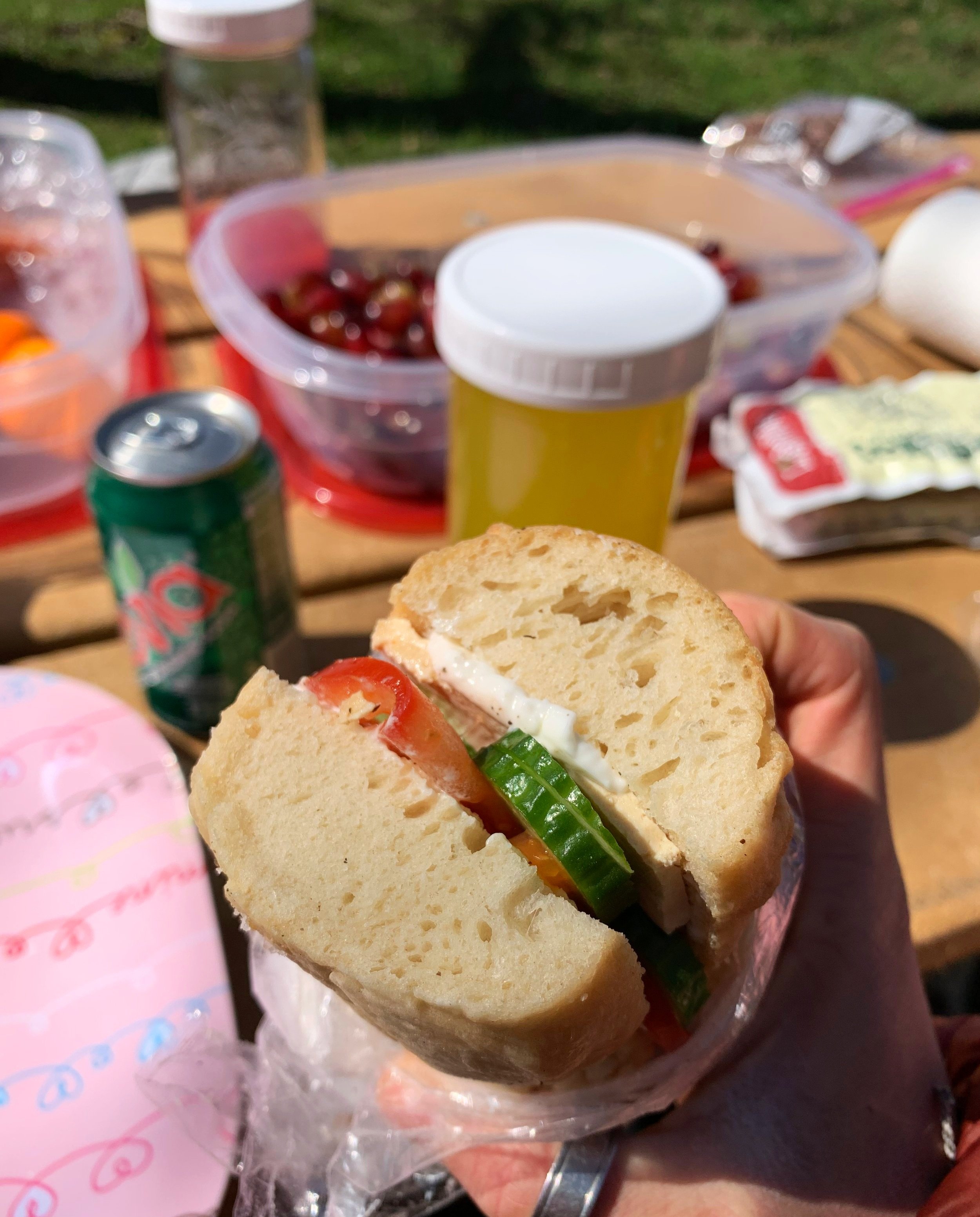
On the picnic table lay a spread of food unlike anything I could have dreamt: first up was real watermelon juice, then smoked tofu sandwiches with cucumber and tomato on pretzel buns, tempeh salad, grapes, bananas with peanut butter and real ginger ale hit all the spots as dessert consisted of a mason jar of pineapple juice and date balls.
Mid-trail fueling
With all packed back into the 75-liter pack, I cringed at the thought of muscling its contents back onto my shoulders and heading once again into the forest, but the wilderness had been awfully inviting all along. Dropped back off at the Blue Mountain Lake/Long Lake Section trailhead, with two poles in hand I traipsed down a soft, sandy trail to see what lay around the next corner awaiting my arrival.
Overall stats for the morning:
7.54-miles
3hr 34 minutes
627’ elevation gain
Part Two.
In part thanks to the sugar-rush from all the fresh fruit I had just consumed, I began pondering the possibilities and likelihood of my next long-distance hike; life in the woods, while it had its arduous moments, was extremely alluring to me. To be alone in the wilderness with all I needed to survive contained on my back, self-sufficiency was the most satisfying task I had ever undertaken.
Under crystal clear, azure skies I trekked as the soft breeze dried my shirt at a comfortable rate; over a moderate yet comfortable grade I ascended amidst freshly budding springtime leaves. As if stepping beyond a curtain I soon entered a swath riddled with recent logging. Such an atrocious scar upon a beautiful forestscape; atop fallen trees I climbed while trying to constantly keep the direction of NPT in sight. Before long the trail runners were weighed down by the sheer volume of sand they contained, stepping onto any logging road was to sink into a fine quicksand.

Tirrell Mountain across Tirrell Pond
The sight of trail immediately brought my attention back to documentaries of Mount Saint Helens, the 1980 eruption which left paths of devastation as torrents of meltwater and debris pulverized anything in its downward path, such is modern day logging: take what they need as fast as possible with minimal regard thenceforth for appearance or those who inhabit the land in the first place.
Atop a two-foot-deep bed of slash I bounced, trying to maintain balance with two spindly poles as the skid roads were traversed, at least the logging was not active today - I tried to remain positive to that fact. What felt like several miles of arrows and logging signs were followed before the devastation gave way to trail once again; a sparkle of water lay just beyond the forest.
The clues come when you need them the most
As the trail swung north, I reached the shore of Tirrell Pond, which was indicated to be home to a lean-to but appeared that the bridge to such a shelter had been washed out. With no need to stop to filter water I continued along its shore, only stopping occasionally to gawk at the craggy slabs which adorn the western flank of Tirrell Mountain. Straining my eyes, I tried to determine from such a distance if what I thought I saw were actually climbers ascending the sheer cliff.
Reaching the northerly edge of the pond I stopped momentarily to visit a beach and stand in the soft sand, what would have made a stellar camp spot had a few too many flying insects for my taste, and with much daylight remaining, I continued down the trail.

Salmon Pond Road
Down a narrow corridor of mature conifer and birch I trekked, all the while looking trailside for a soft area to call home; hoping for a flat, grassy area to pitch the tent, I had hitherto encountered innumerable blowdown patches through which I had not wanted to scramble. By the aid of waterproof map, I simply trekked toward what appeared to be a rough forest road up ahead.
The trail soon exited the forest onto what was basically a roadbed of more quicksand, I had no intention of pitching a tent in this soggy mess. Staring east, then west I looked up and down the desolate pathway to see if either direction held promise of a better place to reside. Reluctantly, I simply continued with familiar blue discs guiding the way, “might as well cover distance on the Northville-Placid Trail until finding a spot”, I thought.

Salmon River from camp
With some sense of guilt as to the “postholes” I left in my wake down the soft, dirt forest road, trampling the trailside moss-carpet was simply not an option either. Eventually reaching a wide truck bridge in the forest, there was an embankment on the northern side which dipped down to the creek. With the indication of a crudely constructed fire ring, I wasted no time staking my claim: pack dropped, tent constructed, firewood gathered and a dinner of grapes was devoured.
The evening ended with no crackling fire but with the satisfying sound of Salmon River lapping at the shoreline; I was able to drift off to another night of sound slumber while trying to speculate what the coming miles may bring.
Overall stats for the afternoon:
7.18-miles
3hr 44 minutes
722’ elevation gain
- Day 7: Salmon River to Long Lake -
As the low light reflected off the shimmering water of Salmon River just beyond my tent door, I awoke from possibly the best night of rest yet on this multi-day adventure through the Adirondack wilderness. With coffee in hand I walked the now solidly-packed forest road barefoot to briefly explore my new surroundings. I welcomed the gritty pedicure on feet which had remained wet for too long.
Over breakfast with the map by my side, it was determined today I would encounter the official high point of the Northville-Placid Trail. The location was not a mountaintop as one would suspect but lay in a mountain pass through which the trail crosses over on its journey toward Long Lake. The pass consisted of Salmon Pond Middle-West Peak to the east and Salmon Pond West Peak on the opposing side.

Flatlanding prior to climbing the mountain pass
With camp once again on my back I began down the road, soon diverging to a rocky incline which opened up to possibly the most scenic setting thus far, a vast grassy plane - stalks of golden tan and reddish-umber sway in the breeze of the high plateau. Mid-field, one could see a small arched bridge which was borrowed straight out of rustic painting, a place I could have stayed for a good long spell had I not miles to cover.
Ascending what one may denote a “standard Adirondack trail”, rocks, roots, and soggy patches comprised the footpath as elevation was gradually gained. Over the shoulder, a panoramic vista began to unfold. While the map had listed a lookout, I never located the destination and concluded it to be perhaps shroud in springtime growth. Reaching the rocky high point of the pass I diverged briefly to check the surrounding hilltop for a sign or marker indicating the high point.

Enroute to Long Lake
With nothing to see but more trees and rock, I began the northward descent at which point a sliver of outlook opened in the direction of my next destination; Long Lake appeared as a mere speck of shimmering blue and white in the far distance. Departing the Salmon Pond peaks, the pathway soon opened up to muddy forest access roads where I picked a tire rut and placed soggy steps down the path. Occasional trailside signs confirmed the town of Long Lake was growing closer by the mile. Passing a spiderwebbing network of cross-country ski trails, I paused briefly at the sight of a wooden boardwalk which seemingly stretched beyond the horizon.
Nearly a mile was trekked atop that stretch of wooden plank, meandering on a near-level course with boggy, moss-covered swampland on either side. All the while I pondered the time, money and resources devoted to crafting such a length of trail, a simply stunning feat. Excitement increased exponentially as the sound of automobile traffic grew near, with lunch now on my mind I stepped out of lush conifer forest and onto solid asphalt.
Boardwalk through the Blue Mountain Wild Forest
Out of town and past old vacation homes, all was quiet as the occasional dump truck rattled by, kicking up a plume of dust - how I longed for my sweet, balsam scented mountain air. Upon reaching the terminus of Tarbell Road at a trailhead register, I stepped off-trail momentarily to consume many oranges - the tart, sweet juice bringing energy back to a tired body.
Following a short descent toward Long Lake I crossed a very rocky outlet from which water trickled underfoot, beyond the outlet I found the trail traversed a low ridgetop. The narrow footpath lay beneath nearly a foot of last year’s fallen hardwood leaves, kicking up a burst of dry duff with each youthful step; nothing else required my tending to except for these miles and forest observations.

Crossing the outlet of Long Lake
Through an understory aglow with rich umbers, yellows and burnt oranges I roamed, tiny Spring Beauty’s poked through the forest floor bringing their flash of white and pink to an otherwise monotoned stretch of land; mushrooms of all shapes, sizes and colors also rose through the dense leaf duff - momentarily I had departed the present moment and traipsed back to an instant of timelessness, an image contained on postcard.
Passing several other southbound day-hikers, we exchanged greetings and wished each other well. The more folks I passed the harder I hoped for a vacant tent site in which to hang the proverbial hat. One by one I saw empty lakeside sites; continuing on, in search of Plumley’s lean-to, a remote site I had picked on the map over the previous evening, I had hoped to call home.

Soft paths of eastern of Long Lake
At the short spur trail I stopped to listen, nothing but the sound of gently blowing breeze in the canopy with loons haunting the airwaves; echoing across the lake and bouncing off the steep flank of Buck Mountain to the west. My prayers had been answered as I emerged from the trail to a vacant site; fire pit, lean-to, waterfront access, boulders on which to perch - all mine for the enjoying.
The site had a small herd path which was used to access and filter water, for what felt like hours I sat lakeside and watched the dark clouds churn overhead; tumbling and folding over one another as they rose and fell over the surrounding mountainscape. Littering the woods were various pieces of docks, ropes, foam buoys - even small wooden shards of old houses were stuck in tree branches.

Buck Mountain across Long Lake, from camp
Being the first evening with a proper roof overhead, I said a quiet “thank you”, as the sky grew darker still and opened up, a torrent of rain which would last through the night began to fall, with that I took to my sleeping bag and shut the tent door behind.
Overall stats for the day:
17.28-miles
8hr 46 minutes
2,418’ elevation gain
- Day 8: Long Lake to Duck Hole -
As the morning drizzle persisted, I stuck an arm through the tent door zipper to light the burner and get coffee water boiling. This was a day I could have remained tucked-in and reading for its entirety. Down the short path out the back of the shelter I moseyed to the outhouse - a once fine, wooden establishment whose door now lay strewn before, as if a toxic bomb had been detonated from within, sending the entryway hatch screaming off its hinges.

Camp from the lean-to
With camp packed up I reluctantly began down a soggy fern-lined path with a breakfast of cold tempeh bar in-hand. Before departing I even had the wherewithal to add a gourmet touch to the dry cube - several well-placed drops of hot sauce to make the fermented bean breakfast more palatable.
Up ahead lay another area which the map had labeled: “Caution: Beaver Activity”, but what was more intimidating were the preceding words, also in italics: “Caution: Blowdown Area”. While I had fought through countless patches of hefty blowdown, I had yet to encounter such an area deemed worthy of notation on the map.
As I walked, trepidatiously awaiting the packed trail to simply disappear into a tangled web of fallen trees, I encountered a first trail re-route, then another - I watched as if a bystander to my own journey as the beaver-ridden boggy area passed by to the east. While making decent time on re-routes, the sound of rain hitting the forest canopy began once again. Thankful for several minutes of dry walking in which to eat my breakfast, I reluctantly donned the Gore-Tex shell upon reaching Shattuck Clearing.
Between raindrops I paused to listen intently to what I curiously thought to be my first thunderstorm encounter on-trail, the thunderous crashing was none other than white-capped waves cresting and inevitably collapsing on itself in the silt-choked Cold River; even the temperature of the damp air surrounding the torrent dropped remarkably upon reaching a short descent leading to the waterway. Luckily, this raging river was bridged, for had it not been I may have witnessed the end of my incredible woods journey.
One suspension bridge spanned the churning flood as mist blew off its surface, water droplets landed high into the trees. The raw energy of the cascading water beneath my feet gave a sinking-sensation in the pit of my stomach, like being strapped-in and sucked down on a speeding roller coaster. Relieved to have made it across the river I hoped for that to be the worst occurrence of the high water.
A swollen and cold, Cold River
Following a snack break to ease nerves wrought haggard from the intense flood cascading mere feet beyond my toes, the trail here would have continued straight but as the high-water had now risen into several minor trailside alcoves, I was in need of either finding a quick re-route bushwhack or just bearing straight through the icy torrent.
As I approached the area of immense blowdown (this time the map was obscenely accurate in its italicized description), rain fell from the treetops in buckets turning the deeply rich, blackened Adirondack soil into a slickened, muddy chute - nearly glissading I slid toward fallen trees just to figure a direction up and over or dive below, oftentimes the oversized pack refused to be carried beneath the low blowdown.
As fingers grew cold from the constant gripping of wet terrain I stopped to stare in utter bewilderment; to my surprise I would need to cross a branch of the swollen Cold River after all. The blue discs I now recognized so well reflected far in the distance as waves nearly reached their lofty height; the murky flood water leaked from the river on my right, across the trail before me and finally crashed into the forest far on my left - what a gnarly, raw sight to behold.
With one step into the frigid water, I immediately found it to be accurately named; with such a lofty distance in either direction in which to reach a trailhead, I had to keep taking steps in a northbound direction. Finally, only after several severely flooded tributary crossings I reached a spot on the maps I had thumbed over: “footbridge”, it read.
Assuming I could use the nearby Ouluska lean-to to change wet clothes and build a fire to get warm, if need be - I searched for the aforementioned footbridge but all I found was a collection of wooden toothpicks - remnants of the footbridge in question, broken from the shore and resting at its new home slightly downstream, mostly underwater with an end sticking above the crashing waves, just enough to recognize its features.
With the lean-to in sight across the deluge of gushing water I searched either side for an answer; fingers and toes both grew colder from the non-movement. Swimming was likely out of the question unless I got upstream of a mammoth log; I had a bundle of rope in my pack but the likelihood of securing to anything seemed an astonishing feat at this point.

Trailside survey bench mark
The entire duration of searching for an answer I had in fact been staring straight down at my answer. Conveniently spanning the raging tributary was a bark-less tree, shining as slick as any chunk of glossy wood could. I consulted its sturdiness with a toe just to realize my expectations - the bare, wet wood might as well have been shrouded in ice.
Hoping the log would bear my weight and not crumble into the abyss upon my reaching its mid-point, I began taking steps; entering a momentary zen-state; all deafening sounds of crashing waves fell silent. All thoughts in my mind had ceased. Any of life’s concerns which had plagued prior, now became a non-issue. I was taking steps with pure instinct as if being led across by another force.
Slow, cautious steps grew more frantic and wider as I neared to the far side; waves cascaded up and over both the log and my feet; grip between shoe and log was reduced to zero as I leapt the final stretch and landed on solid earth. Looking back at the log and swollen waterway which I had just navigated across with complete disbelief, I turned to follow the sandy pathway toward the lean-to.
To my surprise, two young hikers occupied the shelter, both changing into dry sweaters and escaping the chilling downpour. Despite being in eye-shot of them, neither had heard nor witnessed my crossing. One of them asked how the trail was and from whence I hiked. Advising of a few dicey crossings to navigate and the high water to the south, I gave them a brief, cliff-note rendition of my trek thus far. As we wished each other well, the realization now occurred to me that - their very presence at Ouluska Pass lean-to essentially ensured my arrival to the terminal trailhead in the north.

With a lightness to my step beyond the water-crossings, I moseyed at a fast pace due to the continuous deluge from the canopy and passed the historic hermitage site of the self-proclaimed Mayor of Cold River; here, a tree-mounted plaque remembers the forest dweller as several old relics can still be found trailside. This was one area I was looking forward to visiting along my journey but unfortunately the day-long rainstorm ensured a steady pace.
Soon an old tote road was joined as footing grew slick from both fallen leaves and rocks underfoot. Regular blue discs and blazes became scarce upon heading toward Duck Hole but was reassured of proper navigation when I reached a trail sign indicating Duck Hole lay just up ahead. As the rotten snow from days prior had begun to slip my mind like a bad nightmare, I strolled right into another long stretch of the white mess. No matter how delicate the steps were placed, post-holing was the only method of travel until reaching solid earth surrounding the old logging camp area, as the dense conifers kept the sun from melting the lingering snowpack.
With a campsite on my mind, I pressed on, certain I would be nestled in my sleeping bag before nightfall. Down muddy embankments and atop soggy, wet trail I slid until any remaining light faded and beneath the thick forest canopy grew darker than pitch. Out of necessity and pure exhaustion I located the finest trailside flat-spot and cast tent poles into fabric eyelets, somehow creating the shape of a domed-tent in the process.
With minimal hunger, I downed some water to rehydrate taxed muscles before laying my head down - I found myself atop a less-than-optimal, soggy platform of moss and bog for the evening.
Overall stats for the day:
20.18-miles
10hr 1 minute
2,343’ elevation gain
- Day 9: Duck Hole to Lake Placid -
With perhaps 36-minutes of sleep had, while I did not want to see the end of my journey, I was happy to have an end in sight.
After lying awake, staring at the roof of the tent, finally a deep-blue slit shone on the horizon - coffee time. With the other half of warm water, I heated up a final serving of black bean pasta, couscous, and some dehydrated veggie-concoction. While the slurry resembled a certain bog I had plunged into earlier in my excursion, I reminded myself it was simply fuel to burn over the remaining miles.
Over coffee and later breakfast, I consulted the map one last time before setting out, this time decidedly not intimidated by the map-makers italicized warning of “Caution: Beaver Activity”; bring it on - I’ll paddle atop my 75-liter bag to reach the northern terminus, if need be.
Departing the Roaring Brook area with now very soggy backpacking gear on my back, feet expressed a dull ache with every rocky step but I worked to reassure the tired body an end was near. The morning was cool and calm as the sun rose with cotton-ball clouds occasionally drifting by, providing a brief reprieve from the morning sun. While deeply admiring the Wanika Falls area, I promised a return someday; the falls echoing a freight train-like rumble as they toppled, water evidently remaining high here as well.

Passing Cold River lean-to #2
The final miles along the Northville-Placid Trail were not going to be acquired easily, as I encountered frequent wide-brook crossings atop boulders and muddy sections - I had long ago given up trying to retain dry feet, so at this point, no water-crossing could slow this determined pace.
Around a pool of standing water I stopped briefly to admire bog-side toads and small fish which darted around, usually trying to catch my shadow as I trekked along the shoreline. Encountering a trail crew, I thanked them for their up-keep on the trail, especially for cutting blowdown, maintaining bridges and laying stones through soggy sections. The group asked about the journey thus far and finally parted ways as they congratulated the endeavor, exclaiming, “enjoy the next five or so miles!”.
Well, there was a sure way to let down a happy hiker who was previously convinced they had travelled further. Five miles remaining. Really that was not so far, as I had just trekked for 8-days straight, but the sound of 5-miles was utterly unfathomable at that point. Trying to recall a time early in the trek, I sought to appreciate the boulders, bridges and bends in the pathway.
Northville-Placid Trail register
Finally, as I began encountering more southbound hikers I knew I was nearing the trailhead - for I had surmised: the more cologne and perfume lingered in the air, the closer Lake Placid became. The sight of Chubb River meant the end of my long path; I was tremendously pleased, tired, hungry and more than anything wanted a good, long dunk in the cool Chubb.
Underneath my cranky façade I longed for more miles; not an ounce of my being was ready to give up the simple, day-to-day; trail walking, water-filtering, tent-dwelling, bland-food-cooking, nature-loving experience. As I sat alone in the sand, watching day-hikers come and go, various cars scurrying to all their destinations, I secretly plotted and planned my next escape.
Overall stats for the day:
10.6-miles
5hr 2 minutes
1,070’ elevation gain
- Northville Placid Trail -
153.83-miles (tracked by GPS watch)
18,460’ elevation gain (tracked by GPS watch)
21,855 calories burned (according to Strava)
9-days/8-nights